|
UPPER AIR OBSERVATIONS
|
As mentioned in the forecasters section of this tour, much of the forecast is based on computer guidance. These computermodels need to be initialized with current information before the atmospheric equations can be run to produce a forecast. Some of that information is garnered from surface observations; thousands of sites across the country maintain a continuous weather watch with temperature, humidity, clouds, visibility (and any obstructions), winds, and atmospheric pressure data. Often, these sites can be found at airports as accurate, current weather information is necessary for aircraft to take off or land. Much of the time, this "weather watch" is maintained by a group of computerized instruments. However, this only handles what is occurring on the ground; since weather is three-dimensional, we need data from all layers in the atmosphere.
To accomplish this task, instrument packages attached to helium-filled balloons are launched at 70 sites in the continental United States, with an additional 22 sites in Alaska, Hawaii, and Pacific Territories, and others in Canada and Mexico. (For a map of launch sites, click here.) To synchronize the launches in North America and elsewhere around the world, the standard time zone for weather information worldwide is Greenwich Mean Time-- the time zone for Greenwich, England-- which is also know as Universal Coordinated Time, or UTC. Balloon flights occur at midnight and noon Greenwich time, or 00 UTC and 12 UTC. The actual launch takes place an hour earlier, so the data can be collected and transmitted by the observation time listed above. Locally, this translates to an observation time of 8 am/pm in the summer, and 7 am/pm in the winter, again with launch time an hour earlier.
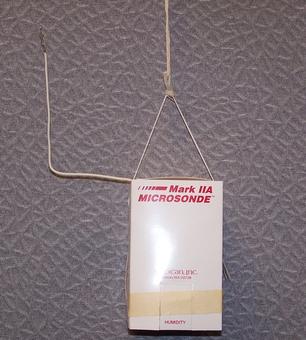
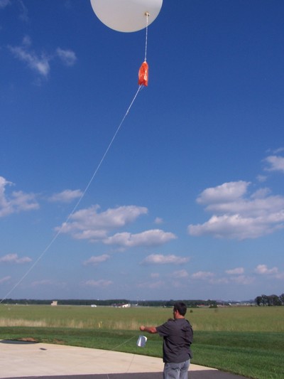
 This instrument package is attached to a helium-filled balloon, which can be seen to the left. The balloon is approximately 5 feet tall and 4 feet wide at launch, and filled with approximately 1500 grams of helium. However, since air pressure decreases with height, this allows the balloon to expand to approximately 35 feet wide before it finally bursts at a height of roughly 15 miles above the Earth’s surface.
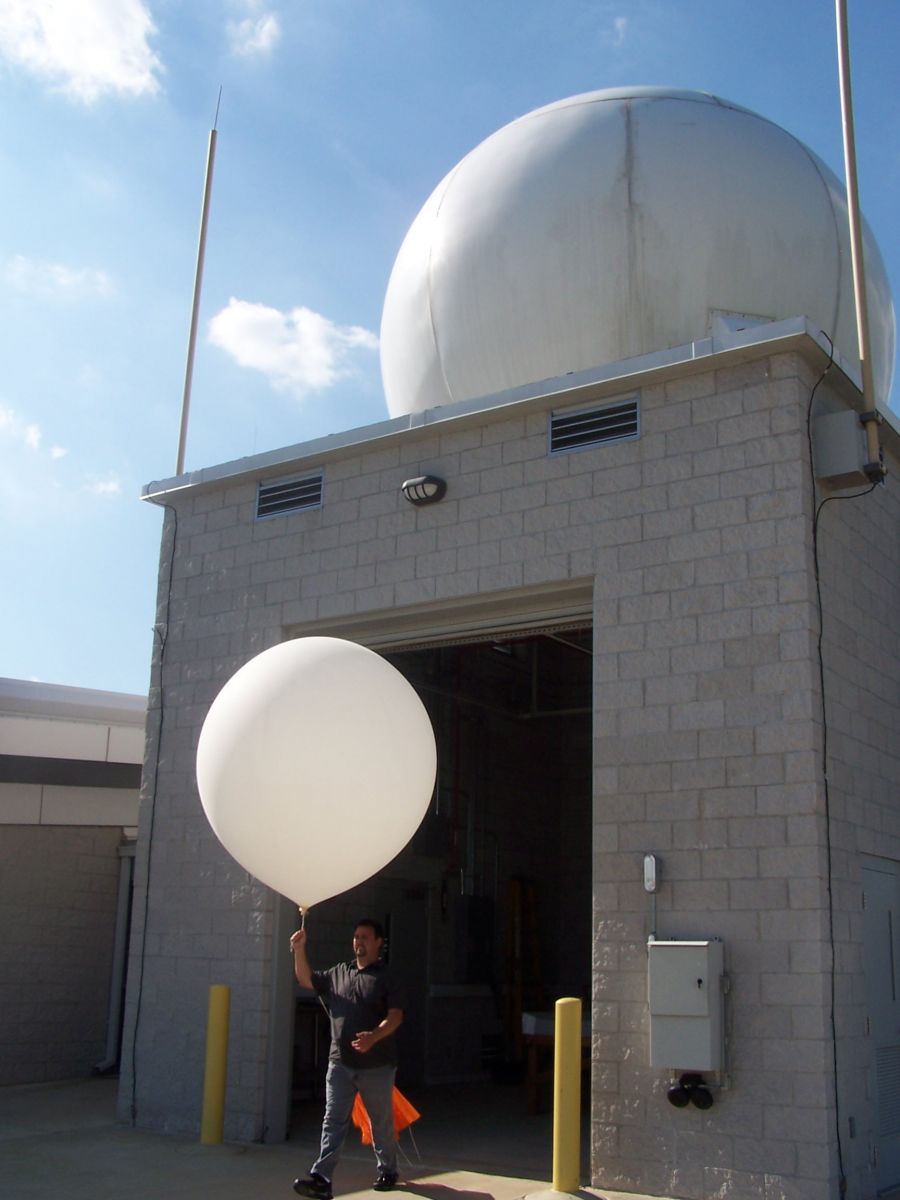
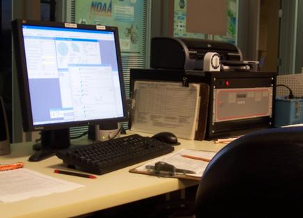
As previously mentioned, GPS technology is utilized to precisely track the movement of the radiosonde. After the weather balloon and instrument package are launched, we listen for the radio signal the sonde sends back to earth with a ground based radar dish. This device is located under a 20 feet wide white dome at the launch site. A new set of weather observations is sent each second through the radio signal and our radar dish records the information. This recording is then carried by underground wire from the dome directly into our office computers. Our computers then send this information to the weather forecasting computers near Washington D.C. so the weather data can be used to make the next weather model forecast. The computer and control display by which we monitor the flight from our office is shown at the bottom center of the page.
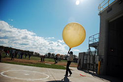
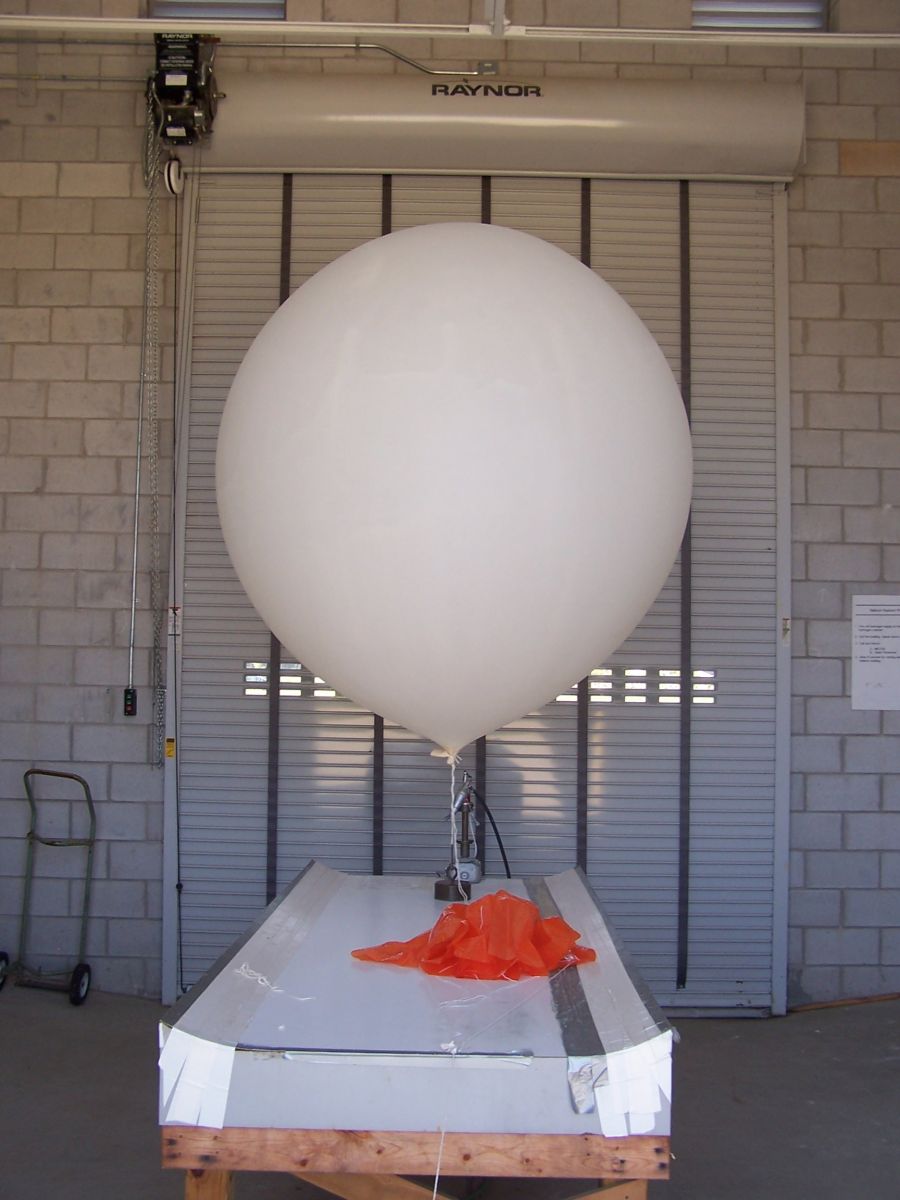
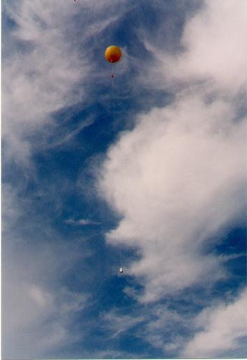
| The launch is illustrated in the next three images below. The computer and control display by which we monitor the flight can be seen in a fourth picture, found below right. | ||
|
 |
|
 |
 |
|
Once the balloon bursts, it is free to fall back to Earth. For this reason, a parachute is attached between the balloon and the sonde, so it will float back to the ground, and no damage will be done to any personal property. The parachute is the orange object below the balloon; it can be seen fully opened to the right.
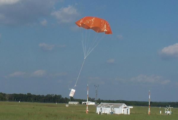
If found, most radiosondes can be returned (using a mailer inside) and reconditioned. Due to the west-to-east steering currents over the mid-latitudes, if the winds are strong enough, sondes launched from this site can reach the Atlantic Ocean. Sondes from this office, howevere can land just about anywhere within a couple hundred miles of our office. Maybe you will find one some day. If you do, remember to send them back!
| <<< Back to NOAA Weather Radio |


 Coastal Flood
 FAQ
FAQ Follow us on YouTube