National Weather Service United States Department of Commerce
Click a location below for detailed forecast.

Last Map Update: Thu, Apr. 25, 2024 at 6:41:02 pm CDT

National Weather Service Tulsa, OKNational Weather Service Springfield, MONational Weather Service Paducah, KY
National Weather Service Norman, OKZoom
Out

National Weather Service Memphis, TN
National Weather Service Fort Worth/Dallas, TXNational Weather Service Shreveport, LANational Weather Service Jackson, Mississippi

Here is a regional radar view.
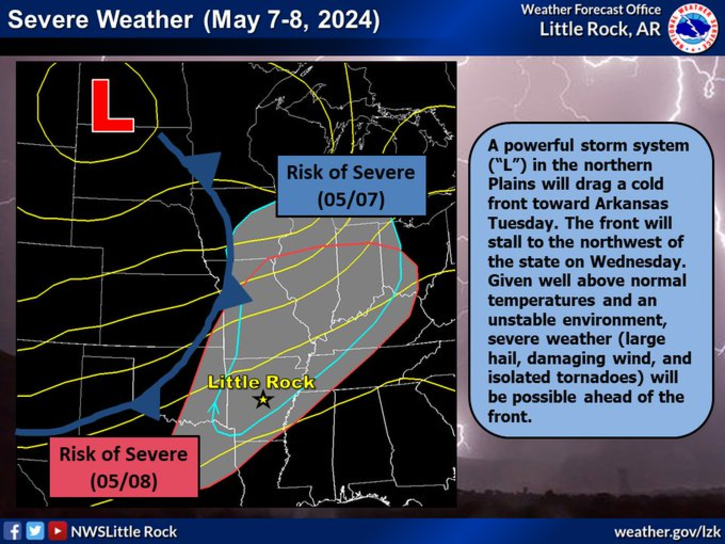
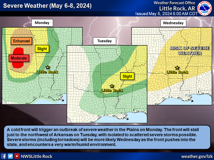
Friday afternoon into Friday night will see all modes of severe weather possible with the highest threat for large hail and damaging winds, but a tornado or two can't be ruled out.
Chances for showers and a few thunderstorms will continue overnight into Friday morning, with the best chances again over northern and northwest sections.
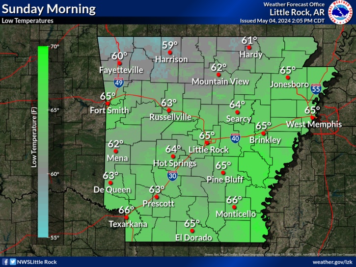
Forecast lows tonight into Friday morning will be in the low 50s to mid 60s.
Forecast highs on Friday will be in the upper 60s to low 80s.
Several rounds of rainfall will remain possible tonight through the weekend, into Tuesday afternoon. Rainfall amounts could exceed 4 inches in some areas across portions of western Arkansas.
On This Day In Arkansas Weather History... The start of a week long tornado outbreak began with Arkansas getting hit by several tornadoes on April 25th, with additional tornadoes occurring the next day. On the 25th, major damage was seen at Vilonia, where a long track EF2 was seen (sadly, another stronger EF4 tornado would just occur 3 yrs later nearly to the day), with an EF2 tornado hitting the Little Rock AFB, and the strongest EF3 near Fountain Lake.
 
Hourly Weather Roundup ( )
Location Sky/Weather Temp Dewpt RH Wind Baro Remarks
Fayetteville
N/A
N/A
N/A
N/A
N/A
N/A
N/A
Harrison
N/A
N/A
N/A
N/A
N/A
N/A
N/A
Mountain Home
N/A
N/A
N/A
N/A
N/A
N/A
N/A
Jonesboro
N/A
N/A
N/A
N/A
N/A
N/A
N/A
Fort Smith
N/A
N/A
N/A
N/A
N/A
N/A
N/A
Russellville
N/A
N/A
N/A
N/A
N/A
N/A
N/A
Mount Ida
N/A
N/A
N/A
N/A
N/A
N/A
N/A
Hot Springs
N/A
N/A
N/A
N/A
N/A
N/A
N/A
Little Rock
N/A
N/A
N/A
N/A
N/A
N/A
N/A
North Little Rock
N/A
N/A
N/A
N/A
N/A
N/A
N/A
West Memphis
N/A
N/A
N/A
N/A
N/A
N/A
N/A
Texarkana
N/A
N/A
N/A
N/A
N/A
N/A
N/A
El Dorado
N/A
N/A
N/A
N/A
N/A
N/A
N/A
Pine Bluff
N/A
N/A
N/A
N/A
N/A
N/A
N/A
Monticello
N/A
N/A
N/A
N/A
N/A
N/A
N/A
Note: "N/A" or "MISG" will be displayed if values are not available. In the LOCATION column, click on links for a list of recent observations at sites of interest. In the WIND column, VRB is "variable" and G is "gust". Wind speeds are in MPH. In the BARO (pressure) column, values are in inches. In the REMARKS column, HX is "heat index", WCI is "wind chill index", and VSB is "visibility" (if shown).
 
 
Point Forecasts
Cities in Arkansas Coordinates (make sure "Lon" is negative)
Lat:   Lon:
 
Local Hazards
Local Hazards
Decision Support
Decision Support
Submit Storm Report
Submit Storm Report
Local Forecast Page
Local Forecast Page
Radar Links
Radar Links
Local Climate Page
Local Climate Page
Local Observations Page
Local Satellite Page
Local Drought Page
Local Drought Page
Local Hydrology Page
Local Fire Page
Local Fire Page
Text Product Viewer
Text Product Viewer