Thursday into Thursday night will present the opportunity for severe weather across Arkansas. The main threats will be damaging winds and large hail. A tornado cannot be ruled out, especially across north-central and northeastern Arkansas.
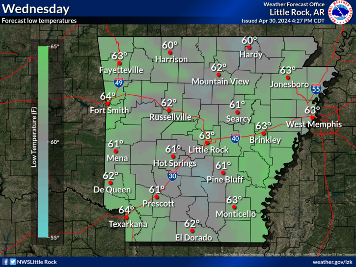
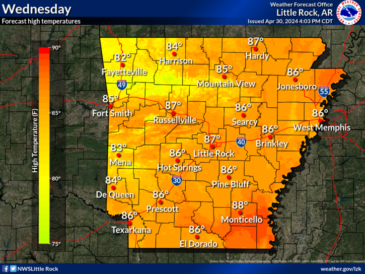
Rain chances on Wednesday will be restricted to the far southeastern part of the state and rain is expected to end in the far southeast part of the state by noon.
Note: "N/A" or "MISG" will be displayed if values are not available. In the LOCATION column, click on links for a list of recent observations at sites of interest. In the WIND column, VRB is "variable" and G is "gust". Wind speeds are in MPH. In the BARO (pressure) column, values are in inches. In the REMARKS column, HX is "heat index", WCI is "wind chill index", and VSB is "visibility" (if shown).


 Regional Radar
 Weather Map
 Social Media Dashboard
 Follow us on YouTube