 |
| High Water Situations |
| To help the local community in times of high water, the National Weather Service is spreading the word about Turn Around Don't DrownTM. |
|
|
 |
Turn Around Don't DrownTM (Horsehead Lake, Arkansas) |
 |
| |
 |
In September, 2010, moisture associated with the remnants of Tropical Storm Hermine flowed into Arkansas. Heavy rain developed in northern sections of the state, with amounts up to a foot in parts of Johnson County. |
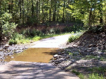
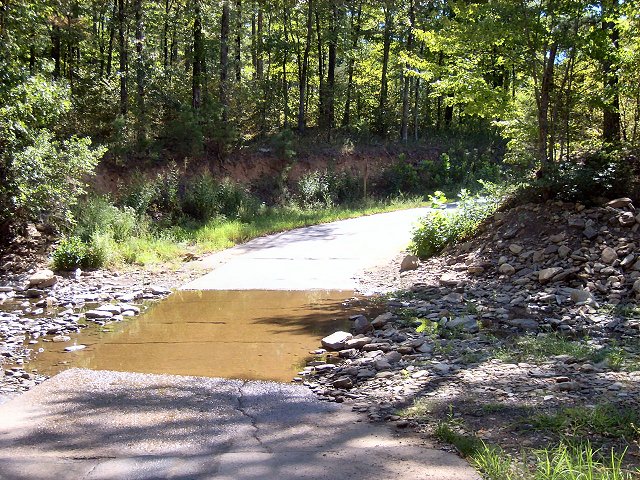
| In the picture: This is one of several low water crossings around Horsehead Lake (Johnson County). Click to enlarge. |
|
On September 7th, roads were covered by water at Horsehead Lake (Johnson County). At one time, the area was inaccessible by law enforcement. There were a couple of campers in the area, but they were in a safe place (higher ground). A few miles north of Hartman (Johnson County), Horsehead Creek went out of its banks on the 9th and flooded a home.
|
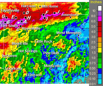 |
| In the picture: Seventy two hour (three day) precipitation through 700 am CDT on 09/10/2010. Point "A" is Devils Knob (Johnson County), "B" is Natural Dam (Crawford County), "C" is Clarksville (Johnson County), "D" is Compton (Newton County), "E" is St. Paul (Madison County), "F" is Blanchard Springs (Stone County), "G" is Strickler (Washington County), "H" is Deer (Newton County), "I" is Mountain View (Stone County) and "J" is Evening Shade (Sharp County). |
| Seventy Two Hour Rainfall (through 700 am CDT on 09/10/2010) |
| Site |
Amount (Inches) |
| Devils Knob (Johnson Co) |
12.02 |
| Natural Dam (Crawford Co) |
9.00 |
| Clarksville (Johnson Co) |
7.76 |
| Compton (Newton Co) |
7.35 |
| St. Paul (Madison Co) |
6.92 |
| Harrison (Boone Co) |
6.58 |
| Lead Hill (Boone Co) |
5.91 |
| Blanchard Springs (Stone Co) |
5.86 |
| Strickler (Washington Co) |
5.81 |
| Deer (Newton Co) |
5.18 |
| Mountain View (Stone Co) |
5.11 |
| Evening Shade (Sharp Co) |
4.80 |
|
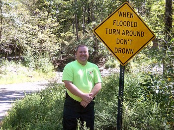
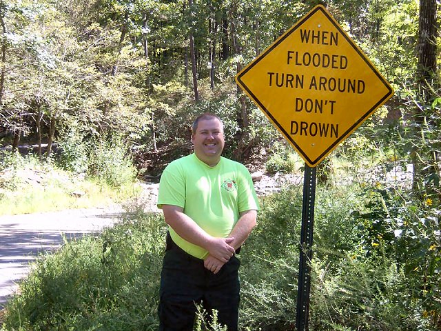
Since that time, signs were posted in the area by Johnson County Emergency Manager Josh Johnston to warn people of the high water danger. On September 8, 2011...the National Weather Service visited the area to view the signs.
|
 |
Each year, more deaths occur due to flooding than from any other thunderstorm related event. Why? The main reason is people underestimate the force and power of moving water. More than half of all flood related deaths occur in automobiles that are swept downstream. |
| In the picture: Johnson County Emergency Manager Josh Johnston stands next to a Turn Around Don't DrownTM sign along County Road 3198 at the north end of Horsehead Lake (Johnson County) on 09/08/2011. Click to enlarge. |
|
|
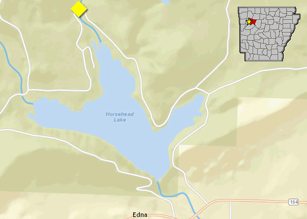
| In the picture: Map of Horsehead Lake (Johnson County), with high water sign placement in yellow. |
|
| |
|
Of these drownings, many are preventable, but too many people continue to drive around the barriers that warn the road is flooded or take precarious risks. A mere six inches of fast-moving flood water can knock over an adult. It takes only two feet of rushing water to carry away most vehicles. This includes pickups and SUVs.
|
| Whether you are driving or walking, if you come to a flooded road, TURN AROUND DON'T DROWN. You will not know the depth of the water nor will you know the condition of the road under the water. |
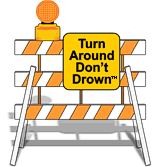 |
| In the picture: Barriers are there for a reason. Don't ignore the barriers! |
|
Turn Around Don't DrownTM (or TADD) is a National Weather Service campaign to warn people of the hazards of walking or driving a vehicle through flood waters. Several counties are adopting TADD signs and posting them at locations where flash flooding often leads to water over the roads.
These TADD Warning Signs are compliant with the Federal Highway Administration's regulations and can be produced and deployed as an official road sign. If your community would like more information on purchasing these signs, contact the Senior Service Hydrologist at the NWS Little Rock office. Civic groups may consider donating or raising money to give to their local community officials for purchase of these TADD signs.
|
|
|


 Follow us on YouTube