
There is an Enhanced Risk (Level 3 of 5) for severe thunderstorms today with threats for significant severe hail and tornado potential over southern Iowa into northern Missouri and west-central Illinois. Elevated to critical fire weather is possible today due to gusty winds and dry conditions over parts of the southern High Plains and northeastern Montana. Read More >
Midland/Odessa
Weather Forecast Office
An upper level low pressure system across northwest Texas ushered a strong cold front into west Texas and southeast New Mexico late Wednesday and early Thursday. Very strong north winds behind the cold front spread across the region, especially across the plains. Wind gusts from near 50 mph to just over 60 mph were common for areas along and north of the Interstate 10 corridor.
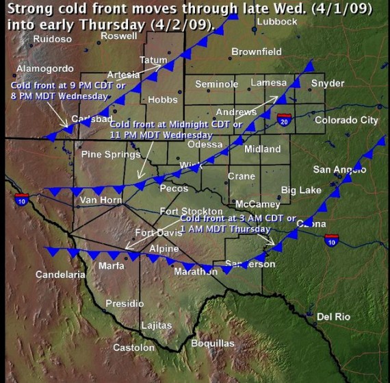
This graphic shows the forecast location of a cold front as it moves south through west Texas and southeastern New Mexico.
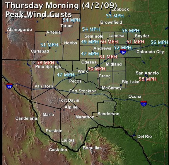
This graphic shows the peak wind speeds behind the strong cold front.
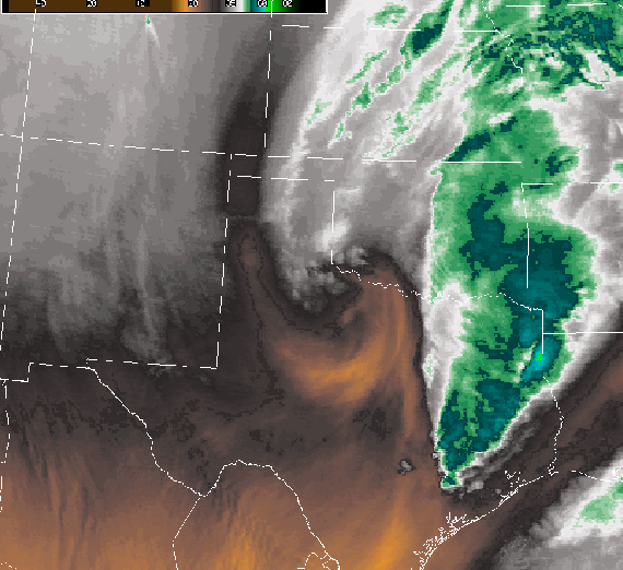
This image shows a strong low pressure center located near Childress, TX.
Hazards
Active Alerts
Current Hazards
Drought
Hazardous Weather Outlook
National Hurricane Center
Outlook
Severe Weather
Spotter Briefing
Storm Prediction Center
Storm Report
Weather Prediction Center
Winter Weather
Past Weather
Cooperative Observations
Local Climate Data
National Climate
Current Weather
Enhanced Data Display
Observations
Radar
Satellite
Tower Cam
Upper Air
West Texas Mesonet
Forecasts
Activity Planner
Aviation
Climate Prediction Center
Fire
Forecast Discussion
Graphical
Local
Space Weather Center
Information Center
Briefing
Forecast Models
GIS
Glossary
International Weather
Road Conditions
Weather Trivia
Water
Hydrology
Precipitation Estimates
Quantitative Precipitation Forecasts
US Dept of Commerce
National Oceanic and Atmospheric Administration
National Weather Service
Midland/Odessa
2500 Challenger Dr.
Midland, TX 79706-2606
(432) 563-5006
Comments? Questions? Please Contact Us.

