Isolated strong to severe thunderstorms capable of producing large hail and damaging wind gusts will be possible this evening across west-central Texas. Elevated to Critical fire weather conditions will persist across the southern Rockies and portions of the southern Plains through this weekend. Read More >
| Submit Your Storm Report | NWS Midland/Odessa Local Storm Reports (LSR) |
|
Mesoscale Discussions
 |
Current Watches
 |
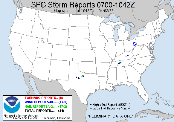
Severe Weather Reports
|
|
|
Day 1 Outlook
 |
Day 2 Outlook
 |
Day 3 Outlook
 |
|
| Radar Sites Midland, TX El Paso, TX Lubbock, TX Dyess AFB, TX San Angelo, TX Laughlin AFB, TX |
 |
Regional Mosaics Southern Plains Southern Rockies Northern Rockies Northern Plains |
 |
| Tornado Warning (a tornado is occuring or imminent) Severe Thunderstorm Warning (a severe thunderstorm is occuring or imminent) Severe Weather Statement (updates tornado and severe thunderstorm warnings) Flash Flood Warning (flash flooding is occuring or imminent) Flash Flood Statement (updates flash flood warning) Watch by County Notification (list of counties within a convective watch) Significant Weather Advisory (strong but less than severe thunderstorms) Hazardous Weather Outlook (potential weather hazards for the next 7 days) Local Storm Reports (preliminary summary of severe weather reports) Storm Data (official publication of significant weather events) |