
Isolated strong to severe thunderstorms capable of producing large hail and damaging winds will be possible through Tuesday evening across northwest Texas. The combination of dry conditions and gusty winds have led to elevated to critical fire weather concerns across southern Colorado and Guam. Read More >
|
|||||||||
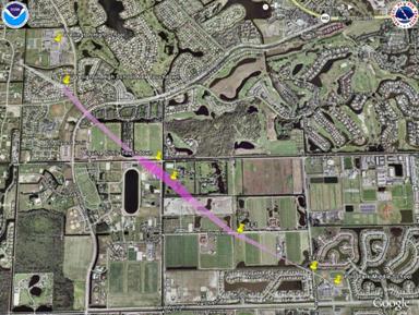
* Maximum estimated winds with tornado approx. 115 mph making it a low end EF2. Color along swath indicates estimated max intensity somewhere along that segment of the swath. The width of the swath indicates approximate width of main tornadic circulation. There is no necessarily a one to one corelation between the depicted swath width and debris field observed during the survey or actual damage experienced. Again it is an approximation. Swath approximately depicts areas where most damage was observed. Damage was also possible around the periphery of the depicted swath but not necessarily observed during the survey. Preliminary Storm Damage Survey Results For Wellington Tornado The following is a preliminary damage assessment for a tornado that moved through the village of Wellington, Florida, associated with the spiral bands of Tropical Storm Fay as it moved across South Florida. Event Date: Tuesday August 19, 2008. Event Time: Approximately 130 AM EDT. Event Location: Tornado began near Polo Mark Middle School near the intersection of Lake Worth Road and Isles View Drive, ending just southwest of Wellington High School. Peak Wind: approximately 115 mph based on NWS Survey Assessment. Rating: Low end EF2 on the Enhanced Fujita Scale. Damage Dimensions: The tornado had an approximate damage path of 2.75 miles from the southeast to the northwest and was around 100 yard wide at its widest point, but mostly 70 to 80 yards. Injuries: None reported. Fatalities: None. Damage Discussion: Tornado moved through a number of Equine Farms and Polo Grounds as well as two subdivisions in Wellington. Worst damage was to Palm Beach Equine Clinic, 13125 Southfields Road, where stables were deroofed, power poles snapped, and many trees down in criss crossing patterns. The Equine Veterinary roof was more than 95 percent detiled, a heavy trailer was tossed about 40 yards from its previous location northwest of the International Polo Club, and an apartment home roof near Folkstone Circle was about 70 percent detiled. Warning: A tornado warning was issued by the National Weather Service Office in Miami at 102 AM EDT until 130 AM EDT mentioning Wellington. The warning was followed up with a new one issued at 128 AM EDT and valid until 200 AM EDT with Wellington mentioned as the first town in its path. The tornado was associated with a spiral band of strong thunderstorms rotating around the circulation of Tropical Storm Fay. |
Click on Images for larger Picture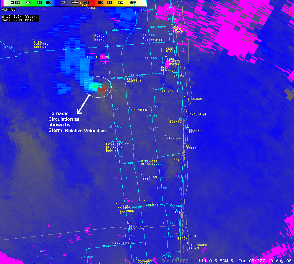
Fort Lauderdale Terminal Doppler Radar Storm Relative Velocity valid on Aug 19 2008 at 0527Z (127 AM EDT). See Also Loop (~2 MB).
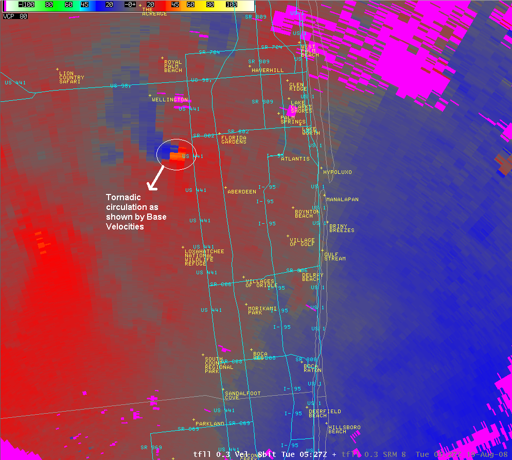
Fort Lauderdale Terminal Doppler Radar Base Velocity valid on Aug 19 2008 at 0527Z (127 AM EDT). See Also Loop (~2 MB).
|
||||||||


 Follow us on YouTube