National Weather Service United States Department of Commerce

Active Pattern for the Center of the Nation

Severe thunderstorms, excessive rainfall, critical fire weather are all in the outlook today and into this last weekend of April. Very large hail, severe wind gusts, and a couple strong tornadoes will all be possible across the central and southern Plains today. Flash flooding also possible for portions of the Plains and Mississippi Valley. Critical fire weather conditions for Southern High Plains Read More >


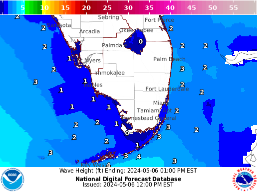
Gulf Stream Ship Route and Wave Model Graphics:


Visit our Experimental High Resolution Marine Model Forecast Page and Click over the South Florida area.

Gulf Stream Forecast Guidance Available Here


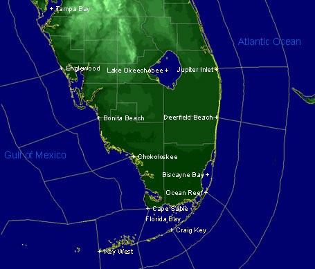
Access Marine point forecasts here
 
 Marine Forecasts and Advisories (click on map to get forecast)
 South Florida  
South Florida Marine Forecast Zones
 Marine Forecasts
South FL Coastal Waters
Atlantic Offshore Waters
Gulf of Mexico Offshore Waters
 Surf & Beach Forecast
South Florida
East Central Florida
West Central Florida
 Surf & Additional Links
Mariner's Guide to Weather Services
Mariner's Weather Log
Lightning and Boats
National Safe Boating Council
 Graphical Forecasts
Link to Graphical Marine Forecasts


 Tide Predictions
Miami Harbor
Lake Worth Pier
Ocean Reef
Thursday
Low 03:57 PM
High 10:48 PM
Thursday
Low 03:34 PM
High 10:12 PM
Thursday
Low 04:14 PM
High 10:40 PM
Friday
Low 04:26 AM
High 10:50 AM
Low 04:34 PM
High 11:30 PM
Friday
Low 04:17 AM
High 10:12 AM
Low 04:11 PM
High 10:53 PM
Friday
Low 04:43 AM
High 10:42 AM
Low 04:51 PM
High 11:22 PM
Across South Florida (out to 4 days):