Event Overview
During the three day period from Thursday, October 6 through Saturday, October 8 portions of eastern North Carolina received up to a foot of rain. The deluge of rain was the result of a combination of meteorological phenomena including Tropical Storm Tammy, an inverted trough of low pressure over the southeast U.S. coast and a cold front associated with a deep surface low over the Great Lakes and southern Canada that approached the area from the west on October 7th and 8th.
On Wednesday, October 5th, the counter-clockwise circulation of Tropical Storm Tammy (located off the northern FL coast) allowed deep-layer moisture from the Atlantic to stream into eastern North Carolina. On Thursday, October 6th a subtle coastal front in the form of an inverted trough along the North Carolina coast began to strengthen in response to pressure falls over the southeast states from Tropical Storm Tammy's landfall [12Z 10/06 Surface Analysis/Radar]. This coastal front moved inland over eastern North Carolina on Thursday evening. The combination of deep moisture from the Atlantic and lift (in the form of surface convergence) associated with the coastal front that moved inland allowed heavy precipitation to develop over eastern North Carolina on Thursday evening. The heavy rain associated with the coastal front/inverted trough over eastern North Carolina continued through the day on Friday, October 7th [12Z 10/07 Surface Analysis/Radar]. On Friday night, a surface front associated with a deep surface low over the Great Lakes and southern Canada approached the area from the west. The surface front linked up with the inverted trough over the southeast, enhancing the lift orginally associated with this feature and allowing a surface low to develop over the Carolinas [12Z 10/08 Surface Analysis/Radar]. Widespread heavy rain continued until mid-day Saturday, October 8th when a 500 mb shortwave over the Ohio Valley approached the region and picked up the surface low, kicking it off rapidly to the NNE along the northeast U.S. coast.
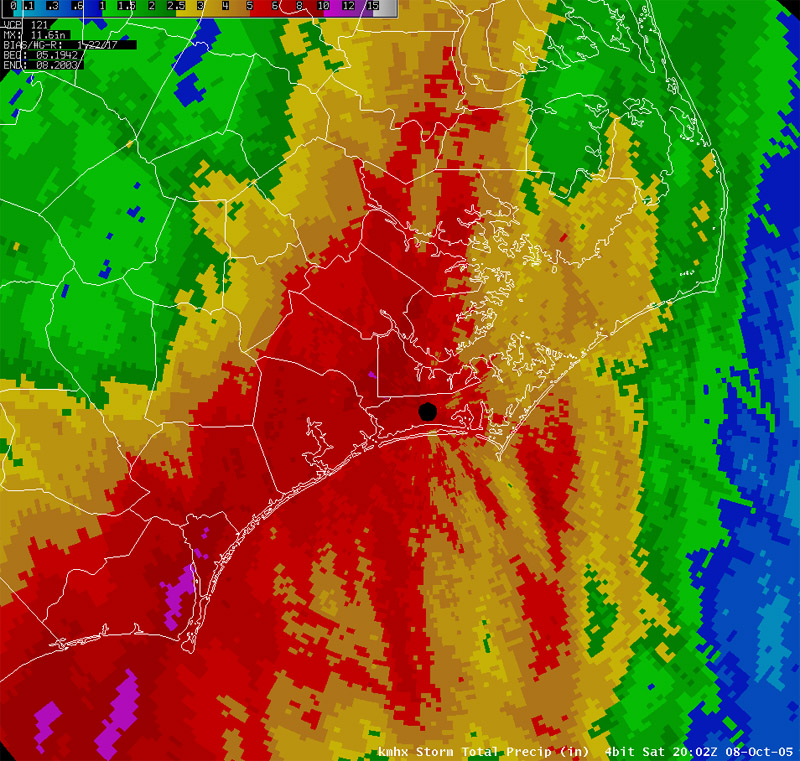
Three-Day Rainfall totals of 6-8" were common across Onslow, Jones, Craven, Carteret, Pamlico and Beaufort counties with locally higher amounts of 10-12". New Bern in Craven County reported 10.79" of rain, Cherry Point reported 6.23", Newport in Carteret County reported 8.48", Morehead City reported 6.77" and Beaufort reported 6.74". Numerous road closures were reported in many counties across eastern North Carolina.
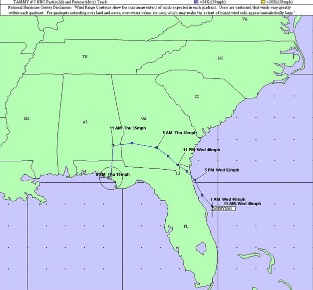
Tropical Storm Tammy's History - Tropical Storm Tammy formed within a large area of disturbed weather north of the Bahamas (just off the FL coast - 20 miles east of Cape Canaveral) on the morning of Wednesday, October 5, 2005. The National Hurricane Center issued their first advisory on Tammy at 7:30 am EDT on Wednesday as a 40 mph Tropical Storm with a minimum central pressure of 1004 mb. By 8:00 pm EDT on Wednesday evening, Tammy made landfall near Mayport, FL as a Tropical Storm with 50 mph sustained winds and a minimum central pressure of 1001 mb. The last advisory issued by the National Hurricane Center was on 11:00 am Thursday morning. Tammy's remnants continued moving inland to the west, dissipating from a tropical system to a remnant low over the FL panhandle on the afternoon of Thursday, October 6.
Radar Imagery - Storm Total Precipitation from Thursday, October 06 through Saturday, October 08 over eastern North Carolina. The map shows widespread totals of 6-8" over Onslow, Jones, Craven, Carteret, Pamlico and Beaufort counties with locally higher amounts of 10-12".
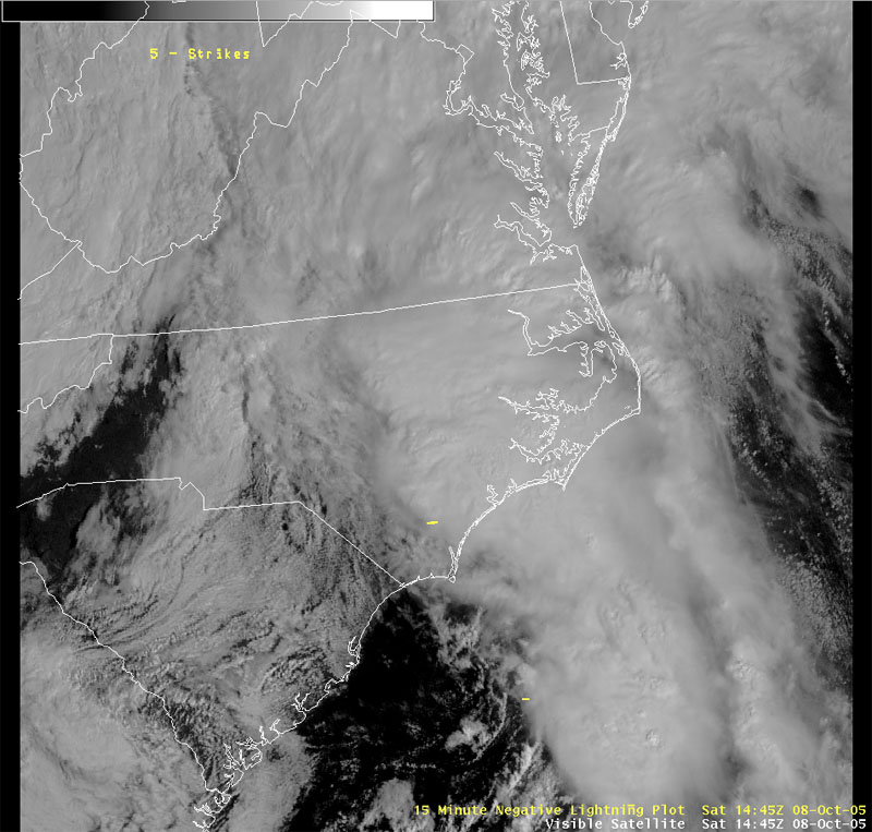
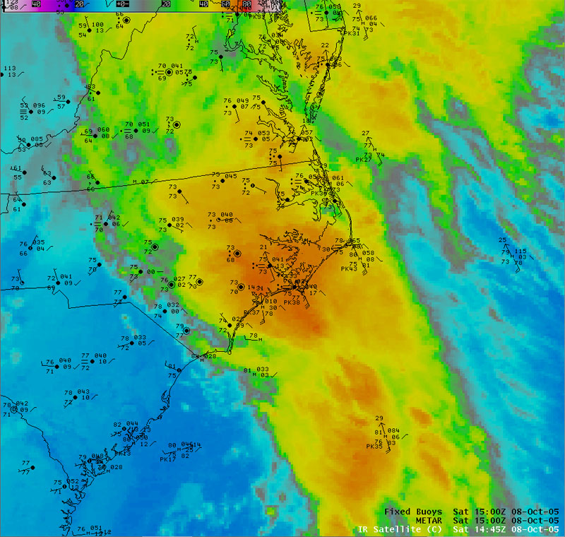
Satellite Imagery - Visible and IR satellite imagery with surface observations overlayed from 1445Z (10:45 am EDT) on October 08, 2005.
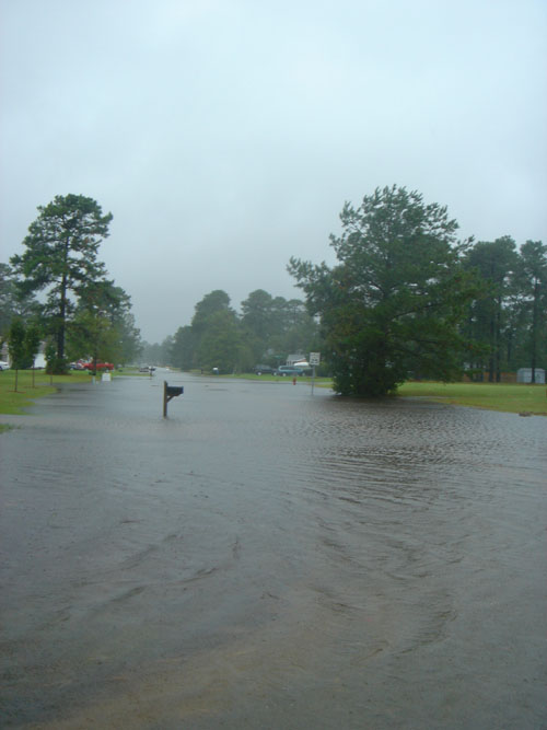
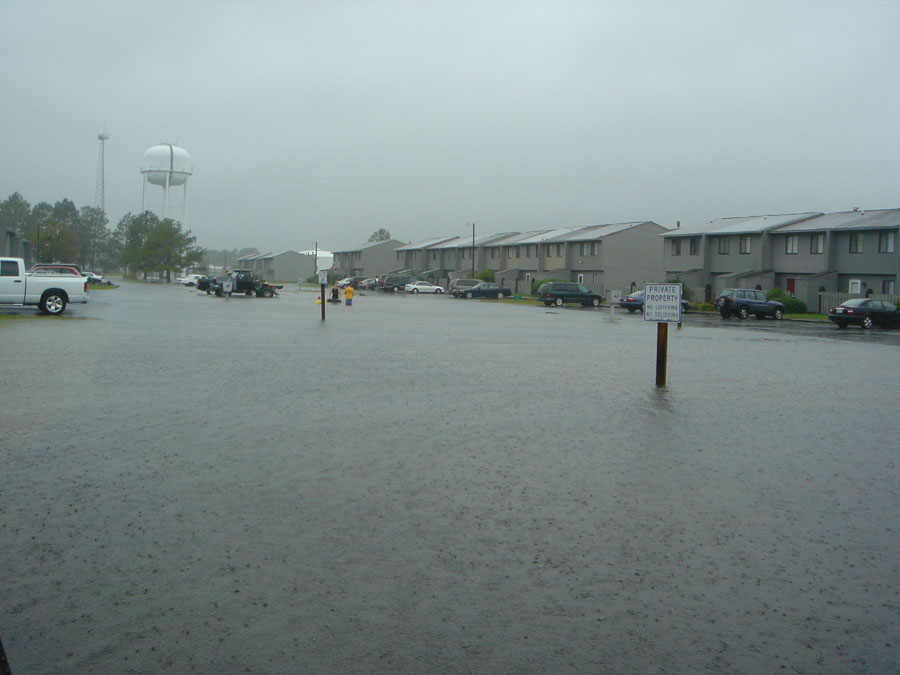
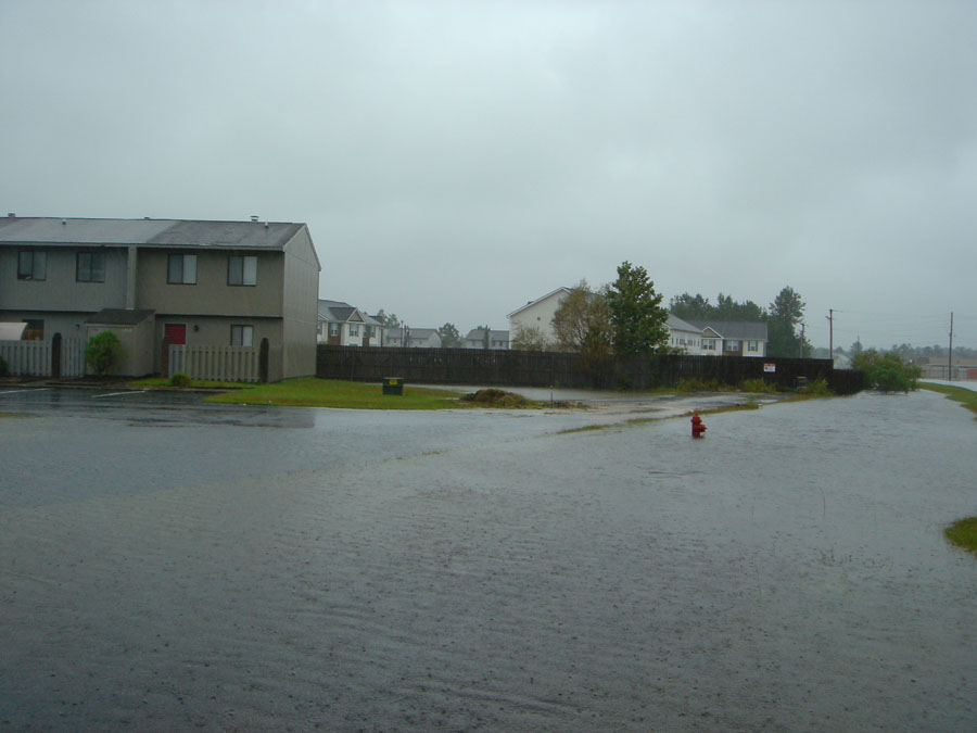
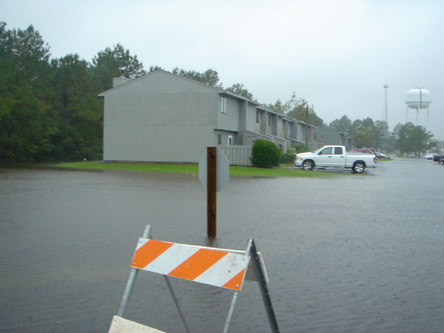
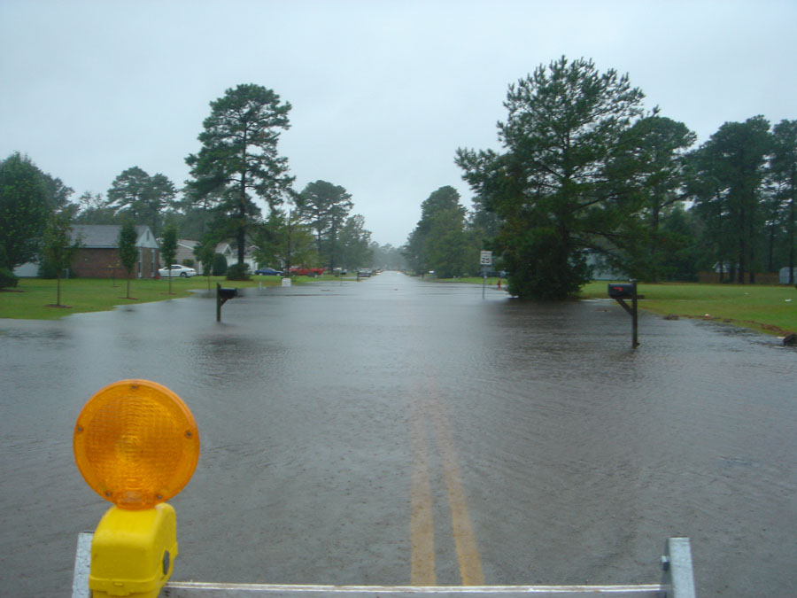
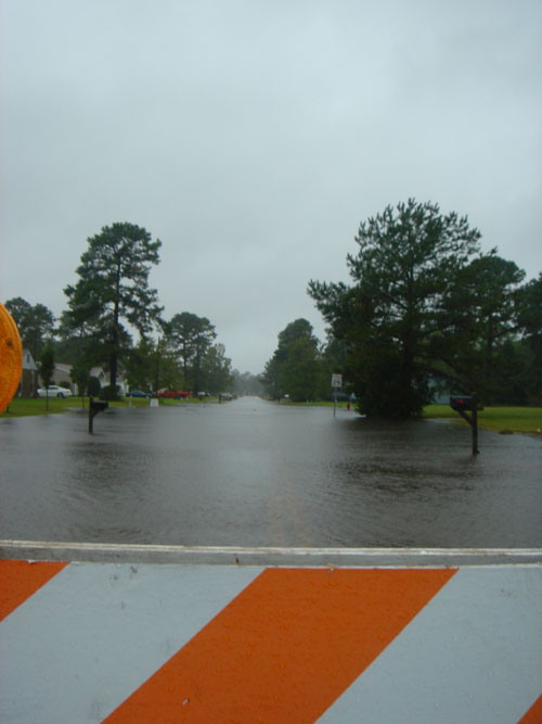
Flooding in Havelock, NC (Craven County).
Photos courtesy of Brandon Vincent, NWS MHX
Case Study Team:
Brandon Vincent


.png) Surf Forecast/Rip Currents
Surf Forecast/Rip Currents Map View
 Weather Hazard Briefing (when applicable)
 Forecaster Discussion
 Marine
 Text Products
.png) Skywarn
Skywarn Submit Storm Reports
 Coastal Flood
 Follow us on YouTube