Groundhog Day Blizzard, 2011
During the overnight hours of Feb 1 to Feb 2, a powerful low pressure center passing south of Wisconsin produced blizzard conditions across much of southern Wisconsin. Snow associated with the system began in the mid-afternoon hours in far southern Wisconsin and pushed northward into the state through the evening. Very strong winds were associated with this storm for an extended period of time. Many locations saw blizzard conditions from early on the evening of Feb 1 through the early morning hours of Feb 2. In addition to the blizzard, several inches of snow fell on Jan 31, with light lake effect snow in the eastern half of the area through the day on Feb 1. It's possible that some locations did not see a break in snowfall between the evening of Jan 31 and the morning of Feb 2.
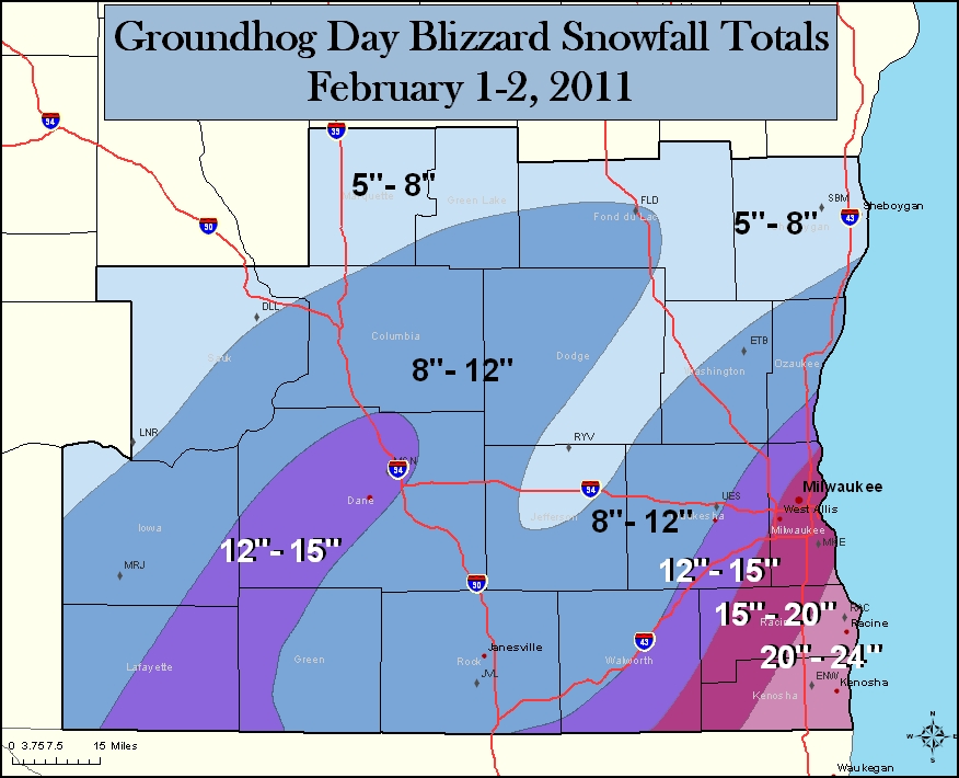
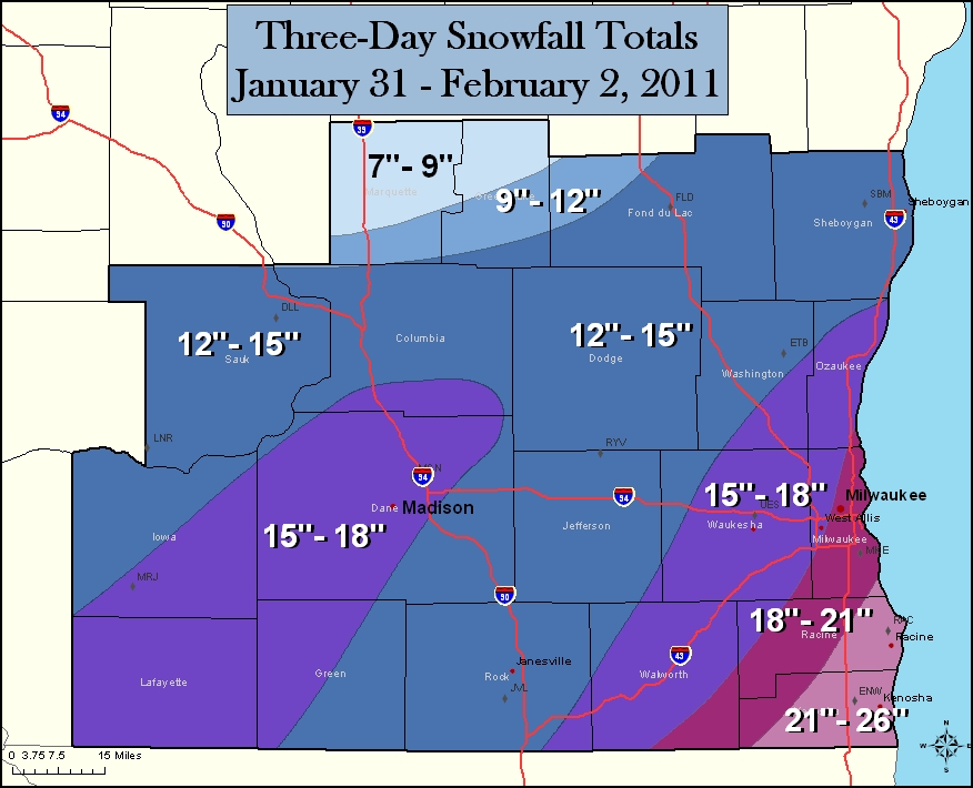
The first image below is snowfall totals for the duration of the blizzard event. The second image is snowfall totals for the entire 2-3 day event. (click on any image for a larger version.)
 |
 |
A sample of some snowfall totals at specific locations can be found here.
|
Monday night through Tuesday afternoon: 3.8" Tuesday evening through Wednesday morning: 16.0" Total: 19.8" Records - 16.0 inches fell between 6 pm on Tuesday, February 1st and noon on Wednesday, February 2nd. This total is tied for fifth for any 24 hour period. - 19.6 inches fell between noon on Monday, January 31st and noon, Wednesday, February 2nd. This total is fifth for any 48 hour period. |
||||||||||||||||||||||||||||||
|
Monday night through Tuesday afternoon: 6.0" Tuesday evening through Wednesday morning: 12.7" Total: 18.7" Records - The total snow that fell on Tuesday, February 1st and Wednesday, February 2nd was 14.3 inches, which is the fifth highest 48 hour snowfall amount. - The 18.7 inches that fell over the three day period from Monday, January 31st and Wednesday, February 2nd is the second most for a 3 day period. |
||||||||||||||||||||||||||||||
Peak wind gusts between 7pm and 4am were 40 to 50 mph in many areas, with some locations having gusts higher.

The image below is an analysis of sea level pressure at midnight on Feb 2. It shows the vast size of the system affecting the entire eastern half of the country.

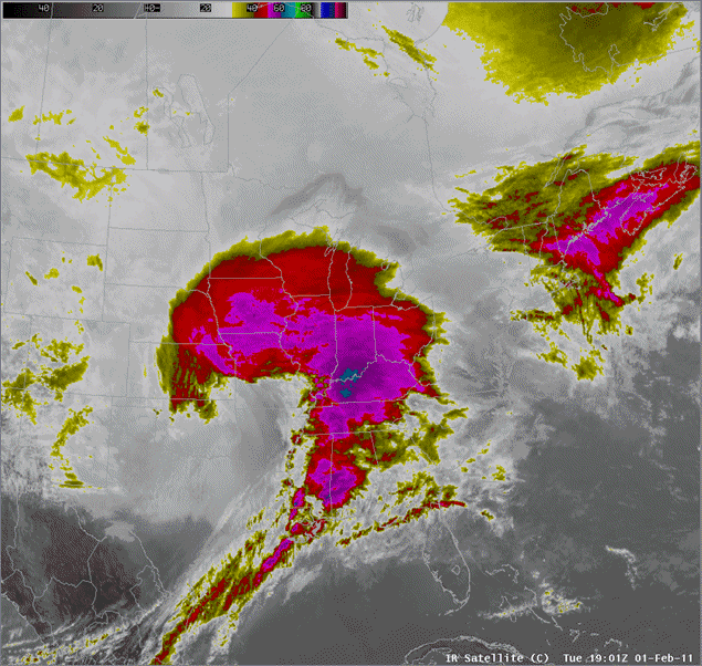
An animation of infrared satellite from 1pm Feb 1 through 4am Feb 2.
The following image is snow depth reported at 7am on Feb 2. We don't very often see widespread snow depth over 20 inches across the area.

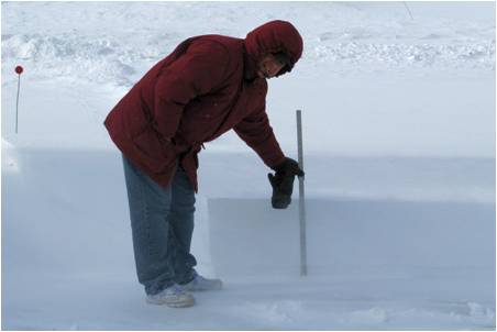
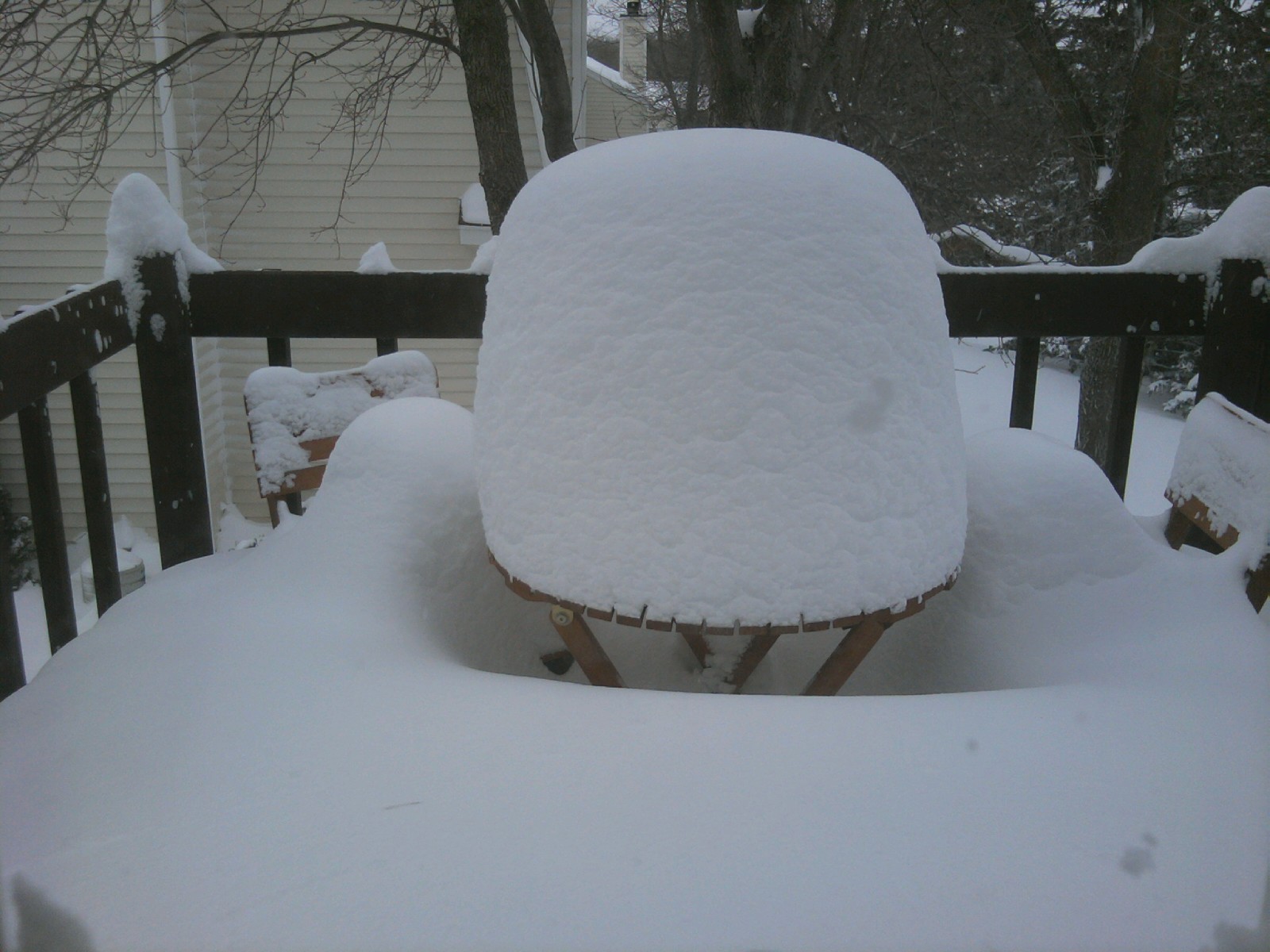
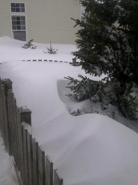
The following are photos emailed to our office. Thanks to those who submitted their photos.
 |
 |
 |
 |
For another great recap of this Blizzard, check out the page by our neighbors to the south, NWS Chicago.
https://www.weather.gov/lot/2011blizzard
NWS Milwaukee
Archives


 Follow us on YouTube