

[Pardeeville EF-2] [Other Tornadoes] [5" Hailstone] [Outbreak Stats]
NOTE: All radar images were saved using Gibson Ridge Level 2 Radar software.
After a late spring dominated by cooler weather, a major pattern shift in the upper level flow allowed a warm, humid air mass to push northward through the Central United States as early as three days in advance of the severe weather event on June 7th. The pattern was dominated by a trough in the Western U.S. and a ridge in the Eastern U.S. The contrast set up by this pattern was pretty stark. A heat wave developed along the East Coast, while snow was reported in higher elevations of the Northern Rocky Mountains. The high temperature in Burlington, Vermont was 92 degrees on Saturday, June 7th! Central Park on Manhattan Island, New York recorded a high of 94 that day, and Washington National Airport recorded a record high of 98 degrees.
By the early afternoon that day, the surface dewpoints across Southern Wisconsin had risen into the low to mid 70s. When combined with warm temperatures on the order of 80 to 85 degrees, the atmosphere became very unstable - a key ingredient for severe thunderstorms. The vertical wind shear, an increase in wind speed with height, was also impressive across the region. When strong instability and wind shear exist together, the atmospheric conditions are considered favorable for the development of supercell thunderstorms. Supercell thunderstorms are intense, rotating thunderstorms, that can produce a variety of severe weather from straight-line winds and large hail, to tornadoes from time to time.

Thunderstorms were ongoing at daybreak in Southern Minnesota on the northern periphery of the extremely moist air mass. These thunderstorms weakened during the late morning hours as they pushed through Southern Minnesota, but then rapidly re-intensified in the noon hour as they pushed into Southern Wisconsin.
One of the thunderstorms intensified into a high-precipitation (HP) supercell just to the east of La Crosse, and eventually tracked through portions of Sauk, Columbia, Marquette, Green Lake, and Dodge Counties. An HP supercell is one that has a large amount of rain and hail that usually partially obscures, or totally obscures, the area of rotation. As this supercell tracked across parts of Southern Wisconsin, it produced tornadoes, destructive straight-line winds to nearly 100 mph and hail. As the afternoon progressed, numerous supercell thunderstorms developed over Southern Wisconsin, and produced a fairly widespread severe weather outbreak. In fact, the tornado outbreak in terms of number of tornadoes, was the 6th most active tornado day in Wisconsin history.
The most notable severe thunderstorm happened to be the supercell that moved from near the Wisconsin Dells through the Beaver Dam area between 1:30PM and 3:30PM. The EF-2 tornado that this thunderstorm produced will be detailed first, and then other aspects of the outbreak will be discussed.


| Beginning Time | 2:32PM | EF-Scale | EF-2 |
| Beginning Location | 1.0 ESE Pardeeville | Path Width | 2 Miles |
| Ending Time | 2:50PM | Path Length | 9 Miles |
| Ending Location | 3.0 S Cambria | Est. Peak Winds | 120 MPH |
The following description is the results of the damage survey as conveyed in a Public Information Statement (PNS), with a few minor additions. The NWS survey of the storm damage from Saturday Afternoon, June 7th, revealed that a strong tornado, rated EF-2 on the Enhanced Fujita Scale, touched down in Columbia County. The storm damage was extremely complex and was associated with a large HP supercell.
Downburst straight-line wind damage, consisting of numerous trees damaged or downed, extended from the Wisconsin Dells, through Portage and into the western part of Pardeeville. This damage was consistent with wind gusts around 60 mph. This damage was also found along and north of Highway 16 all the way to the Dodge County line.
The damage then became more severe in the central and eastern portions of Pardeeville, where wind speeds were likely around, or greater than, 70 MPH. The RAWS Fire Weather Observation measured a gust to 73 mph around this time, just before 2:30 pm CDT.
Just north of this developing downburst of west to northwest winds, a tornado formed around 2:32 pm CDT one mile east-southeast of Pardeeville - just south of the intersection of Highway P and Pardeeville Road. The tornado was on the ground for about 18 minutes along a path 8 miles long, and apparently lifted about 3 miles south of Cambria around 2:50 pm CDT. The tornado tracked slightly south of east during its lifespan.
What was unusual about this storm is the width of the wind damage. Minor tree damage was observed in a 10-mile wide path over Northeast Columbia County in this area, consistent with wind gusts in excess of 60 mph. Trees to the north of the tornado track were blown down facing west, while those south of the track were blown down facing east. A two mile wide swath of more significant damage was embedded, where winds were estimated in the 70 to 90 mph range, or EF-0 to EF-1 damage. Thousands of trees were uprooted or snapped in the first four miles of the tornado track from one mile east-southeast of Pardeeville, to 4 miles east-southeast of Pardeeville.


Within this area, at times separated by one mile or more, were areas of even stronger damage with estimated peak wind speeds of 100 to 120 mph, into the lower end of the EF-2 range. Evidence strongly suggests brief multiple vortices were located within the main tornado. Small swaths of damage were found where nearly all trees were snapped or uprooted. Other damage in these swaths included barns destroyed, well built houses with roof damage and windows blown out, and a couple dozen large power poles snapped. These swaths were often just 100 to 200 yards wide and long and did not seem to follow any logical progression.


.jpg)
.jpg)
.jpg)


One of these swaths destroyed just about every white pine tree in a grove of 4000 to 6000 trees on one citizen’s property three miles east-southeast of Pardeeville near the intersection of Pardeeville Road and Highway SS. Most of these pine trees were snapped right near the ground level, which is not necessarily visible in the damage survey photos below. Near the end of the tornado track, a barn was destroyed and a grain silo sheared in half three miles south of Cambria. Beyond this location, only straight-line wind damage of about 60 mph was evident to the Dodge County line.


Broad rotation was indicated by the doppler radar several miles across, with an embedded intense circulation. Thus, a term sometimes referred to as a "mesocyclone on the ground" probably occurred. The multiple smaller vortices were embedded within this larger circulation.


We also have 4-panel images available for the Columbia County storm from the 2:36 PM radar scan. For a 4-panel of reflectivity images from 0.5º, 0.9º, 1.3º, and 1.8º, click here. For a 4-panel of storm relative motion images from 0.5º, 0.9º, 1.3º, and 1.8º, click here.
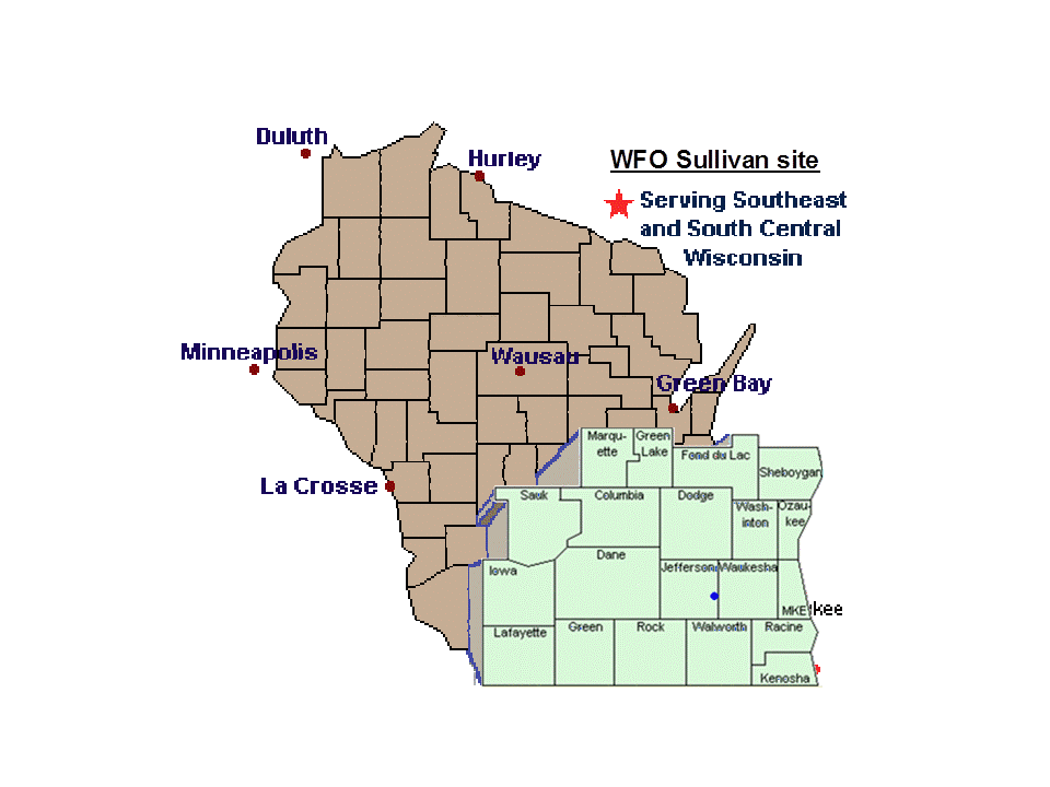
In addition to the tornado rated an EF-2 in Columbia County, 8 other tornadoes occurred on June 7th across the NWS Sullivan County Warning Area (click here to see our CWA). This makes the total number of tornadoes for the day across Southern Wisconsin 9. Below are details as shown in a Public Information Statement, with additional details or images provided, if available.
...TORNADO ONE - /MARQUETTE COUNTY/...
BEGINNING TIME      159 PM                  EF-SCALE  EF-1
BEGINNING LOCATION  2.5N BRIGGSVILLE      PATH WIDTH  100 YARDS
ENDING TIME         205 PM               PATH LENGTH  2.2 MILES
ENDING LOCATION     2.0NE BRIGGSVILLE      MAX WINDS  90 MPH
2:04 PM 0.5º Reflectivity 2:04 PM 0.5º Storm Relative Velocity


This tornado likely started just east of the Marquette-Adams County border and then moved east. The majority of the damage with this tornado was tree damage, with a few larger trees downed, but some minor damage to barns and homes was also noted.
...TORNADO TWO - /COLUMBIA COUNTY/...
Details about this tornado were provided in the section above.
...TORNADO THREE - /COLUMBIA & DODGE COUNTIES/...
BEGINNING TIME      305 PM                  EF-SCALE  EF-0
BEGINNING LOCATION  2.5NE FALL RIVER      PATH WIDTH  25 YARDS
ENDING TIME         309 PM               PATH LENGTH  2.2 MILES
ENDING LOCATION     5.1NW ASTICO
3:08 PM 0.5º Reflectivity 3:08 PM 0.5º Storm Relative Velocity
This tornado was originally reported in a Local Storm Report to be 5 miles southwest of Beaver Dam. It was witnessed by several spotters, and at times was confused for the larger tornado that had occurred to the west.
...TORNADO FOUR - /COLUMBIA & DODGE COUNTIES/...
BEGINNING TIME      308 PM                  EF-SCALE  EF-1
BEGINNING LOCATION  3.4S RANDOLPH         PATH WIDTH  75 YARDS
ENDING TIME         314 PM               PATH LENGTH  3.1 MILES
ENDING LOCATION     5.6NW S. BEAVER DAM    MAX WINDS  95 MPH


This tornado probably had peak winds around 90-95 mph. A barn was mostly destroyed due to winds that blew in a side door, causing the walls to fail, and roof to be blown off. The flying debris then sheared off a small part of the top of a silo.
...TORNADO FIVE - /SAUK COUNTY/...
BEGINNING TIME      316 PM                  EF-SCALE  EF-0
BEGINNING LOCATION  2.0SW PLAIN           PATH WIDTH  25 YARDS
ENDING TIME         317 PM               PATH LENGTH  0.2 MILES
ENDING LOCATION     1.8SW PLAIN
...TORNADO SIX - /DANE COUNTY/...
BEGINNING TIME      325 PM                  EF-SCALE  EF-0
BEGINNING LOCATION  2.4NE COTTAGE GROVE   PATH WIDTH  25 YARDS
ENDING TIME         326 PM               PATH LENGTH  0.4 MILES
ENDING LOCATION     2.8NE COTTAGE GROVE
This tornado was witnessed by a sheriff’s deputy as it briefly spun up in a field. No other details are known, and no damage was reported since it spun up in a field.
...TORNADO SEVEN - /DANE COUNTY/...
BEGINNING TIME      338 PM                  EF-SCALE  EF-0
BEGINNING LOCATION  3.2NW SUN PRAIRIE     PATH WIDTH  25 YARDS
ENDING TIME         339 PM               PATH LENGTH  0.2 MILES
ENDING LOCATION     3.1NW SUN PRAIRIE
This tornado spun up briefly near the intersection of Egre Road and Highway C and was witnessed by a trained spotter. While the brief spin-up was observed, the spotter witnessed a dust swirl and minor debris near ground level.
...TORNADO EIGHT - /JEFFERSON COUNTY/...
BEGINNING TIME      349 PM                  EF-SCALE  EF-0
BEGINNING LOCATION  3.7E LAKE MILLS       PATH WIDTH  30 YARDS
ENDING TIME         350 PM               PATH LENGTH  0.2 MILES
ENDING LOCATION     3.9E LAKE MILLS
3:51 PM 0.5º Reflectivity 3:51 PM 0.5º Storm Relative Velocity
This tornado briefly spun up in an area that was encompassed by a treeline, an open field and a backyard. A few large limbs were ripped off some trees on the treeline, and a swingset was tossed 100-200 feet.
...TORNADO NINE - /DANE COUNTY/...
BEGINNING TIME      442 PM                  EF-SCALE  EF-1
BEGINNING LOCATION  1.4N STOUGHTON        PATH WIDTH  100 YARDS
ENDING TIME         444 PM               PATH LENGTH  1.9 MILES
ENDING LOCATION     3.2NNE STOUGHTON       MAX WINDS  100 MPH
4:42 PM 0.5º Reflectivity 4:42 PM 0.5º Storm Relative Velocity
4:42 PM 1.4º Reflectivity 4:42 PM 1.4º Storm Relative Velocity
This tornado was embedded in a larger swath of severe downburst winds that extended from Northeast Green County into Southern Dane County, into the Stoughton area. Tree damage from this larger downburst wind event was confirmed on damage surveys for the tornadoes of June 12th. However, there was a band of more intense wind damage found within the damage swath, and spotters witnessed a tornado touch down in the Stoughton area. Automobiles were moved around, homes and a church were damaged, and trees and power lines were downed.
...TORNADO TEN - /WAUKESHA COUNTY/...
BEGINNING TIME      537 PM                  EF-SCALE  EF-0
BEGINNING LOCATION  1.5S EAGLE            PATH WIDTH  20 YARDS
ENDING TIME         538 PM               PATH LENGTH  0.1 MILES
ENDING LOCATION     1.4S EAGLE
Another brief tornado spin-up was witnessed by a trained spotter.
To summarize, there were numerous supercell thunderstorms that developed over Southern Wisconsin and produced brief tornadoes areawide.
The National Severe Storms Laboratory in Norman, Oklahoma has an algorithm that produces a 2-dimensional graphic of areas where strong rotation tracked. This is done by computing the amount of shear off radar data. By examining these images, we can determine approximately where supercells with strong rotation tracked. The images below are of the rotation algorithm for June 7th over Southern Wisconsin. Special thanks go to the NSSL OnDemand site and Patrick Marsh of the National Severe Storms Laboratory. Bright yellow, red, and white regions, indicate where an area of strong rotation tracked.


The image on the above right shows how the HP supercell had strong rotation as it tracked over Southern Juneau and Adams Counties and then into Southwest Marquette County before that area of rotation weakened. Then a new area of rotation developed to the south over Columbia County, spawning the EF-2 tornado that affected eastern parts of the county.
Although it is somewhat difficult to interpret, if you look at the image on the above left, you can pick out swaths stretching from the southwest to the northeast. Most supercells on this day moved from the southwest to the northeast, and the HP-supercell over Columbia County was anomalous in that it moved to the east-southeast. There is also a considerable amount of noise near the Waukesha-Jefferson County border, and this is just because that is an area very close to the radar site.
There was a wide and extensive swath of wind damage associated with the severe HP supercell that tracked from near the Wisconsin Dells to near Beaver Dam between about 1:30 PM and 3:30 PM. Tree limbs were reported downed as far west as La Valle, in extreme northwest Sauk County. Trees and power lines were downed across much of northern Sauk County as the supercell tracked east, from the La Valle area, through Reedsburg and into the Wisconsin Dells and Lake Delton areas. Widespread tree damage then occurred across Columbia and Marquette Counties, but especially across Columbia County. As noted in the section concerning the EF-2 tornado, tree damage was noted in nearly a 10-mile wide swath across Northern Columbia County. Trees to the north of the tornado track were blown down facing west and trees to the south of the tornado track were blown down facing east. This damage was likely associated with the strong circulation in the storm, and other seperate downbursts caused damage throughout the area.
In addition to the the damaging winds and tornadoes, there were some areas that received significant hail, most notably across Waukesha County. This occurred with a supercell thunderstorm that moved over the county between 4:00PM and 5:00PM. Below are a couple of radar images from this timeframe, around the time the most significant hail was being reported. Both images show the large hail core aloft. Proximity to the radar limited the vertical sampling of the thunderstorm.


There were numerous reports of severe hail received anywhere from near the Jefferson-Waukesha county border in Oconomowoc, to near the Waukesha-Milwaukee county border in Brookfield. The more significant reports appeared to be from Oconomowoc and Delafield to the west side of Waukesha. Here there were several reports of golf ball size, or larger, hail. The most significant report received was a measured 5" diameter hailstone from 2 miles east-northeast of Delafield at 4:35 PM. A measured 3.25" diameter hailstone was also reported at 4:53PM from 2 miles west of Waukesha.


The 5" diameter hailstone is the 3rd largest hailstone in Wisconsin history! Coincidentally, the hailstone ranks behind a 5.5" hailstone that fell one year earlier, to the date, on June 7, 2007 in Northern Wisconsin.
The National Severe Storms Laboratory in Norman, Oklahoma has an algorithm called "MESH" - Maximum Expected Size of Hail - that computes the maximum estimated hail size from a given storm based on the radar data. It then produces a 2-dimensional graphic of hail swaths. The image below is of the MESH algorithm for June 7th over Southern Wisconsin. Special thanks go to the NSSL OnDemand site and Patrick Marsh of the National Severe Storms Laboratory.

We did not receive any hail reports from Columbia County. However, it is very likely that severe hail occurred. If you, or anyone you know, experienced hail in Columbia County on June 7th, email us with a size estimate (compare it to a common object or coin) through the webmaster account at w-mkx.webmaster@noaa.gov
Below is a radar image that shows the massive hail core aloft over Columbia County.

On June 7, 2008, 13 tornadoes occurred in the state of Wisconsin. Three of those tornadoes were in the NWS La Crosse’s County Warning Area (CWA), while the other ten were in the NWS Sullivan’s CWA. The 13 tornadoes in Wisconsin on that date makes June 7, 2008 the 6th most active tornado day in Wisconsin history.
Below is a list of the top 10 tornado days, as taken from a Public Information Statement:
   ...RANK...           ...DATE...              ...TORNADOES...

       01               AUG 18 2005                   27
       02               MAY 08 1988                   24
       03               JUL 03 1983                   22
       04               JUN 08 1993                   18
       05               JUN 23 2004                   17
   *** 06 ***       *** JUN 07 2008 ***               13
       07               AUG 09 1979                   12
       07               JUL 18 1996                   12
       09               5 DIFFERENT DATES             10
This makes the June 7th tornado outbreak the 4th most active tornado outbreak, in terms of number of tornadoes, in Wisconsin in the past 20 years. The nine tornadoes in the NWS Sullivan County Warning Area (CWA) is the 5the most active tornado day for this area.
Below is a list of the top 10 tornado days in the Sullivan CWA, as taken from a Public Information Statement:
   ...RANK...           ...DATE...              ...TORNADOES...

       01               AUG 18 2005                   16
       02               MAY 08 1988                   11
       03               AUG 09 1979                   10
       03               JUL 18 1996                   10
   *** 03 ***       *** JUN 07 2008 ***               10
       06               JUN 08 1993                    8
       06               JUN 23 2004                    8
       08               JUN 08 1984                    7
       09               JUL 03 1983                    6
       09               JUN 06 1980                    6


 Follow us on YouTube