7 Tornadoes in our Forecast Area June 16-18, 2014
A powerful line of thunderstorms rolled across southern Wisconsin during the late evening and early morning hours of June 16-17th, 2014. The line generated strong, straight-lined winds. Severe thunderstorm warnings were out well ahead of any of the severe weather. These warnings also mentioned that these storms had a potential to produce brief tornadoes and widespread significant wind damage. Around 11 pm, we started to see the northern end of a line of storms develop a pronounced, but broad rotation over northern Lafayette and southern Iowa counties, it then continued into far northeast Green county and eventually Dane county.

Details:
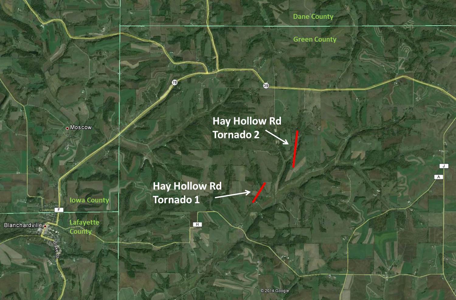
Tornado #1 and #2 (Hay Hollow Rd)
Where: Green County near 3-4 mile northeast of Blanchardville
When: Around 11:36 - 11:38 PM, June 16, 2014
Strength: Both EF-1 with estimated peak wind speeds around 95 mph. 500 yard track and 125 yards wide. The other 800 yard track and 125 yards wide.
Damage: Two separate tracks very close to each other. Hit farmsteads along Hay Hollow Rd, they sustained damage, and there were numerous trees down.
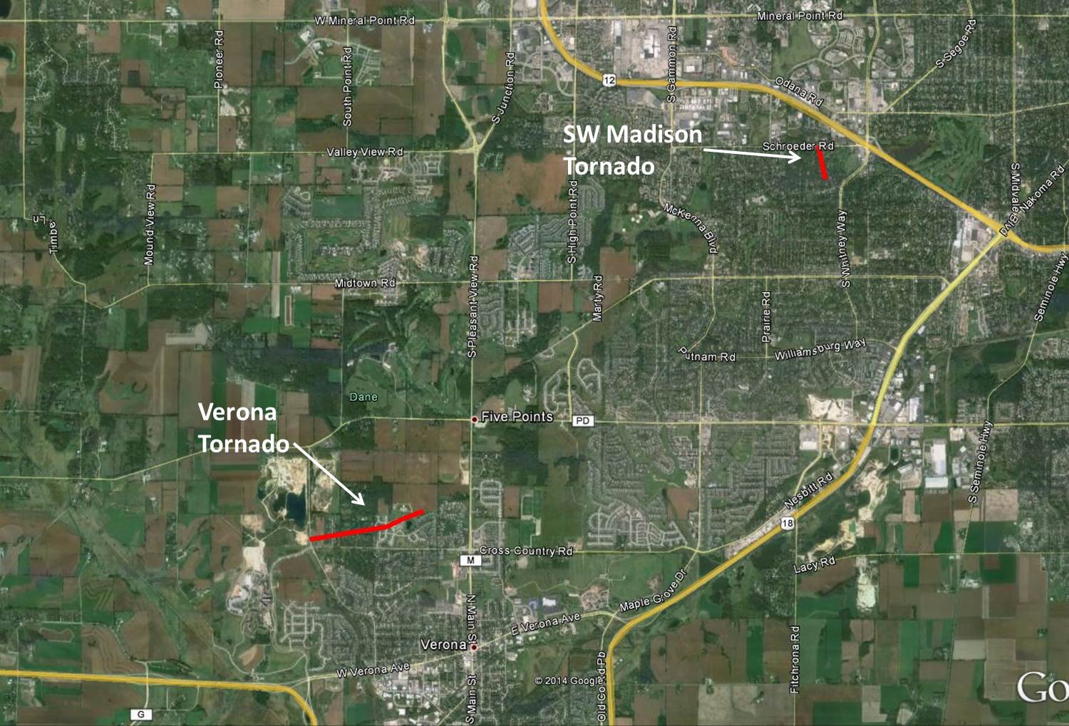
Tornado #3 (Verona)
Where: Dane County, city of Verona, southwest of Madison
When: About 12:08-12:10 AM, June 17, 2014
Strength: EF-3 with estimated peak wind speeds around 140 mph. 50-100 yards wide and 1 mile track.
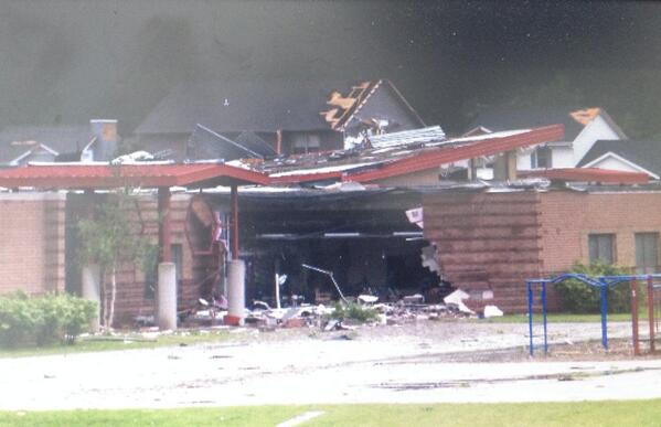
Damage: Numerous structures sustained minor to severe damage. Part of a wall of an elementary school collapsed.
Tornado #4 (SW Madison)
Where: Dane County, 4-5 miles southwest of the State Capitol on Madison's southwest side
When: 12:15 AM, June 17, 2014
Strength: EF-2 estimated peak wind speeds around 120 mph. 200 yards wide and 1/4 mile long track.
Damage: Trees/power lines and some structural damage on Friar Lane, stretching to Schroeder Road in the Sherwood Forest Park area.
Tornado #5
Where: Iowa County 3 miles east of Rewey
When: Around 11 PM, June 16, 2014
Damage: 50 to 75 large Oak trees 1 1/2 to 2 feet in diameter taken down and twisted. About 3 buildings damaged. Sporadic damage path with length roughly 1 to 1 1/2 mile.
Tornado #6
Where: 1 mile northeast of Madison
When: 12:21 AM, June 17, 2014
Strength: EF1
Damage: In Marquette neighborhood approximately 1 mile long from BB Clarke Beach to Hudson Park. Numerous large oak trees uprooted or snapped with some trees landing on homes and cars. Power pole and power lines knocked down. A roof removed from one home and a roof removed from a business. Shingle damage to other homes. Boats and small sailboats sunk or missing. An 80 pound canoe and 2 kayaks thrown.
Tornado #7
Where: 2 miles northeast of Black Earth (Dane County)
When: 7:27 AM, June 18, 2014
Strength: EF0
Damage: 1/4 mile long and approximately 100 feet wide. Trees were observed being ripped apart.
The thunderstorm complex that zipped southeast through the Upper Midwest last night is classified as a Quasi-Linear Convective System (QLCS), which is a fancy way of saying squall line, or line of thunderstorms. In these types of systems, lines of thunderstorms often bow out in segments and produce damaging straight-line winds (identified as a bow echo on radar). In some cases, a comma head can develop on the northern side of a bow and sometimes they spin up brief tornadoes (see the schematic diagram below on the right). That is what happened Monday night (16th/17th), with the comma head rolling right across central Dane County. Check out the radar reflectivity loop below on the left:
 |
 |
A tornado touched down on the northwest side of Verona, in the Country View Elementary school area. The school and multiple homes nearby sustained damage. The tornado was rated a low-end EF3 with estimated wind speeds of 140 mph, with a touchdown time around 12:10 am CDT June 17th, 2014.
The tornado warning was issued for Verona at 11:51 PM CDT with a lead time of 15 to 20 minutes.
Here are some pictures of some structures that were damaged Monday night (16th/17th). There were numerous reports of damage in the Verona area and also southwest Madison near the intersections of the Beltline, Whitney Way and Schroeder Road. Click for a larger image.
 |
 |
 |
| Country View Elementary School in Verona | Damaged Home along Schroeder Road in SW Madison | Damage along E Spaight Street in Downtown Madison |
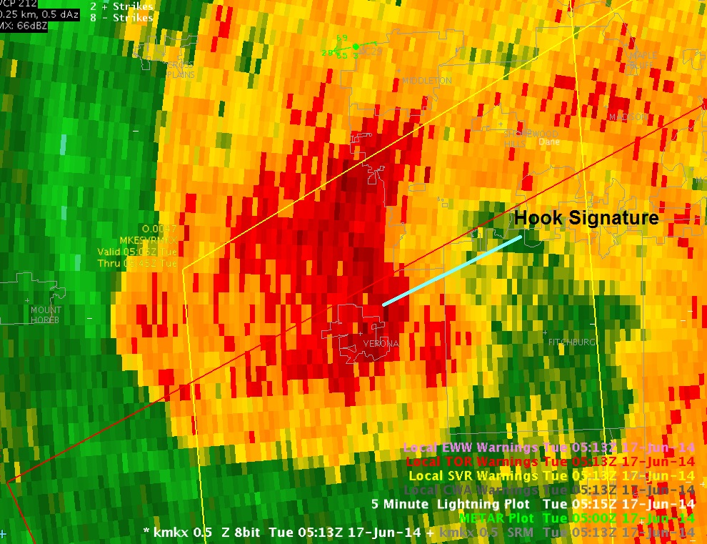
Below are some radar images of the Verona area tornado.
This one is reflectivity and clearly shows a nice hook associated with a large, rotating thunderstorm centered over Verona:
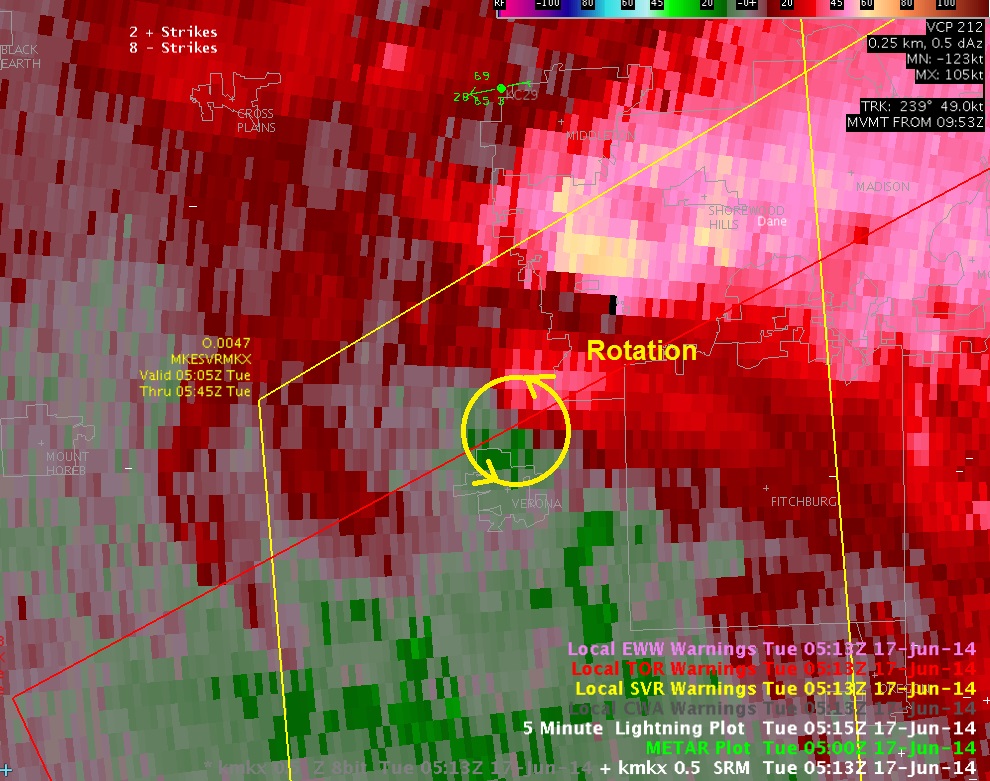
The next is a velocity image and it shows a rather weak rotation. It doesn't do the intensity of the tornado much justice. Red colors are winds moving away from the radar and green colors are toward the radar. When they are next to each other, it implies rotation.
This final image is of a Dual Pol product call CC...Correlation Coefficient. When debris from a tornado gets ingested into the thunderstorm, it gives us a rather clear signature. This "hole" shows us where targets have large variations in sizes and shapes.

Davis/Cronce/MBK/Marquardt


 Follow us on YouTube