A powerful weather system moving through the region today will continue to bring moderate to heavy rainfall across south central and portions of southeast Wisconsin this morning. As low pressure moves northeast across southern and east central Wisconsin today, the moderate to heavy rainfall will gradually taper off.
Here are the latest radar loops across the area and region:
| Local Radar | Regional Radar - West View | Regional Radar - East View |
 |
 |
 |
Here are weather maps from the Weather Prediction Center, showing the track of the low pressure system today:
| Noon Today | 6 PM Today |
 |
 |
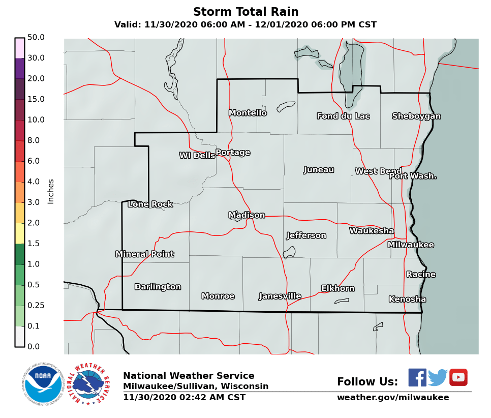
So far, about one to two inches of rain has fallen across southern Wisconsin. Total rainfall amounts, including the rain from Sunday through this afternoon, will generally be in the 1.50 to 2.50 inch range. The highest amounts will be across mainly south central Wisconsin.
Here are maps showing the expected additional rainfall amounts across southern Wisconsin, and all of Wisconsin, into this afternoon:
| Southern Wisconsin | All Of Wisconsin |
 |
 |
Given the already wet ground conditions across this area, and the expected rainfall, area rivers should rise above bankfull to minor flood stage early this week. In addition, low lying and urban areas may see some minor areal flooding develop through this afternoon.
Thus, a Flood Watch remains in effect for south central and portions of southeast Wisconsin into this afternoon. This is generally along and west of a Beloit, to Jefferson, to Mayville, to Sheboygan line.
Here is a map of the Flood Watch across the region:

Click here to submit a rainfall report.
Click here for the latest Hazardous Weather Outlook.
Keep up with the latest forecasts.
Wood/REM


 Follow us on YouTube