There is a threat for severe thunderstorms across southern Wisconsin Tuesday afternoon and evening. The cause of the strong thunderstorms will be low pressure tracking from the central Plains into the Upper Midwest Monday through Tuesday morning, and then across Central or Southern Wisconsin Tuesday and Tuesday night. There remains some uncertainty regarding the exact track and timing of the low pressure system across Wisconsin. Hence there remains uncertainty regarding the extent and intensity of the storms, and their location across southern Wisconsin.
However, here is a first guess at simulated radar imagery for Monday night into Tuesday night for the region from one of our forecast models generated Sunday morning:
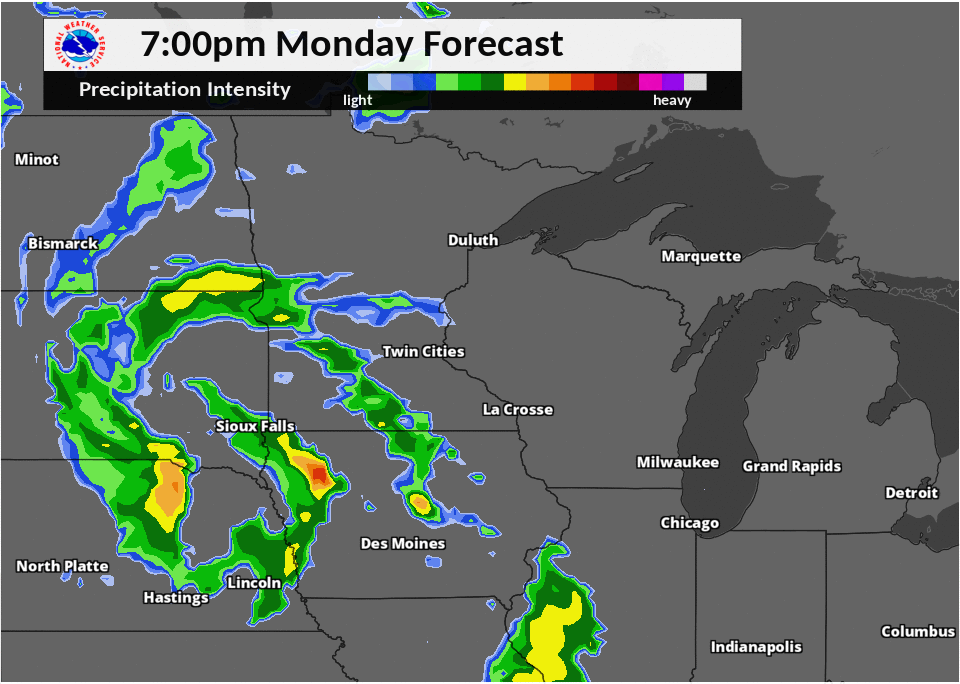
The favored timing for the strongest thunderstorms to affect southern Wisconsin would be Tuesday afternoon and evening, as illustrated by the above radar simulation.
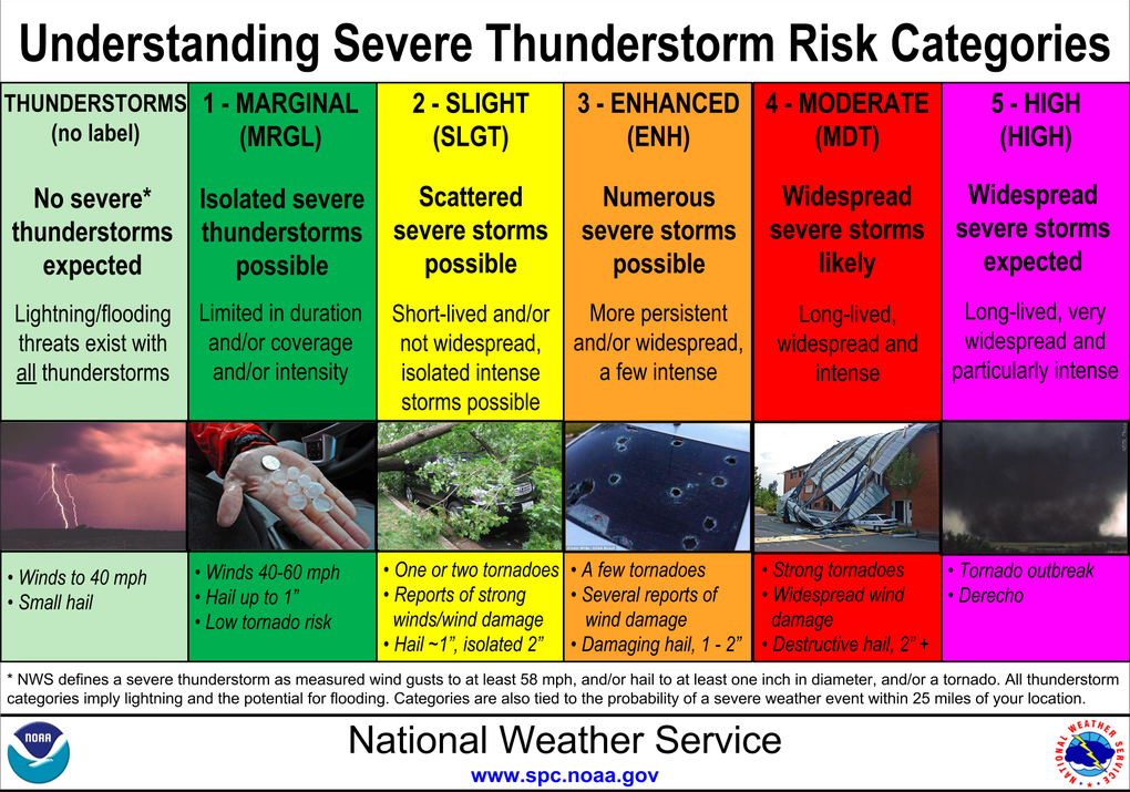
Much of southern Wisconsin is in a Slight Risk for severe thunderstorms on Tuesday and Tuesday night.
 |
 |
 |
To help you understand what a Slight Risk means, review the below chart:
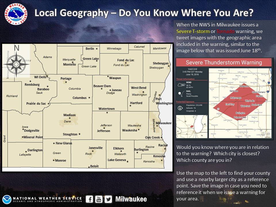
On Tuesday, the NWS may be issuing Severe Thunderstorm or Tornado Warnings across southern Wisconsin. To help protect yourself and take the appropriate action, know your location! Know the nearest large city, and what county you are in.


 Follow us on YouTube