The large low pressure system, currently over far northeast Ohio, will continue to track northeast across the eastern Great Lakes overnight. Its main affect on southeast Wisconsin will be gusty north to northwest winds. Light snow or flurries may affect the far southeast overnight, but amounts will remain well less than an inch. Sorry snow lovers!
The below radar animations show how close the heavier snow is to southeast Wisconsin:
| Local Radar | Regional Radar - East View |
 |
 |
Gusty north to northwest winds of 15 to 30 MPH, with gusts to 40 MPH, are expected near Lake Michigan into the overnight hours. These winds will weaken somewhat into Thursday morning, but remain gusty through Thursday afternoon.
The below map shows the latest warnings and advisories across the region:

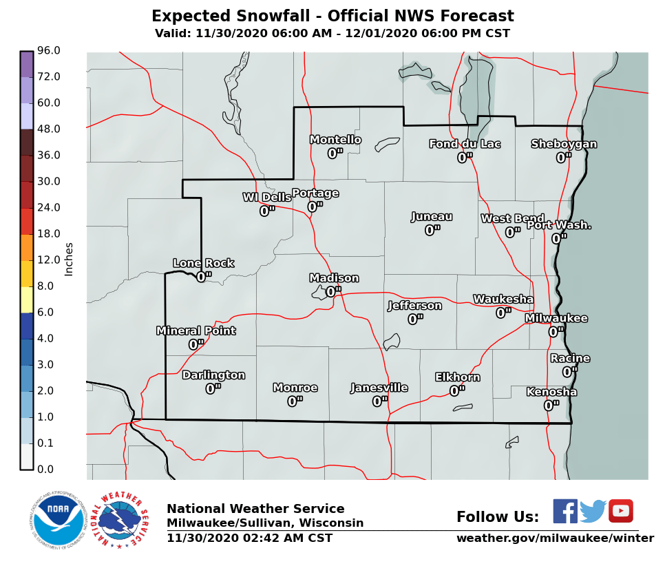
Below is the latest snowfall map for southern Wisconsin through tonight. Snowfall is expected to remain less than an inch across far southeast and east central Wisconsin.
Here is a link to our Probabilistic Snowfall Experiment page. Using a sophisticated ensemble approach to winter storm prediction, the snowfall graphics will show the spectrum of possible snowfall accumulations, given the ensemble of model solutions. If you want to nerd out, here's a link to a detailed explanation of this process.
If you're planning to drive through Chicago, Indiana or Lower Michigan tonight, your travels will be impacted. You may want to reconsider and delay your plans.
The two maps below show the massive size of this storm system, a storm that will cover nearly the entire eastern half of the U.S. Here's the Weather Prediction Center's web page that has all kinds of great info for the entire U.S. (navigate to the winter weather page off their left-hand menu).
|
|
 6 AM Thursday Morning 6 AM Thursday Morning |
Davis/REM/PC/Kavinsky/SPM/Wood


 Follow us on YouTube