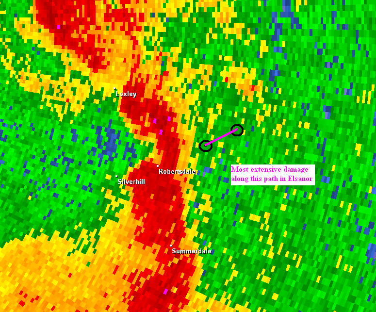
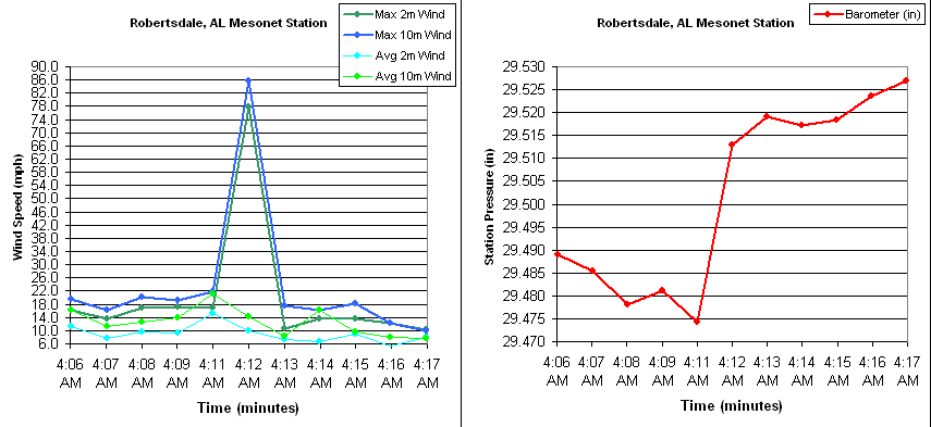
During the early morning hours (approximately 412 AM CDT) of 27 Mar 2009, a fast moving bow echo damaged areas of central Baldwin County Alabama from Robertsdale to just north of Elsanor. The damage path is shown in Figure 1. Some of the damage was quite prolific with wind speeds ranging from 90 to as high as 120 mph. Uniquely, a Univerity of South Alabama Center for Hurricane Intensity and Landfall Investigation (CHILI) surface observation site captured an 86 mph wind gust as the storm moved just nort of Roberstdale vicinity (see Figure 2).
Click to Enlarge
Click to Enlarge
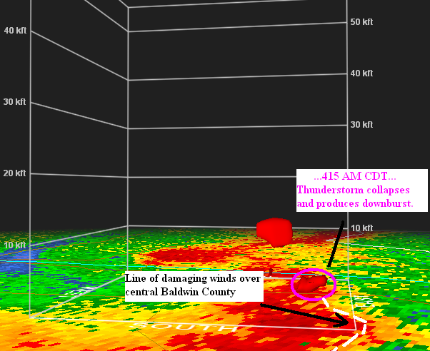
The worst of the damage was in Elsanor where the bow echo cut a swath of damage about 2 miles long and 200-400 yards wide.Radar showed that a thunderstorm core aloft collapsed to the ground as the storm moved between Robertsdale and Elsanor and simultaneous with the arrival of the storm in Elsanor, AL (Figs 3a and 3b). A NWS Mobile, Alabama Storm Survey Team found that all of the debris was blown in a single direction ...from west-southwest to east-northeast.
Click to Enlarge
Click to Enlarge


 Follow us on YouTube