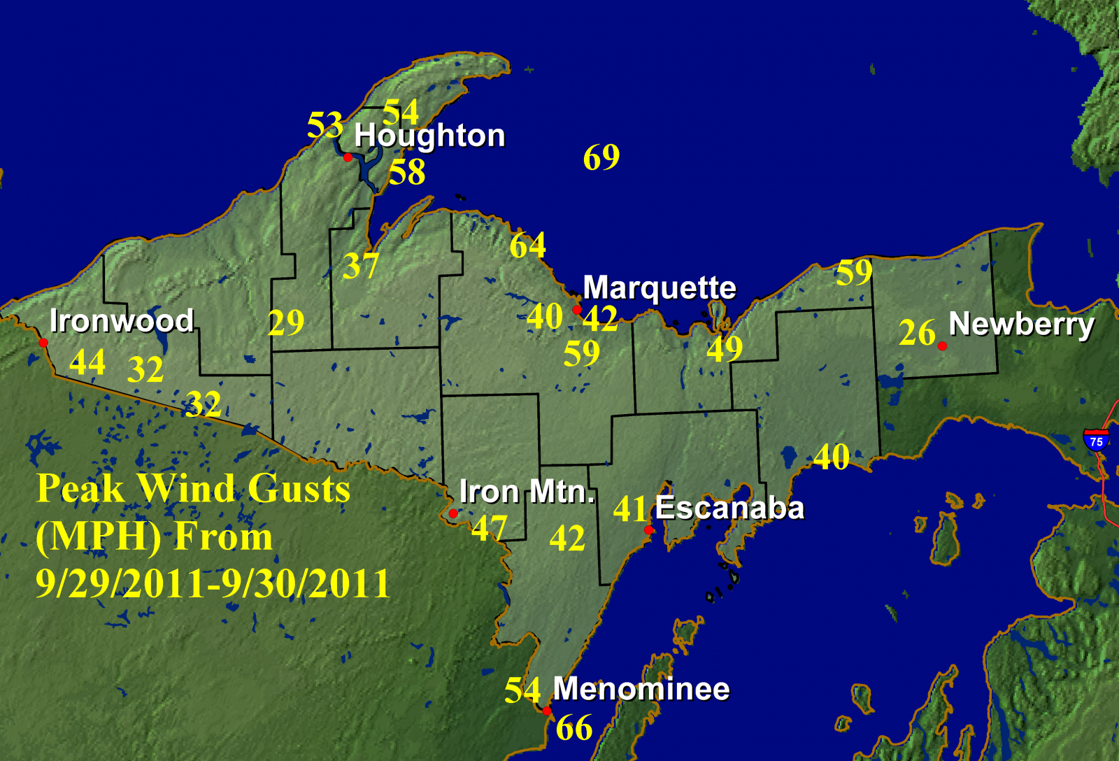
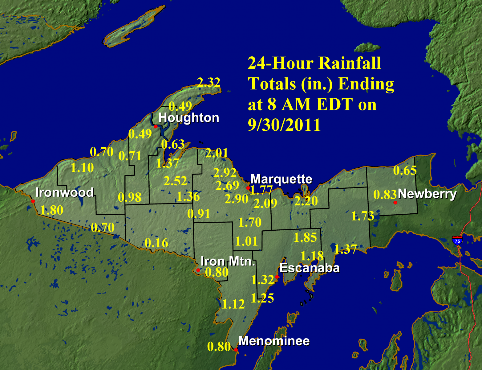
A powerful early fall storm affected much of Upper Michigan on 9/29/2011, with its effects lingering into 9/30/2011. Strong winds and heavy rain were associated with this system, causing tree damage and power outages across Upper Michigan. The strong nature of the winds was due to a combination of a rapidly strengthening low pressure system moving out of northern Minnesota and a strong high pressure system across the northern Great Plains and southern Canada. As the storm moved east throughout the day, light southerly to westerly winds quickly changed to very strong northerly winds at many locations.
Below are two images of data from the event. The first contains the maximum wind gusts (in mph) that were observed at airports and marine sites across Upper Michigan. The second image includes 24-hour rainfall totals ending at 8 AM on 9/30/2011. This system was a heavy rain producer for a majority of the U.P., with rainfall totals greater than 1" central and east. The greatest totals were recorded in Marquette and Alger counties near Lake Superior, where over 2" was common. At the NWS office in Negaunee Township, the 2.90" recorded for 9/29/2011 was the 5th highest daily precipitation total since weather records began in 1961.


 Follow us on YouTube