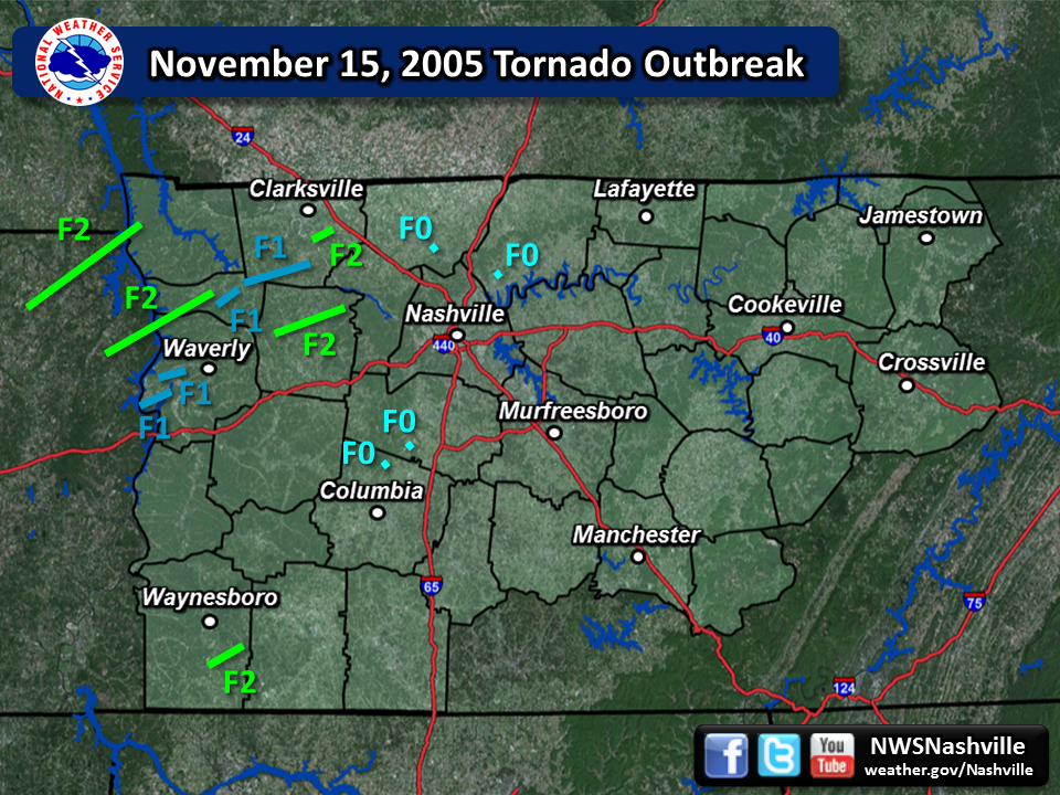
| Tornado Statistics | ||||||||
| # | Counties | Rating | Time (CST) | Length (miles) | Width (yards) | Fatalities | Injuries | |
| 1 | Henry/Stewart | F2 | 1435 | 28.5 | 200 | 0 | 13 | |
| 2 | Benton/Humphreys/Houston | F2 | 1540 | 24.6 | 200 | 0 | 0 | |
| 3 | Houston | F1 | 1610 | 4.0 | 100 | 0 | 0 | |
| 4 | Houston/Montgomery | F1 | 1622 | 12.5 | 75 | 0 | 0 | |
| 5 | Montgomery | F2 | 1641 | 4.8 | 400 | 0 | 0 | |
| 6 | Humphreys | F1 | 1652 | 4.5 | 100 | 0 | 0 | |
| 7 | Humphreys | F1 | 1700 | 4.0 | 100 | 0 | 0 | |
| 8 | Dickson | F2 | 1733 | 10.0 | 200 | 0 | 0 | |
| 9 | Wayne | F2 | 1752 | 8.4 | 100 | 0 | 1 | |
| 10 | Robertson | F0 | 1820 | 0.10 | 20 | 0 | 0 | |
| 11 | Maury | F0 | 1825 | 0.10 | 10 | 0 | 0 | |
| 12 | Williamson | F0 | 1832 | 0.10 | 10 | 0 | 0 | |
| 13 | Sumner | F0 | 1837 | 0.10 | 10 | 0 | 0 | |
| Reports & Outlooks | |||
| SPC Storm Reports | SPC Day 1 Outlook | SPC Event Archive | Public Information Statements |
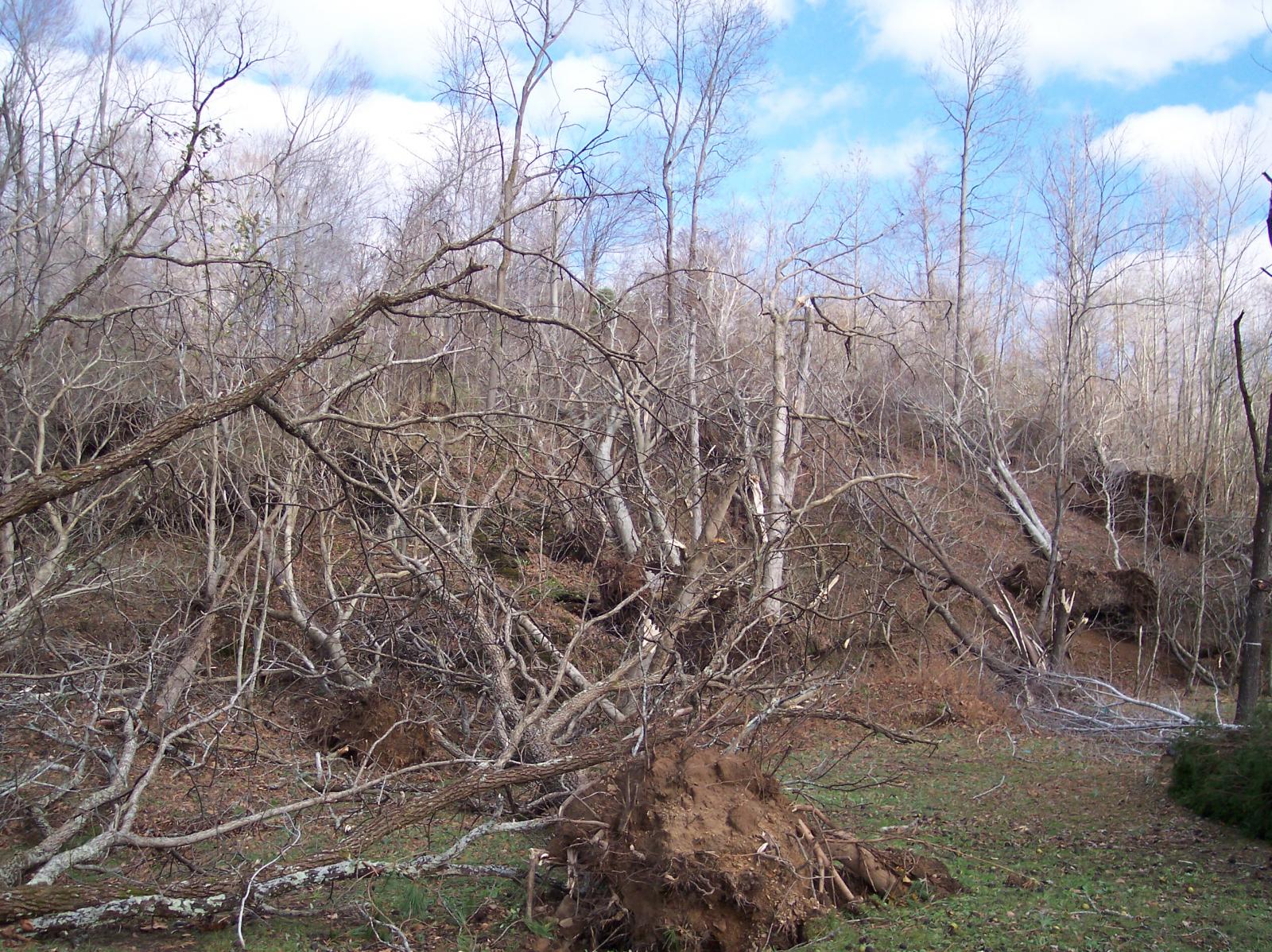
| F2 Henry/Stewart County Tornado | |
| Counties: | Henry/Stewart |
| Time: | 2:35 PM CST |
| F Scale: | F2 |
| Damage Path Length: | 28.5 miles |
| Damage Path Width: | 200 yards |
| Fatalities: | 13 |
| Injuries | 0 |
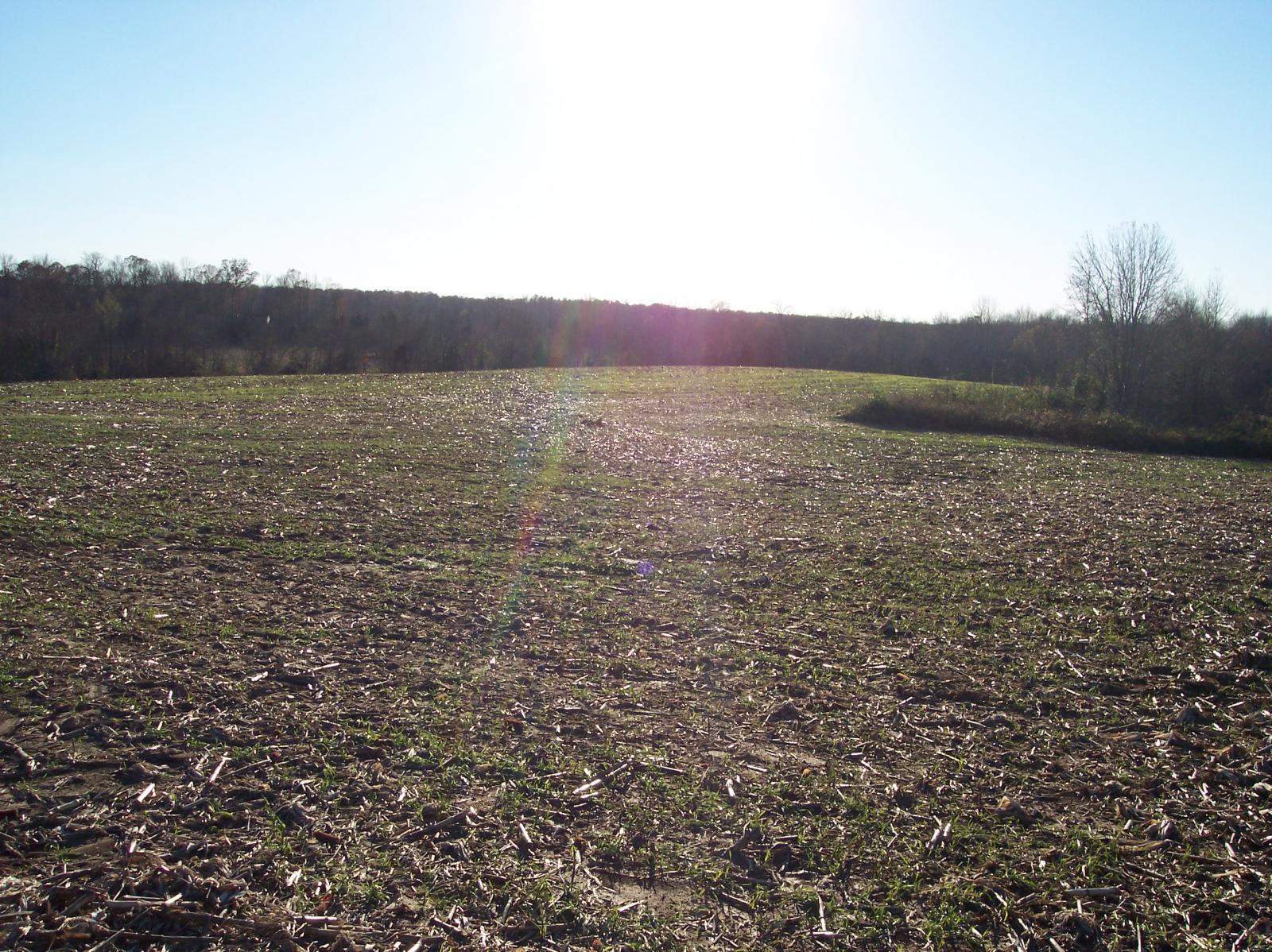
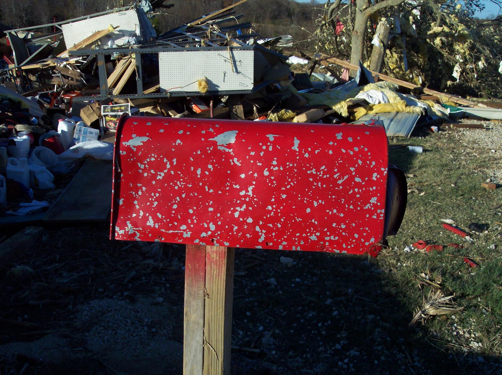
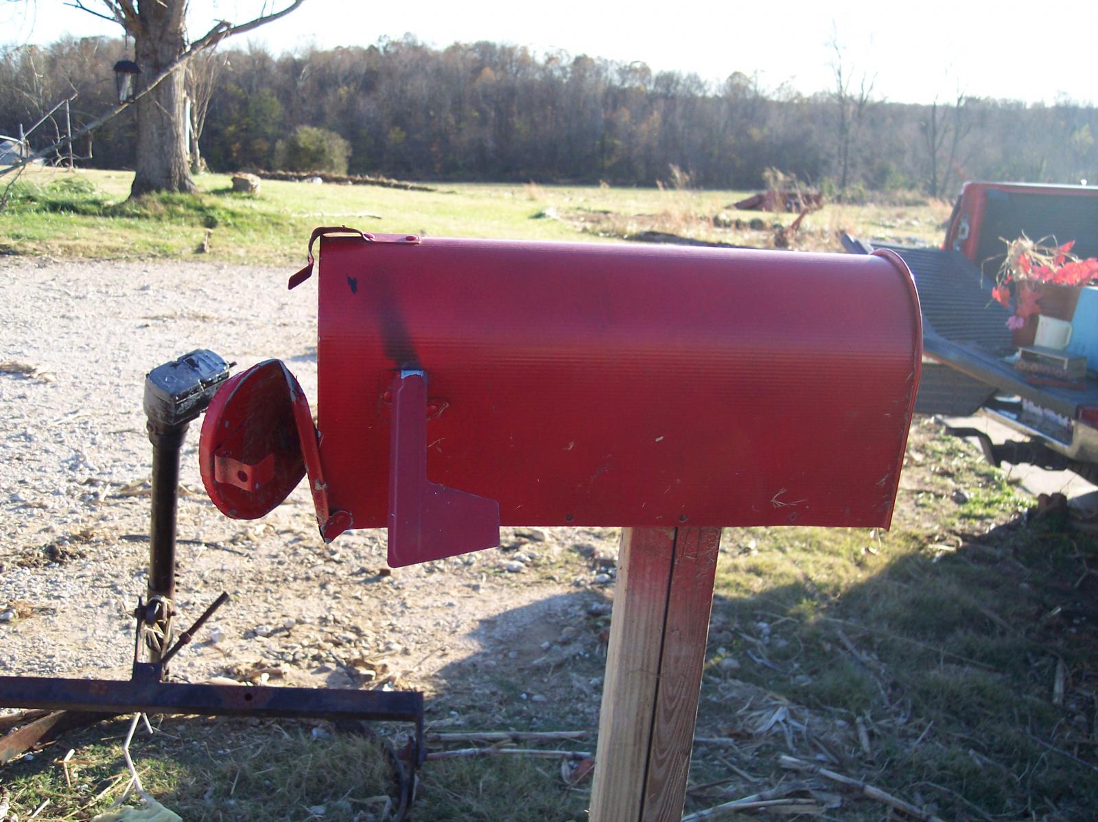
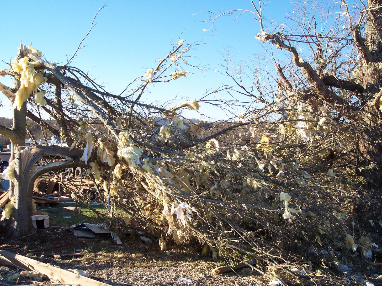
| Damage: STORM DATA (Henry County): The tornado touched down southwest of Paris and moved northeast skirting by the northern edge of Paris. Thirty homes were destroyed and several manufacturing plants were demolished. Over 100 homes were damaged. SHAMBURGER (2016): Based on radar data and satellite imagery from Google Earth, the same tornado that struck Paris, TN and caused significant damage across Henry County continued across the Tennessee River and moved onshore on a small peninsula at the end of Highway 233/Boswell Landing Road in far western Stewart County. Dozens of trees were blown down in this area per Google Earth satellite imagery before the tornado apparently lifted over an inlet to the northeast. Based on this data, this previously unknown part of the Paris tornado track in Stewart County has been added to the NWS Nashville tornado database. Although damage in Henry County was rated F2 with 13 injuries, the damage in Stewart County was only rated F0 with no injuries. |
|
| F2 Benton/Humphreys/Houston County Tornado | |
| Counties: | Benton/Humphreys/Houston |
| Time: | 3:54 PM CST |
| EF Scale: | F2 |
| Damage Path Length: | 24.6 miles |
| Damage Path Width: | 200 yards |
| Fatalities: | 0 |
| Injuries | 0 |
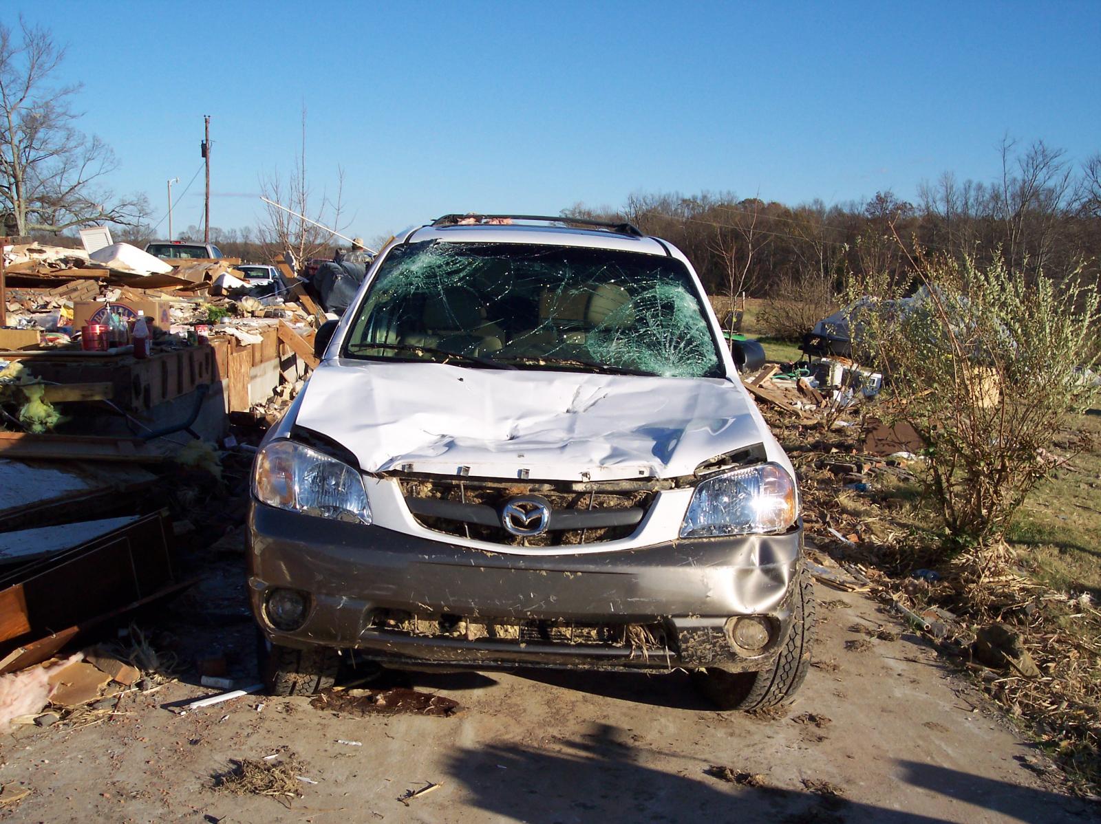
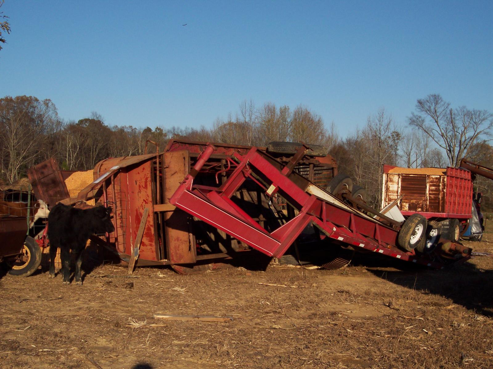
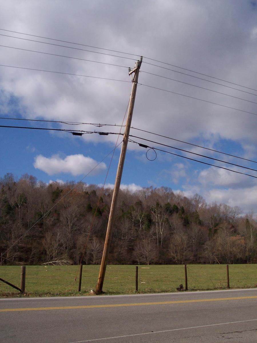
| Damage: STORM DATA (Houston County): Well built modular home was destroyed at intersection of Waverly Road and Long Branch Road. Other homes in the area were damaged. Damage was estimated to be $650K by the EMA Director. STORM DATA (Benton County): Home destroyed. Roof was gone and walls left standing on a home on French Store Rd. SHAMBURGER (2016): Both radar data and satellite imagery from Google Earth clearly indicate that this damage in Benton County and Houston County is from one long-track tornado, which began around 4.6 miles north of Camden, moved northeast across northern Benton County and the Tennessee River, crossed far northwest Humphreys County, then entered Houston County before ending around 2 miles southwest of Erin. The time, path length, start and end points, and location of this tornado were all corrected based on radar data and the damage path on aerial imagery from Google Earth, and the Humphreys County portion of the tornado track was also added to this entry. NWS Storm surveys were only conducted for small parts of the damage path in Benton and Houston Counties (F2), and no survey was conducted for the part of the track in Humphreys County where hundreds of trees were blown down per Google Earth satellite imagery (F1). |
|
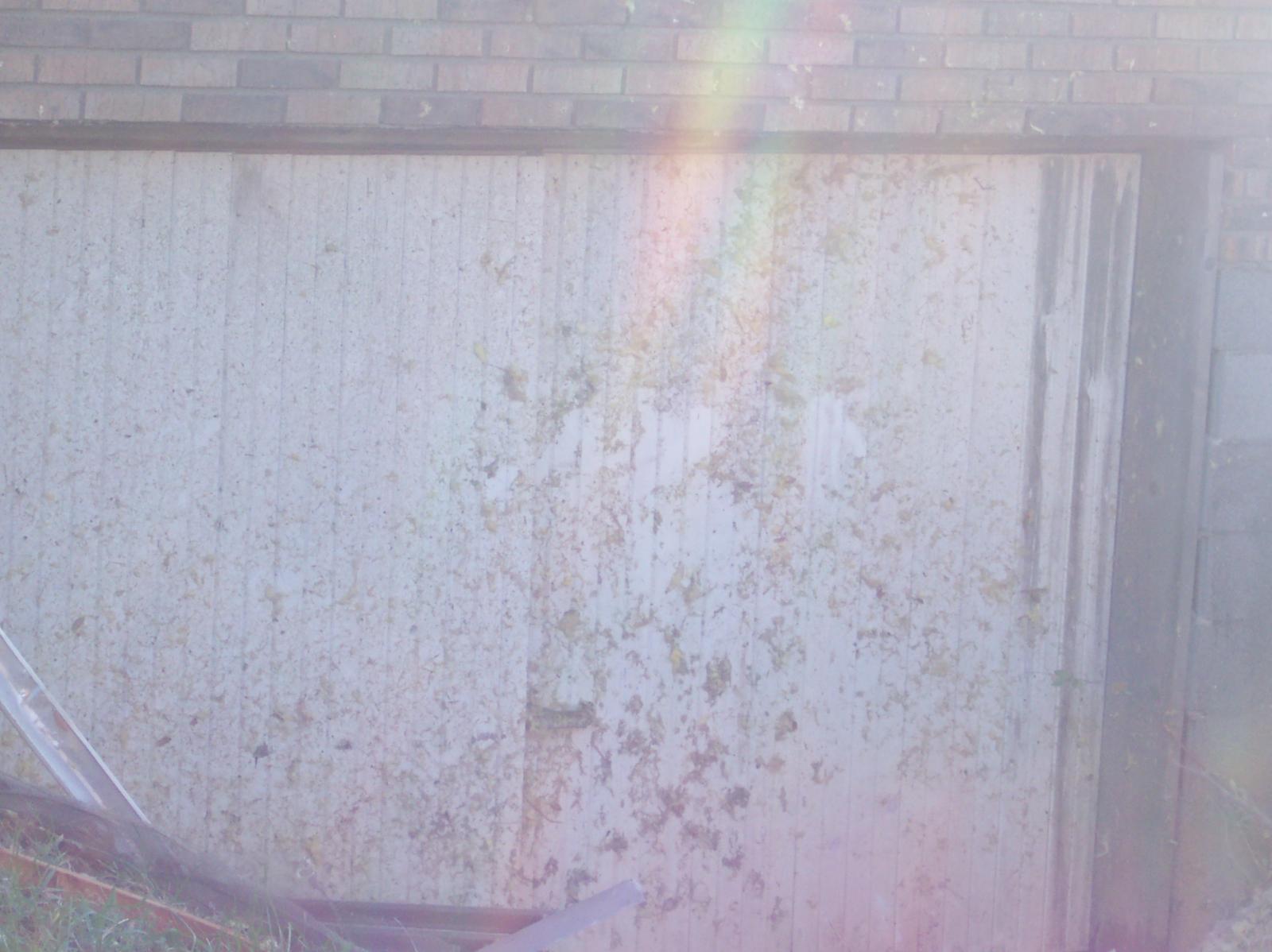
|
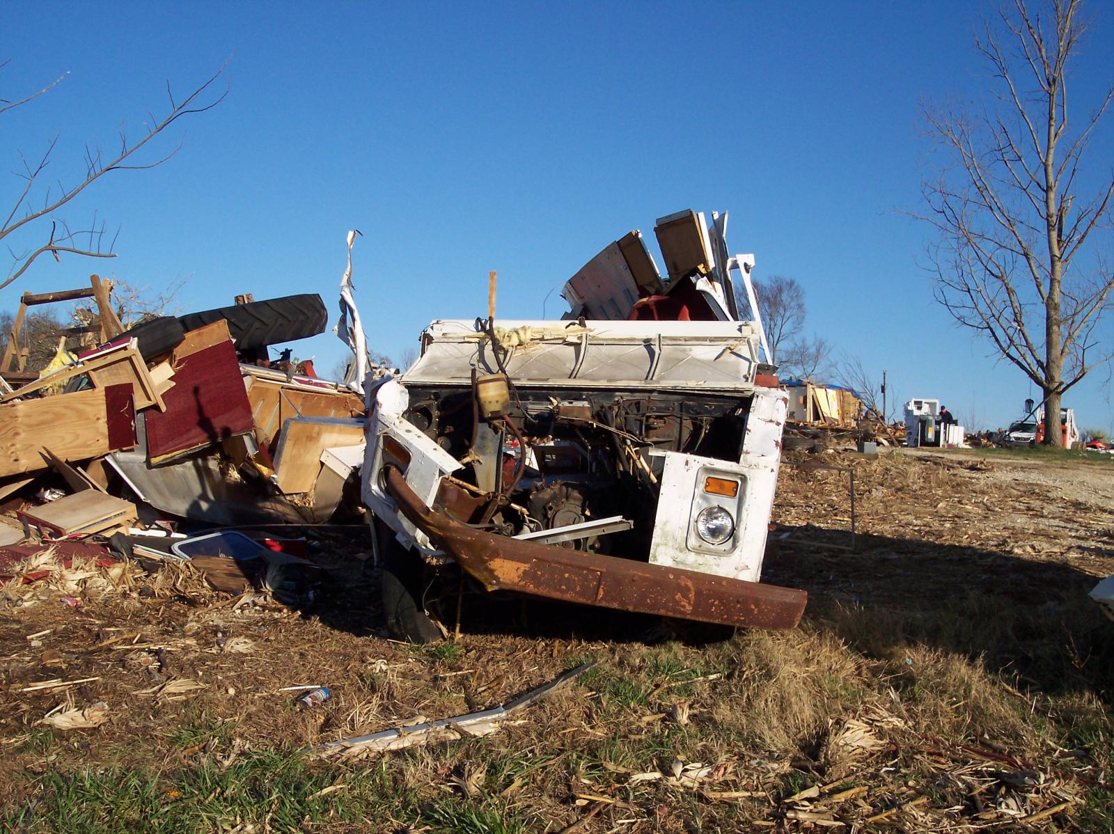
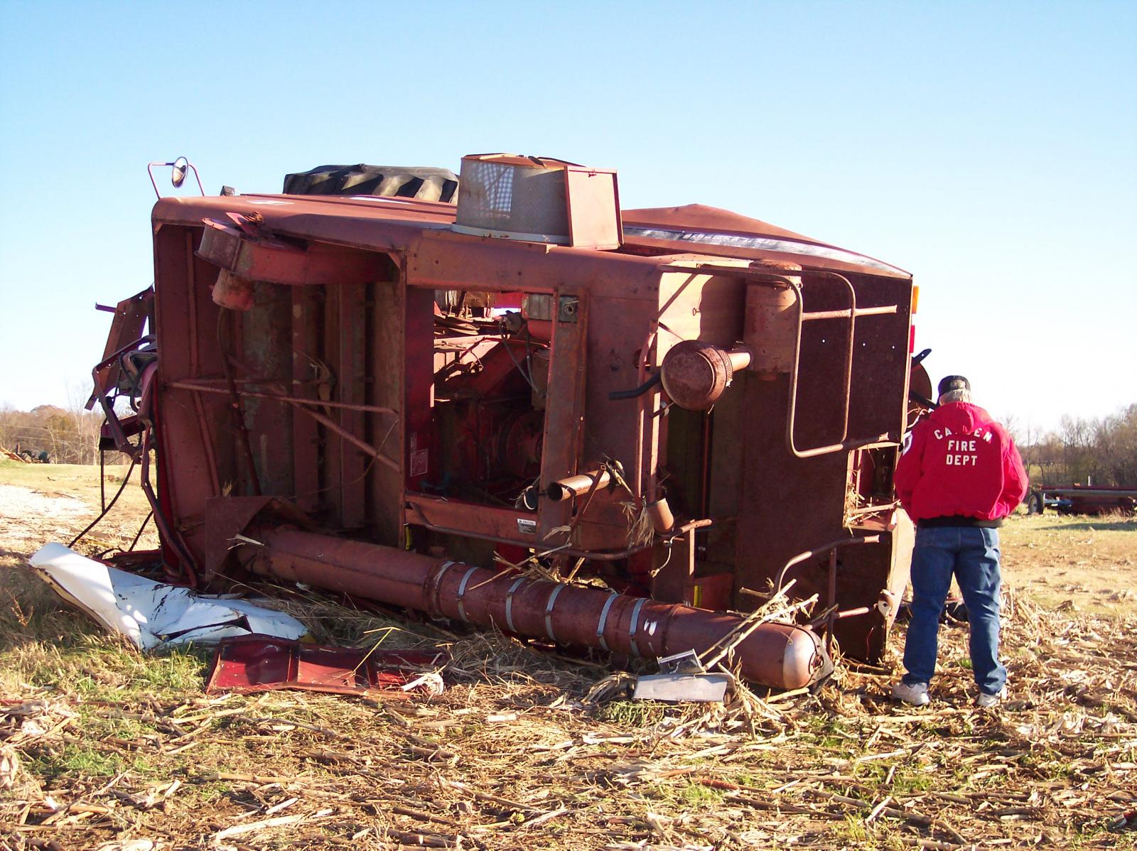
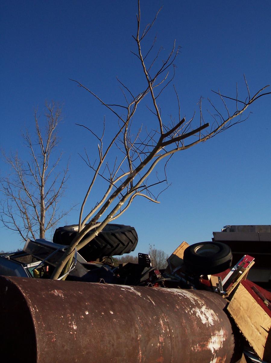
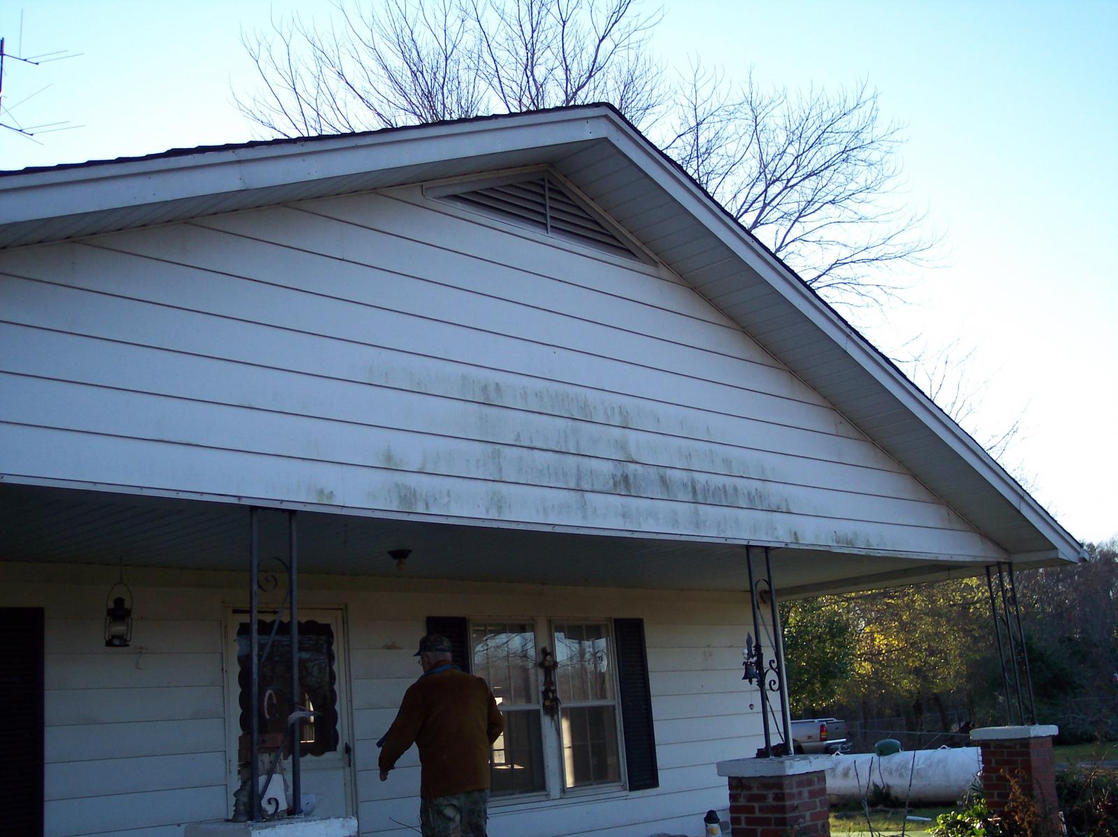
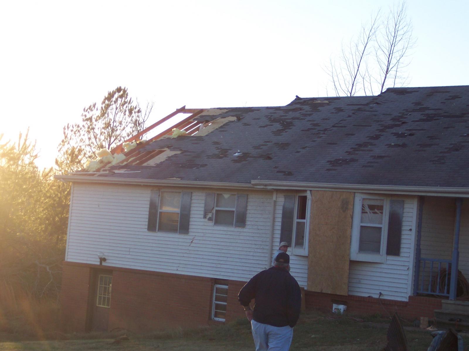
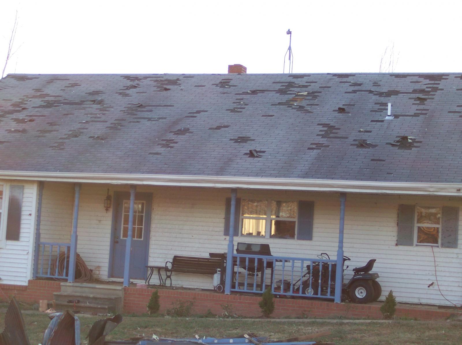
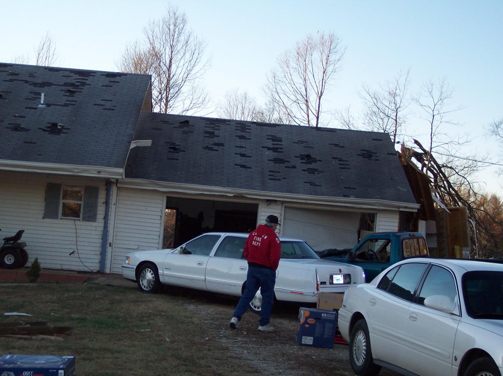
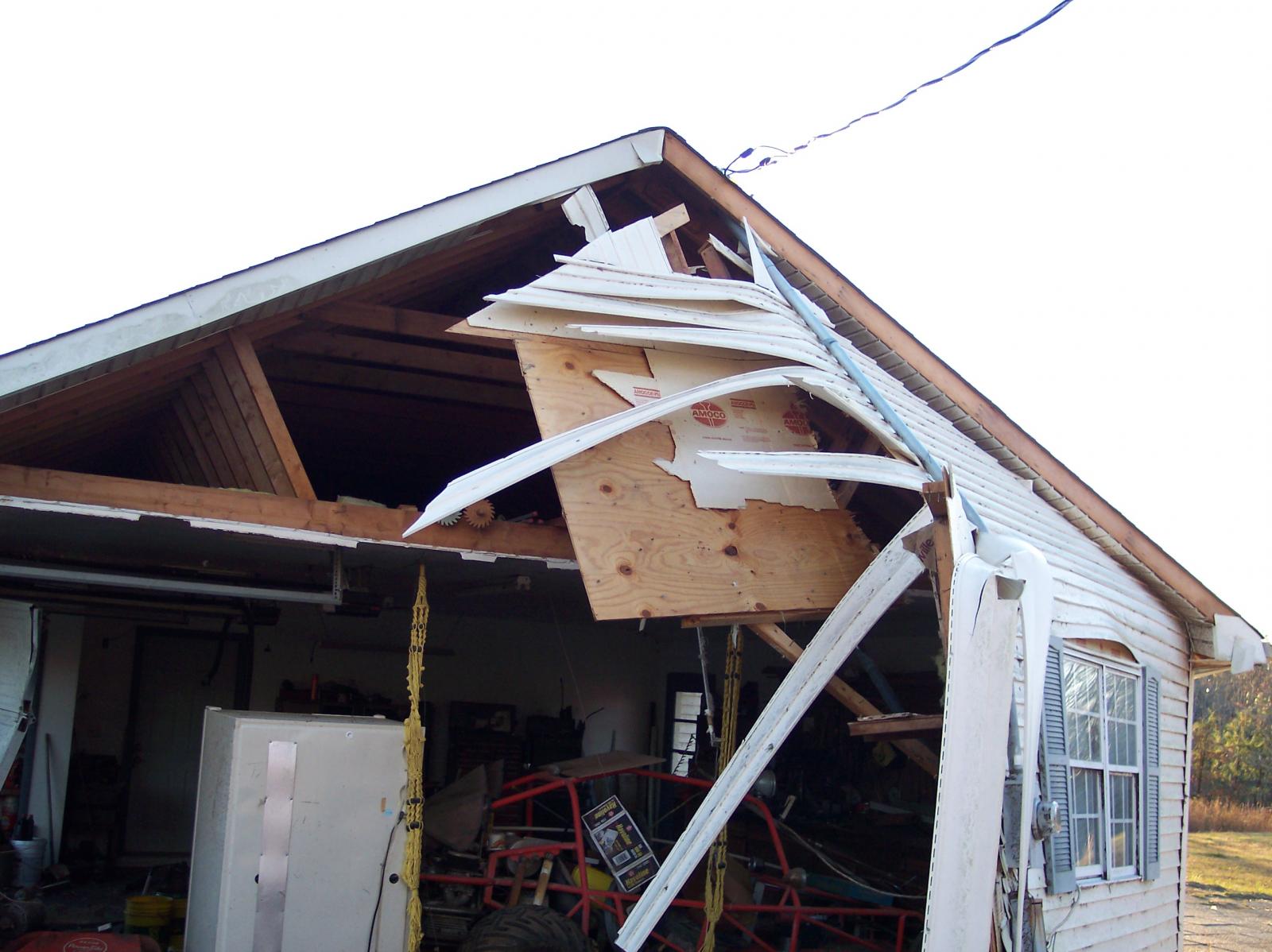
Photos in Benton County by Jerry Orchanian, NWS Nashville Warning Coordination Meteorologist: Roof missing and significant wall failure from home located on French Store Road northeast of Camden in Benton County. Large farm vehicles were also blown over near French Store Road in Benton County. At the home, wind blew from left to right, penetrated garage door (barely visible on left edge of photos) and blew out side wall, exposing the insides of the garage.
|
|
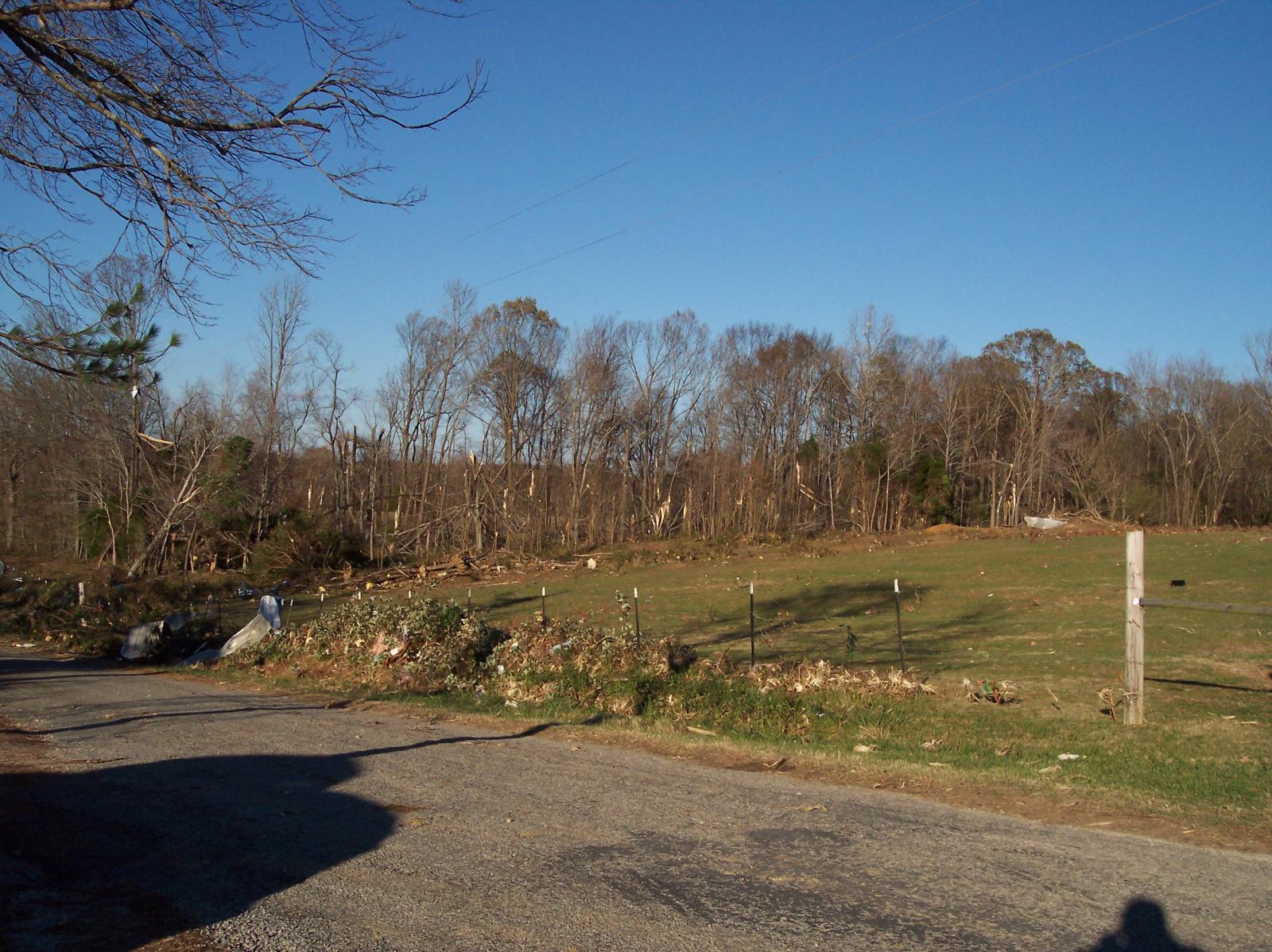
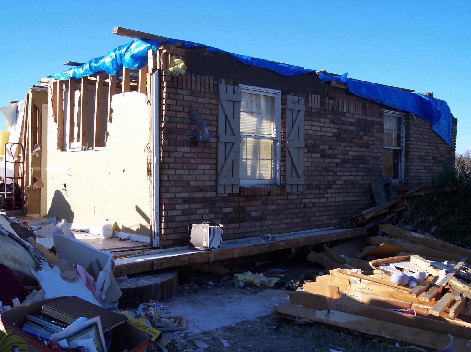
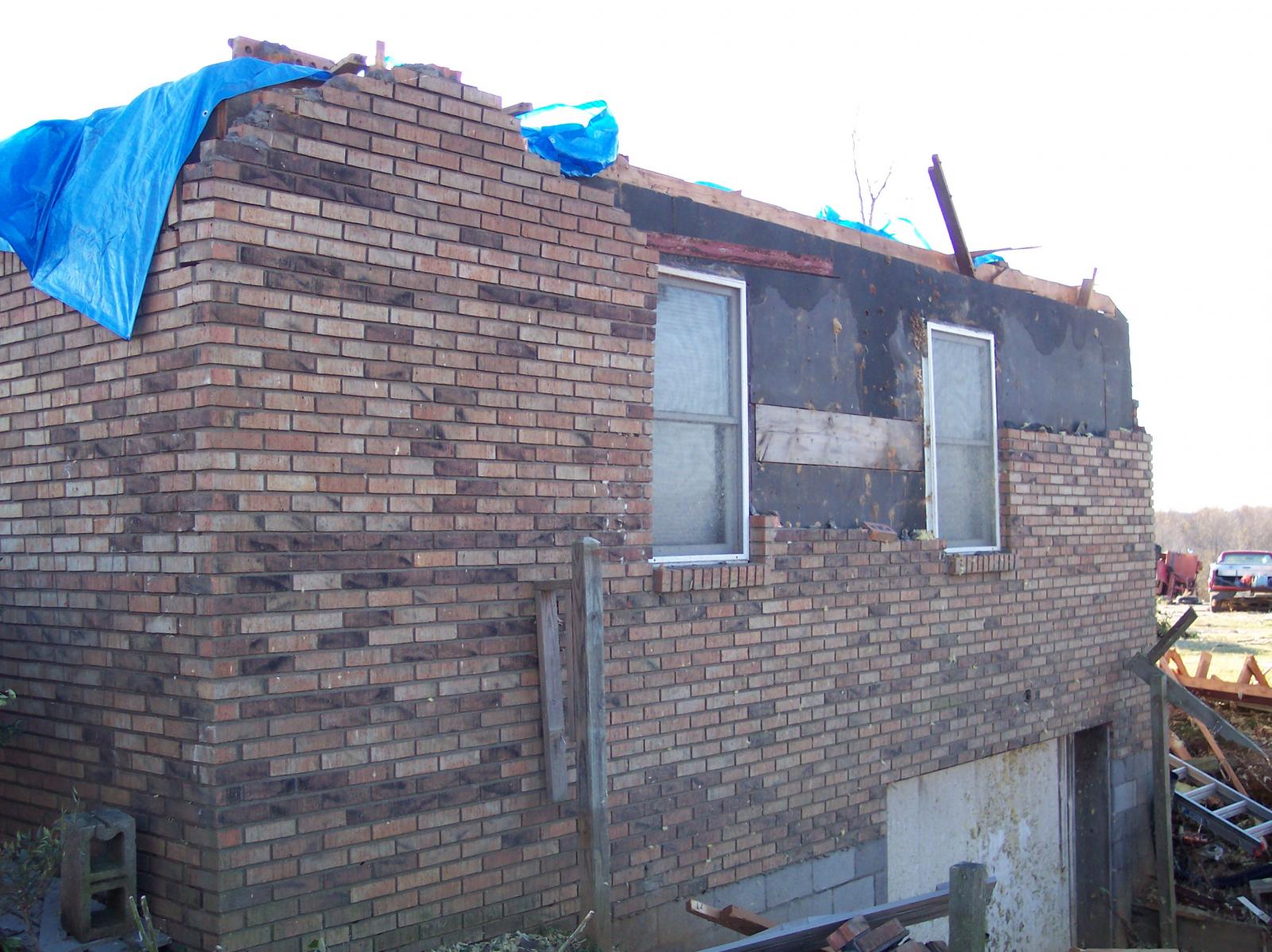
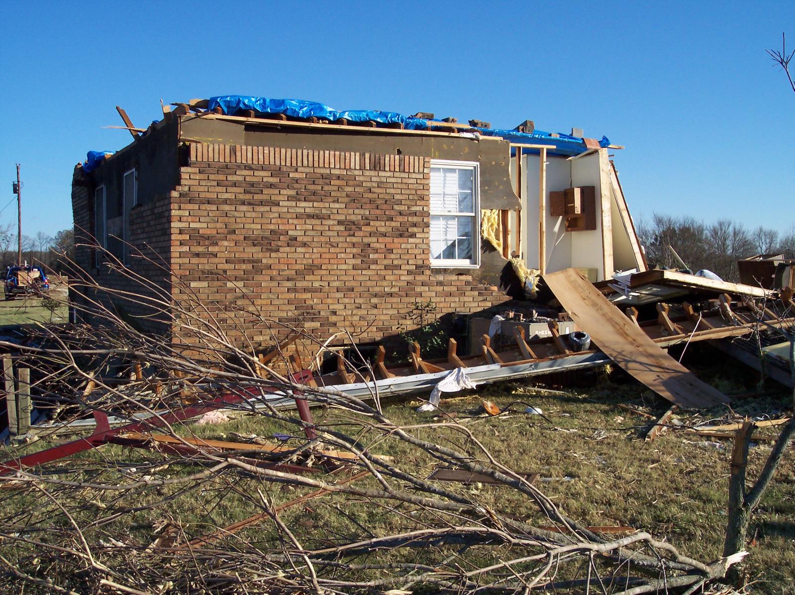
| F1 Houston County Tornado | |
| Counties: | Houston |
| Time: | 4:10 PM CST |
| EF Scale: | F1 |
| Damage Path Length: | 4.0 Miles |
| Damage Path Width: | 100 yards |
| Fatalities: | 0 |
| Injuries | 0 |
|
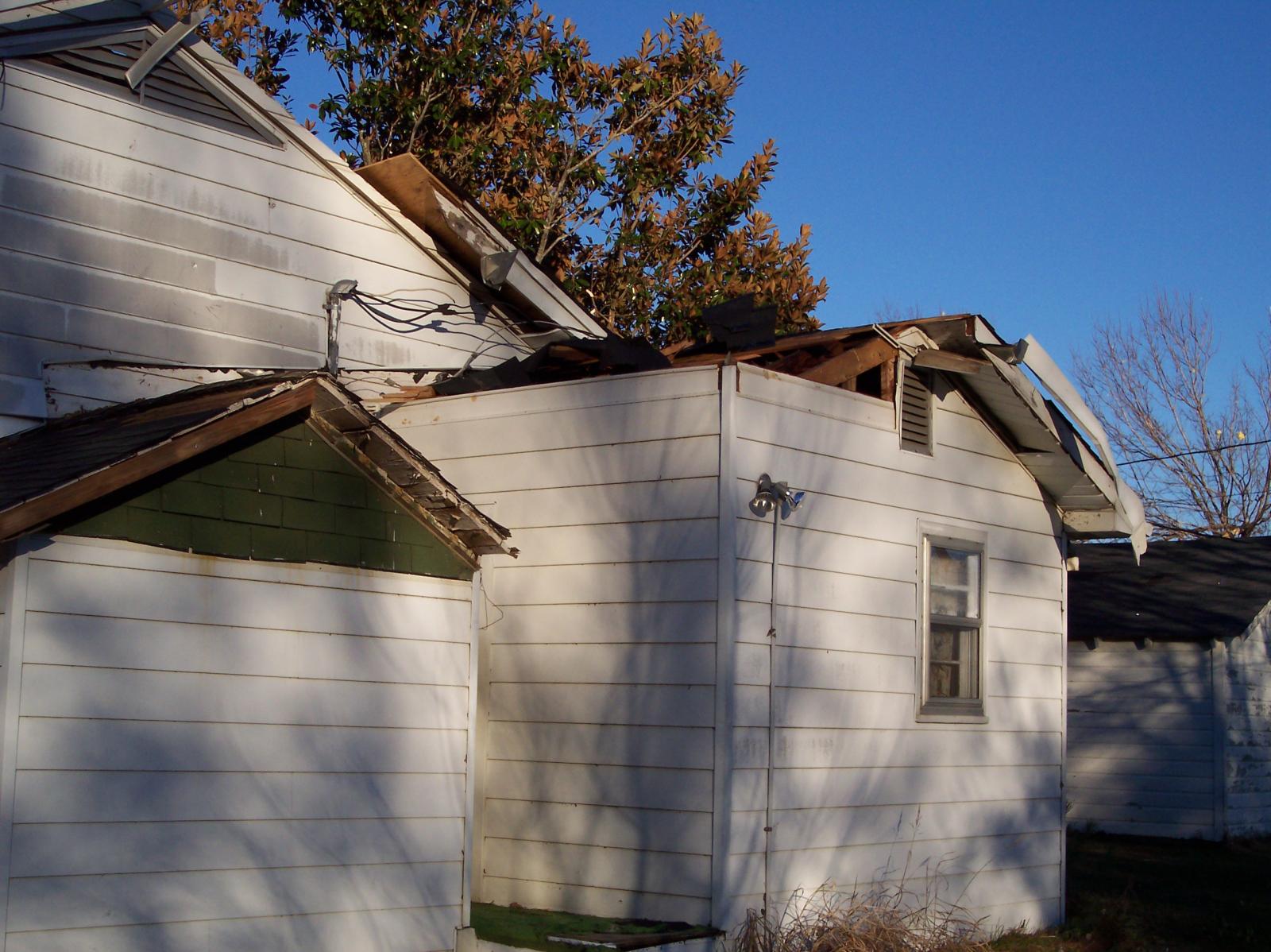
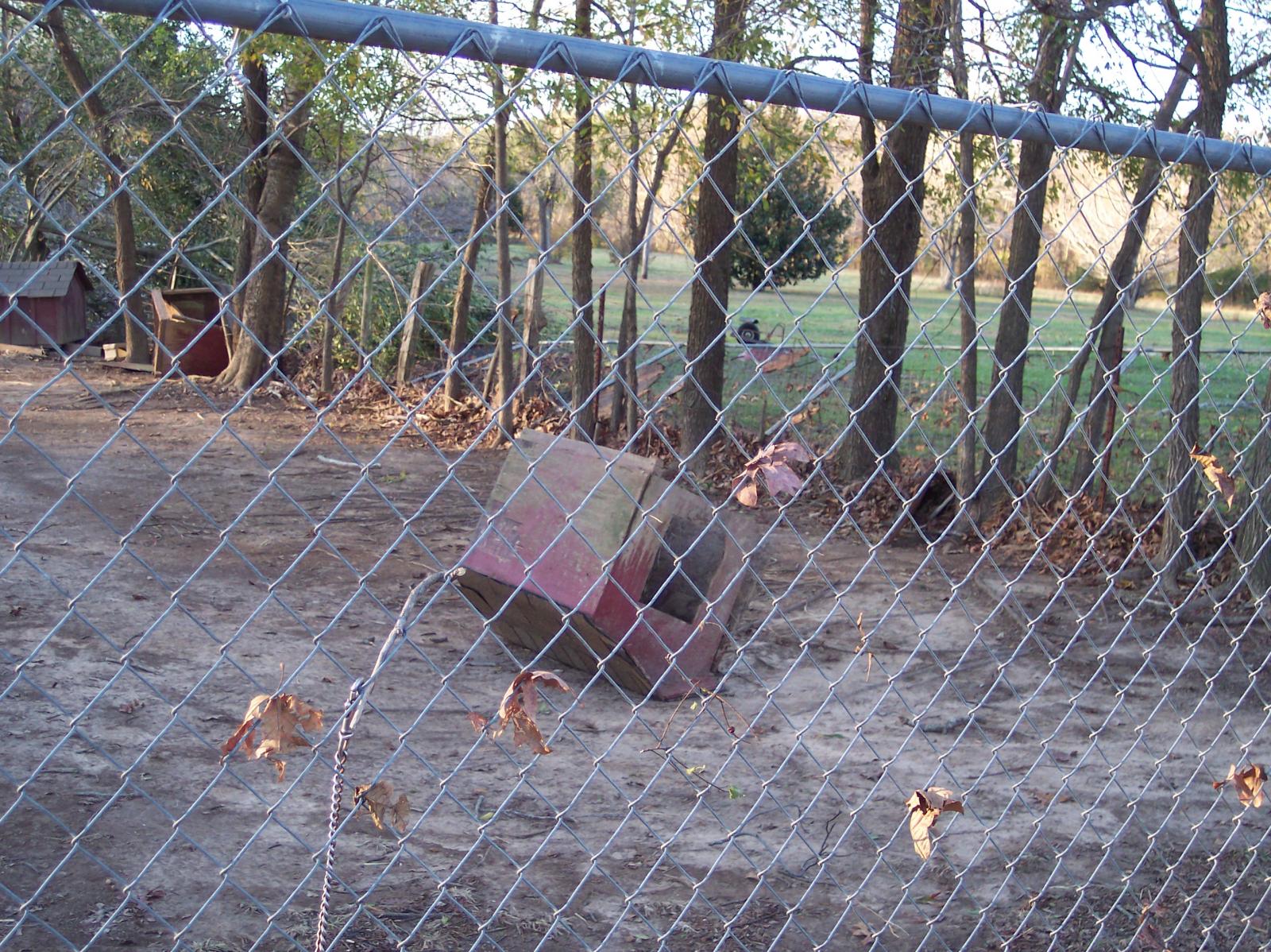
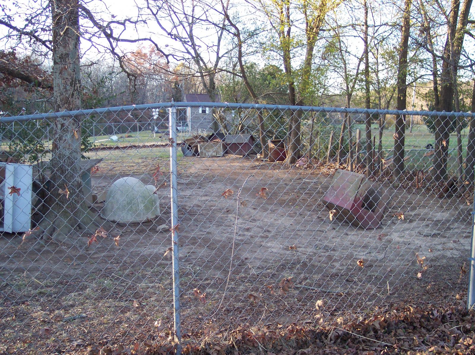
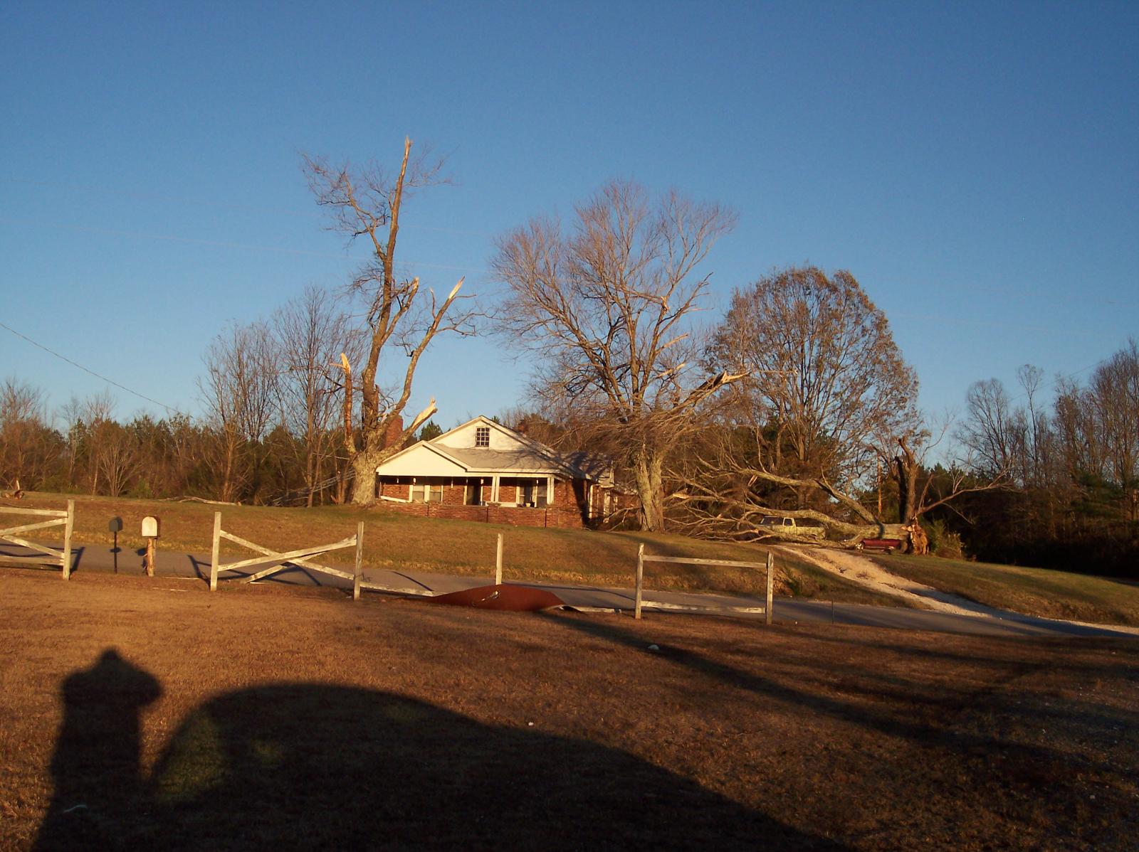
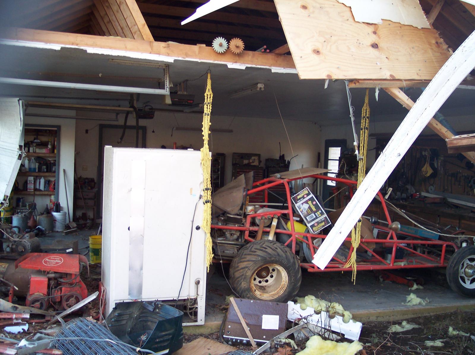
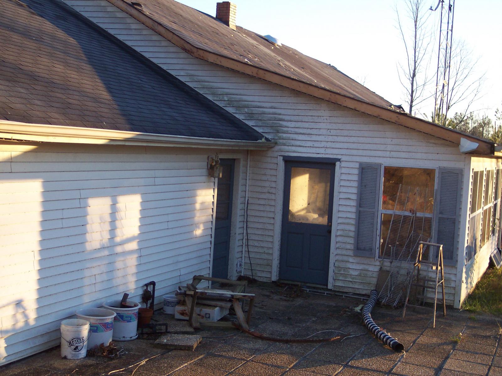
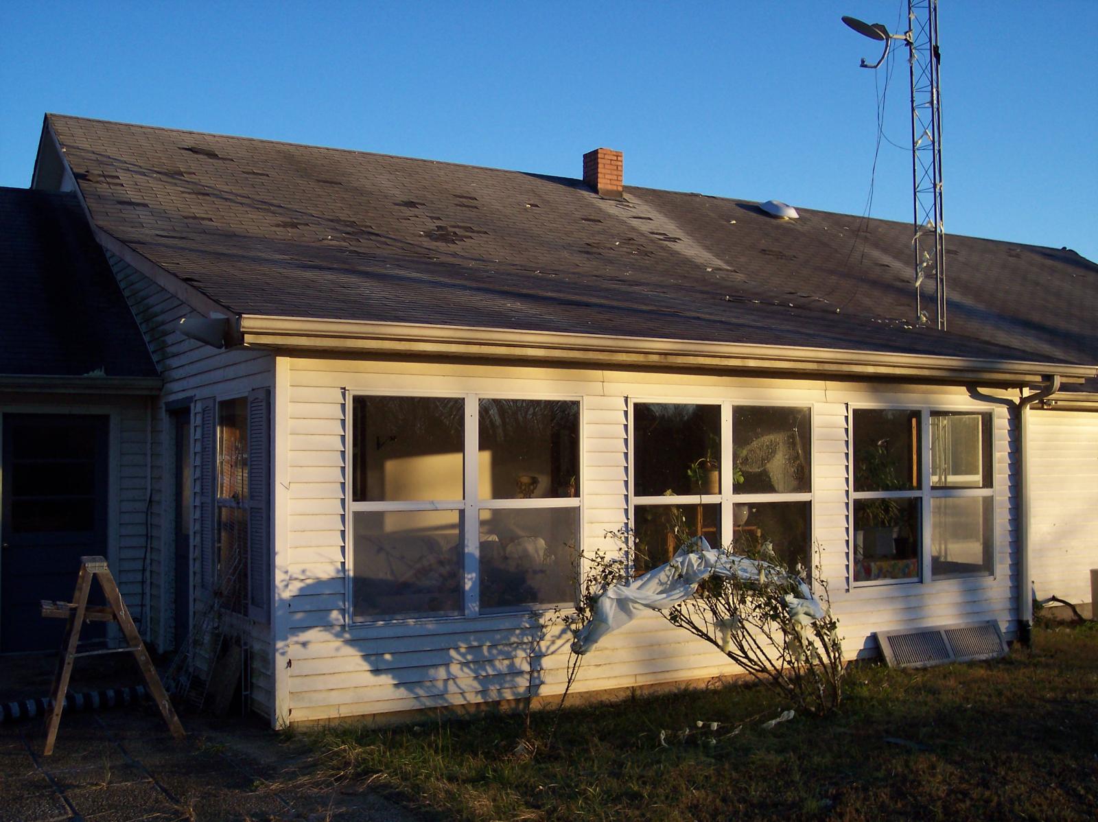
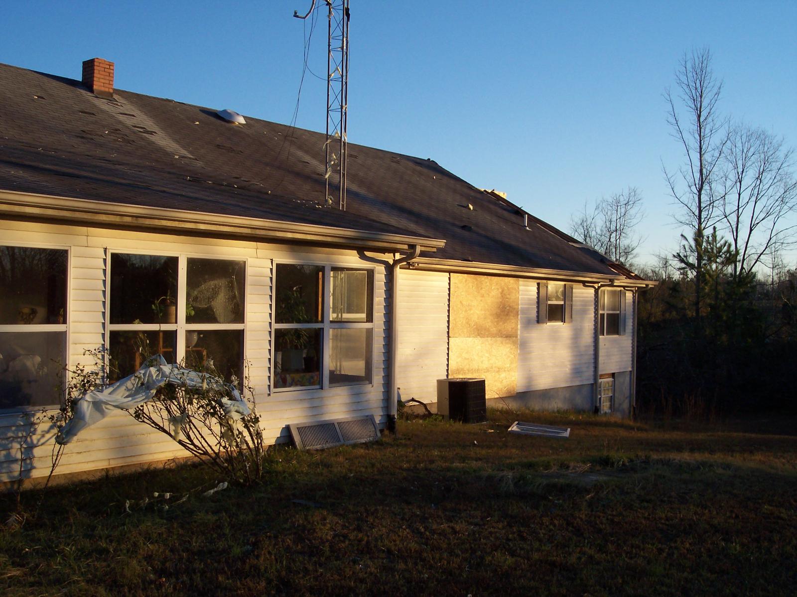
Damage: |
|
|
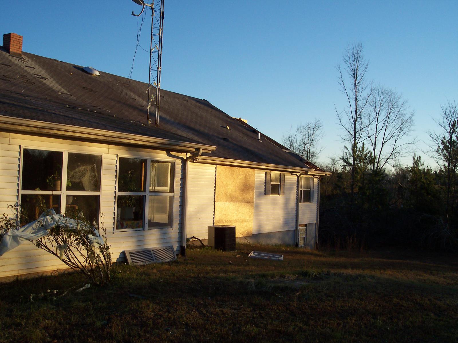
Photos by Jerry Orchanian, NWS Nashville Warning Coordination Meteorologist:
|
|
| F1 Houston/Montgomery County Tornado | |
| Counties: | Houston/Montgomery |
| Time: | 4:22 PM CST |
| EF Scale: | F1 |
| Damage Path Length: | 12.5 Miles |
| Damage Path Width: | 75 yards |
| Fatalities: | 0 |
| Injuries | 0 |
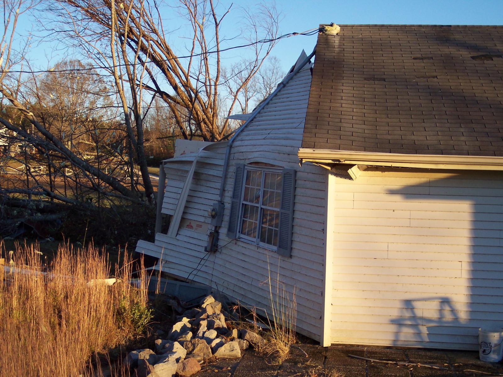
| Damage: STORM DATA (Montgomery County tornado entry #1): Mobile home is completely demolished. It was overturned on Thorne Hollow Road. STORM DATA (Mongtomgery County tornado entry #2): Damage to mobile home. Roof was taken off the Cunningham Market on Marion Rd. STORM DATA (Mongtomery County tornado entry #3): Damage to trees were observed (1 mile north-northeast of Cunningham). SHAMBURGER (2016): NCDC and Storm Data incorrectly list 3 separate brief tornadoes occurring one minute after each other in close proximity across southwest Montgomery County. However, radar data clearly indicates these were all the same tornado, and these 3 erroneous entries have been combined into this single entry. In addition, radar data and aerial imagery from Google Earth indicate this tornado actually began in northern Houston County west of Barber Highway to the south of Highway 13, where several trees were blown down (F0). The tornado then moved northeast along and parallel to the Highway 13 corridor before lifting just north of Cunningham. The path length, location, start and end points, and time of the tornado have all been corrected based on radar data and the damage path on Google Earth satellite imagery. |
|
|
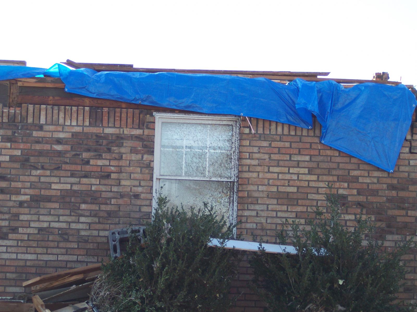
Photos by Ralph Troutman, NWS Nashville Observing Program Leader: Mobile/modular home with roof gone and corner wall failure. Location is on south side of Highway 13 in extreme southwest Montgomery County. 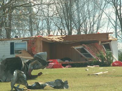 |
|
| F2 Montgomery County Tornado | |
| Counties: | Montgomery |
| Time: | 4:41 PM CST |
| EF Scale: | F2 |
| Damage Path Length: | 4.80 Miles |
| Damage Path Width: | 400 yards |
| Fatalities: | 0 |
| Injuries | 0 |
| Damage: STORM DATA: Well built brick home lost roof. Very large oak trees snapped around home. This storm complex came from Houston County. SHAMBURGER (2015): NCDC and Storm Data incorrectly list the path length, location and time of this tornado, which were corrected based on radar data. |
|
|
Photos by Ralph Troutman, NWS Nashville Observing Program Leader: Roof off large home just southeast of Clarksville. Large pine trees snapped 10-15 feet high just southeast of Clarksville. Note the three tree trunks that landed on this home.  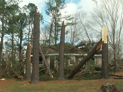 |
|
| F1 Humphreys County Tornado | |
| Counties: | Humphreys |
| Time: | 4:52 PM CST |
| EF Scale: | F1 |
| Damage Path Length: | 4.50 Miles |
| Damage Path Width: | 100 yards |
| Fatalities: | 0 |
| Injuries | 0 |
| Damage: STORM DATA: Roof damage to several homes was observed from Old State Route 1 and on Long Street (south of New Johnsonville). One house and several mobile homes were destroyed. Many other homes had structural damage. A barn on Old State Route 1 lost its roof. As many as 2000 people were without power during the height of the storm. This storm complex moved into Dickson County. SHAMBURGER (2015): NCDC and Storm Data incorrectly list the time, path length, and location of this tornado, which were corrected based on radar data and the damage path on Google Earth aerial imagery. |
|
|
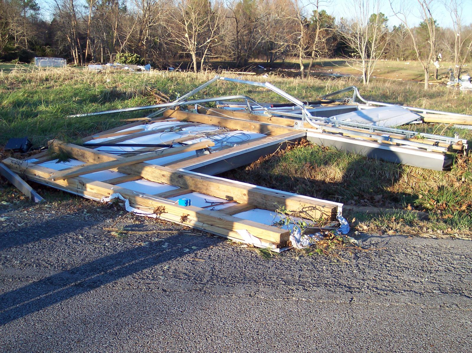
Photos by Jerry Orchanian, NWS Nashville Warning Coordination Meteorologist: 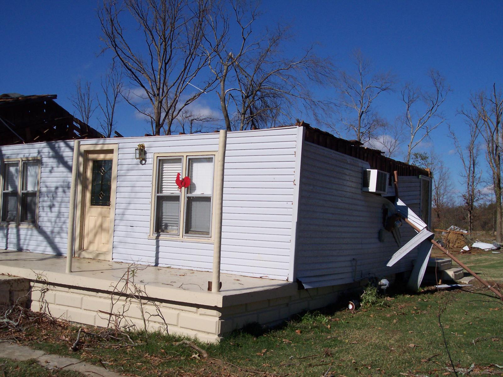 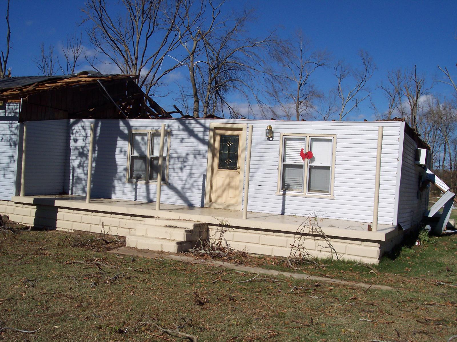 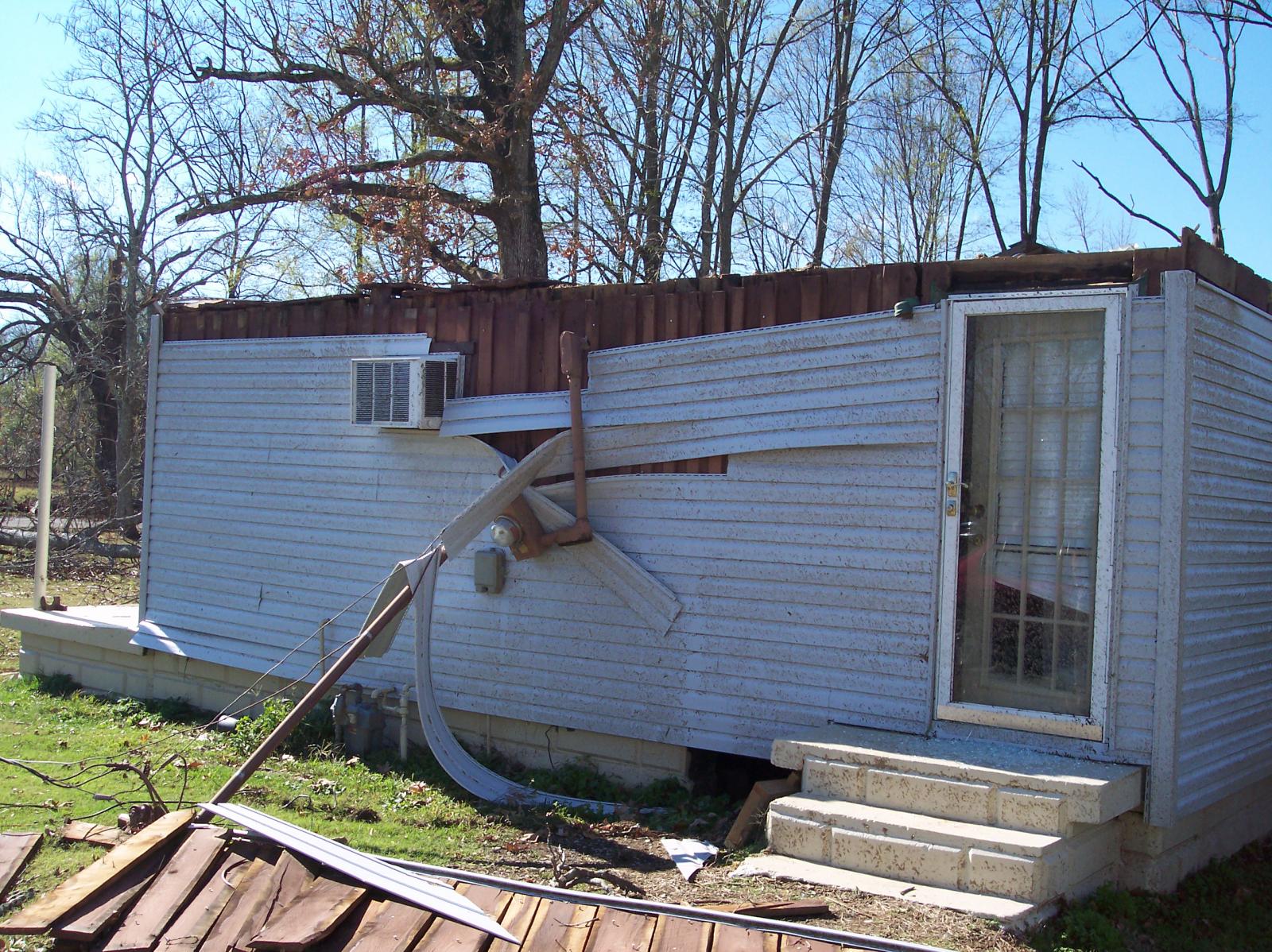 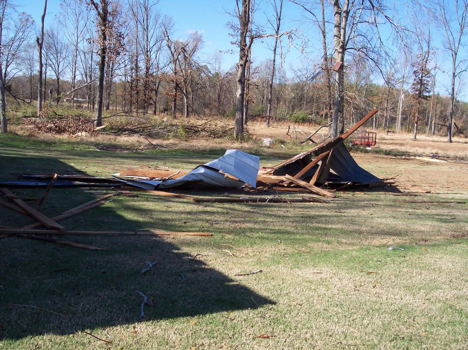 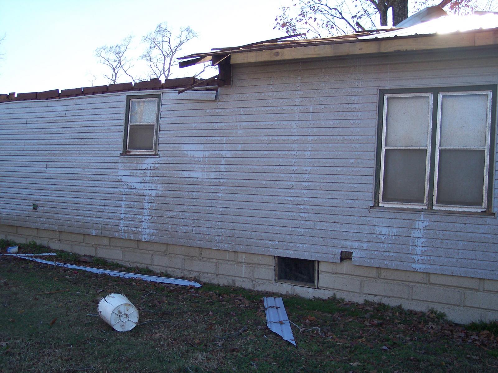  |
|
| F1 Humphreys County Tornado | |
| Counties: | Humphreys |
| Time: | 5:00 PM CST |
| EF Scale: | F1 |
| Damage Path Length: | 4.0 Miles |
| Damage Path Width: | 100 yards |
| Fatalities: | 0 |
| Injuries | 0 |
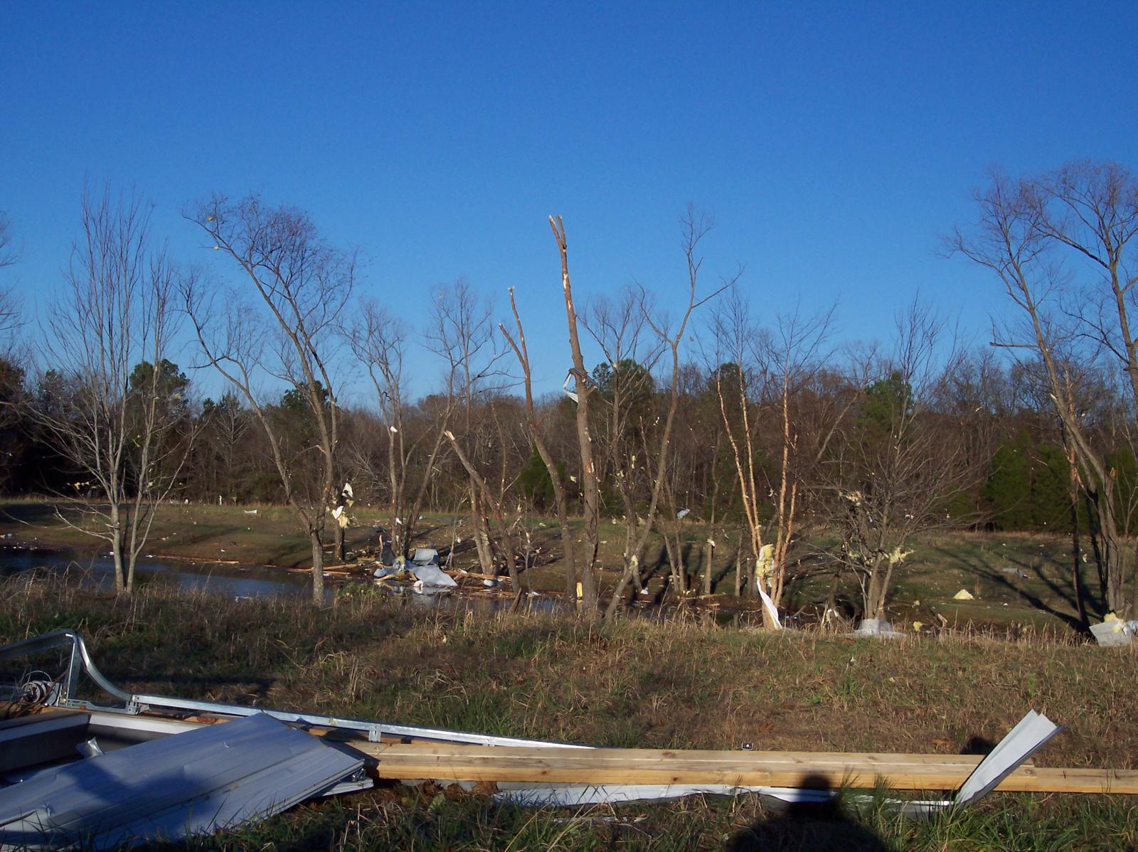
| Damage: STORM DATA: Emergency Manager reported structural damage to homes (near Bakerville). Trees were down. SHAMBURGER (2016): No NWS storm survey was conducted for this damage. However, radar data and aerial imagery from Google Earth clearly indicate this damage was caused by a tornado, and this new tornado has been added to the NWS Nashville database. The time, path length, path width, location, and F-scale rating of this tornado were all estimated based on the narrative in Storm Data, radar data, and the damage path on Google Earth aerial imagery. The tornado is estimated to have touched down north of Crockett Road just west of Old State Highway 1, about 2.6 miles south-southwest of Denver. The tornado then moved east-northeast along Old State Highway 1, crossed the Duck River, then moved across Bakerville Road near Pearl Road where a few homes and outbuildings were damaged and several trees blown down per Google Earth satellite imagery. The tornado then lifted east of Bakerville Road. |
|
| F2 Dickson Tornado | |
| Counties: | Dickson |
| Time: | 5:33 PM CST |
| EF Scale: | F2 |
| Damage Path Length: | 15.7 Miles |
| Damage Path Width: | 200 yards |
| Fatalities: | 0 |
| Injuries | 0 |
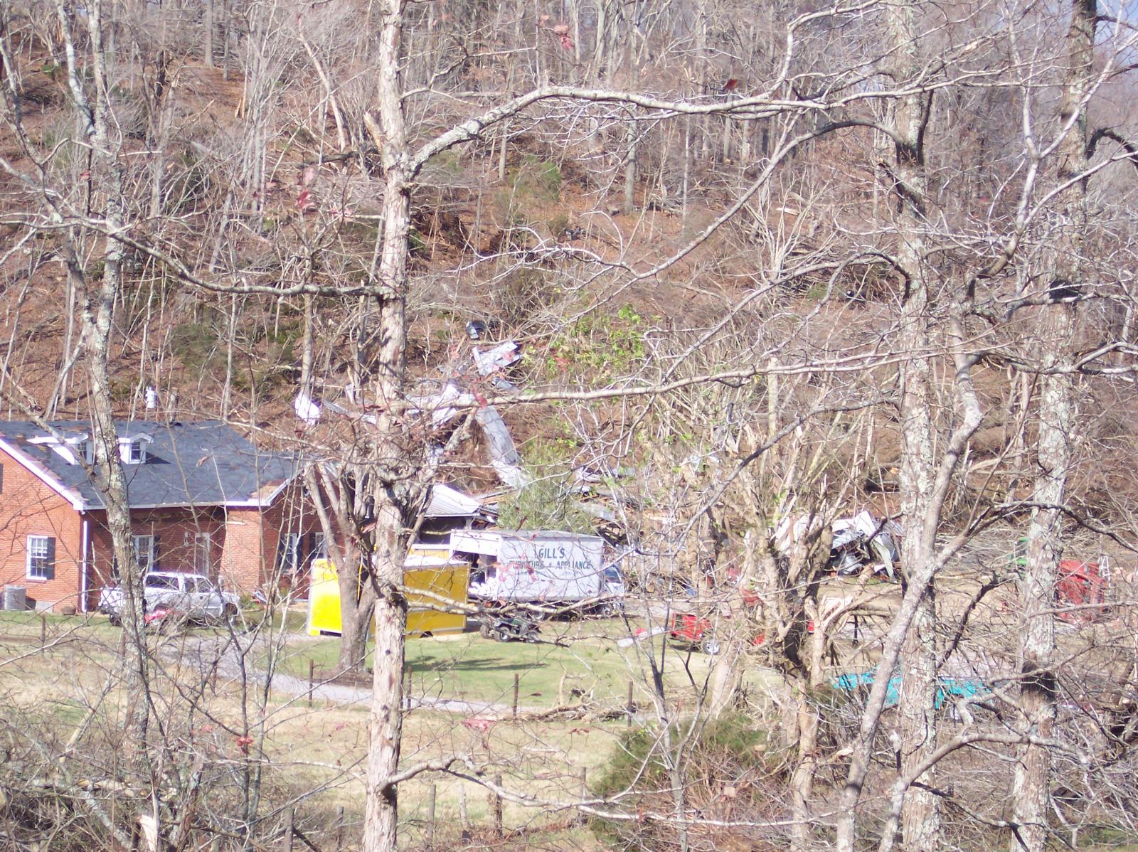
| Damage: STORM DATA (west Dickson County): Damage to homes (near Sylvia). This storm complex came from Humphreys County. STORM DATA (north Dickson County): Trees were damaged (from 3 miles NW of Charlotte to 3 miles N of Charlotte). NWS STORM SURVEY (Dickson County): Numerous trees were snapped and uprooted. A house roof was destroyed. No injuries. Significant structural damage (occurred) to home one mile south of Sylvia in west central Dickson County. Insulation and dirt was caked on all four sides of the structure. Elderly male was in kitchen when the tornado struck but he was extremely fortunate to escape unharmed. SPC STORM REPORTS: Houses and barns were damaged (by a) possible tornado (6 miles north of Dickson). SHAMBURGER (2016): NCDC and Storm Data incorrectly list two separate tornadoes occurring in Dickson County, when radar data clearly indicates they were part of the same long-track tornado. Little information is available about much of the tornado path except near Sylvia. The NWS Nashville storm survey information erroneously states that the home with significant structural damage was located one mile south of Sylvia, when it was actually located 1/2 mile west-northwest of Sylvia. Google Earth satellite imagery shows several homes and outbuildings were damaged or destroyed on the west and north sides of Sylvia by this tornado. The path length, start and end points, and location of the tornado were corrected and estimated based on radar data, the damage path on Google Earth satellite imagery, and the narratives in Storm Data and the NWS Nashville website. |
|
|
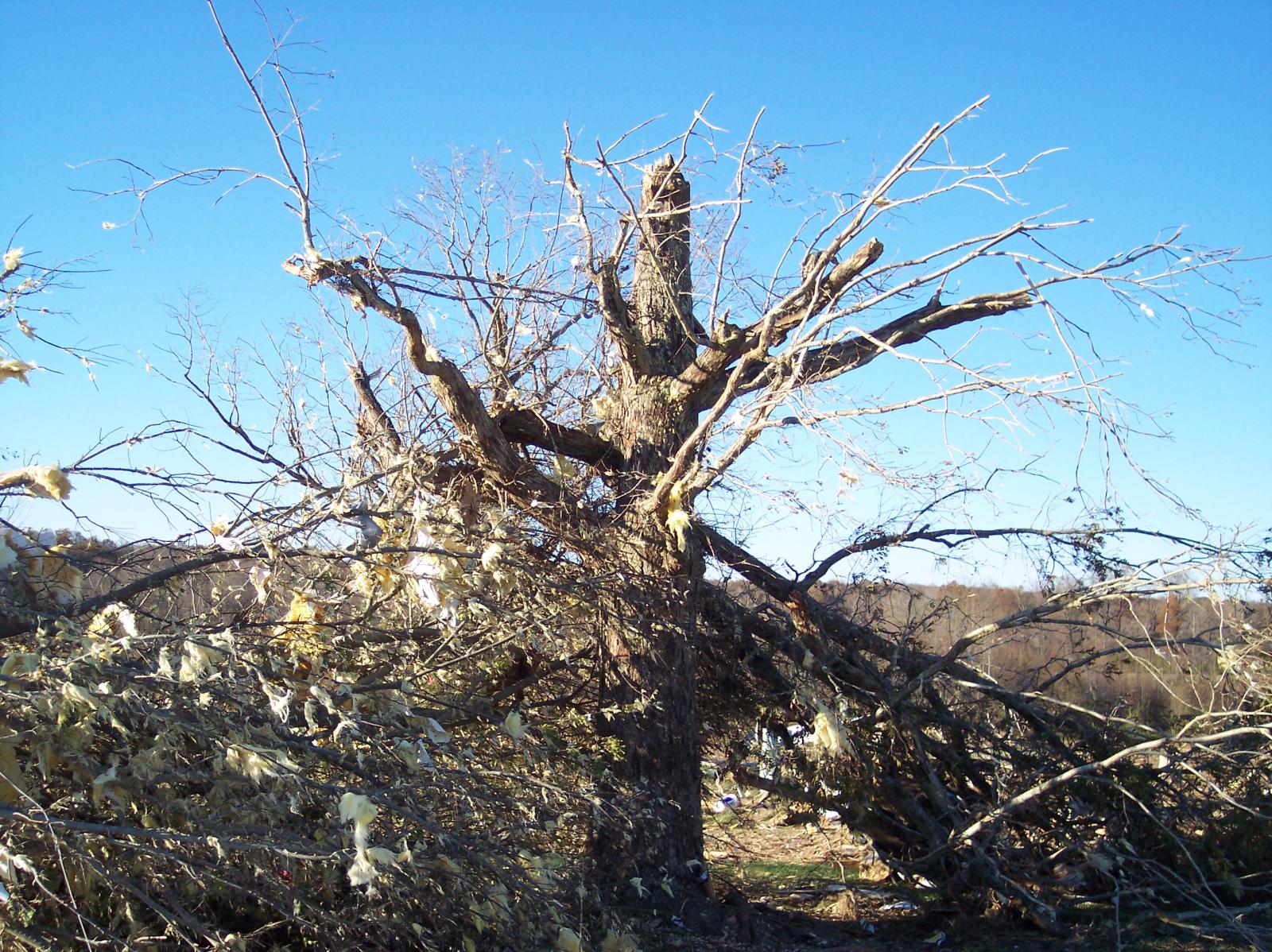
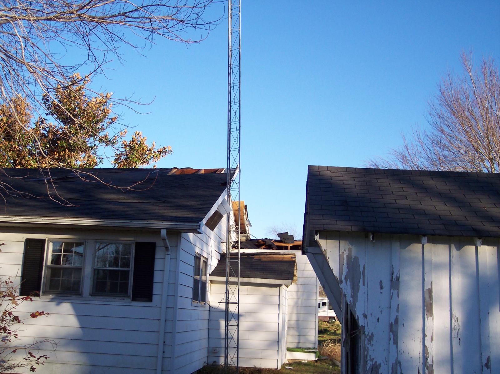
Photos by Ralph Troutman, NWS Nashville Observing Program Leader: Significant structural damage to home one mile south of Sylvia in west central Dickson County. Insulation and dirt was caked on all four sides of the structure. Elderly male was in kitchen when the tornado struck but he was extremely fortunate to escape unharmed. 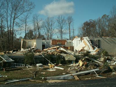 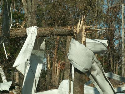 |
|
| EF2 Wayne County Tornado | |
| Counties: | Wayne |
| Time: | 5:52 PM CST |
| EF Scale: | F2 |
| Damage Path Length: | 8.4 Miles |
| Damage Path Width: | 100 yards |
| Fatalities: | 0 |
| Injuries | 1 |
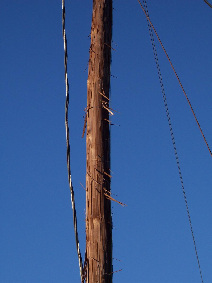
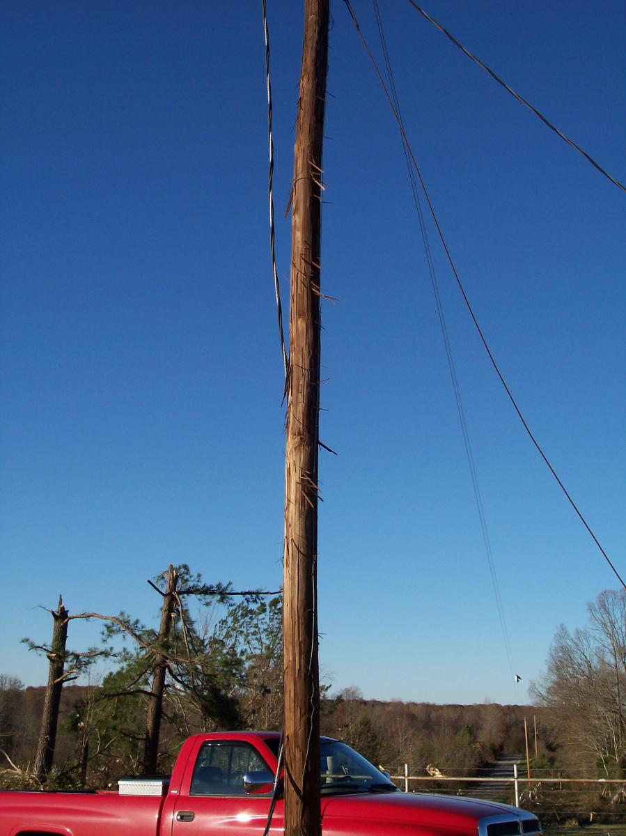
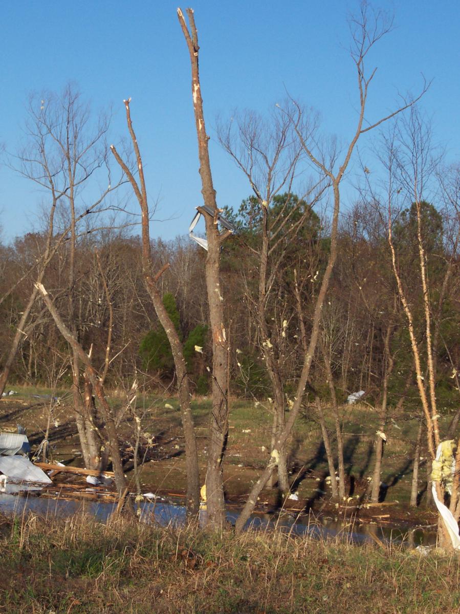
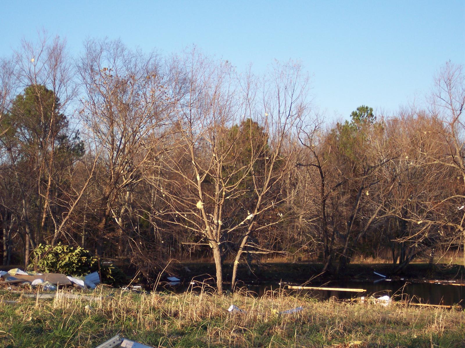
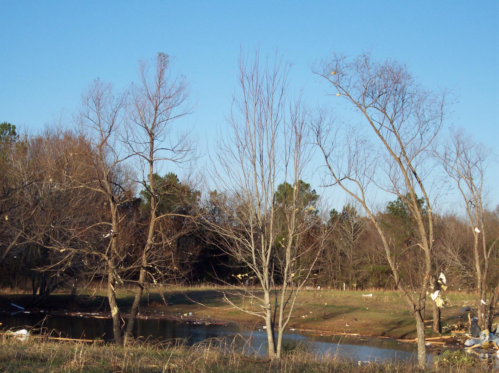
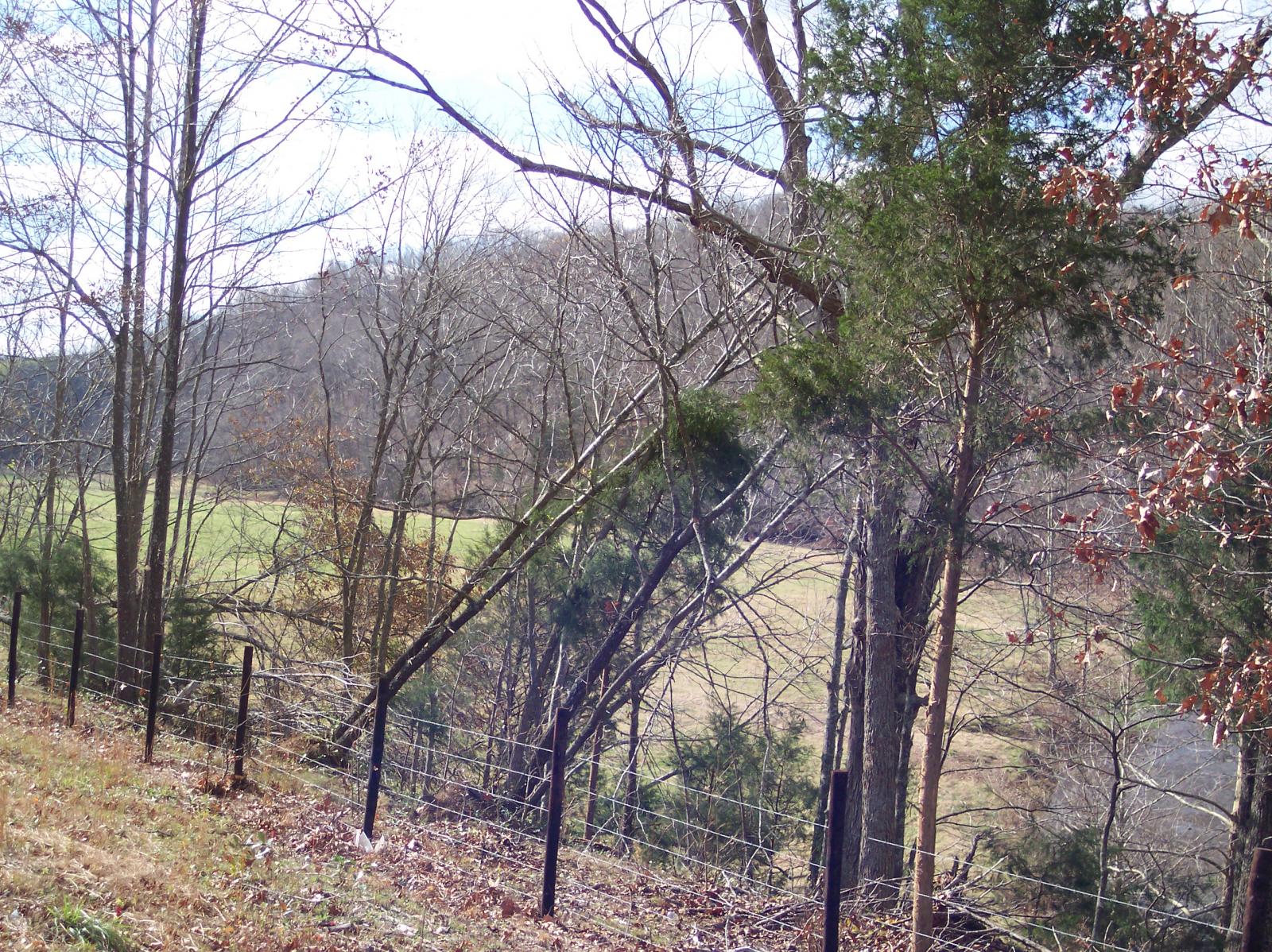
| Damage: STORM DATA: The NWS Storm Survey found that a tornado first touched down just south of Collinwood along Highway 13 near Shackelford Funeral Home. The tornado moved northeast and damaged several homes and snapped off numerous large trees along Ayers Rd. A barn was destroyed near the intersection of Ayers Road and Millrock. Several homes near this intersection received significant structural damage. Two trailer homes were damaged and were moved off their foundations. The tornado contiued to move northeast and did significant damage to the Millrock Baptist Church. Along Shawnette Road, more homes were damaged and numerous trees were blown down. Between Little Shawnette Road and Double Branch Road, a home was nearly destroyed. This was the last evidence of damage from the tornado in Wayne County. One injury occurred while a woman was inside her house on Shawnette Road when the tornado moved the house off the foundation. SHAMBURGER (2015): NCDC and Storm Data incorrectly list the time and path location of this tornado, which were corrected based on radar data and the narrative in Storm Data. In addition, the path length was extended over 2 miles to the northeast past Double Branch Road based on Google Earth satellite imagery, which showed numerous trees blown down across the inaccessible, rural forests of eastern Wayne County. |
|
|
Photos by Mike Murphy, NWS Nashville Service Hydrologist:  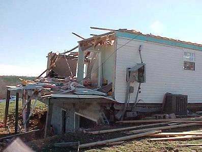 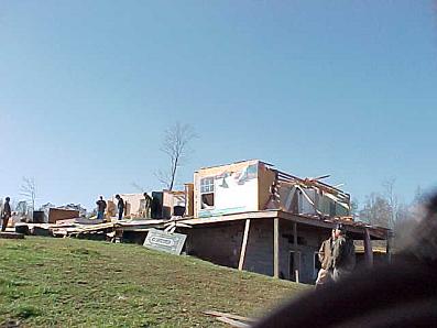 |
|
| EF0 Robertson County Tornado | |
| Counties: | Robertson |
| Time: | 6:20 PM CST |
| EF Scale: | F0 |
| Damage Path Length: | 0.10 Miles |
| Damage Path Width: | 20 yards |
| Fatalities: | 0 |
| Injuries | 0 |
| Damage: STORM DATA: Trees were snapped, and large tree branches were down near the intersection of I-24 and Highway 49. This was part of the storm complex from Dickson County. SHAMBURGER (2015): Radar data shows no evidence of a tornado in the area mentioned in Storm Data. However, this same storm complex later on does develop a weak tornado east of Highway 431 to the west of Greenbrier per radar data. Based on the radar data, the time and location of this tornado was corrected and estimated. |
|
| EF0 Maury County Tornado | |
| Counties: | Maury |
| Time: | 6:25 PM CST |
| EF Scale: | F0 |
| Damage Path Length: | 0.10 Miles |
| Damage Path Width: | 10 yards |
| Fatalities: | 0 |
| Injuries | 0 |
| Damage: STORM DATA: Trained spotter observed a tornado (5 miles west-northwest of Spring Hill). This storm moved into Williamson County and was later observed in Williamson County as another tornado by a NWS Co-op observer. |
|
| EF0 Williamson County Tornado | |
| Counties: | Williamson |
| Time: | 6:32 PM CST |
| EF Scale: | F0 |
| Damage Path Length: | 0.10 Miles |
| Damage Path Width: | 10 yards |
| Fatalities: | 0 |
| Injuries | 0 |
| Damage: STORM DATA: NWS Cooperative observer reported a tornado. No damage was reported from this storm. |
|
| EF0 Sumner County Tornado | |
| Counties: | Sumner |
| Time: | 6:37 PM CST |
| EF Scale: | F0 |
| Damage Path Length: | 0.10 Miles |
| Damage Path Width: | 10 yards |
| Fatalities: | 0 |
| Injuries | 0 |
| Damage: STORM DATA: Several 16 to 24 inches diameter trees were blown down. This storm complex came from Davidson County. SHAMBURGER (2015): NCDC and Storm Data incorrectly list the time and location of this tornado, which were corrected based on radar data. |
|


 Follow us on YouTube