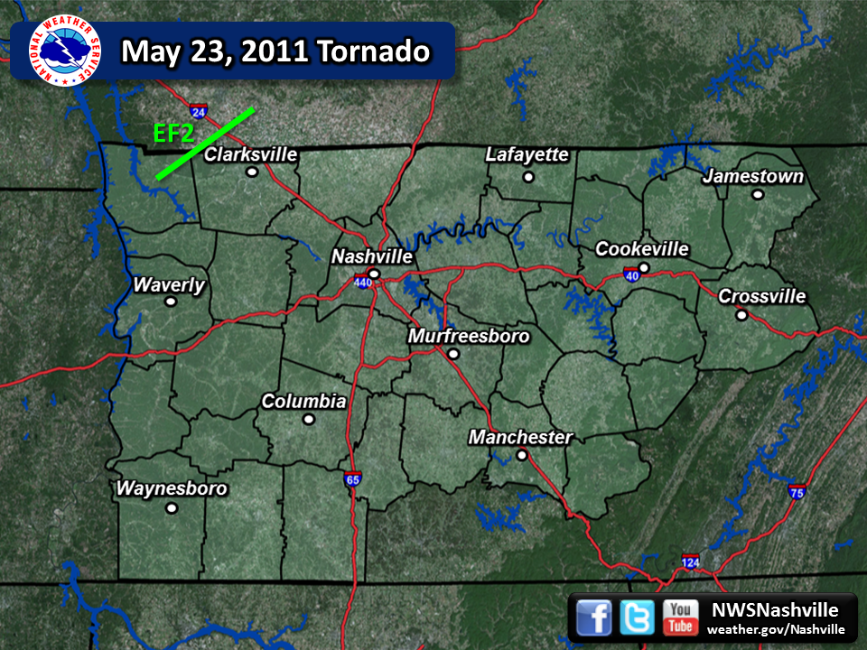
| May 23, 2011 Tornado | ||||||||
| # | Counties | Rating | Time (CST) | Length (miles) | Width (yards) | Fatalities | Injuries | |
| 1 | Stewart/Montgomery/Christian KY | EF2 | 1752 | 30.29 | 150 | 0 | 2 | |
| Reports & Outlooks | |||
| SPC Outlooks | SPC Storm Reports | SPC Event Archive | Public Information Statement |
| EF2 Big Rock Tornado | |
| Counties: | Stewart/Montgomery/Christian KY |
| Time: | 5:52 PM CST |
| EF Scale: | EF2 |
| Damage Path Length: | 30.29 Miles |
| Damage Path Width: | 150 Yards |
| Fatalities: | 0 |
| Injuries | 2 |
| Storm Data: Damage began near the intersection of Bumpus Mills and Brazzie Dock Roads and was continuous at least 13 miles northeast across Ft. Campbell into Christian County, KY, where it continued for another 17 miles. The last visible evidence of damage in TN was 1/2 mile east of the Intersection of State Route 20 and Big Rock Road. The most significant damage, as the result of an EF-2 tornado with winds near 120 mph, was along Cherry Hollow Rd. just northeast of the Big Rock community. Several homes suffered significant roof damage including one with a complete roof loss. An occupied mobile home was totally destroyed with debris scattered at least 100 yards into a field. SHAMBURGER (2015): Aerial imagery from Google Earth indicates this tornado also clipped far northwest Montgomery County where it blew down numerous trees, and Montgomery County was added to this entry. |
|
Photos: 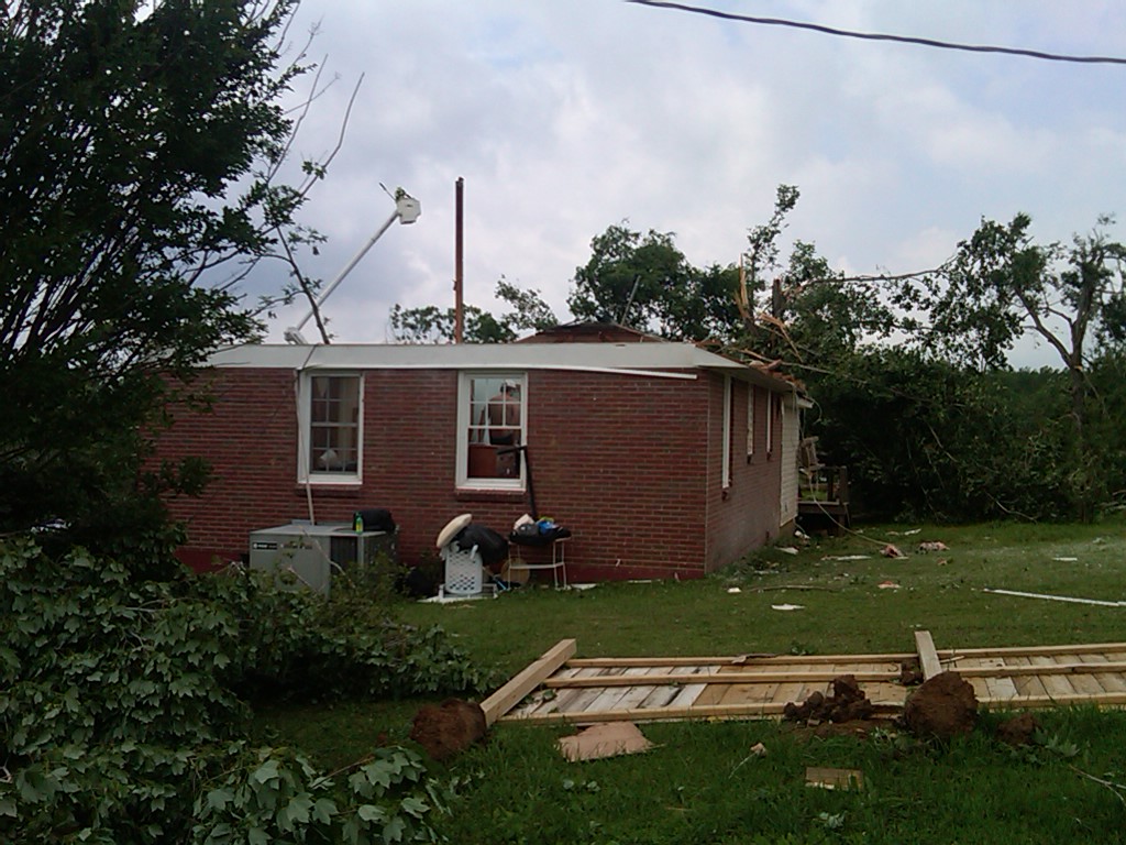 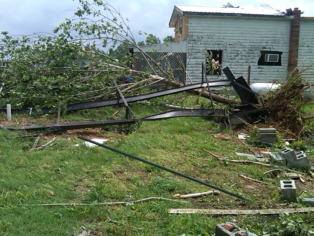 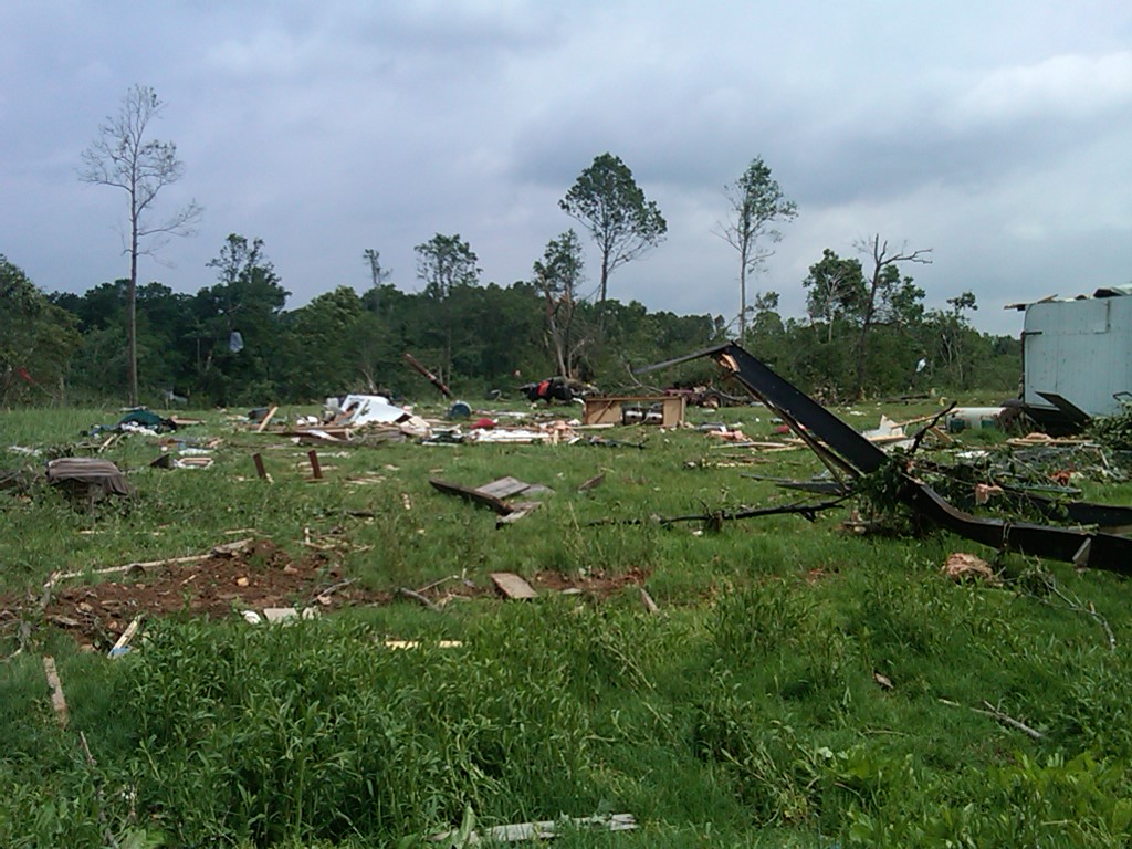 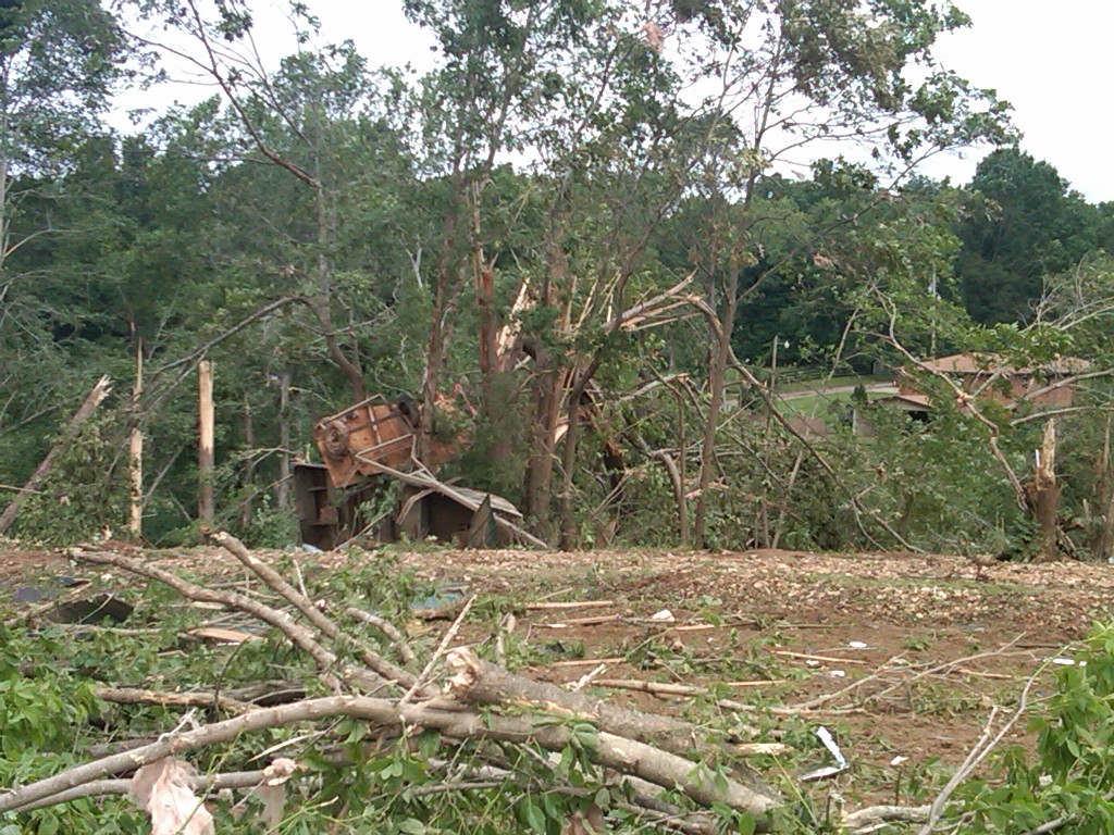 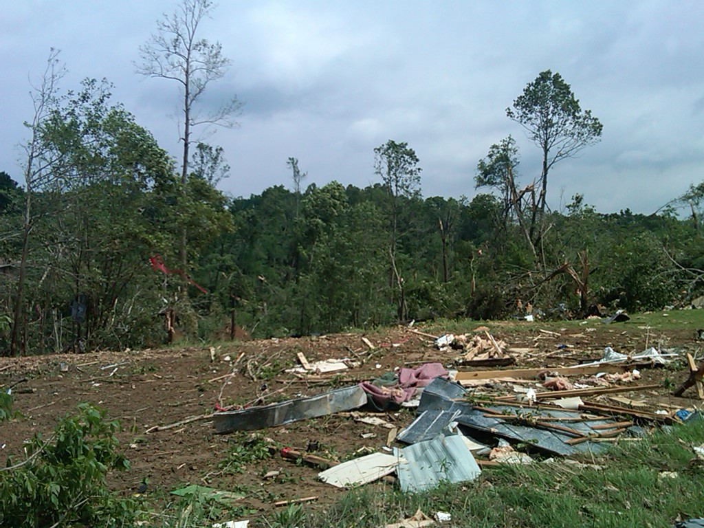 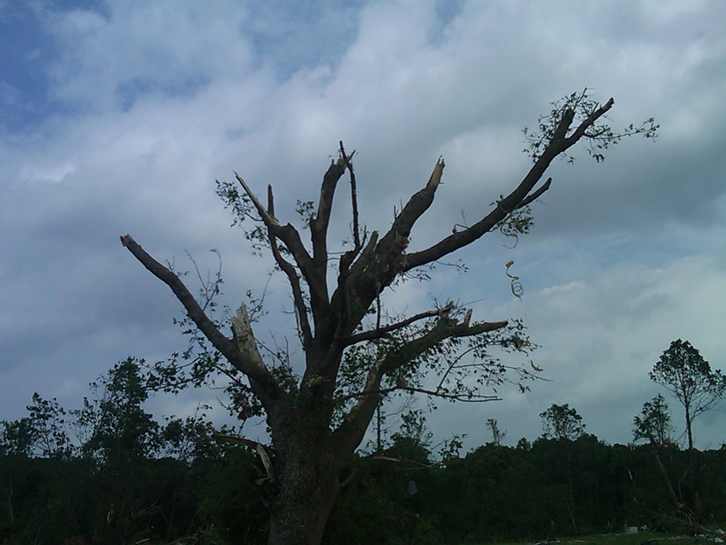 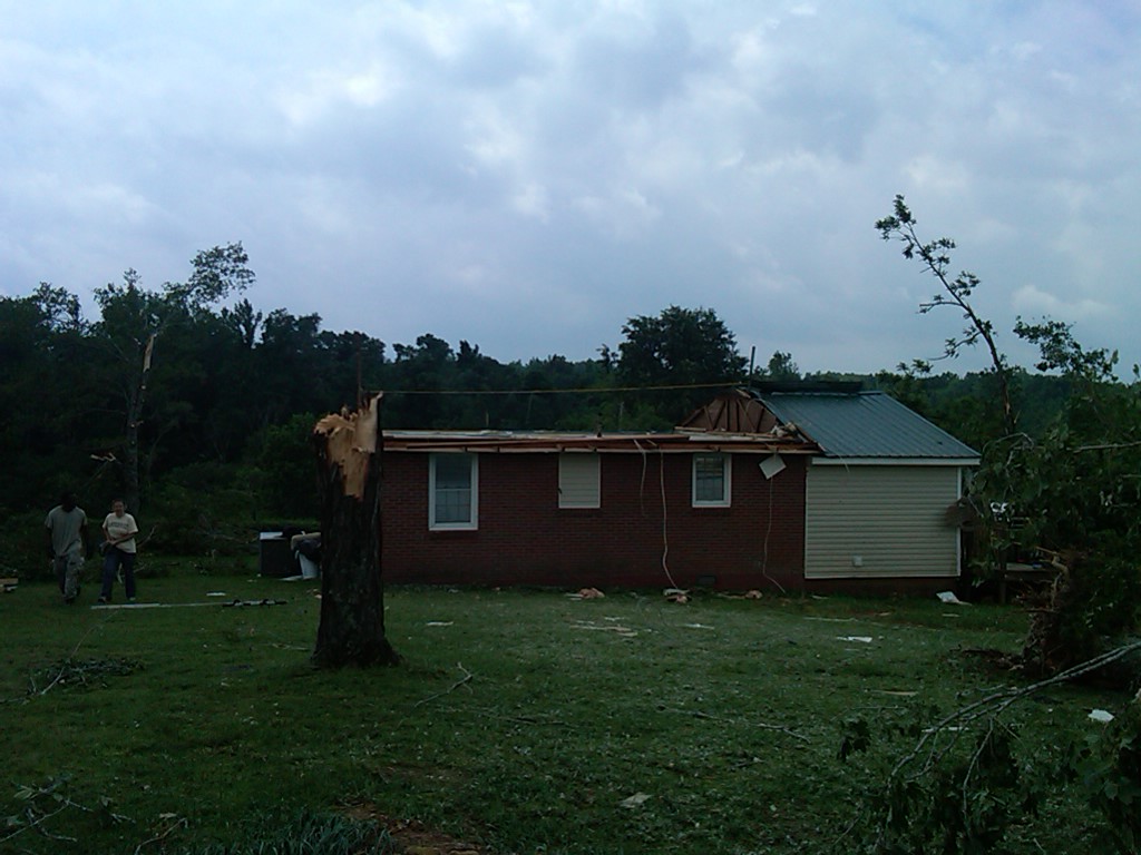     |
|


 Follow us on YouTube