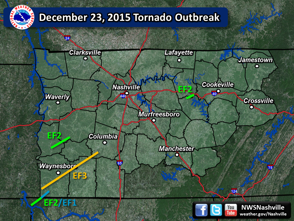
| Tornado Statistics | ||||||||
| # | Counties | Rating | Time (CST) | Length (miles) | Width (yards) | Fatalities | Injuries | |
| 1 | Perry/Hickman | EF2 | 1818 | 16.00 | 500 | 2 | 0 | |
| 2 | Wayne/Lawrence/Lewis/Maury | EF3 | 1855 | 50.01 | 800 | 0 | 7 | |
| 3 | Lauderdale AL/Wayne | EF2/EF1 | 1900 | 14.94 | 400 | 0 | 0 | |
| 4 | DeKalb/Smith | EF2 | 2214 | 8.92 | 250 | 0 | 0 | |
| Overview | |
| An unusually powerful upper level trough moved across the eastern United States on December 23, 2015, spawning widespread severe weather from the Gulf Coast to the Great Lakes. Several tornadic supercell thunderstorms developed across northern Mississippi and western Tennessee, which then moved rapidly east-northeastward at up to 70 mph across Middle Tennessee during the evening hours on December 23. These storms produced 4 long-track tornadoes that caused 2 deaths and at least 7 injuries. Only 7 tornadoes had been previously recorded across Middle Tennessee in the month of December from the 1800s through 2014, easily making this the largest and worst December tornado outbreak in Middle Tennessee history. In addition to the tornadoes, several reports of wind damage, large hail up to 1 inch in diameter, and flash flooding were received. Some of the worst flash flooding occurred in Maury County, where 3 teenagers drowned in a submerged vehicle on Carters Creek Pike. |
| Reports & Outlooks | |||
| SPC Storm Reports | SPC Event Archive | Local Storm Reports | Public Information Statements |
| Radar Imagery | |
|
OHX radar loop from December 23, 2015 |
| EF2 Perry/Hickman County Tornado | |
| Counties: | Perry/Hickman |
| Time: | 6:18 PM CST |
| EF Scale: | EF2 |
| Estimated Peak Winds: | 115 mph |
| Damage Path Length: | 16.1 miles |
| Damage Path Width: | 500 yards |
| Fatalities: | 2 |
| Injuries | 0 |
|
Damage: |
|
NWS Storm Survey photos: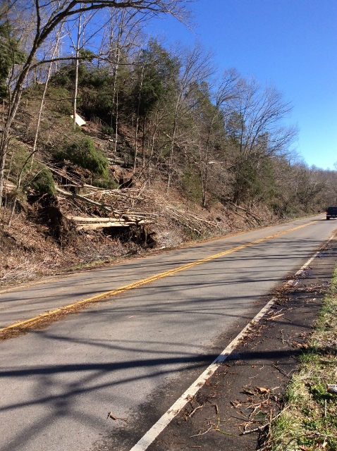 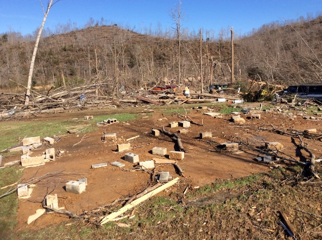  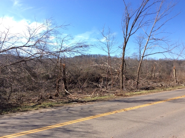 |
|
| EF3 Wayne/Lawrence/Lewis/Maury County Tornado | |
| Counties: | Wayne/Lawrence/Lewis/Maury |
| Time: | 6:55 PM CST |
| EF Scale: | EF3 |
| Estimated Peak Winds: | 157 mph |
| Damage Path Length: | 50.01 miles |
| Damage Path Width: | 800 yards |
| Fatalities: | 0 |
| Injuries: | 7 |
|
Damage: Based on newly available high resolution Google Earth satellite imagery in July 2019, this tornado path was adjusted to begin slightly further southwest and end slightly further northeast than previously indicated, giving a total path length of 50.01 miles. However, the high resolution Google Earth imagery also indicates this tornado path was likely made up of two separate tornadoes, with the first tornado (EF-3) occluding and lifting near the Natchez Trace Parkway north of Ovilla Lane in far eastern Wayne County, and the second tornado (EF-2) touching down south of Barrett Branch Road in far eastern Wayne County about 3/4 mile northwest of where the first tornado lifted. |
|
NWS Storm Survey photos - Wayne County: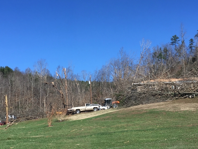    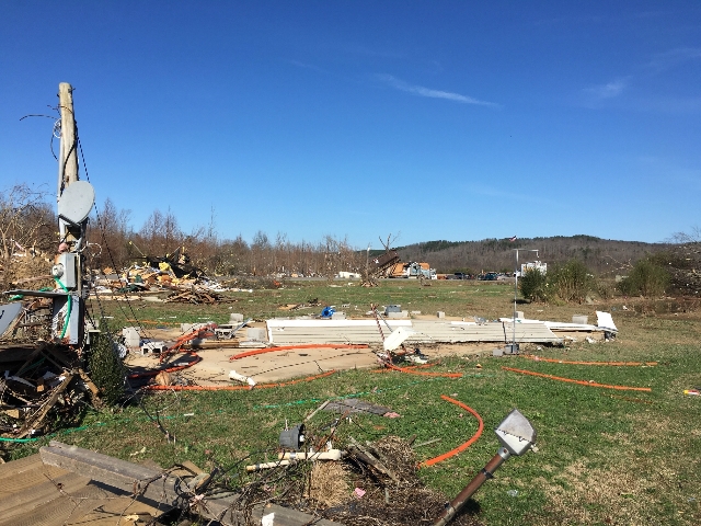  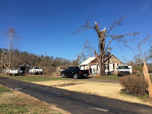  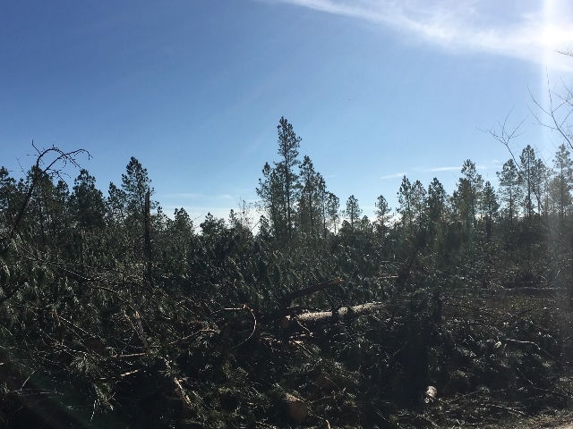 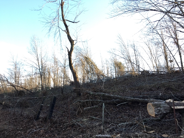 |
|
NWS Storm Survey photos - Lawrence County: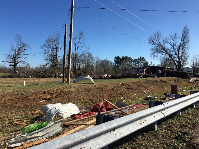  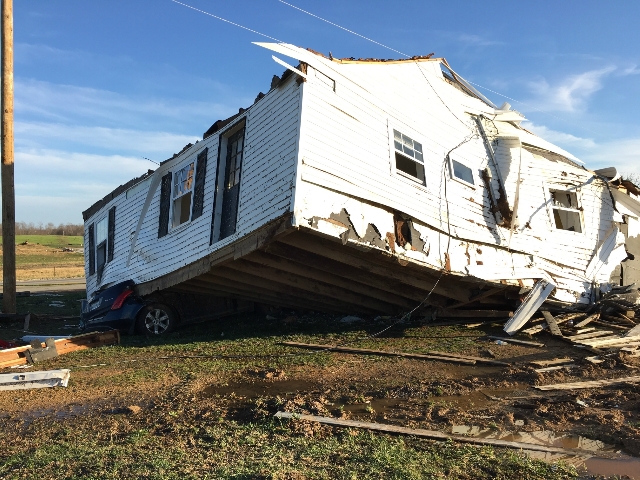   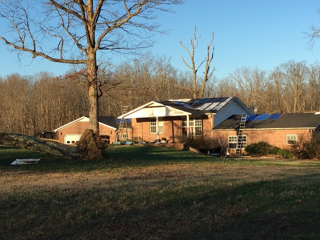 |
|
NWS Storm Survey photos - Maury County: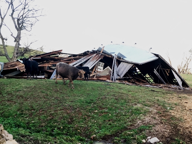 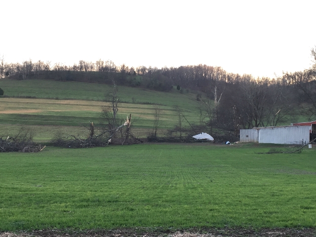 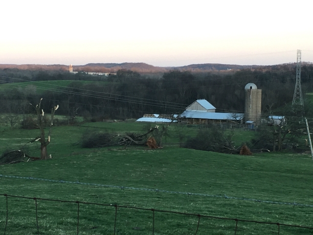 |
|
| EF2 Lauderdale AL/Wayne County Tornado | |
| Counties: | Lauderdale AL/Wayne |
| Time: | 7:00 PM CST |
| EF Scale: | EF2 (AL)/EF1 (TN) |
| Estimated Peak Winds: | 110 mph (TN) |
| Damage Path Length: | 7.46 miles (AL)/7.48 miles (TN) |
| Damage Path Width: | 400 yards |
| Fatalities: | 0 |
| Injuries | 0 |
|
Damage: |
|
NWS Storm Survey photos: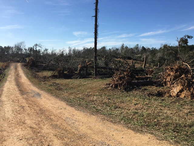  |
|
| EF2 DeKalb/Smith County Tornado | |
| Counties: | DeKalb/Smith |
| Time: | 10:14 PM CST |
| EF Scale: | EF2 |
| Estimated Peak Winds: | 125 |
| Damage Path Length: | 8.92 miles |
| Damage Path Width: | 250 yards |
| Fatalities: | 0 |
| Injuries | 0 |
|
Damage: |
|
NWS Storm Survey photos: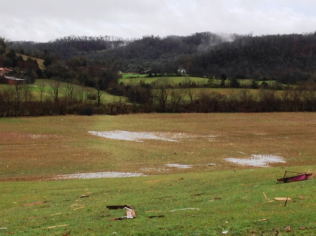 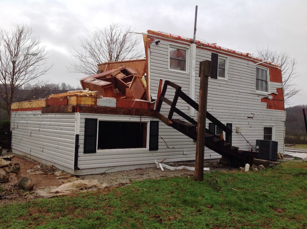    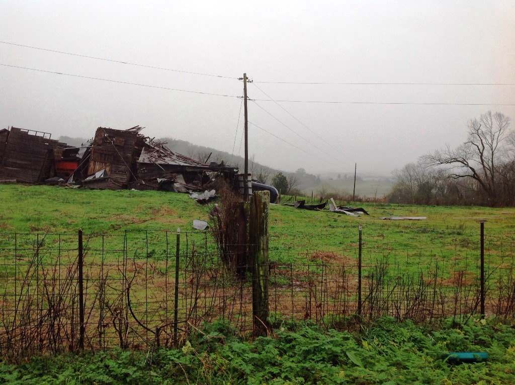 |
|


 Follow us on YouTube