
| Tornado Statistics | ||||||||
| # | Counties | Rating | Time (CDT) | Length (miles) | Width (yards) | Fatalities | Injuries | |
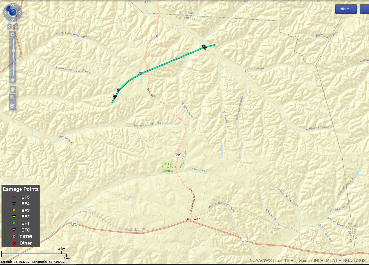
| 1 | Humphreys | EF0 | 858 PM | 3.9 miles | 75 yards | 0 | 0 | |
| Overview | |
| A small complex of thunderstorms developed across West Tennessee during the evening hours on July 5, then moved into Middle Tennessee during the late evening and overnight hours. These storms produced a few reports of wind damage, along with a EF1 tornado in Carroll County and a weak EF0 tornado in northeast Humphreys County. |
| Radar | |
 |
|
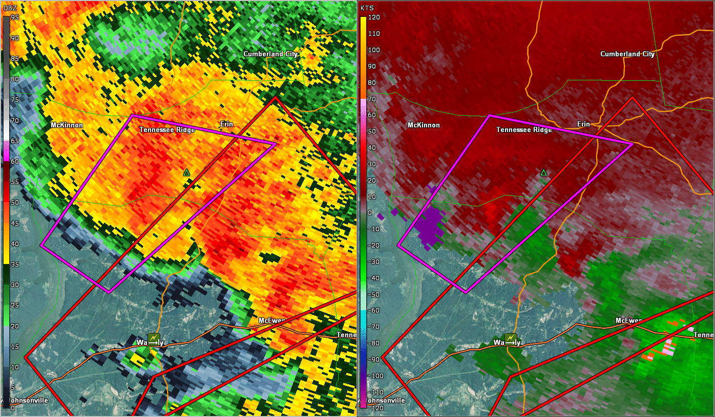
| HPX BR/SRV Radar Loop of Humphreys County Tornado |
|
| Reports & Outlooks | |||
| SPC Storm Reports | SPC Event Archive | Local Storm Reports | Public Information Statements |
| EF0 Humphreys County Tornado | |
| Counties: | Humphreys |
| Time: | 858-909 PM |
| EF Scale: | EF0 |
| Estimated Peak Winds: | 80 mph |
| Damage Path Length: | 3.9 miles |
| Damage Path Width: | 75 yards |
| Fatalities: | 0 |
| Injuries | 0 |
|
Storm Survey:
|
|
|
Humphreys County Damage Survey Photos: |
|
 |
 |
 |
 |


 Follow us on YouTube