Links | Map | Warnings, Radar, & Satellite | Fire & Thunder Forecasts
Outlooks and Climate| Fuels and Fire Danger Maps
 |
||||||
|
||||||
| Marten Creek Inciweb Page | ||||||
| WFO Riverton Fire Weather Page | ||||||
| Fire Weather Planning Forecast For Zone 414 | ||||||
| Lincoln County Homeland Security & Emergency Management Facebook Page | ||||||
| U.S. Forest Service Bridger-Teton National Forest Facebook Page | ||||||
| Click Boxes to Expand Product on Page | ||||||
|
||||||
|
||||||
Current Warnings, Radar, and Satellite
(Click thumbnails to expand Images)
 |
|
|
|
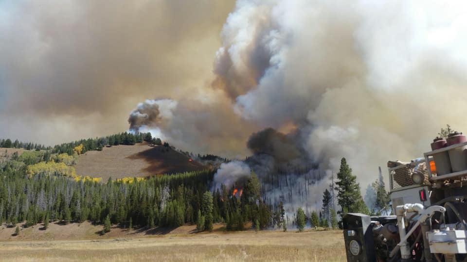
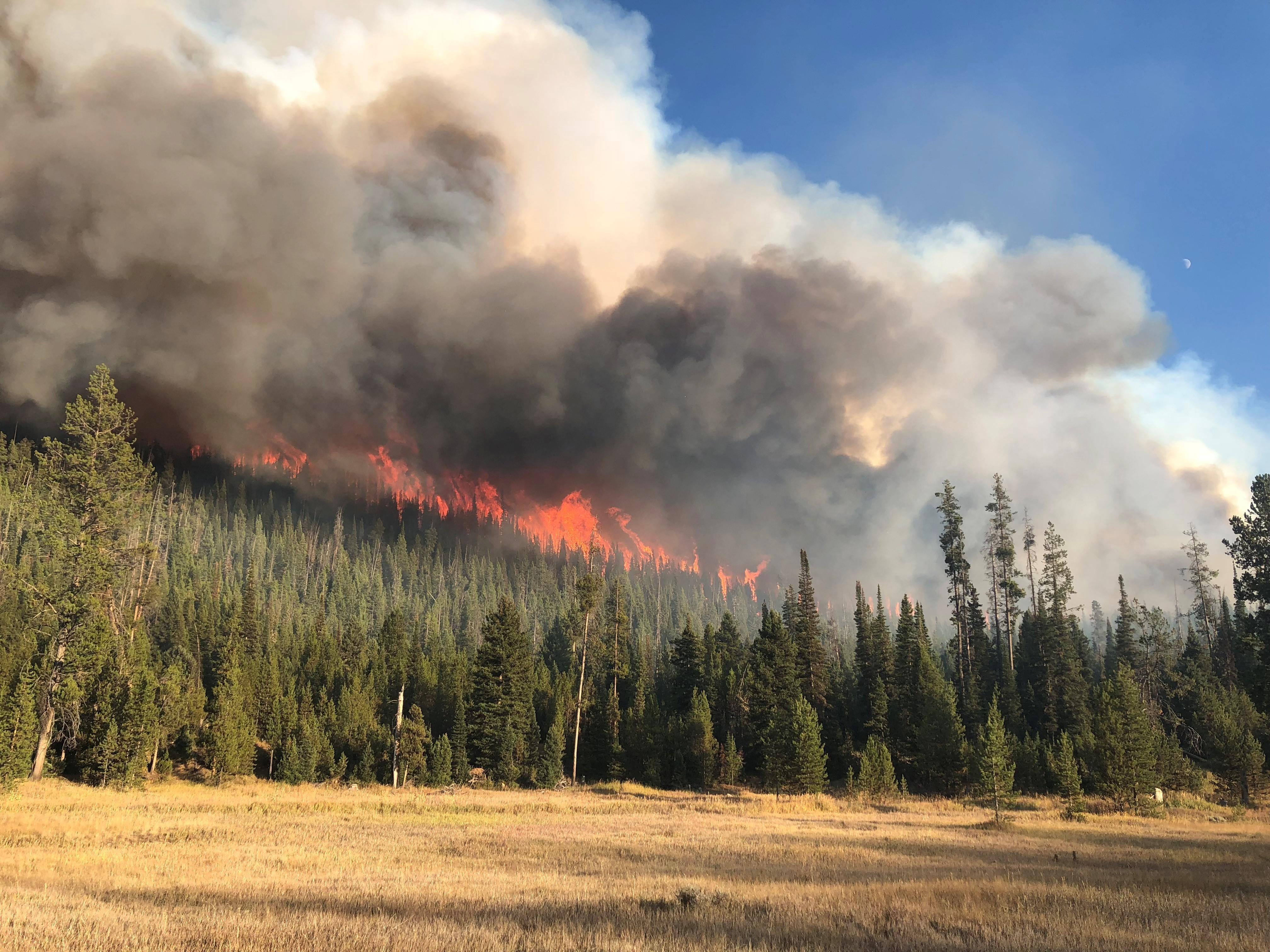
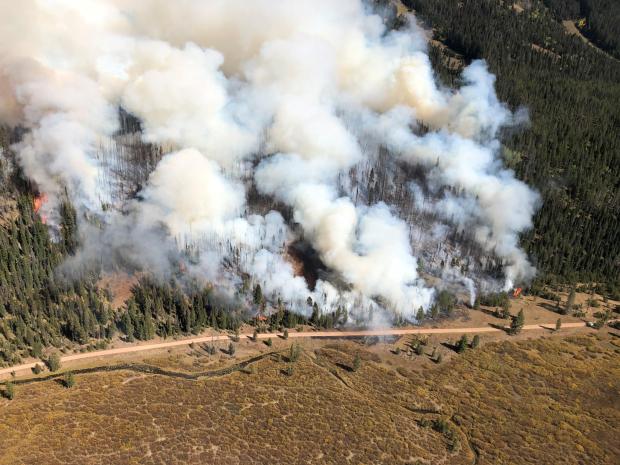
| Marten Creek Fire Pictures | |
 |
 |
| Picture taken on 9/18 Courtesy of the Bridger-Teton Forest Service |
Picture taken on 9/18 Courtesy of the Bridger-Teton Forest Service |
 |
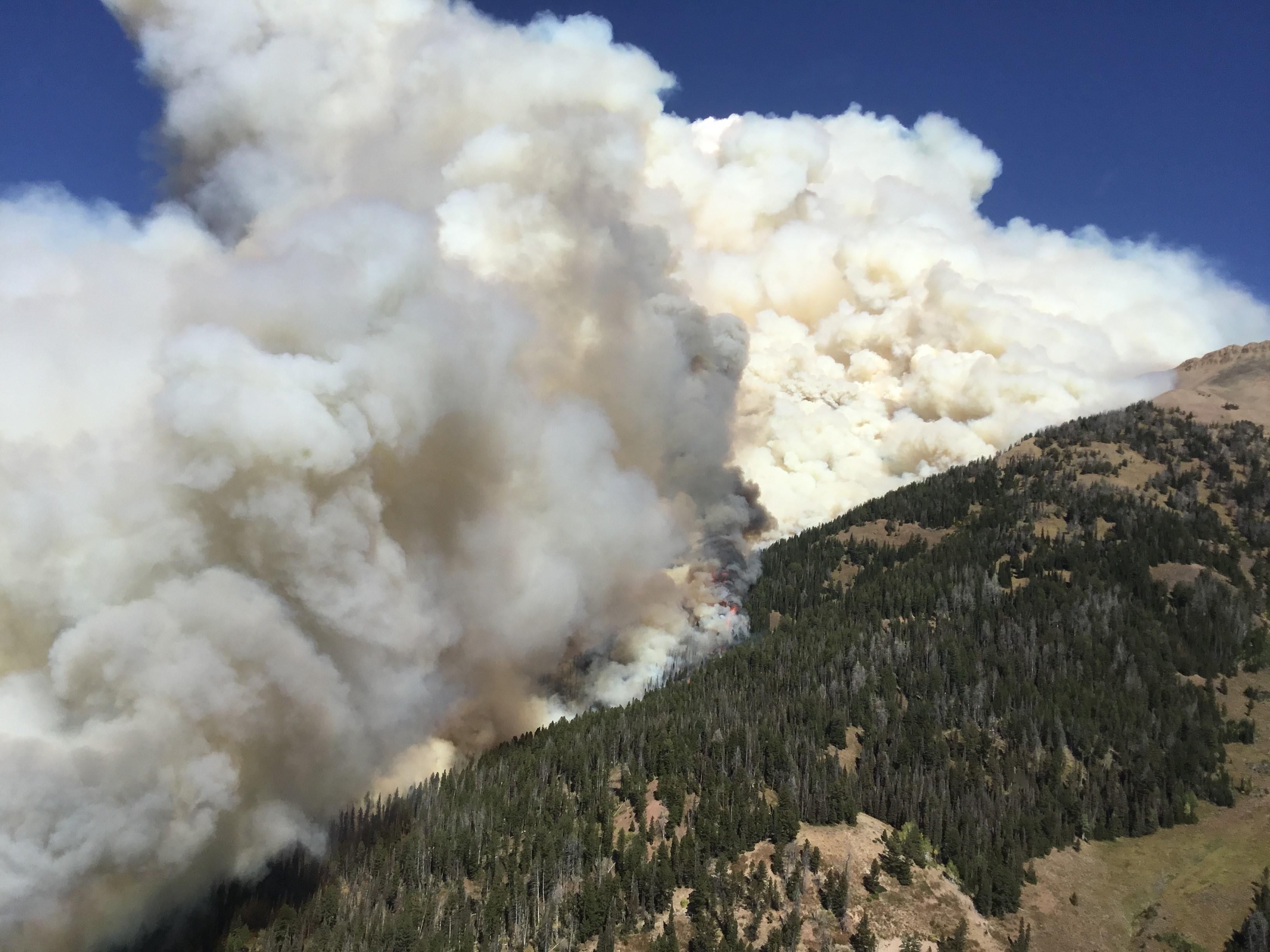 |
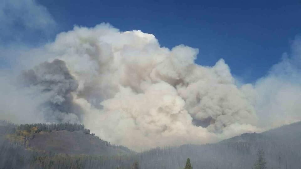
| InciWeb 9/16 | InciWeb 9/16 |
 |
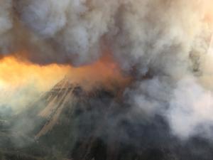 |
| Picture from InciWeb 9/16 | Picture from InciWeb 9/16 |
|
|
|
|
|

|

|

|
 |
|
|
|
|
|
|
Storm Prediction Center Critical Fire Areas and Thunderstorm Forecasts
(Click thumbnails to expand Images)
|
|
|
|
 |
 |
 |
|
|
Day 2 Categorical | Day 3 Categorical |
 |
 |
 |
|
|
|
|
|
|
 |

|
 |
 |
 |
|
|
|
|
|
|
 |

|
 |
 |
 |
Weather Outlook and Climate Information
(Click thumbnails to expand Images)
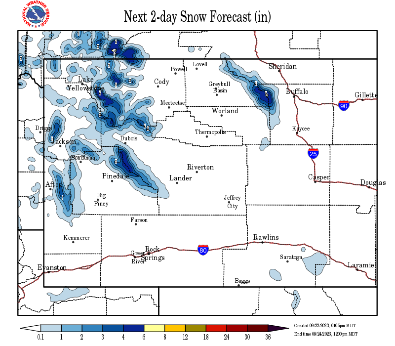
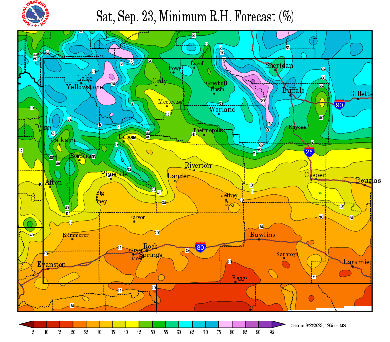
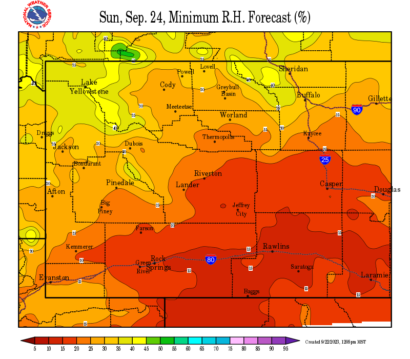
| Local Precipitation, Wind, and Humidity Information (NWS) |
|
|
|
|
|
 |
 |
 |
 |
|
|
|
|
|
 |
 |
 |
 |
|
|
|
|
|
|
|
 |
 |
 |
 |
|
|
|
|
|
 |
 |
 |
 |
USFS Fire Danger Graphics and Fuels
(Click thumbnails to expand Images)
|
|
|
|
 |
 |
 |
|
|
|
|
|
 |
 |
 |
 |
|
|
|
|
|
 |
 |
 |
 |
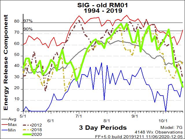
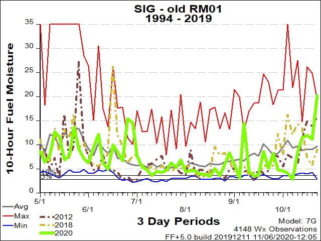
| RM01 ERC Fuels Graph |
|
|
 |
 |
 |
|
Select the ERC, 10-hr fuel moisture and pocket card graphics closest to the wildfire. Change headers, then DELETE this cell.
Pocket Cards Found Here: https://famit.nwcg.gov/applications/WIMS/PocketCards/PocketCards |
||
Return to NWS Riverton Homepage
 |
Building a Weather-Ready Nation |


 Follow us on YouTube