…Wyoming December 2017 precipitation was 110 to 120 percent of average...
...Current water year precipitation is averaging 95 to 105 percent of normal across Wyoming…
…Mountain snowpack across Wyoming is 105 to 115 percent of median...
…Above normal snowmelt streamflow volumes are expected across several major basins in Wyoming…
…Wyoming reservoir storages are 115 to 125 percent of average for January…
December 2017 precipitation totals across Wyoming were 110 to 120 percent of average. Precipitation numbers varied between 175 percent of normal over the Shoshone/Clarks Fork River Drainage (northwest Wyoming) to near 65 percent of normal over the Snake (western Wyoming) and Little Snake (south central Wyoming) Watersheds. Current water year (October-December 2017) precipitation across Wyoming is 95 to 105 percent of average.
Mountain snowpack across Wyoming was 105 to 110 percent of median by early January. Snowpack "water" numbers and/or SWEs were the highest across basins in northwest to north central Wyoming—varying between 130 to 160 percent of median. SWEs across basins in south central to southeastern Wyoming were 70 to 95 percent of median.
Above normal (105 to 115 percent) snowmelt streamflow volumes are expected across several major basins across Wyoming. Well above average streamflow volumes are expected across portions of the Wind, Bighorn, Shoshone, and Upper Yellowstone Watersheds. The Tongue, Lower Green, Upper North Platte, and Little Snake Basins are forecasted to have below to near normal streamflow volumes during the upcoming snowmelt season.
Reservoirs storages across Wyoming are above average at 115 to 125 percent for January.
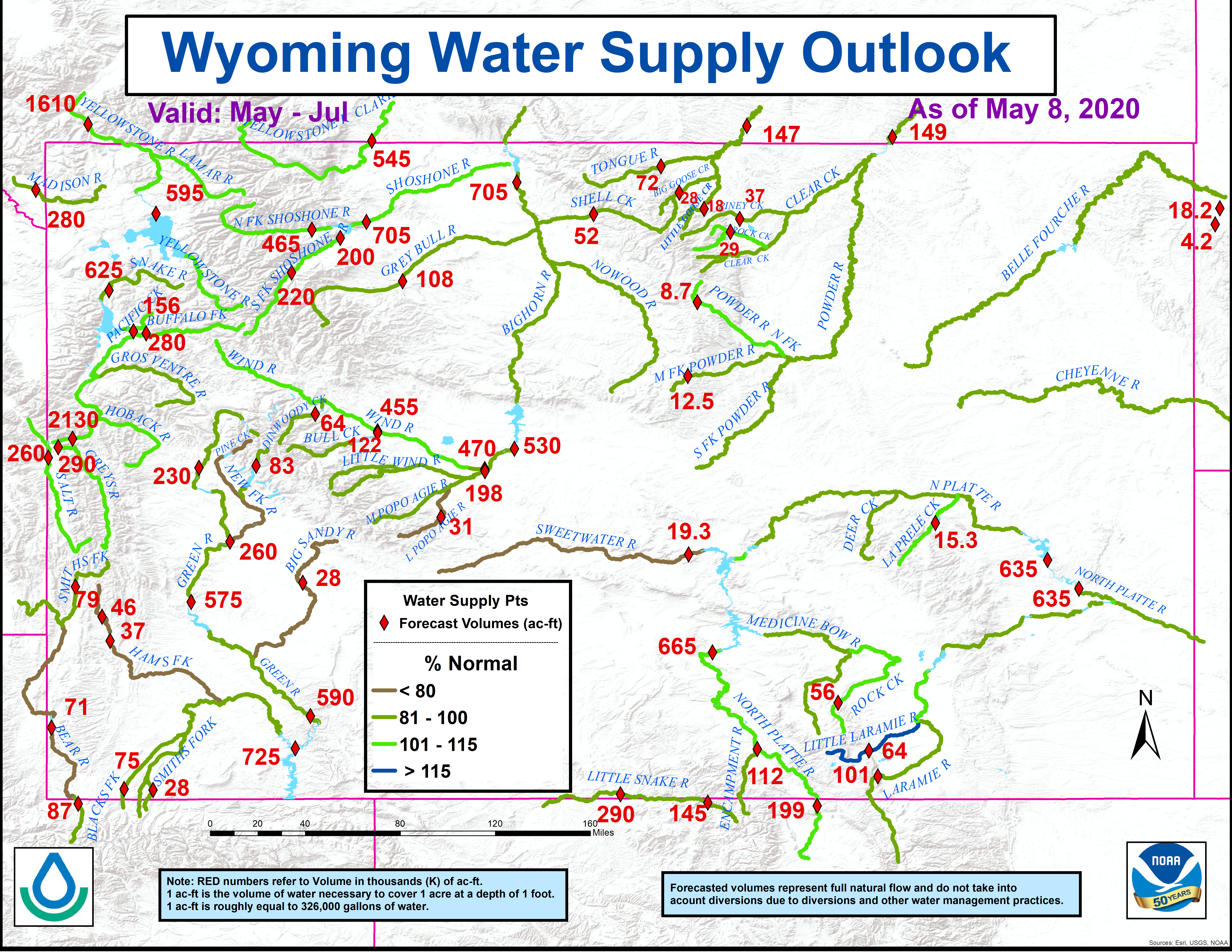
The latest Wyoming water supply outlook graphic:


 Follow us on YouTube