Low pressure tracked across the southern U.S. and strengthened in response to an upper low digging out of Plains and pulled significant moisture from Gulf and Atlantic into the southern Appalachian region, spreading over top of deep cold air from a strong surface ridge and cold air damming scenario. The cold layer in place was deep enough for mainly snow, with brief periods of sleet and very light freezing rain across the southern Piedmont of Virginia into North Carolina near the end of the event.
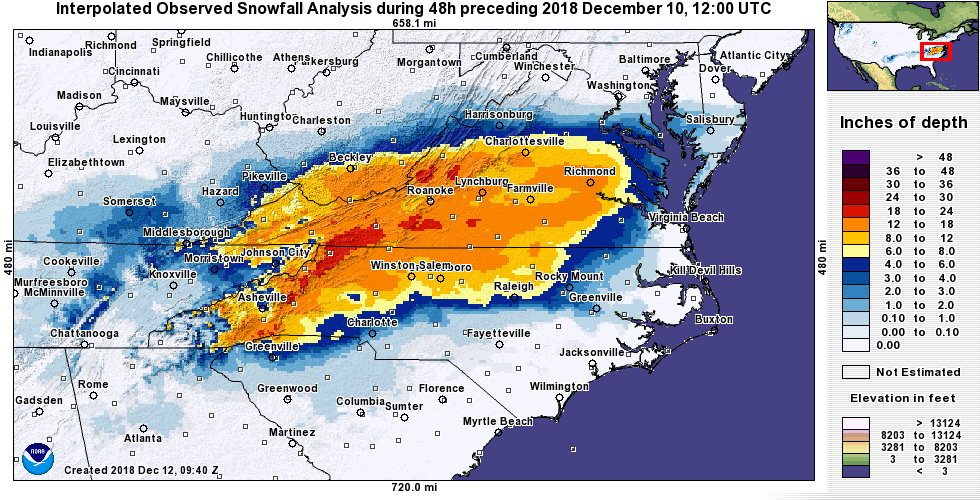
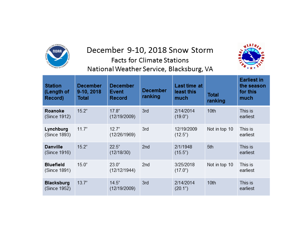
The resultant snowfall was significant across our entire forecast area (most areas over a foot, and a few locations around 2 feet), and had enough weight in some places to result in power outages, and made for extremely hazardous travel for those who had to venture out on a Sunday when most of the snow fell, or early Monday. At our primary climate locations (see table below) this was either the 2nd or 3rd largest December snowfall on record for any event (records go back to different years at each site), and was the earliest in the season that this much snow had fallen at each of those locations. At Danville this was the most snow measured in an event since February 1948.
|
|
|
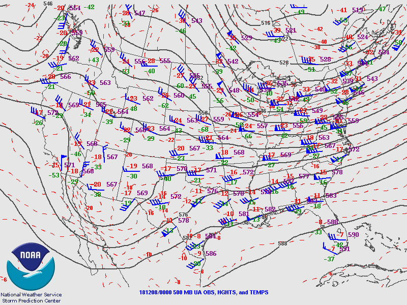
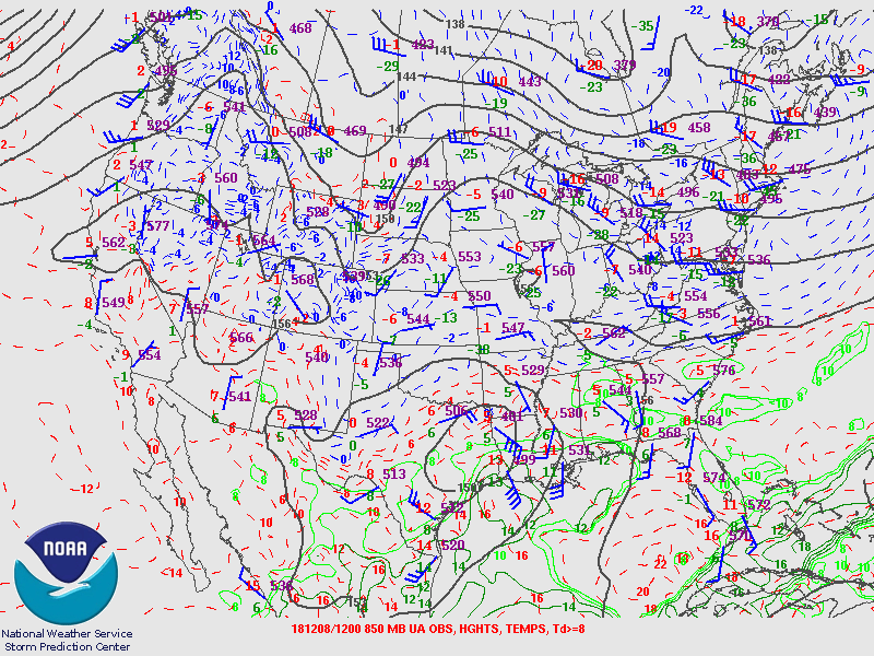
Storm Track
The graphic below shows a loop of the storm track overlayed with radar. It starts the evening of December 8th, and ends late morning on December 10th.
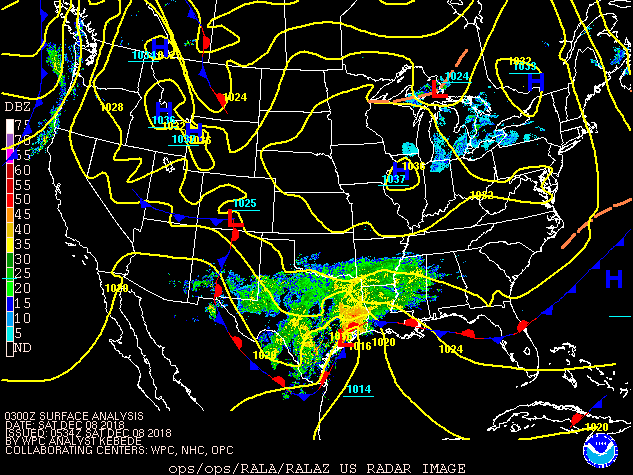
500 millibar loop - December 8th-10th, 2018
850 millibar loop December 8th-10th, 2018
Click on the other tabs for more information.
Snowfall
Widespread 12"+ and many locations with 18-24", especially from the High Country of North Carolina to Floyd County, Virginia.
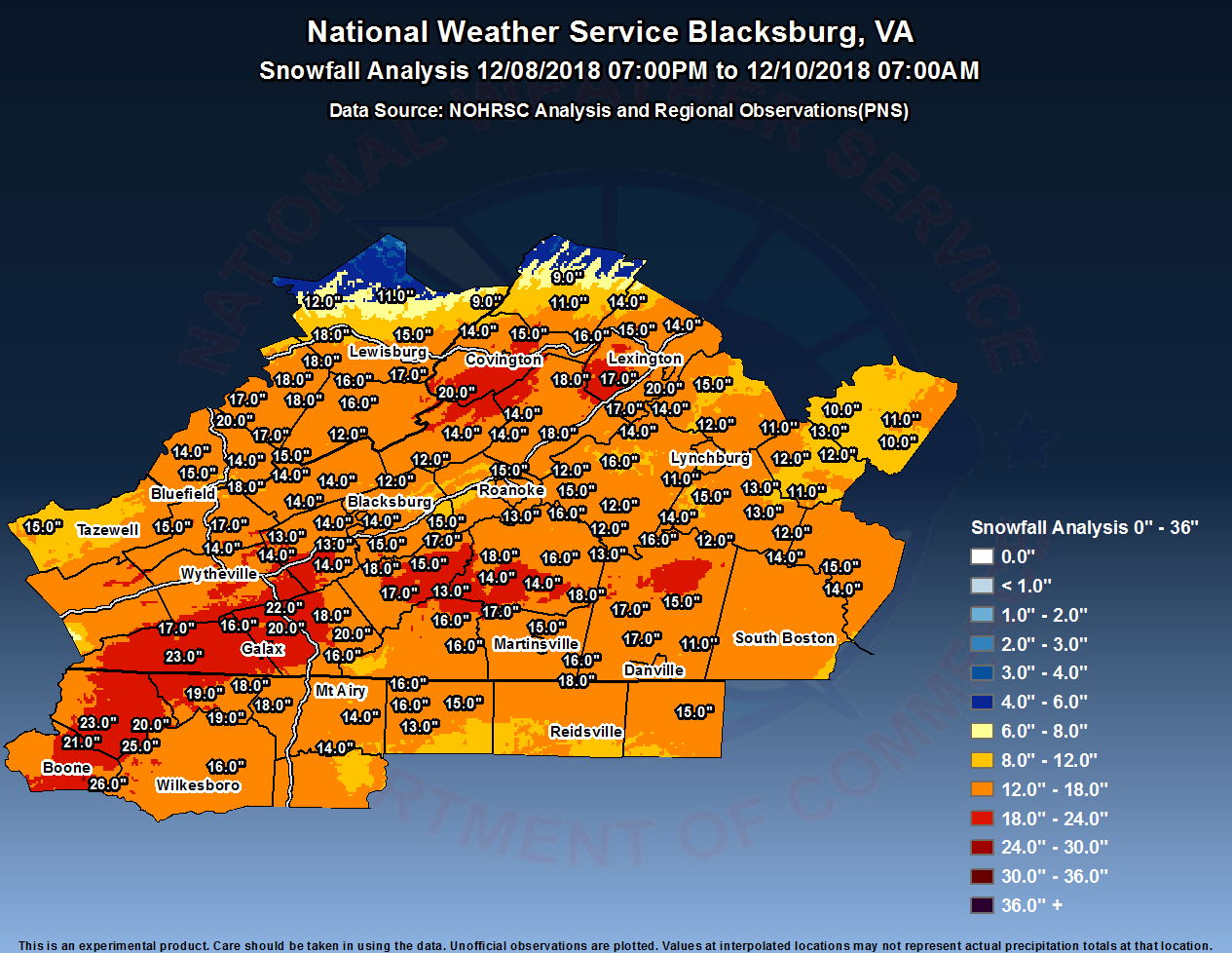 Snowfall Analysis from Storm |
 Regional Snowfall Analysis from Storm |
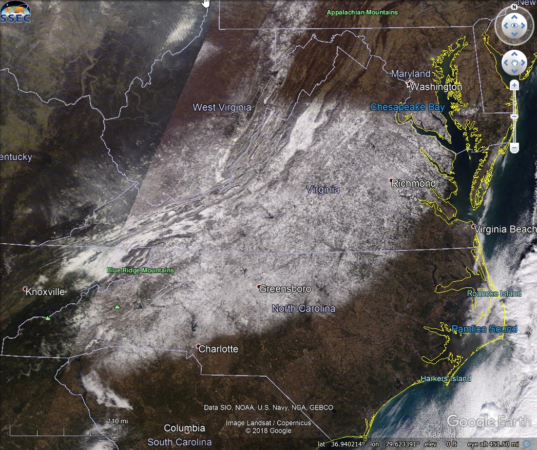 Snow Cover via Satellite |
Storm Reports
Thanks to everyone who supplied their reports
The following are storm total snow reports from the winter storm
beginning late on December 8th and ending early on December 10th.
Not all reports submitted were included since there were many
duplicates, some were quality controlled out, and others were
believed to have been reported before snow had ended. Thanks to all
who submitted reports.

Location                     Amount    Time/Date       Provider

...North Carolina...

...Alleghany County...
2 SSE Whitehead              19.0 in   0900 AM 12/10
3 ESE Whitehead              18.6 in   0815 AM 12/10
3 E Glade Valley             18.0 in   0826 AM 12/10

...Ashe County...
3 SE Fleetwood               25.0 in   1030 AM 12/10
1 SW Baldwin                 23.0 in   0951 AM 12/10
1 N Fleetwood                21.0 in   0844 AM 12/10
1 NE Idlewild                20.0 in   0700 PM 12/09
2 NE Deep Gap                18.0 in   0700 AM 12/10   COCORAHS
2 SW Ashland                 16.0 in   0930 AM 12/10   COCORAHS

...Caswell County...
Yanceyville 4 SE             15.4 in   0700 AM 12/10   COOP

...Rockingham County...
2 W Eden                     17.5 in   0951 AM 12/10

...Stokes County...
3 ESE Woodville              16.1 in   0732 PM 12/09
3 ESE Woodville              16.0 in   0732 PM 12/09
Danbury                      14.8 in   0700 AM 12/10   COOP
Pinnacle                     13.0 in   0915 PM 12/09

...Surry County...
4 NNE Roaring Gap            17.5 in   0100 PM 12/10
Pilot Mountain               13.5 in   0933 PM 12/09

...Watauga County...
Aho                          26.0 in   0700 AM 12/10   COCORAHS
2 WSW Boone                  21.5 in   0252 PM 12/10
2 SSE Rutherwood             19.0 in   0900 AM 12/10
2 SW Rutherwood              19.0 in   0935 AM 12/10
1 SE Rutherwood              18.5 in   0900 AM 12/10   COCORAHS
3 WSW Blowing Rock           16.7 in   1030 AM 12/10
2 W Boone                    16.5 in   1025 AM 12/10

...Wilkes County...
North Wilkesboro             17.8 in   0700 AM 12/10   COOP
North Wilkesboro             16.0 in   0745 PM 12/09

...Yadkin County...
Boonville                    14.5 in   0819 PM 12/09

...Virginia...

...Alleghany County...
3 W Hollins                  15.0 in   0720 PM 12/09

...Amherst County...
Pedlar Dam                   15.4 in   0700 AM 12/10   COOP
3 NNW Amherst                13.5 in   1030 PM 12/09
1 SW Amherst                 13.5 in   0900 AM 12/10   COCORAHS
1 SW Amherst                 13.3 in   0832 PM 12/09
3 ESE Elon                   11.5 in   0800 AM 12/10   COCORAHS
1 ENE Madison Heights        11.3 in   0954 PM 12/09
3 ESE Amherst                11.0 in   0921 AM 12/10

...Appomattox County...
Appomattox                   13.4 in   0854 AM 12/10   COOP
Bent Creek                   13.0 in   0818 PM 12/09
1 NE Concord                 12.0 in   0843 PM 12/09
4 E Appomattox               11.5 in   1115 PM 12/09
3 WNW Evergreen              11.0 in   0759 PM 12/09

...Bath County...
Millboro                     14.0 in   0700 AM 12/10   COCORAHS
Hot Springs                  11.0 in   0700 AM 12/10   COOP
1 W Warm Springs             8.8 in    0751 PM 12/09

...Bedford County...
2 WSW Chamblissburg          16.3 in   0900 AM 12/10
3 SSE Goodview               15.8 in   0800 AM 12/10   COCORAHS
4 SW Boonsboro               15.7 in   0800 AM 12/10
Thaxton                      15.5 in   0910 PM 12/09
3 NW Forest                  15.4 in   0928 AM 12/10
Stewartsville                15.0 in   0910 PM 12/09
Holcomb Rock                 14.2 in   0700 AM 12/10   COOP
2 WNW Big Island             14.2 in   0700 AM 12/10   COCORAHS
2 SW Boonsboro               13.5 in   0805 PM 12/09
3 SW Moneta                  12.2 in   0800 AM 12/10   COCORAHS
1 NE Forest                  12.1 in   0643 PM 12/09
4 NNW Chamblissburg          12.0 in   0610 AM 12/10   COCORAHS
Moneta                       12.0 in   0849 AM 12/10

...Bland County...
Bland                        17.0 in   0920 PM 12/09
3 SW Long Spur               14.2 in   1150 PM 12/09

...Botetourt County...
2 E Lithia                   17.5 in   0924 AM 12/10
Fincastle                    14.0 in   1000 PM 12/09
1 NNW Fincastle              14.0 in   0700 AM 12/10   COCORAHS
Laymantown                   12.5 in   0728 PM 12/09

...Buckingham County...
Buckingham                   11.0 in   0700 AM 12/10   COOP
3 NNE Tower Hill             10.3 in   0949 PM 12/09
7 SE Dillwyn                 9.8 in    0909 AM 12/10

...Campbell County...
Rustburg                     15.0 in   0829 PM 12/09
3 WNW Aspen                  14.5 in   0800 AM 12/10   COCORAHS
1 NNE Altavista              13.5 in   1014 PM 12/09
4 SSW Concord                13.0 in   0655 PM 12/09
Gladys                       13.0 in   0730 PM 12/09
Brookneal                    12.1 in   0830 AM 12/10   COOP

...Carroll County...
1 NNE Galax Hillsville Airpo 22.0 in   0900 AM 12/10
3 NE Galax City              20.5 in   0815 PM 12/09
3 S Gladesboro               20.0 in   0645 PM 12/09
1 W Pipers Gap               18.5 in   0712 PM 12/09
1 SSE Hillsville             18.0 in   1104 AM 12/10
Fries                        17.5 in   0730 PM 12/09
Fancy Gap                    16.0 in   0750 PM 12/09
2 SSE Byllesby               15.5 in   0700 AM 12/10   COCORAHS

...Charlotte County...
Keysville 2 S                15.5 in   0800 AM 12/10   COOP
Drakes Branch                15.1 in   0720 PM 12/09
3 N Wylliesburg              14.0 in   0700 AM 12/10   COCORAHS

...City of Buena Vista County...
1 ESE Buena Vista City       15.0 in   0858 PM 12/09

...City of Covington County...
Covington Filter Plant       15.0 in   0700 AM 12/10   COOP

...City of Galax County...
Galax Water Plant            15.0 in   0700 AM 12/10   COOP

...City of Lexington County...
5 NW Buena Vista City        14.8 in   0700 AM 12/10   COOP

...City of Lynchburg County...
3 ENE Forest                 12.4 in   0700 AM 12/10   COCORAHS
1 WSW Lynchburg City         11.7 in   0800 AM 12/10   Broadcast Media
2 E Forest                   11.0 in   0958 PM 12/09

...City of Martinsville County...
Martinsville Filter Plant    15.0 in   0700 AM 12/10   COOP

...City of Roanoke County...
2 S Roanoke Airport          15.2 in   0800 AM 12/10   Broadcast Media

...City of Salem County...
1 WSW Salem City             14.8 in   1105 PM 12/09
2 NNE Salem City             11.0 in   0815 PM 12/09

...Craig County...
3 NE Abbott                  14.5 in   0655 PM 12/09

...Floyd County...
5 ENE Alum Ridge             18.4 in   0720 AM 12/10
Floyd                        17.0 in   0830 PM 12/09
1 SW Terrys Fork             16.8 in   0926 AM 12/10
2 S Pilot                    14.8 in   0912 PM 12/09
4 ENE Alum Ridge             14.3 in   0700 AM 12/10   COCORAHS

...Franklin County...
Snow Creek                   18.5 in   0700 PM 12/09
2 WNW Rocky Mount            18.0 in   0700 AM 12/10   COCORAHS
2 SE Rocky Mount             16.0 in   0700 AM 12/10   COCORAHS
3 W Sydnorsville             14.1 in   0700 AM 12/10   COCORAHS
Ferrum 2.7 SW                13.6 in   0600 AM 12/10   COCORAHS
6 N Penhook                  13.0 in   0716 PM 12/09
2 NE Burnt Chimney           12.5 in   0700 AM 12/10   COCORAHS

...Giles County...
1 NE Pearisburg              14.3 in   0736 PM 12/09
3 S Mountain Lake            14.0 in   0738 PM 12/09
3 SW Eggleston               14.0 in   0900 AM 12/10
2 SE Mountain Lake           13.2 in   0930 PM 12/09
1 NNE Pembroke               12.7 in   0700 AM 12/10   COCORAHS
Newport                      12.0 in   0625 PM 12/09

...Grayson County...
Independence                 22.8 in   1000 PM 12/09
3 S Comers Rock              17.0 in   0830 PM 12/09

...Halifax County...
South Boston                 17.0 in   0950 PM 12/09

...Henry County...
Bassett                      16.8 in   0700 AM 12/10   COCORAHS

...Montgomery County...
4 WSW Pilot                  15.5 in   0920 AM 12/10
Pilot                        15.3 in   0715 PM 12/09
1 WNW Prices Fork            14.5 in   0800 AM 12/10   COCORAHS
1 NE Merrimac                13.7 in   0700 AM 12/10   Official NWS Obs
2 NE Blacksburg              13.0 in   0703 PM 12/09
1 ENE Blacksburg             13.0 in   0700 AM 12/10   COCORAHS
1 ESE Christiansburg         12.2 in   0700 AM 12/10   COCORAHS
Blacksburg 0.4 N             12.2 in   0700 AM 12/10   COCORAHS

...Patrick County...
3 ESE Buffalo Ridge          17.0 in   0626 PM 12/09
4 NW Sanville                16.0 in   0620 PM 12/09
4 W Sanville                 16.0 in   0930 PM 12/09
3 WNW Charity                13.4 in   0800 AM 12/10   COCORAHS

...Pittsylvania County...
Chatham                      17.4 in   0700 AM 12/10   COOP
6 SSE Swansonville           17.0 in   0800 PM 12/09
5 NE Cascade                 15.5 in   1030 PM 12/09
4 NNW Pittsville             15.5 in   0700 AM 12/10   COCORAHS
1 SE Chatham                 15.0 in   1045 AM 12/10
1 ESE Hurt                   12.0 in   1000 AM 12/10
3 NNW Ringgold               11.4 in   0130 PM 12/10

...Pulaski County...
Fairlawn                     14.1 in   0700 AM 12/10   COCORAHS
2 ESE Pulaski                13.5 in   0621 PM 12/09
2 NW Copper Valley           13.5 in   0900 PM 12/09
Graysontown                  13.3 in   0800 PM 12/09
Pulaski 2 E                  13.0 in   0845 AM 12/10   COOP

...Roanoke County...
Bent Mountain                15.0 in   0656 AM 12/10
3 ESE Cave Spring            14.3 in   0853 PM 12/09
2 W Poages Mill              14.0 in   0711 PM 12/09
Cave Spring                  14.0 in   0700 AM 12/10   COCORAHS
3 N Salem City               13.2 in   0808 PM 12/09
2 NE Vinton                  13.0 in   0723 PM 12/09
1 S Cave Spring              13.0 in   0856 AM 12/10
2 E Vinton                   12.5 in   0700 PM 12/09
1 W Cave Spring              12.5 in   0700 AM 12/10   COCORAHS
1 NW Cave Spring             12.0 in   0830 AM 12/10   COCORAHS
3 N Bradshaw                 12.0 in   0856 AM 12/10

...Rockbridge County...
4 WSW Buena Vista City       20.0 in   1011 AM 12/10
4 SW Collierstown            18.0 in   0700 AM 12/10   COCORAHS
5 NW Glasgow                 17.4 in   1030 PM 12/09
Glasgow 1 SE                 16.7 in   0700 AM 12/10   COOP
7 SSW Rockbridge Baths       16.0 in   0932 PM 12/09
6 N Collierstown             16.0 in   0700 AM 12/10   COCORAHS
3 ENE Collierstown           15.0 in   0847 PM 12/09
4 SW Rockbridge Baths        15.0 in   0910 PM 12/09
5 NW Buena Vista City        14.0 in   0712 PM 12/09
3 NNE Rockbridge Baths       13.5 in   0640 PM 12/09
Glasgow                      13.0 in   0909 AM 12/10

...Tazewell County...
Richlands                    15.0 in   0954 PM 12/09
Burkes Garden                15.0 in   0615 AM 12/10   COOP
Gratton                      13.5 in   0932 PM 12/09
2 WNW Bluefield              13.5 in   1000 PM 12/09

...Wythe County...
2 WSW Wytheville             16.5 in   0830 AM 12/10
1 NNW Wytheville             16.0 in   1007 PM 12/09

...West Virginia...

...Greenbrier County...
2 E Lawn                     18.5 in   0800 PM 12/09
Alderson                     18.0 in   0800 PM 12/09
White Sulphur Springs        18.0 in   0900 PM 12/09
Lewisburg                    17.5 in   1028 AM 12/10
Organ Cave                   17.0 in   0800 PM 12/09
3 S Maxwelton                15.0 in   0815 PM 12/09
3 SSW Neola                  13.5 in   0743 PM 12/09
Rainelle                     12.0 in   0700 PM 12/09
Renick                       11.0 in   0800 PM 12/09
Neola                        9.0 in    0800 PM 12/09

...Mercer County...
Oakvale                      18.0 in   0953 PM 12/09
Lerona                       17.0 in   1047 AM 12/10
Bluewell                     15.0 in   1032 AM 12/10
1 NNW Athens                 14.5 in   0637 PM 12/09
2 NNE Montcalm               14.0 in   1045 PM 12/09
Bramwell                     13.0 in   0920 PM 12/09
Bluefield                    12.2 in   0700 AM 12/10   COOP

...Monroe County...
2 SSE Sweet Springs          20.0 in   1034 AM 12/10
3 E Wayside                  16.5 in   1000 PM 12/09
Alderson                     16.0 in   0800 AM 12/10   COOP
3 S Red Sulphur Spring       15.0 in   0400 AM 12/10
Lindside                     12.0 in   0713 PM 12/09

...Summers County...
3 E Ellison                  20.0 in   1051 AM 12/10
1 ENE Hinton                 18.0 in   0651 PM 12/09
3 ESE Hinton                 18.0 in   0811 PM 12/09
Bluestone Lake               17.0 in   0730 AM 12/10   COOP
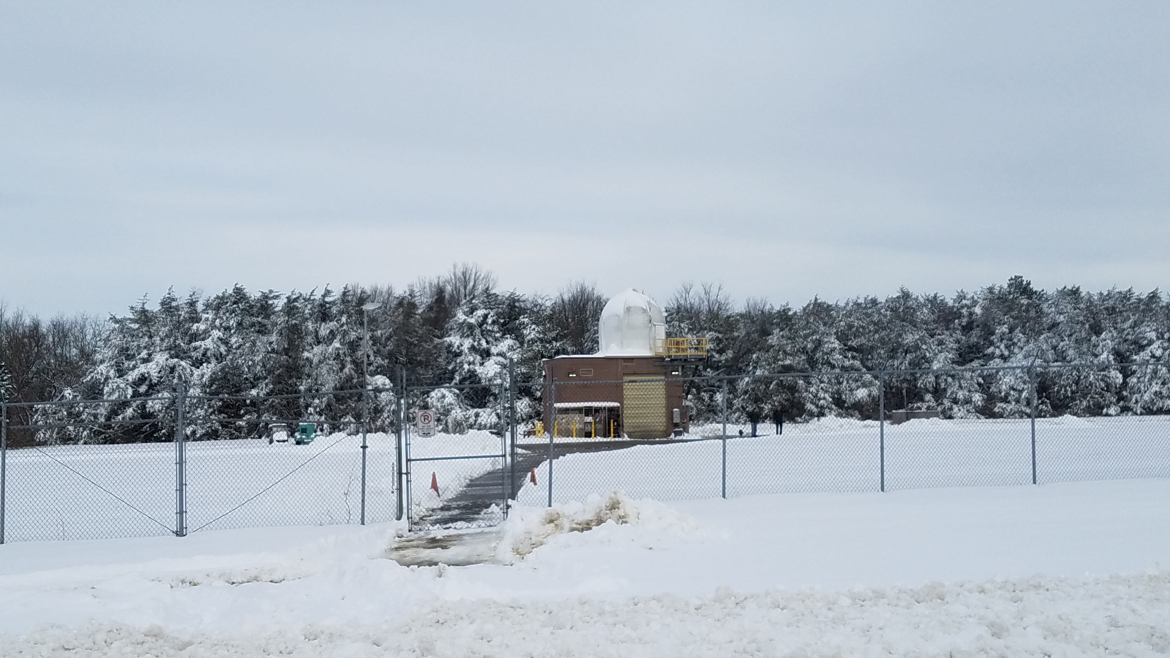
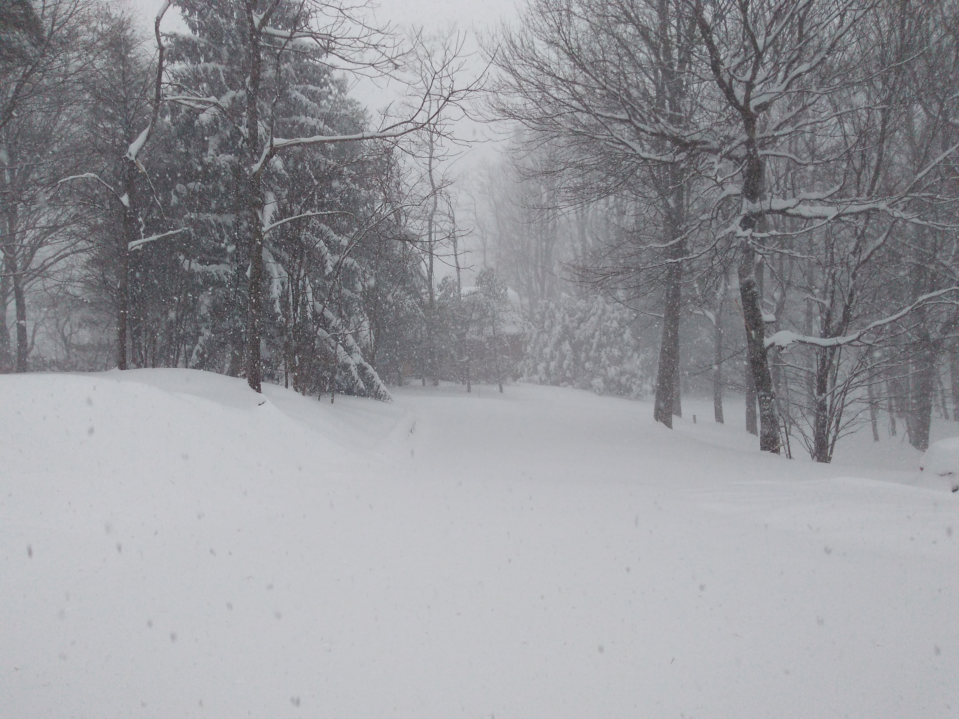
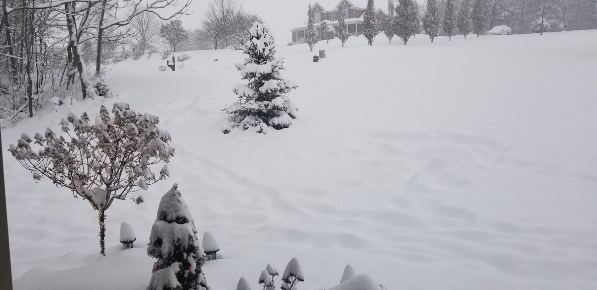
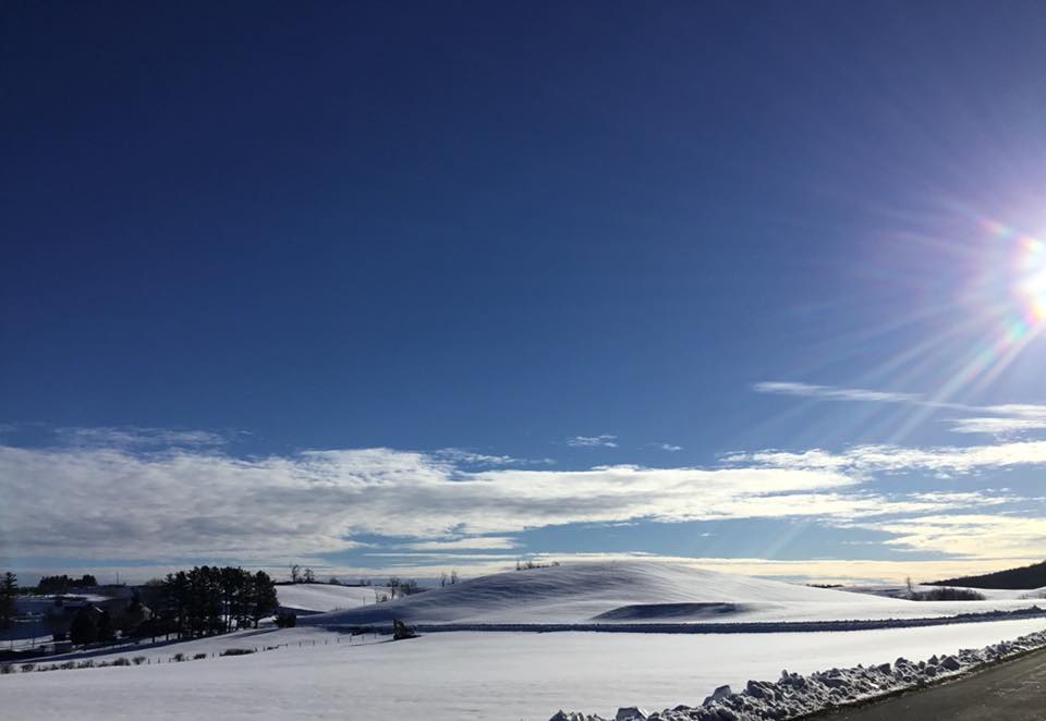
Photos:
 |
 |
 |
 |
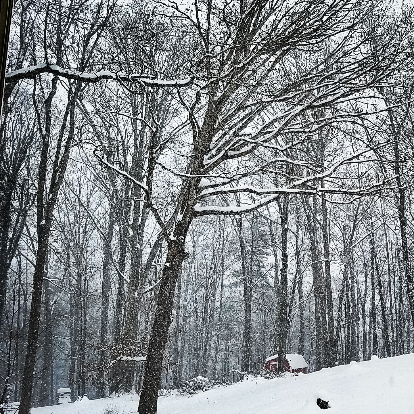
| NWS Blacksburg, VA, Dec 10th (Vance J.) |
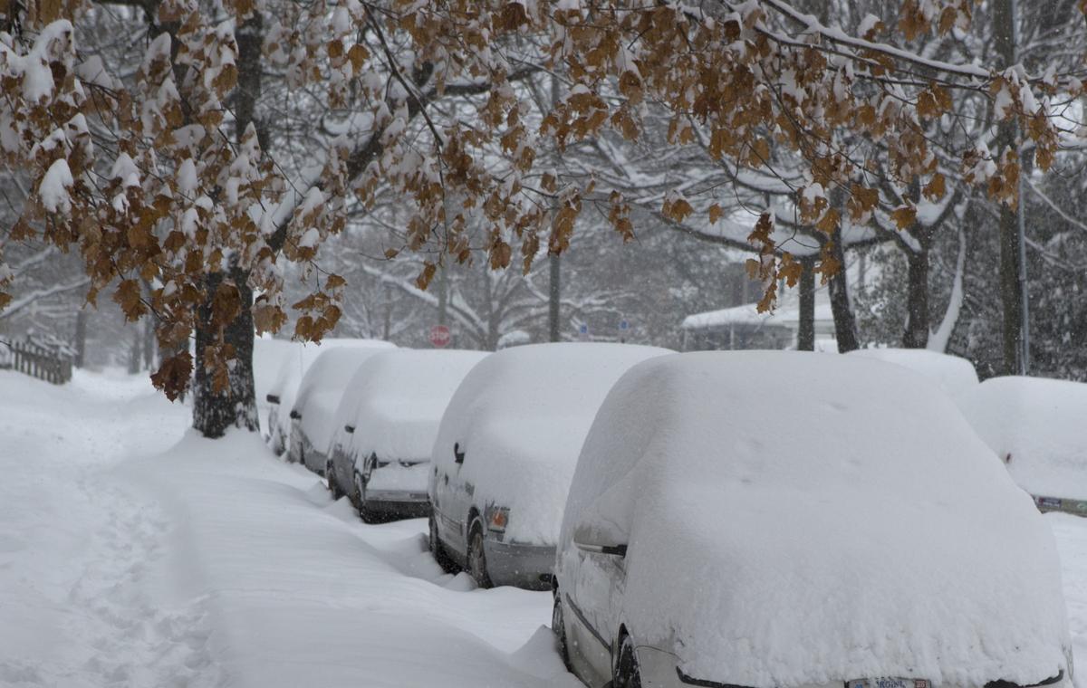
Fancy Gap, VA Dec 9th (Beavers) |
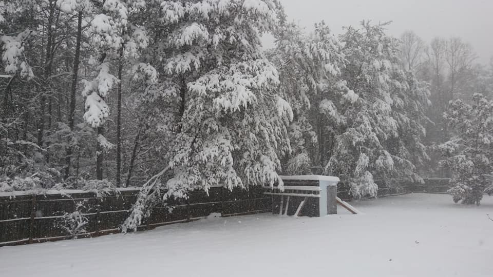
Galax, VA Dec 9th (Kathleen H) |
Roanoke, VA Dec 9th (Roanoke Times.) |
 |
 |
 |
 |
| East Bend, NC Dec 9th (D. Rudy R.) |
Ennice, NC Dec 9th (W Bottomley) |
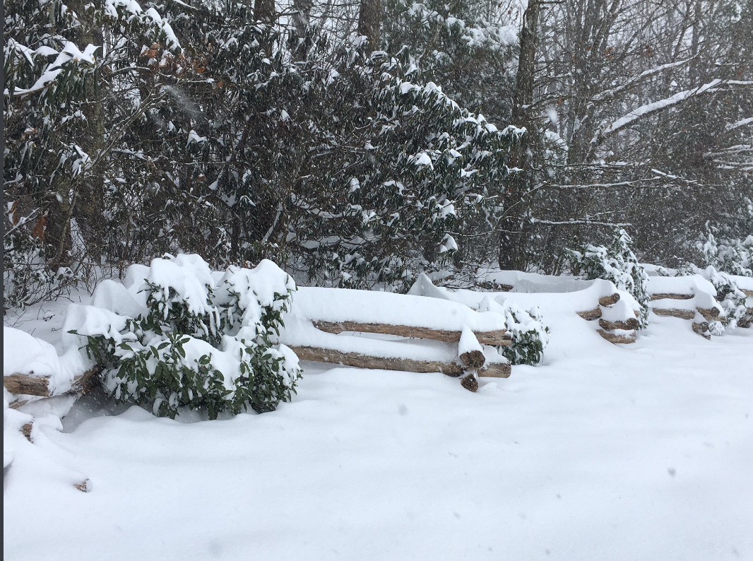
Botetourt County, VA Dec 9th (PJGator) |
Meadows of Dan, VA Dec 10th (Beth F.) |
 |
Media use of NWS Web News Stories is encouraged! Please acknowledge the NWS as the source of any news information accessed from this site. |
|


 Follow us on YouTube