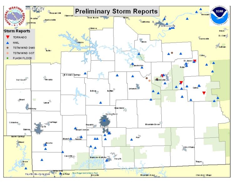
Warm, moist and unstable air moved into the Missouri Ozarks and southeast Kansas during the day south of a warm front which had lifted north into central Missouri. Afternoon temperatures reached the upper 70s to low 80s over southeast Kansas and southwest Missouri with dew points in the 50s. Thunderstorms were able to develop along a cold front over southeast Kansas and western Missouri along a strong cold front by the late afternoon and were able to become severe after breaking through the thermal cap.
Instability and wind shear were favorable for supercells to develop during the evening with large hail as the main severe weather hazard. As the storms moved into central Missouri closer to the warm front, the storms had more shear to work with and started to show signs of tornadic development. Several reports of funnel clouds and brief touchdowns were relayed to the WFO in Springfield, however storm surveys conducted on the 28th did not reveal any tornadic damage.
Most of the damage was done by the large hail. Most of the storms that became severe did produce large hail, many as large as golf ball to baseball size. The were several reports of golf ball hail covering the ground.
Behind the front, additional thunderstorms began to develop at mid evening over western Missouri in an area of elevated instability. There was still enough shear remaining for these storms to produce large hail with hail as large as golf balls being reported with this second wave of severe weather.


 Weather Story
 Weather Map
 Local Radar
 Follow us on YouTube