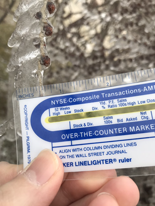
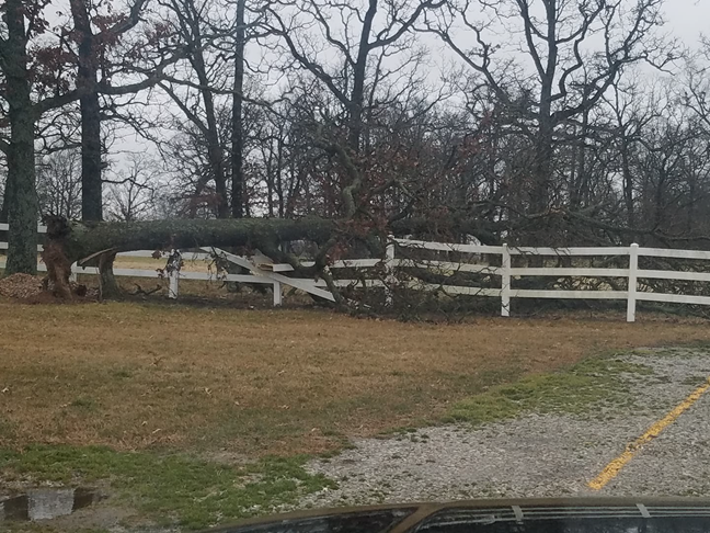
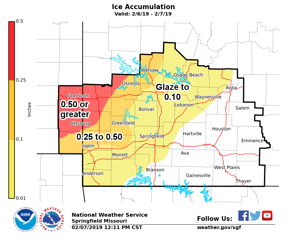
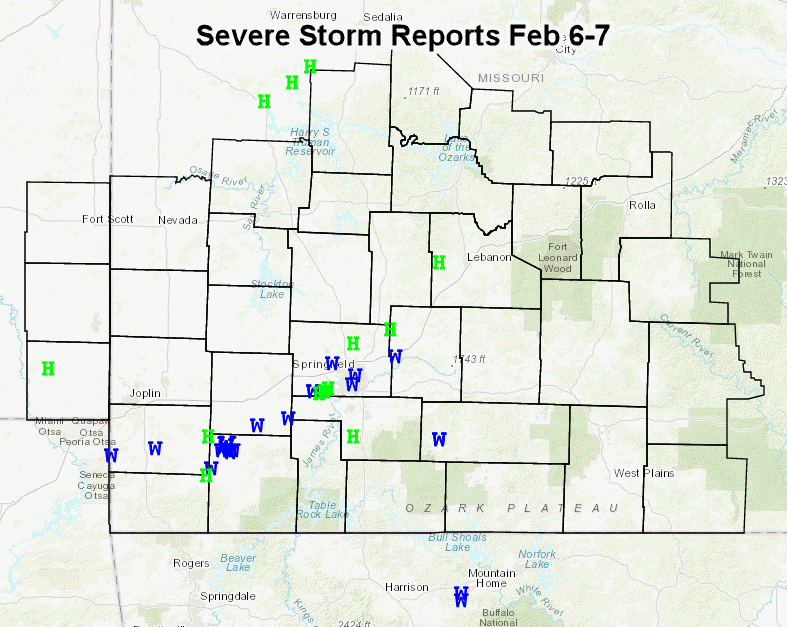
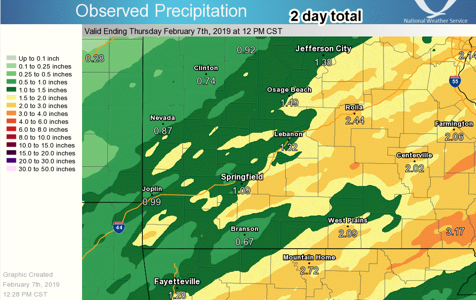
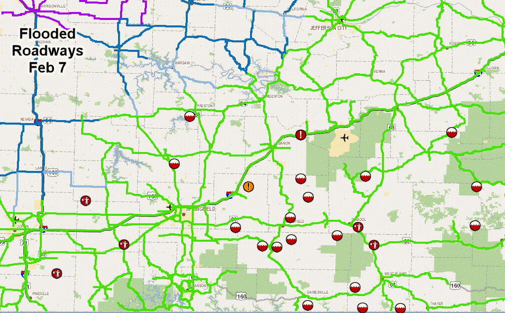
A slow moving frontal boundary was a dividing line between cold air with temperatures below freezing over west central Missouri into southeast Kansas and temperatures in the 50s over south central Missouri. Several rounds of thunderstorms and heavy rain occurred over the course of 2 days from the 5th into the morning of the 7th of February. Significant icing occurred over parts of central and west central Missouri and into southeast Kansas and parts of far southwest Missouri. The heaviest freezing rain occurred during the evening and night of February 6th. Thunderstorms which moved over the area also produced sleet on top of the freezing rain. Over a half inch of ice occurred in western sections of the area. Within the more moist and unstable air further east and south, severe weather occurred, with damaging wind and hail. Some tornado warnings were issued based on mesos forming within the lines of thunderstorms. The several rounds of heavy rainfall over the 2 day period caused some flooding to occur across the area. As the front eventually shifted east on the morning of the 7th, the heavier rain shifted east and colder air moved in changing precipitation to light freezing drizzle and snow showers.


 Weather Story
 Weather Map
 Local Radar
 Follow us on YouTube