Overview
|
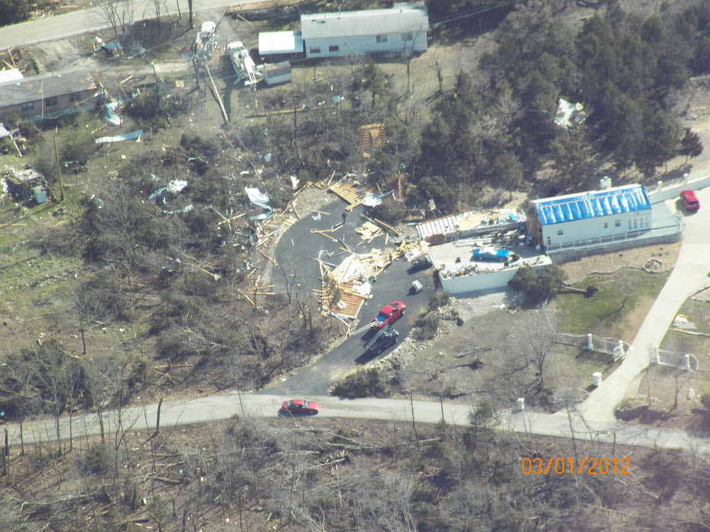
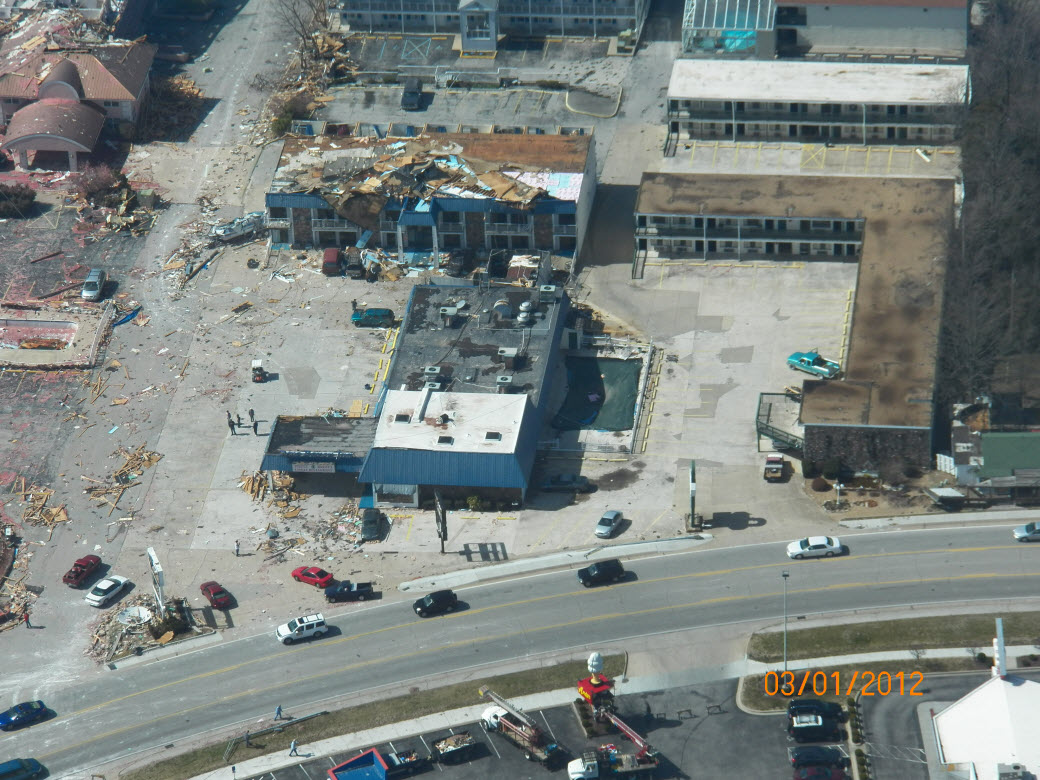
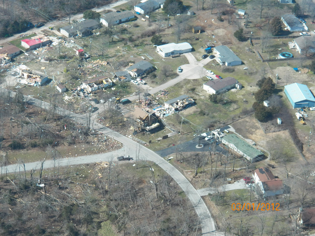
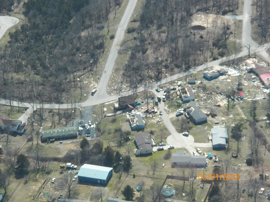
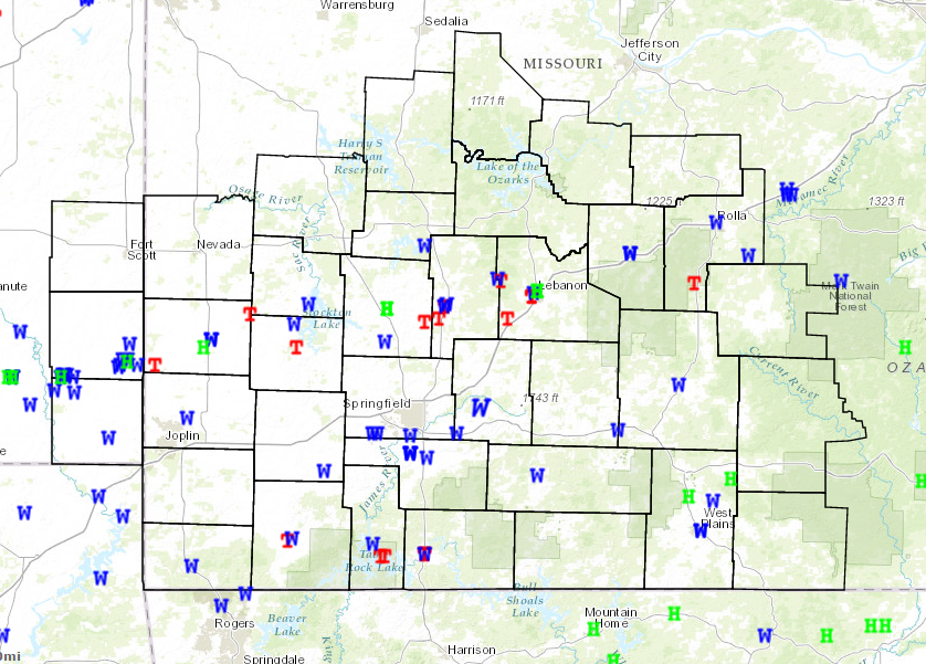
Severe thunderstorms moved across southeastern Kansas and the Missouri Ozarks late in the evening of February 28th through the early morning hours of February 29th. Numerous reports of severe weather were received during the night, including large hail, high winds, and several likely tornadoes. Significant damage has been reported near Pittsburg, KS to Lamar, MO, Buffalo, MO to Lebanon, MO, and in Branson, MO. 8 Total tornadoes 5 EF-1 tornadoes Event SynopsisA deepening surface low ejected off the Colorado Front Range and across the northern plains during the day on Tuesday 28 February 2012. A surface dry line developed across far western Kansas through Oklahoma and Texas. Through the afternoon, southerly surface winds continued to transport warm moist air into the region ahead of the advancing front/dry line combination, increasing instability across the area. A very strong low level jet created by the strong dynamic properties of the low resulted in 0-6 km shear between 60 and 70 knots across the forecast area and 0-1 and 0-3 km Storm Relative Helicity values in excess of 700 M2/S2 in some areas. Instability continued to increase across the region through the afternoon and evening, with up to 1000 J/KG of MLCAPE spread across the forecast area. Given the combination of strong dynamic forcing and thermodynamic forcing, severe storms were expected to develop rapidly across the southern plains and spread into the forecast area through the evening. Storms began to enter far southeastern Kansas shortly after 1000 PM CST, forming along the advancing cold front. Given the strength of the low level jet, the speed of the line was roughly 55 to 65 MPH, an extremely fast line of convection. The line quickly took on the characteristics of a Quasi-Linear Convective System (QLCS) with embedded supercells. As the line moved across Southeastern Kansas and the Missouri Ozarks through 330 AM CST it produced numerous reports of severe wind damage, with gusts up to 70 MPH, hail to the size of golf balls, and numerous reports of tornadoes. |
 |
 |
 |
 |
Tornadoes:
|
Tornado - 3 WNW Cassville
Track Map 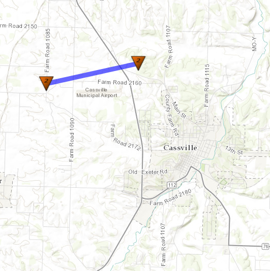
|
||||||||||||||||
|
Tornado - Kimberling City to Branson
Track Map 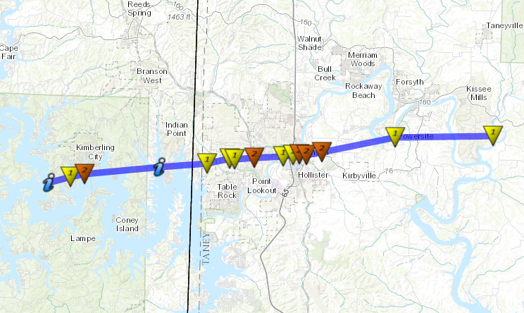
|
||||||||||||||||
|
Tornado - 2E Buffalo
Track Map 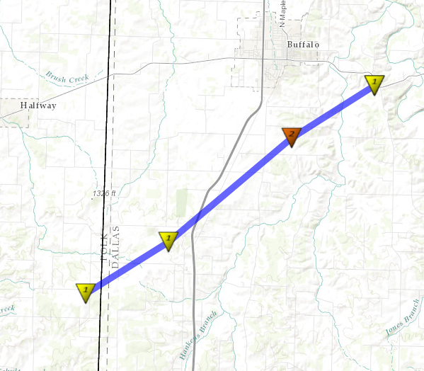
|
||||||||||||||||
|
Tornado - Bennett Spring
Track Map 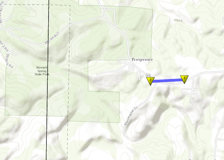
|
||||||||||||||||
|
Tornado - 1SE Lebanon
Track Map 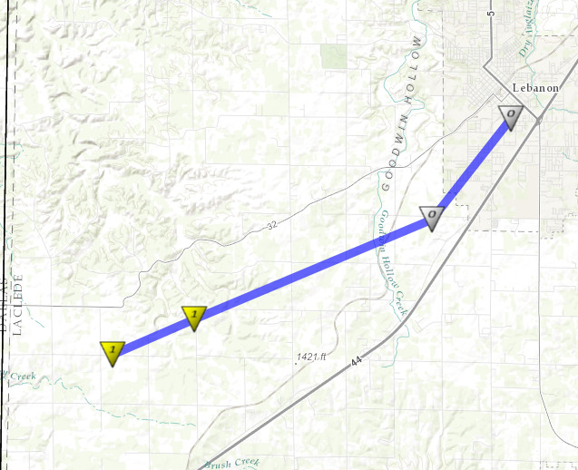
|
||||||||||||||||
|
Tornado - 1/2mile NW Edgar Springs
Track Map 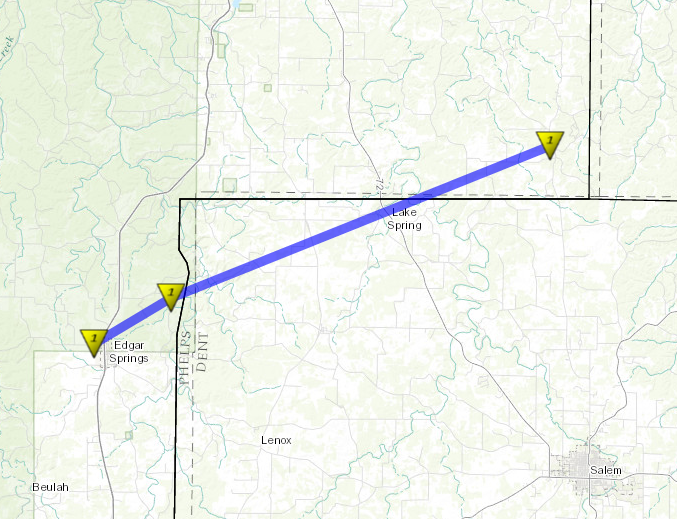
|
||||||||||||||||
|
Tornado - 3NNW Greenfield
Track Map 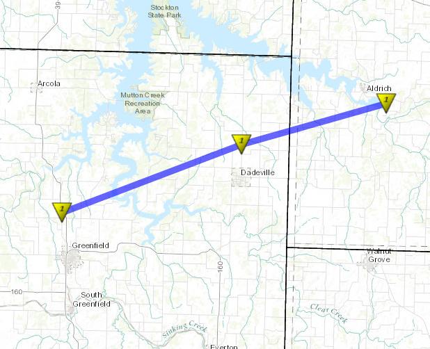
|
||||||||||||||||
|
Tornado - 1.5 miles NW Lamar
Track Map 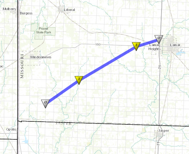
|
||||||||||||||||
The Enhanced Fujita (EF) Scale classifies tornadoes into the following categories:
| EF0 Weak 65-85 mph |
EF1 Moderate 86-110 mph |
EF2 Significant 111-135 mph |
EF3 Severe 136-165 mph |
EF4 Extreme 166-200 mph |
EF5 Catastrophic 200+ mph |
 |
|||||
Radar:

Storm Reports
 |
Media use of NWS Web News Stories is encouraged! Please acknowledge the NWS as the source of any news information accessed from this site. |
|


 Weather Story
 Weather Map
 Local Radar
 Follow us on YouTube