Overview
|
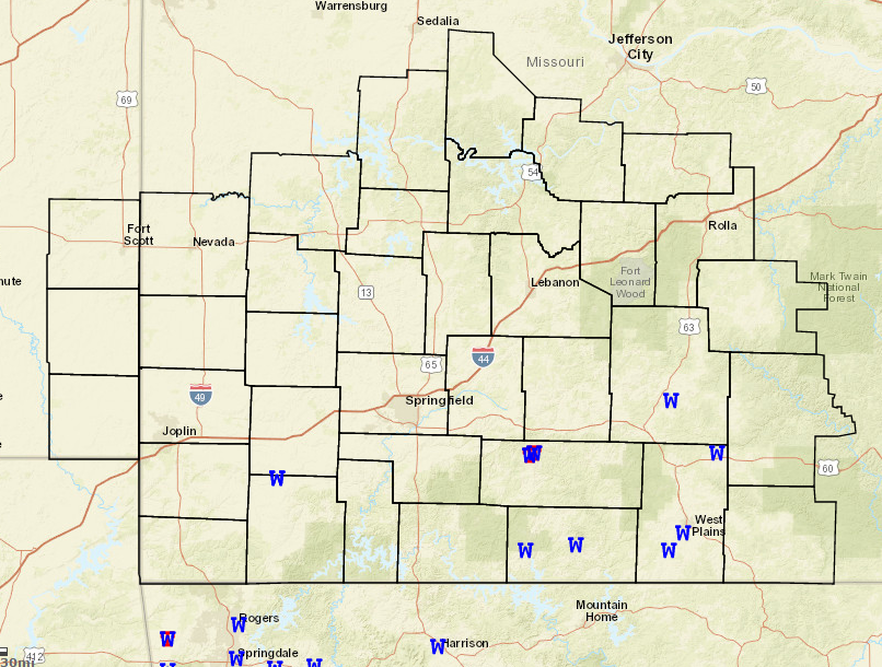
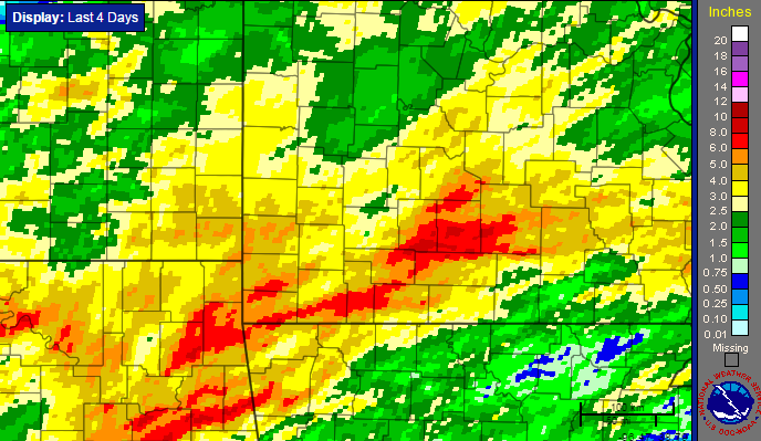
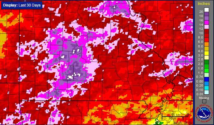
Several rounds of showers and thunderstorms with heavy rain pushed across portions of the Missouri Ozarks and extreme southeast Kansas during the period from the evening of July 6th into the morning of July 10th. Severe weather also occurred with some of these storms, including two tornadoes on July 9th. |
 Caption |
Tornadoes:
|
Tornado - 4 N Ava
Track Map 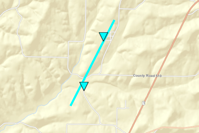 
|
||||||||||||||||
|
Tornado - 5 NE AVA
Track Map 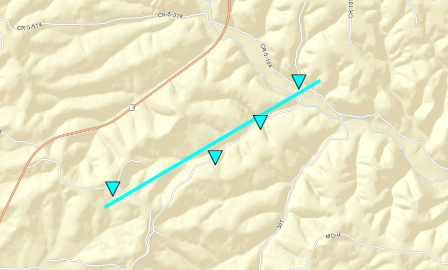
Downloadable KMZ File |
||||||||||||||||
The Enhanced Fujita (EF) Scale classifies tornadoes into the following categories:
| EF0 Weak 65-85 mph |
EF1 Moderate 86-110 mph |
EF2 Significant 111-135 mph |
EF3 Severe 136-165 mph |
EF4 Extreme 166-200 mph |
EF5 Catastrophic 200+ mph |
 |
|||||
Radar:
(July 6th evening - July 7th afternoon)

(Early morning July 8th - Mid evening July 8th)

(Early July 9th - Mid morning July 10th)

Rain Reports
 |
Media use of NWS Web News Stories is encouraged! Please acknowledge the NWS as the source of any news information accessed from this site. |
|


 Weather Story
 Weather Map
 Local Radar
 Follow us on YouTube