
Locally critical fire weather conditions continue for portions of the Northern/Central Plains and much of northern lower Michigan Monday evening. Red Flag Warnings are currently in effect. Dry conditions and gusty winds will persist across southern Colorado Tuesday. Read More >
| Overview | |||||||||||||||||||||||||||||||||||||||||||||||||||
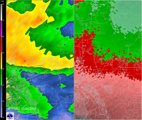
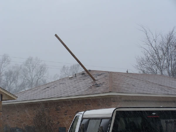
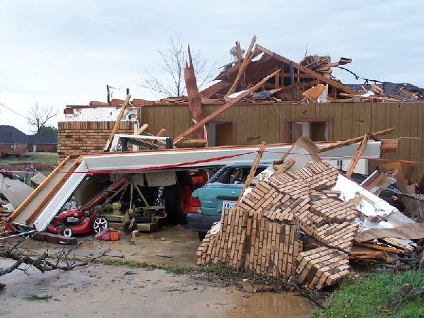
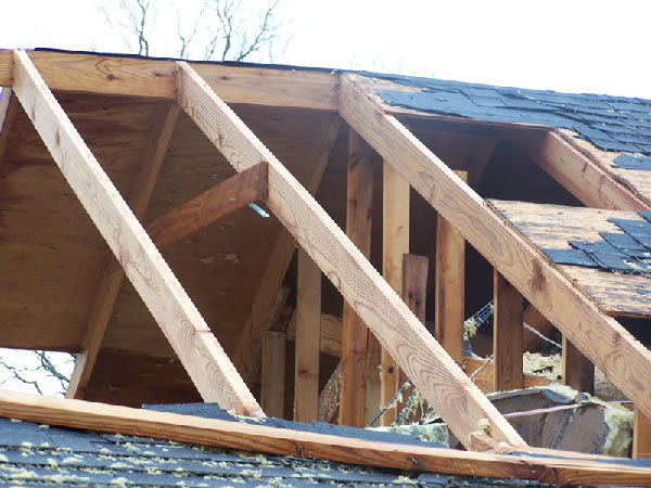
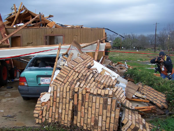
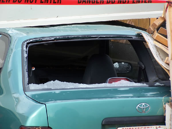
| The National Weather Service in Shreveport conducted a damage survey for Bossier Parish on Saturday, February 24th. The damage that occurred in Bossier City, LA, was the result of a very strong supercell thunderstorm that moved through the city during the morning hours. The numbers of damaged structures was between 40 and 60 homes. The extent of damage ranged from a few shingles blown off some homes to substantial roof loss on other homes. Most of the homes that sustained damage had only roof shingles blown off. The damage path was located on the north side of Bossier City, north of Interstate 220, in the Hickory Ridge and Carriage Oaks subdivisions. The damage path was approximately one mile in length and 250 yards wide. The damage path ran parallel to Hickory Ridge Road and Lake Side Road, beginning near Coach Road, and ending near Coy Road in Bossier City. The damage was consistent with that of a weak tornado on the Enhanced Fujita Scale. The rating for this tornado was an EF1, with peak wind speeds estimated at 90 to 100 mph. No injuries of fatalities were reported. The Enhanced Fujita Scale is a new scale used to rate tornado intensity and was incorporated by the National Weather Service on February 1, 2007. |
|||||||||||||||||||||||||||||||||||||||||||||||||||
|
TOTAL TORNADO COUNT = 1
|
|||||||||||||||||||||||||||||||||||||||||||||||||||
|
Tornado Table
Graphics
Photos
Damage Map


|
|||||||||||||||||||||||||||||||||||||||||||||||||||
| Back to Top | |||||||||||||||||||||||||||||||||||||||||||||||||||


 Follow us on YouTube