
Isolated strong to severe thunderstorms capable of producing large hail and damaging wind gusts will be possible this evening across west-central Texas. Elevated to Critical fire weather conditions will persist across the southern Rockies and portions of the southern Plains through this weekend. Read More >
| Overview | |||||||||||||||||||||||||||||||||||||||||||||||||||||||||||||||||||||||||||||||||||||||||||||||||
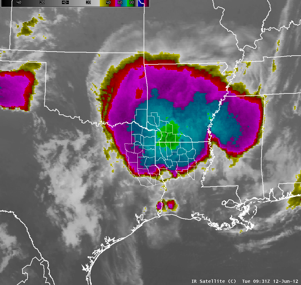
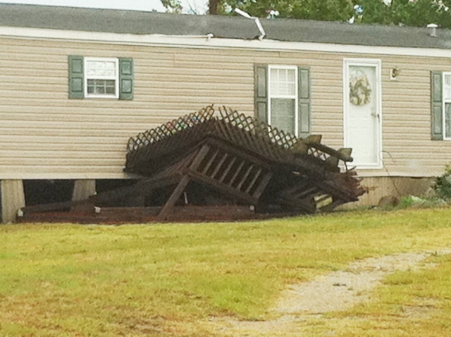
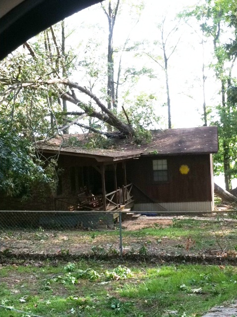
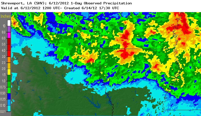
| The morning of June 12, 2012, began with a complex of very intense severe thunderstorms traversing the ArkLaTex. These thunderstorms resulted in widespread wind damage across Northeast Texas, Southwest Arkansas, and North Louisiana. Many trees and power lines were brought down, resulting in significant power outages. The hardest hit area was the Claiborne Parish area, specifically in and around Homer, Louisiana. Significant damage was done to numerous homes and businesses in the area. These storms were the result of a mesoscale convective system (MCS) that developed to the west of the area during the nighttime hours and quickly moved southeast across the region between 2am and 8am. Some of the results of this system were welcome, however. The region was suffering from a significant dry period, and this system brought widespread rainfall amounts in excess of one inch. | |||||||||||||||||||||||||||||||||||||||||||||||||||||||||||||||||||||||||||||||||||||||||||||||||
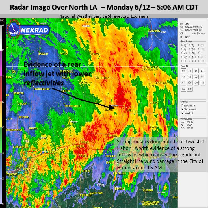
| A stationary front was draped across the ArkLaTex on the morning of June 12, and a very unstable airmass had setup across the region during the afternoon and evening of Monday, June 11. In fact, high temperatures across the Four State Region on Monday topped out 97 to 99 degrees F at most sites. Combined with surface dewpoints in the middle 60s and strong low level winds, the atmosphere was primed for strong to severe thunderstorms. Per mesoanalysis on the evening of June 11, deep layer shear values ranged 25 to 40 kts across East Texas and Southeast Oklahoma...and were aligned as such they were supportive of strong storms organizing into lines and clusters. This occurred late that evening as storms developed over North Texas and Southern Oklahoma around 11pm and organized into a large squall line which moved southeastward along the Red River of Texas and Oklahoma. As the storms moved into Northern Louisiana, a strong rear inflow jet developed (noted in the radar imagery below), resulting in widespread wind damage in Bossier, Webster, and especially Claiborne Parishes. | |||||||||||||||||||||||||||||||||||||||||||||||||||||||||||||||||||||||||||||||||||||||||||||||||
|
Satellite & Radar Images
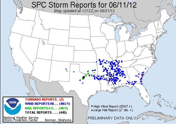
Storm Reports
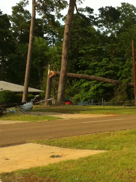
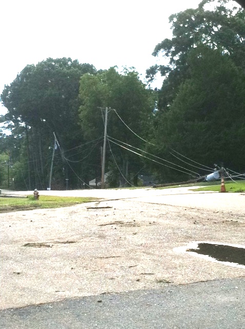
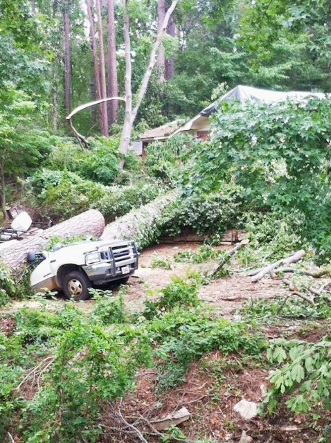
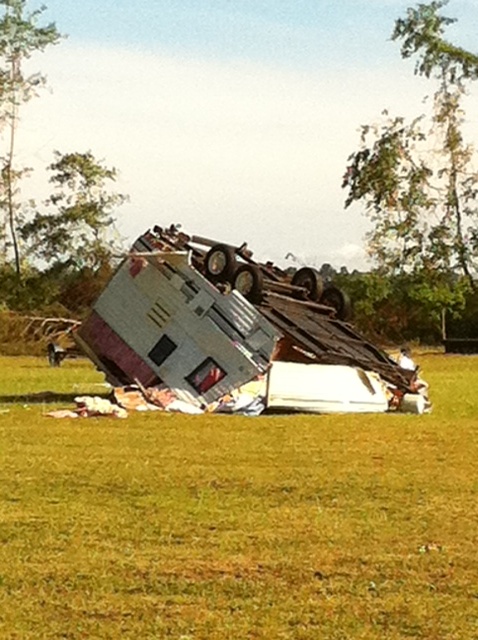
Storm Damage in Homer, LA
Significant Rainfall
|
|||||||||||||||||||||||||||||||||||||||||||||||||||||||||||||||||||||||||||||||||||||||||||||||||
| Back to Top | |||||||||||||||||||||||||||||||||||||||||||||||||||||||||||||||||||||||||||||||||||||||||||||||||


 Follow us on YouTube