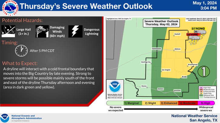
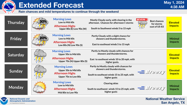
A cold front will move through the Big Country this afternoon and through the rest of West Central Texas tonight. Isolated severe storms are possible, with large hail and damaging winds are the main threats.
Numerous showers and storms are possible this weekend, most likely on Saturday afternoon and Saturday evening. Some of this activity may produce pockets of locally heavy rainfall that may lead to some minor flooding of city streets and other poor drainage areas.
Cooler with showers and storms for the weekend. Rain and storms become widespread Friday night with locally heavy rainfall Saturday and Saturday night. Cloudy and cool Sunday with clearing and warming Monday.
Temperatures climbing to near the 100 degree mark this afternoon across the Concho valley, with slightly cooler temperatures behind an approaching cold front for the Big Country.


 Virtual Tour
 Current Observations
 Weather Briefing
 Satellite Loops
 Past Weather Reports
 Past Rainfall Maps
 Climate And Drought
 River & Lake Levels
 Fire Weather
 Aviation Weather
 Additional Resources
 Social Media