
Severe thunderstorms, excessive rainfall, critical fire weather are all in the outlook today and into this last weekend of April. Very large hail, severe wind gusts, and a couple strong tornadoes will all be possible across the central and southern Plains today. Flash flooding also possible for portions of the Plains and Mississippi Valley. Critical fire weather conditions for Southern High Plains Read More >
|
NOTICE TO ALL USERS - The graphical surf zone forecast is experimental and may not be available at all times. For additional information please contact the webmaster. |
| Risk Level | Description | Click on the icons for more detail |
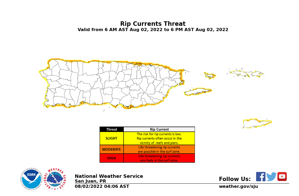
| Low |
The risk for rip currents is low, however, life threatening rip currents often occur in the vicinity of inlets, groins, jetties, reefs, and piers.
|
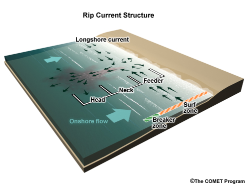
Rip currents are powerful, channeled currents of water flowing away from shore. They typically extend from the shoreline, through the surf zone, and past the line of breaking waves. Rip currents can occur at any beach with breaking waves. If caught in a rip current, swim parallel to the beach and you will eventually swim out of the outgoing current. Remember to heed the advice of the local beach patrol and flag warning systems.
|
|
Moderate
|
Life threatening rip currents are possible in the surf zone.
|
|
|
High
|
Life threatening rip currents are likely in the surf zone.
|
|
| Rip Current Safety Videos | Click here for the Surf Zone Forecast | |
 |
 |
|
|
|


 Graphical Hazardous Weather Outlook
 Tropical Analysis
 Tropical Weather
 Regional Satellite
  Puerto Rico and U.S. Virgin Islands
 Local Radar