
A few strong to marginally severe thunderstorms are possible across the Southeast U.S. Friday. A Marginal Risk (Level 1 of 5) outlook has been issued. Strong winds and hail will be the main threats. Elevated to locally critical fire weather conditions will persist across south-central Colorado today due to dry conditions and gusty winds. Read More >
|
Event Summary
|
With the 2 AM AST Tropical Weather Outlook on September 12, 2022, a tropical wave located more than 1000 miles east of the Windward Islands was identified by the National Hurricane Center as having a 20% chance of development over the next five days. At the time, it had a large, disorganized area of showers associated with it, and was forecast to move westward to west-northwestward. Prior to development, the Hazardous Weather Outlook (HWO) included a mention of “an elevated risk of flooding” for the area associated with a strong tropical wave, which was forecast at the time to arrive on Friday; this mention first appeared in the HWO issued at 10:52 PM on Sunday, September 11. Tropical Depression 7, which would go on to become Hurricane Fiona, formed on Wednesday, September 14, 2022, with the first advisory issued for the system going out at 11 AM AST; at the time, it was 805 miles east of the Leeward Islands. The storm was heavily sheared, with the bulk of the convection occurring to the east of the center. Even so, it continued to strengthen, becoming a tropical storm less than 12 hours later.
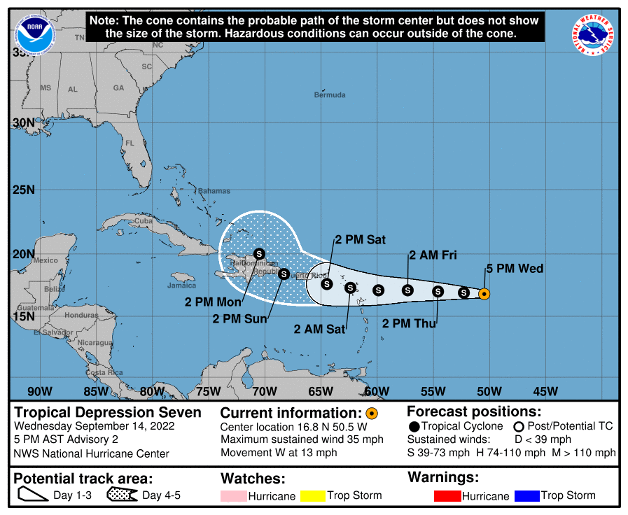
Figure 1: National Hurricane Center forecast on Tropical Depression 7 on September 14th at 5 PM AST. Antecedent conditions in Puerto Rico and the U.S. Virgin Islands varied widely. There was a long-standing drought occurring for the USVI and portions of Puerto Rico, including northwestern and southern into some of the central portions of the island, though improvements had been seen in early September. Hurricane Earl had passed by the region just to the north of the CWA boundary as a tropical storm. As that system turned northward, it dragged moisture over the region over the course of several days. Because of this, significant rainfall was seen, especially across eastern, northern, and interior portions of Puerto Rico, including along the Cordillera Central. Soils were therefore near saturation for much of the island, and rivers were running at near-normal to above-normal levels for much of the island of Puerto Rico. For the USVI, drought conditions had improved, but there remained severe drought conditions for St. Croix and St. John. Moisture pushed ahead of the system also brought some additional rainfall to the islands in advance of Tropical Storm Fiona Thursday into Friday. This led to further saturation of the soils ahead of the actual system. Initial rainfall forecasts for Hurricane Fiona were relatively conservative given uncertainties in the track. The center of Fiona dropped southward several times as it entered the Caribbean, and the potential for the system going by to the south could not be ruled out. Northward motion was inhibited at the time by a strong surface ridge over the central Atlantic. However, it was forecast to be a rain-producer if the storm did get close enough to the island. And, as the system drew nearer to the islands and became more cohesive and organized, the rainfall forecast was adjusted upward, as confidence increased that the system would, at the very least, come very close to the island of Puerto Rico, and push moisture over the island, before turning more northward and pulling additional moisture over the islands. Rainbands began to affect the islands late on Friday, increasing in frequency and intensity through the day on Saturday, especially Saturday evening into the night across Puerto Rico. In St. Croix, the main area of precipitation arrived during the evening on Saturday. Moderate to heavy rain was seen on that island through much of the day on Sunday. Upwards of 4 inches of rain had fallen by Sunday afternoon, resulting in some flooding across the island; at the same time, minor coastal flooding was also occurring. The system continued on a west-northwest path, bringing its rain to Vieques late Saturday night, before the rain spread across the main island of Puerto Rico during the morning on Sunday. The storm intensified, becoming a hurricane with the 11 AM AST advisory on Sunday; over 12 hours, between 11 PM AST on Saturday and 11 AM AST on Sunday, now-Hurricane Fiona went from a 50 knot tropical storm to a 70 knot hurricane, and by 2 PM AST was a 75 knot hurricane. And around 3:20 PM AST, Hurricane Fiona made landfall near Punta Tocón.
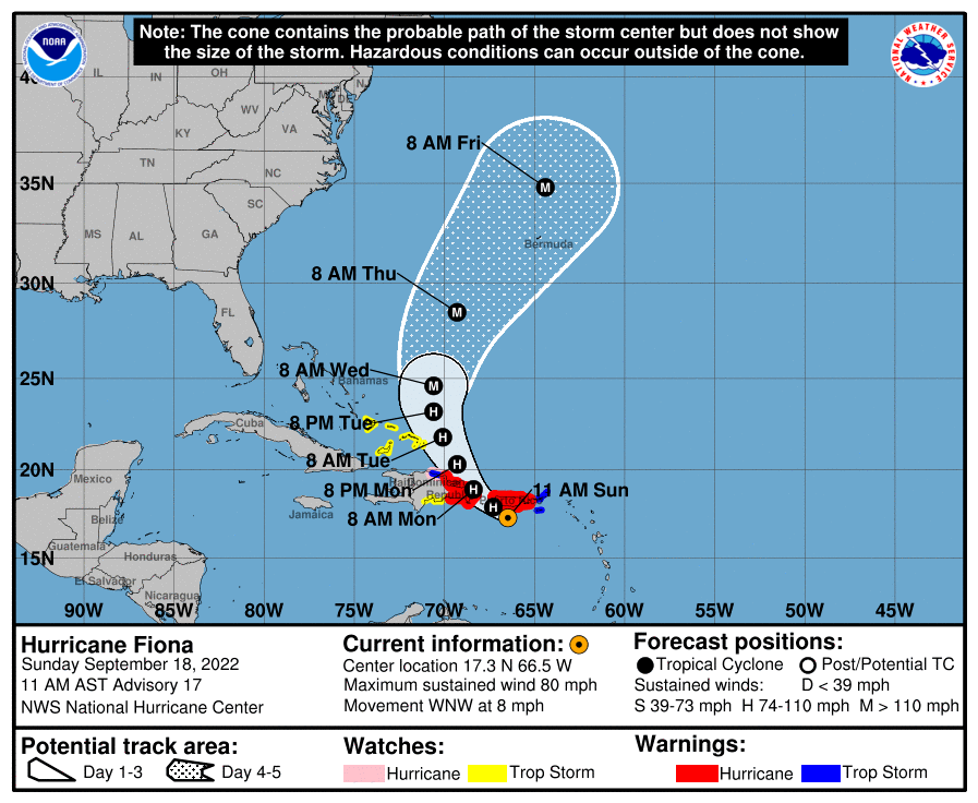
Figure 2: National Hurricane Center forecast on Hurricane Fiona on September 18th at 11 AM AST. Strong, gusty winds accompanied much of the stronger convection embedded within the hurricane. Hurricane-force gusts were observed over portions of southern Puerto Rico during the afternoon on Sunday. These gusty winds combined with ground saturation resulted in damage across the island due to fallen trees and power lines. As had been anticipated, the greatest hazards and impacts were caused by the extreme rainfall, especially for southern into eastern Puerto Rico, largely along the Cordillera. With southerly to southeasterly wind flow and the beyond abundant moisture available from the hurricane, rainfall activity intensified due to the topography. In areas along the Cordillera and around El Yunque, widespread rainfall totals in excess of 16 inches were seen, most of which fell on Sunday. Preliminary estimates suggest that amounts in excess of 2 feet of rain were seen locally, mostly around Cayey and southern Caguas and Aibonito to southern Jayuya. Multiple rivers in eastern Puerto Rico, mostly those that had been most affected by the previous week’s rain, were at action stage by early Sunday morning. Widespread flooding was reported, mostly in southern and central Puerto Rico. Numerous mudslides were also reported throughout the affected areas of steep terrain. Moisture continued to be pulled across the islands through Monday into Tuesday, well behind Hurricane Fiona, after her exit westward from the region. Rainbands lingered over the region, within which there was significant convective activity. This resulted in continuing enhanced shower activity, exacerbating the already soaked and dangerous conditions that persisted across the islands. Rainfall totals continued to climb as showers with moderate to heavy rain persisted through Tuesday with total rainfall accumulations in excess of 30 inches in Ponce, Caguas and San Lorenzo. |
|
Satellite & Radar Imagery
|
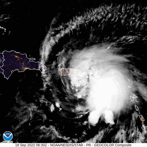
Figure 3: Animated image of Hurricane Fiona on September 18th, 2022. Image credit NOAA.
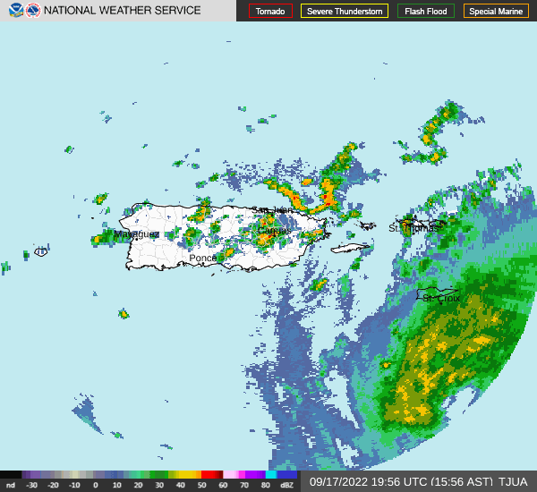
Figure 4: Radar loop of Hurricane Fiona as it moved over southwest Puerto Rico. Image credit NOAA/NWS.
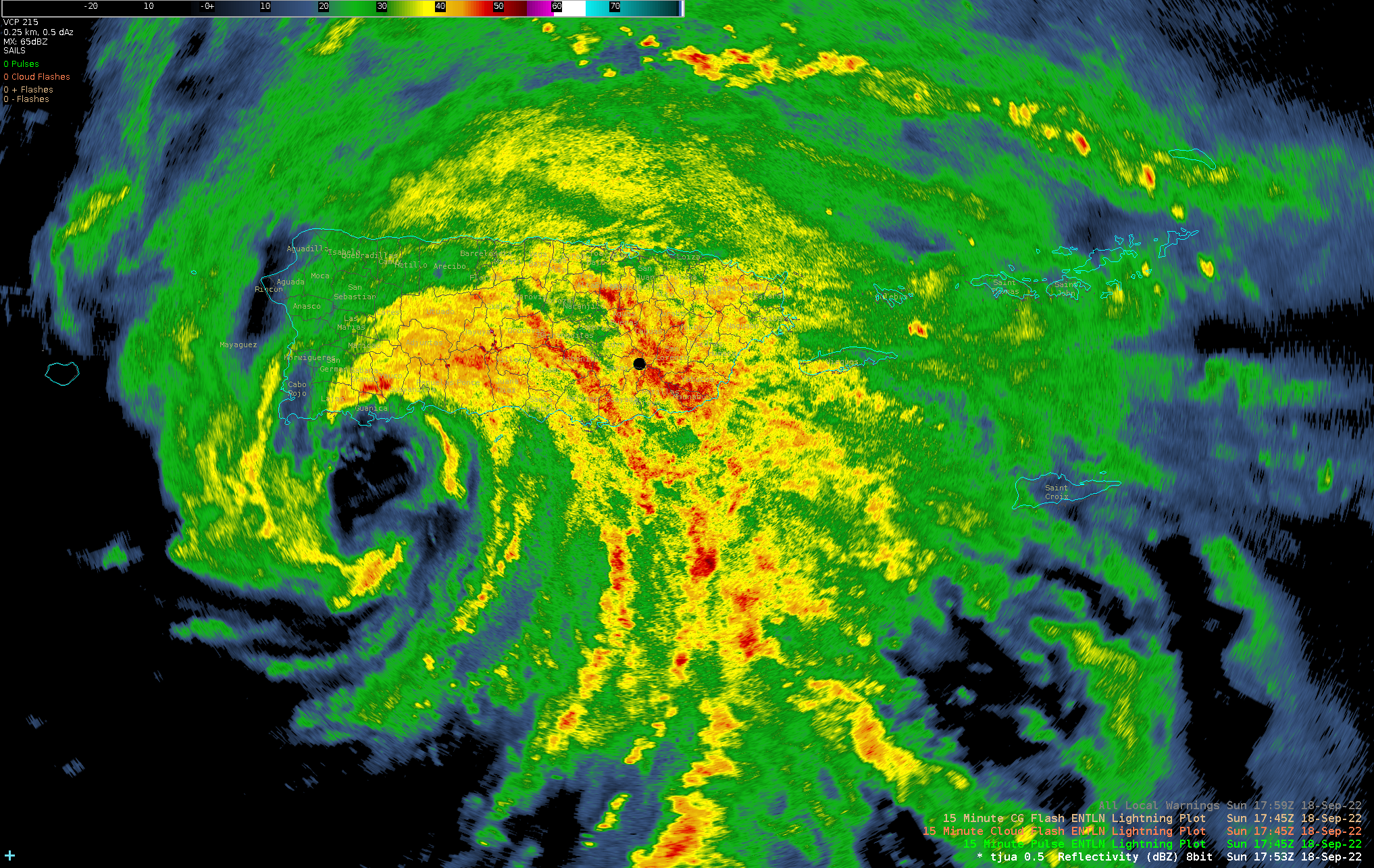
Figure 5: Radar image of the eyewall of Hurricane Fiona as it approaching southwest of Puerto Rico. Image credit NOAA/NWS.
|
Total Rainfall Accumulation
|
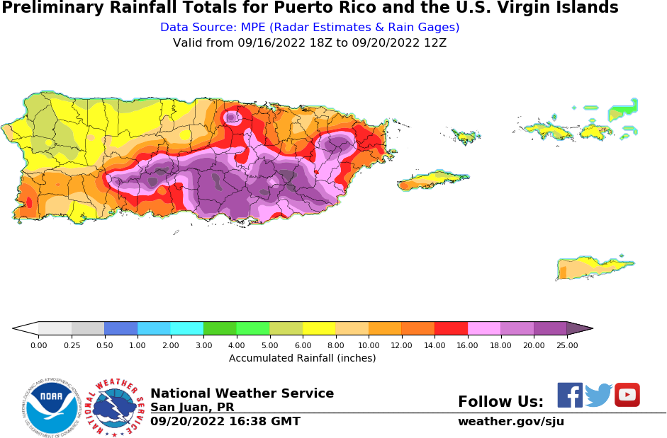
Figure 6: 72-hours rainfall accumulation associated with Hurricane Fiona.
|
Maximum Wind Gust Reports
|
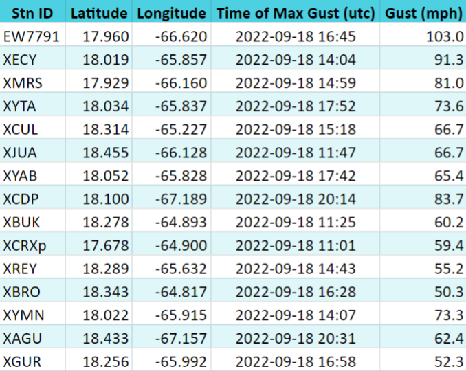
Table 1: Maximum Wind Gusts (MPH) measured during the passage of Hurricane Fiona.
|
Hydrological Response in Rivers
|
| The initial Flood Watch was issued by the Forecast Office for all Puerto Rico and the US Virgin Islands Thursday, September 15th, 2022 at 12:50 PM AST. The issuance of the Flood Watch came before the issuance of any tropical product due to the high confidence in a rainfall event regardless the intensity or trajectory associated with Fiona. It was highlighted that the areas most likely to receive the highest rainfall accumulations were portions of eastern Puerto Rico. Flooding began to affect portions of the CWA early Sunday, September 18th with the first Flash Flood Warning issued at 8:25 AM AST for Saint Croix. Flooding became widespread across the eastern half of Puerto Rico by midday and across the western half of the island during the afternoon hours. Based on preliminary information from the US Geological Survey Streamgage Network, 50 out of 108 river gauges rose above the USGS-NWS floodstage. Most river gauges along Río Grande de Manatí, Río Cibuco, Río Grande de La Plata, Río Grande de Arecibo, Río Grande de Loíza, and Río Guanajibo rose above moderate or major flood stage. Across southern and southeastern portions of the island, significant to catastrophic flooding was observed due to sharp rises along rivers combined with storm surge/coastal flooding. As a matter of fact, thousands of families were rescued in Salinas where a Flash Flood Warning with a catastrophic threat tag was issued on Sunday night. About 50 Flash Flood Warnings and about 30 Flood Warnings were issued between Sunday, September 18th and early Tuesday, September 20th. The flooding rains associated with Fiona significantly improved the observed drought conditions across the local islands with “Moderate Drought”(D1) and “Severe Drought” (D2) classification being removed across Puerto Rico. Several improvements were observed across the US Virgin Islands as well. |
|
River observations
|
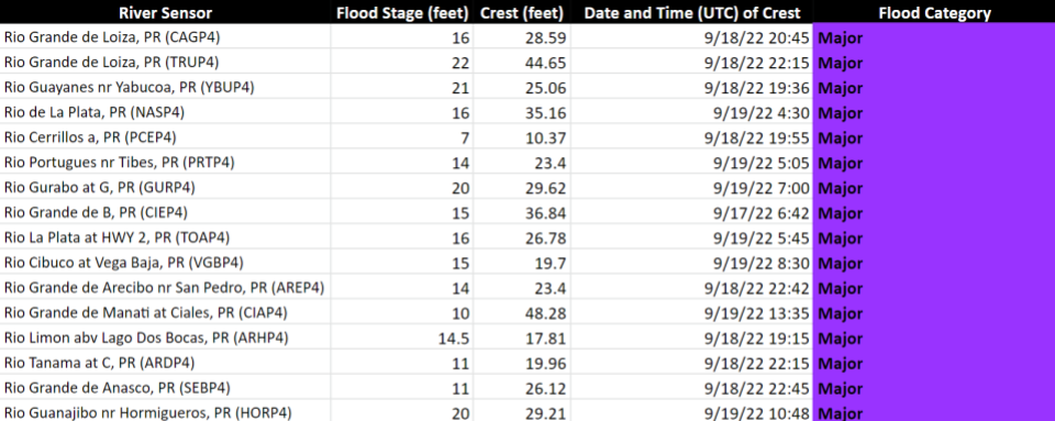
Table 2: Preliminary data of river streamflow that reached major flooding during Hurricane Fiona. Source: USGS
|
Damages
|
|
- Due to extensive flash flooding and large debris, several roads, bridges, causeways, and access routes were impassable, closed, or washed away - Thousands of rescues in more than 25 municipalities, over 400 of which were in Salinas municipality only - Flash flooding emergency in Salinas, with the highest impact in sector El Coqui, Playa, and La Playita. - Island-wide utility outages, mainly due to hurricane-force winds and flooding, including large areas with communication interruptions - Significant landslides and rockfalls along the interior and southern portions of Puerto Rico left over a dozen structures uninhabitable, and multiple communities were affected by the hurricane - Over one million dollars in crop damages - Other impacts are currently under assessment |
|
Local Storm Reports
|
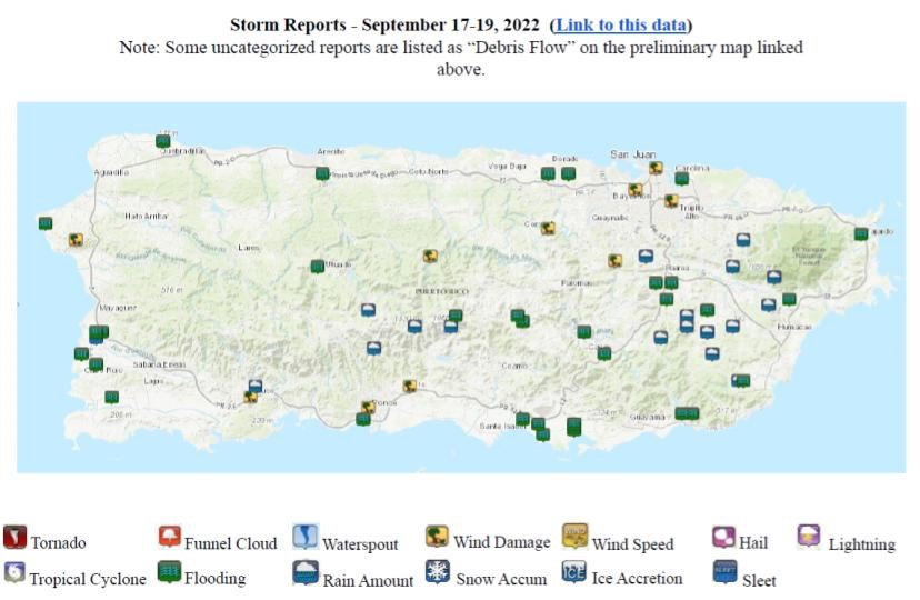
Figure 7: Local Storm Reports received during Hurricane Fiona.
|
Decision Support Services (IDSS)
|
|
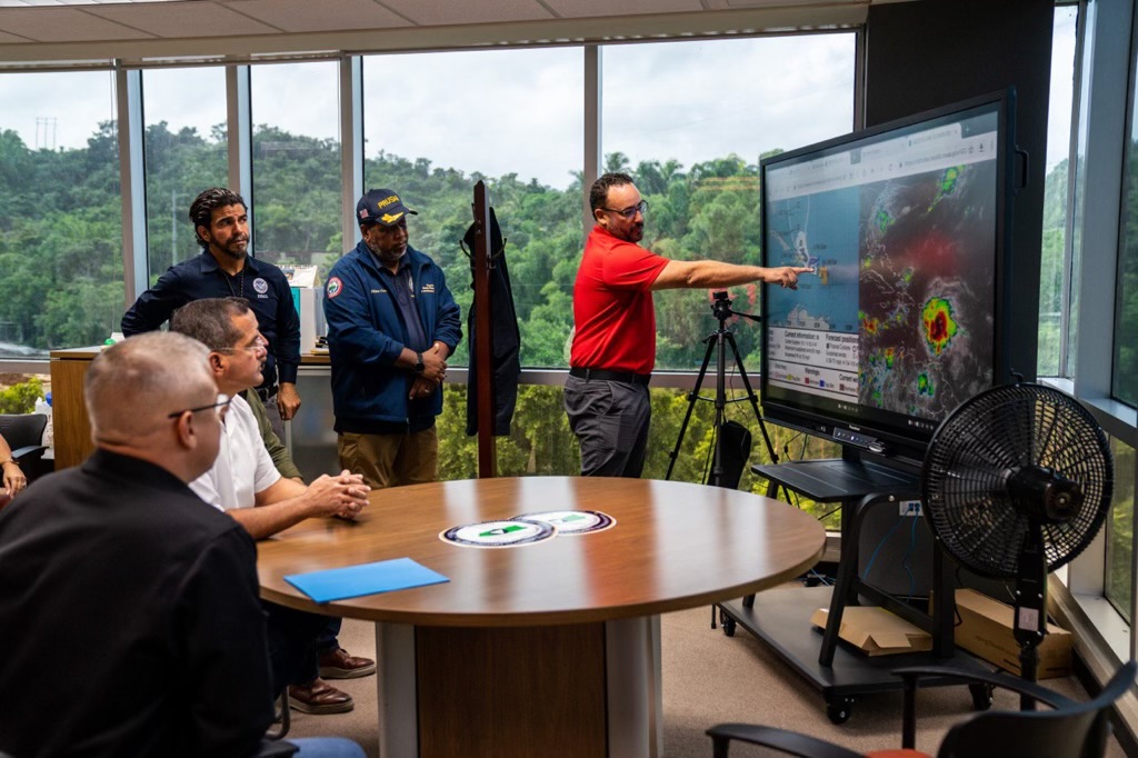
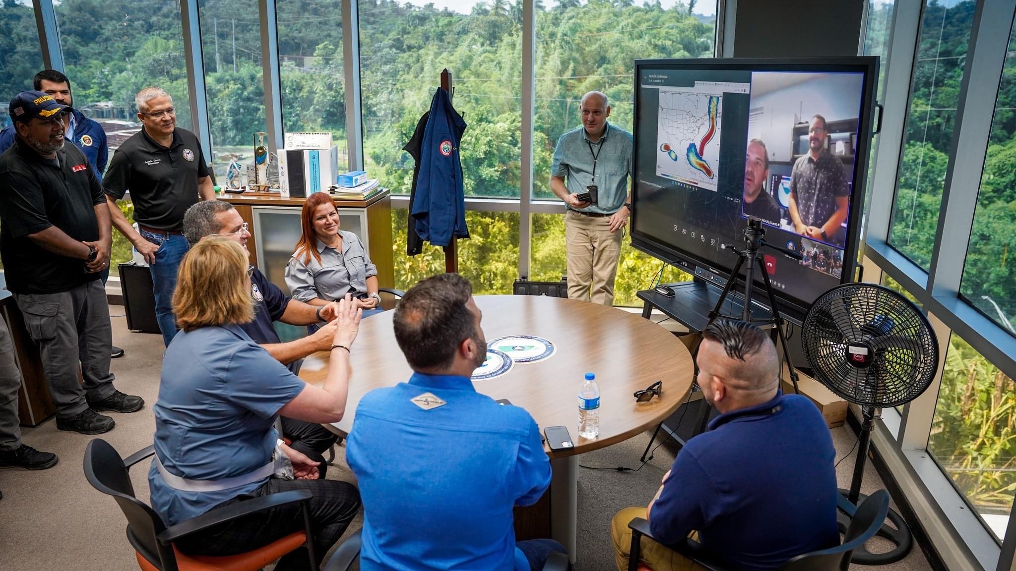
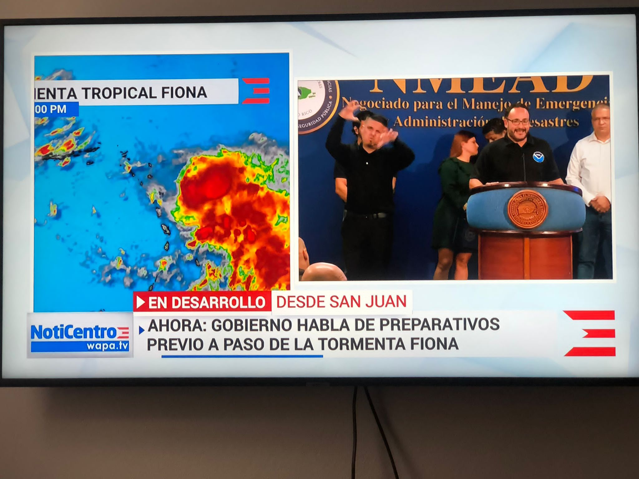
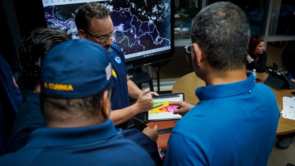
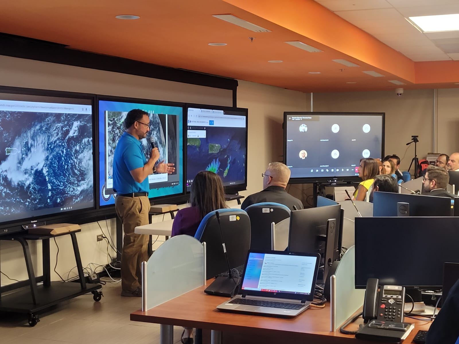
Since the early development stages from a strong tropical wave over the Atlantic toward the development of Hurricane Fiona just south of Puerto Rico the NWS Forecast Office- San Juan had the opportunity to brief national, regional and local key decision makers. Since Tuesday September 13, WFO SJU management team briefed Deep Core Partners including; U.S. Coast Guard, Virgin Island Emergency Management Agency, and Puerto Rico Emergency Management Bureau. As the system developed and moved closer to our local region, these types of support interaction increased significantly. Every day since Thursday September 15, the WFO San Juan Staff gave web-based briefings, where municipal emergency managers, agency administrators and local media participated. Two of these briefings were done daily, one in Spanish and the other one in English. The first briefing at the PR EOC was done on Thursday September 15, and all the Puerto Rico Governor's cabinet was present. On Friday September 16, the Puerto Rico Governor's Office staff was briefed and the first press conference was done. The PR EOC was officially open at 8:00 AM on Saturday September 17, where our WCM gave an onsite briefing to the staff. The Governor of Puerto Rico, Pedro Pierluisi and his cabinet were briefed on site twice a day from Saturday through Tuesday. After each briefing, a press conference was done and was covered by all major local news outlets. During these briefings, many important decisions were done based on the information given by the National Weather Service Forecast Office. The U.S. Virgin Islands Emergency Management Agency, VITEMA, invited the personnel of the WFO San Juan Office to participate in several webinar meetings with the U.S. Virgin Islands Governor and its cabinet. Our office gave briefings about the actual and future weather associated with tropical cyclone Fiona. The Puerto Rico Governor Office developed a new office to support the deaf and hearing-impaired community in the island. The new office in collaboration with the Warning Coordination Meteorologist developed weather briefing videos with sign interpretation directed to this community. The videos were done after every Governor's press conference. The feedback from these was extremely positive and the preliminary views reached the thousands. Fiona was a major story at local, national and international level. During the period of September 13 and September 21 the WFO San Juan had over 350 interview requests. These interviews were mostly done on radio, TV, newspapers and virtual media. |


 Graphical Hazardous Weather Outlook
 Tropical Analysis
 Tropical Weather
 Regional Satellite
  Puerto Rico and U.S. Virgin Islands
 Local Radar