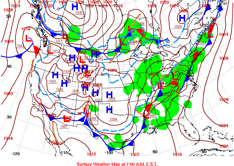
As an upper level trough dug southward across the western and central U.S., southerly flow drew moisture from the Gulf of Mexico northward into the tri-state area over the weekend. Upper air soundings measured this increased moisture with precipitable water values around 1.5 inches on Sunday, well above the 90th percentile and a record for the 12z February 11 sounding, although the record for that date and time are below the average max for this time of year. With a cold front and upper level trough west of the area, the persistent deep layer moisture helped to create a favorable set-up for high rainfall amounts.
 |
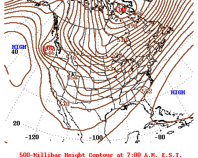 |
| Surface plot from February 11, 2018 | 500mb plot from February 11, 2018 |
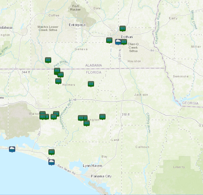 |
| Flood reports in which water was over the road and/or roads were washed out |
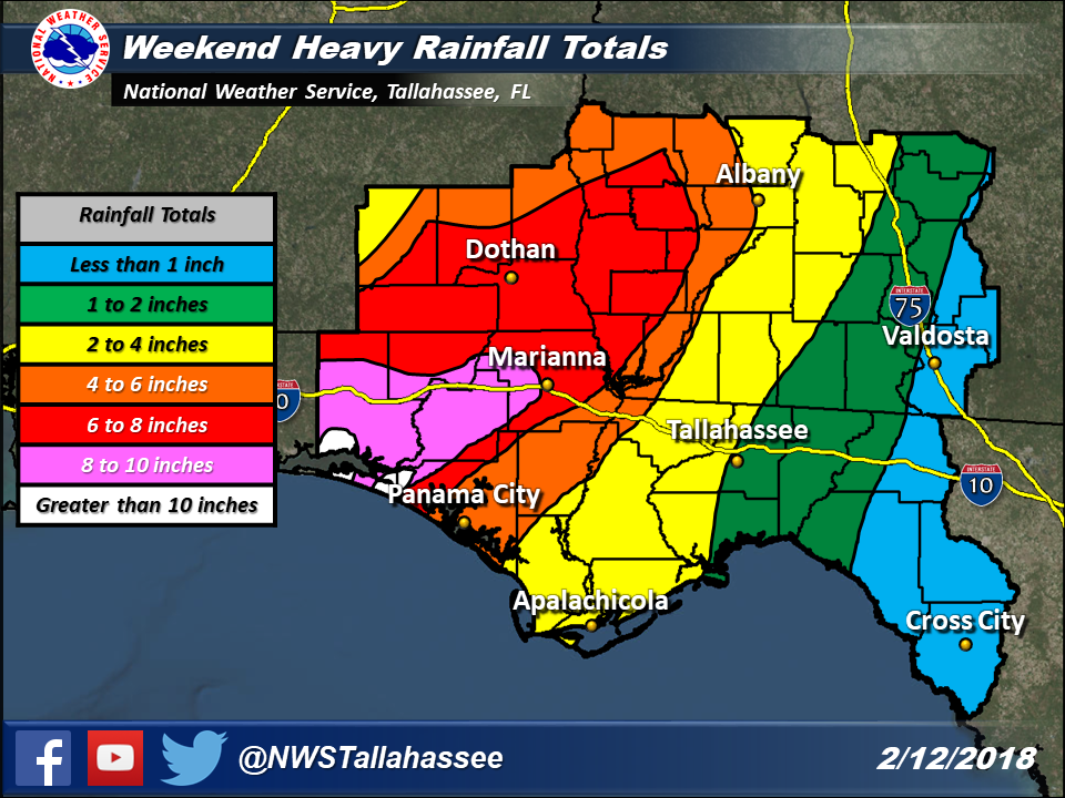
This wet pattern resulted in copious amounts of rainfall across the tri-state region. The highest rainfall amounts were across the Florida Panhandle where 8 to 10 inches fell with localized areas receiving more than 10 inches across coastal Walton and Bay counties. The highest observed rainfall total was in Walton County, where a 48-hour rainfall total of 11.45 inches was recorded. Across southeast Alabama and portions of southwest Georgia, widespread 6 to 8 inches of rain fell. While one Flash Flood Warning was issued, the majority of the impacts from this event were from moderate rainfall rates over a prolonged period of time as convection trained across the tri-state area. These high rainfall totals resulted in numerous road closures across the Florida Panhandle from water covered roads and washed out roadways. In addition, a few roads were closed across southeast Alabama.
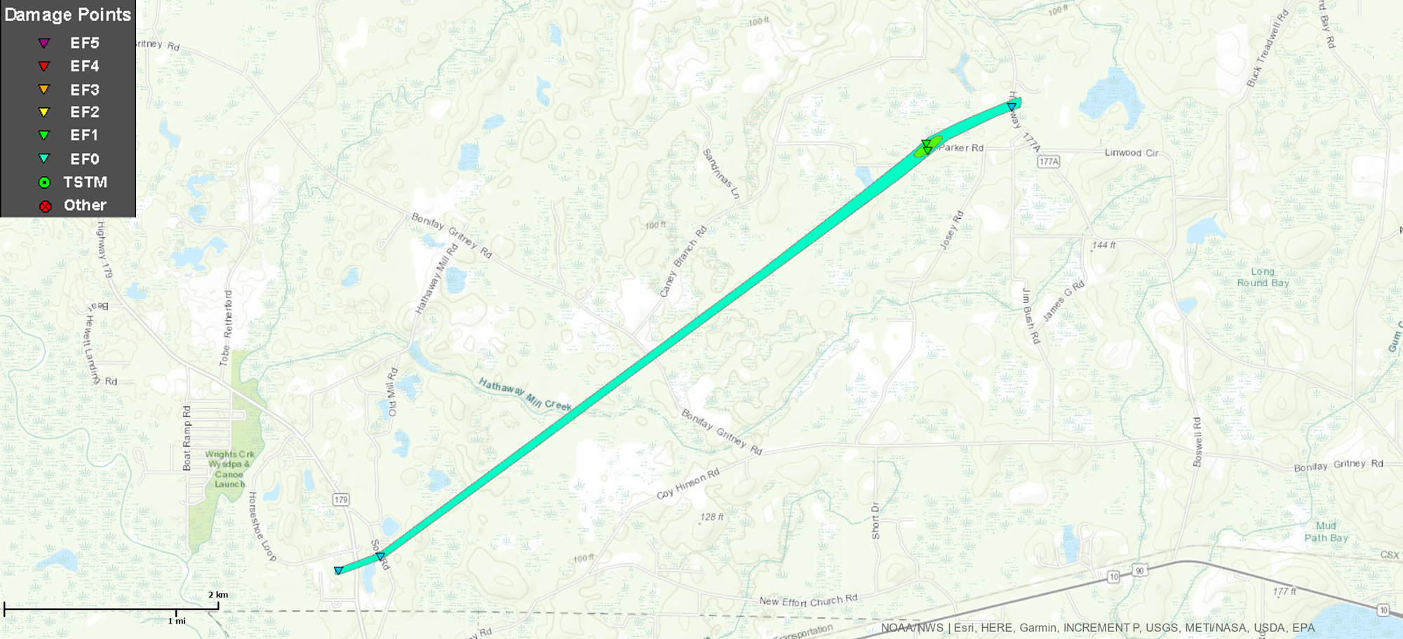
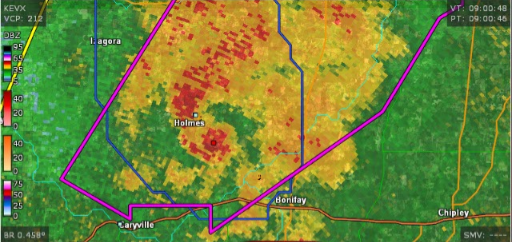
Early in the event Sunday morning, before the significant rainfall issues developed, strong thunderstorms moved across the Florida Panhandle. One of these storms resulted in an EF-1 tornado that touched down in Holmes County and tracked through the south central portion of the county. The tornado had winds of 110 mph and tracked 4.8 miles. During its time on the ground, the tornado downed trees, destroyed two barns and one brick carport and removed most of a metal roof on a home.
| Rating | EF1 |
| Estimated Peak Wind | 110 mph |
| Path Length (statue) | 4.79 miles |
| Path Width | 100 yards |
| Fatalities | 0 |
| Injuries | 1 |
| Start Date | 2/11/2018 |
| Start Time | 2:53 AM CST |
| Start Location | 30.7941, -85.8089 |
| End Date | 2/11/2018 |
| End Time | 3:02 AM CST |
| End Lat/Lon | 30.8339, -85.743 |
 |
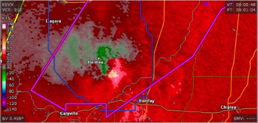 |
| Reflectivity from the Holmes County Tornado | Velocity assocaited with the Holmes County Tornado |
 |
 |
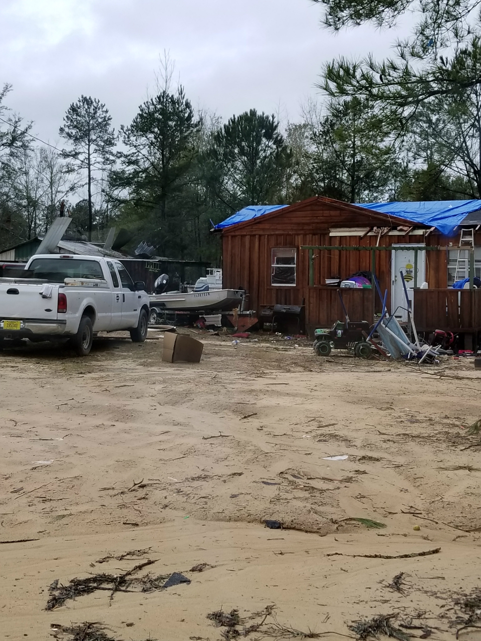 |
| Damage to a metal roof on the home and a destroyed carport | Barn destroyed | Damage to a home and barn |
In addition, the same thunderstorm that produced the tornado in Holmes County continued on to produce a brief tornado in northwest Jackson County. This tornado tracked near Graceville and downed a few trees and caused minor roof damage.
| Rating | EF0 |
| Estimated Peak Wind | 65 mph |
| Path Length (statue) | 0.2 miles |
| Path Width | 25 yards |
| Fatalities | 0 |
| Injuries | 0 |
| Start Date | 2/11/2018 |
| Start Time | 3:28 AM CST |
| Start Location | 30.9507, -85.5161 |
| End Date | 2/11/2018 |
| End Time | 3:29 AM CST |
| End Lat/Lon | 30.9512, -85.5120 |


 Follow us on YouTube