| Severe Weather and Flooding of April 13, 2009 |
On Monday, April 13, 2009, a series of bowing segments of severe storms produced numerous instances of straight-line wind damage and large hail across the entire forecast area including Southeast Alabama, Southwest & South Central Georgia, and the Florida Panhandle and Big Bend. There was a tornado reported in Geneva County, AL, and many reports of flooding across the region. Storm total rainfall generally ranged from 2.5-3.5 inches across the forecast area. This unfortunately reversed the trend of falling stages at many area rivers that saw significant flooding from extremely heavy rains that fell earlier in the month. In many cases, rivers are predicted to exceed flood stage once again. From Figure 1, you can quickly see that this was a busy day for NWS Tallahassee as a single radar image shows six distinct bowing structures extending from off the FL Panhandle coast northeastward across the forecast area into Southeast GA. Warning polygons are in effect for several of these storms. The northeastern most storm that was in Apling County, GA, at the time of this radar image was responsible for significant straight-line wind damage as it passed through Ben Hill County, GA, earlier that afternoon. Most of this damage occurred in the county seat of Fitzgerald. Figures 2 & 3 show photos of some of the damage in Fitzgerald. The NWS conducted aerial and ground storm surveys of the damage From Sylvester to Fitzgerald, GA, and both concluded that much of the damage was produced by strong straight-line winds of 80-90 mph. This is equivalent to an EF-1 tornado. While most of the damage was determined to be from straight-line winds, photographic evidence proves that a small tornado did in fact move through Fitzgerald (see Figure 4).
The storm over northern Liberty County, FL, in Figure 1 produced severe hail of around one-inch diameter in Washington, Calhoun and Liberty Counties. There was also wind damage scattered across northern Calhoun County north of State Highway 20. An NWS survey team concluded that damage in this county was produced by straight-line winds of 70-80 mph, the equivalent of an EF-0 tornado. Figure 5 shows a picture of some of this damage. This same storm continued eastward across southern Gadsden County producing golf ball size hail south of Quincy. It later crossed Leon County, including the City of Tallahassee, producing quarter-size hail, uprooting trees, and causing urban and small stream flooding in the city.
Details on the three storm surveys conducts after this event are included in this public information statement. Additional information on damage reports across the forecast area can be found in the Local Storm Report for this event.
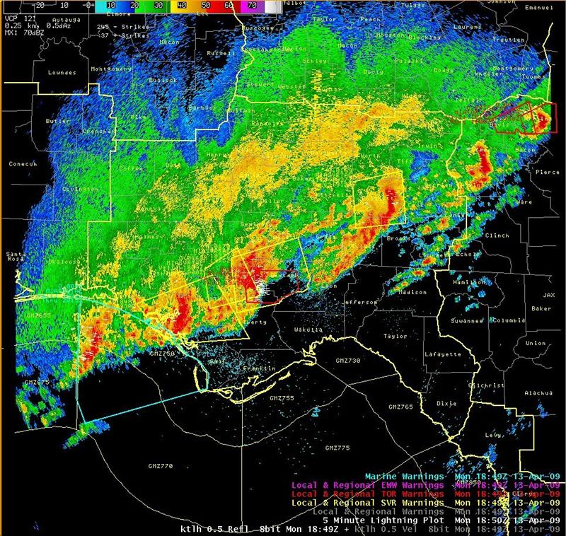
Figure 1. Radar reflectivity image from the Tallahassee Doppler Radar (KTLH) at 1849 UTC (2:49 pm EDT) April 13, 2009. The image shows six distinct bow echoes across the forecast area. Warning polygons are also indicated with red for tornado warnings, yellow for severe thunderstorm warnings, and blue for special marine warnings.
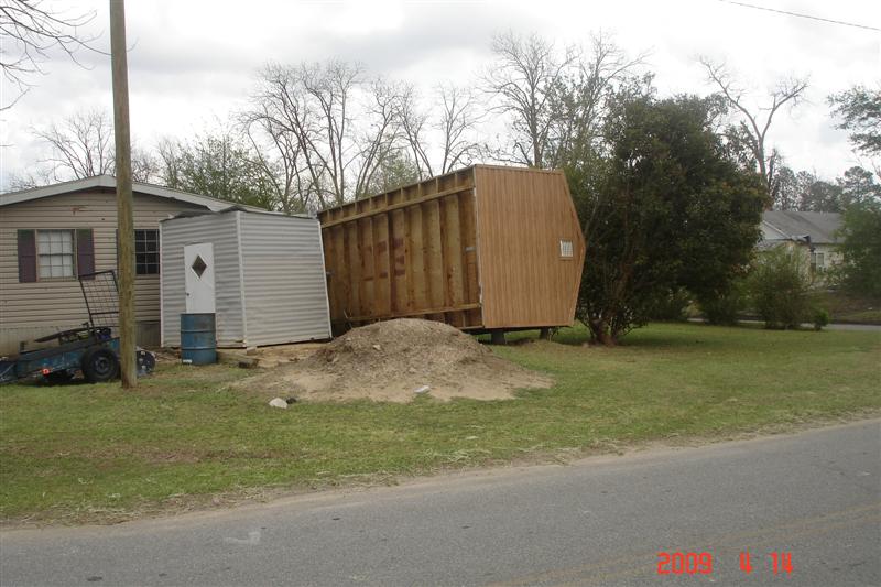
Figure 2. A mobile home is overturned in Fitzgerald, GA, by an EF-1 tornado that struck on April 13, 2009.
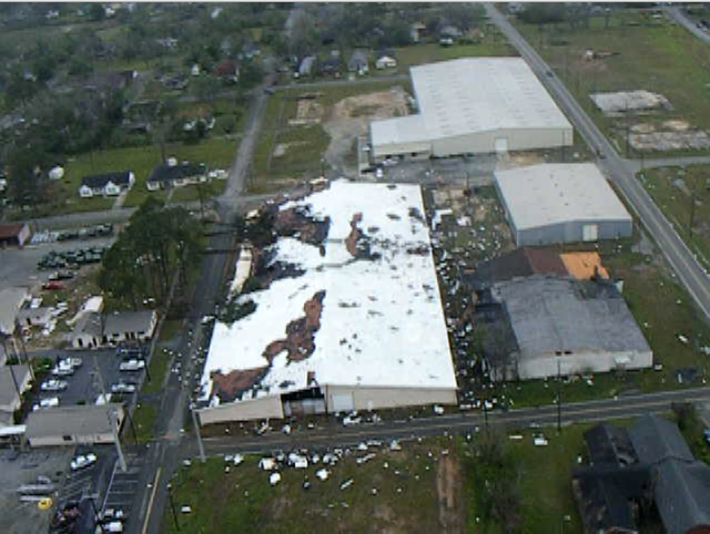
Figure 3. Aerial view of significant damage to the roof of a warehouse in Fitzgerald, GA, caused by an EF-1 tornado that struck on April 13, 2009.

Figure 4. Cell phone picture of the tornado that passed through Fitzgerald, GA, on the afternoon of April 13, 2009.

Figure 5. Large trees felled by 70-80 mph straight-line winds on April 13, 2009, in Blountstown, FL.


 Follow us on YouTube