National Weather Service United States Department of Commerce
 
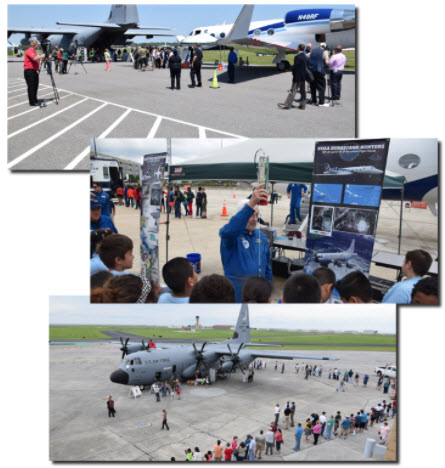
Hurricane Awareness Tour stop #5
May 7, 2018
Sunday, May 6th Determine your risk


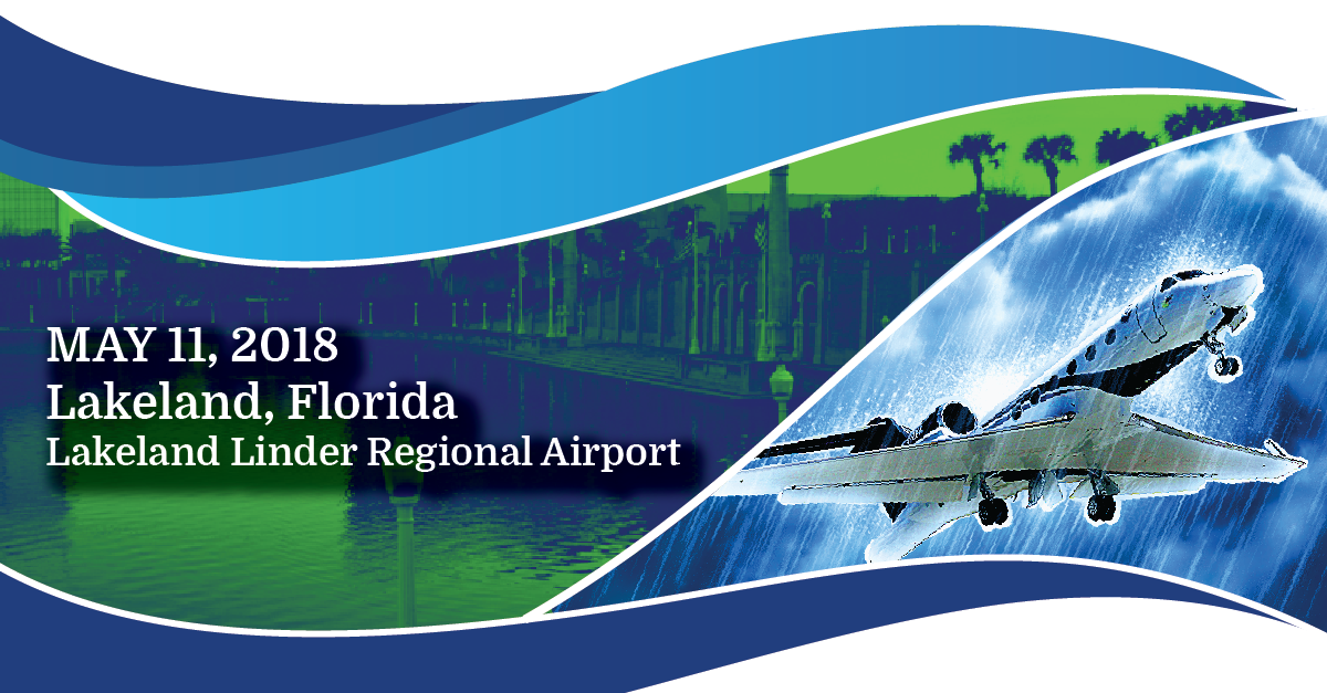
2018 Hurricane Awareness Tour Coming to Lakeland, FL!

 
Event Info The Planes Participants Directions  
 

Ever been fascinated by hurricanes or wondered how in the world people fly safely into them? Have a passion for flying and love viewing various aircraft? Check out this 2-minute video about what it is like to be a Hurricane Hunter then mark your calendar for the 2018 Hurricane Awareness Tour in Lakeland on May 11th!

As part of a week-long tour along the Gulf Coast, the NOAA Hurricane Hunters will be making a stop at the Lakeland Linder Regional Airport. Come tour two of the Hurricane Hunter aircraft, speak with the pilots, and walk through vendor exhibits from various local agencies and organizations. The event is FREE and the public is invited to attend from 2 pm to 5 pm!


Event Information


What: 2018 Hurricane Awareness Tour

Where: Lakeland Linder Regional Airport
             3900 Don Emerson Dr, Lakeland, FL 33811

When: Friday, May 11th, 2 PM to 5 PM

Admission: FREE!
 

Things To Do: 

  • Tour Hurricane Hunter aircraft
  • Meet the pilots & flight crew
  • Speak with hurricane forecasters
  • Meet with local National Weather Service meteorologists
  • Walk through exhibits from various agencies & organizations
  • Learn about weather safety & preparedness
  • FEMA  Immersed - a virtual reality experience about floods
  • Hurricane terms and definitions
 

About the Planes

WC-130J - "Hercules"

The WC-130J is a high-wing, medium-range aircraft used in weather reconnaissance missions. This plane is configured to penetrate tropical disturbances and storms, hurricanes and winter storms and obtains data on the movement, size and intensity of these systems. The WC-130J is the weather data collection platform for the 53rd Weather Reconnaissance Squadron. It carries a minimal crew of five: pilot, co-pilot, navigator, aerial reconnaissance weather officer and weather reconnaissance loadmaster. The crew collects and reports weather data as often as every minute. Click here to learn more.


NOAA Gulfstream IV-SP (G-IV) - "Gonzo"

NOAA’s Gulfstream IV-SP (G-IV) jet is a high-tech, high-flying, and high-speed platform used for hurricane forecasting and research. It is a sophisticated twin-engine jet piloted by NOAA Corps officers and crewed by NOAA civilian engineers and meteorologists. The G-IV flies around and over developing tropical cyclones to create a detailed picture of the surrounding upper atmosphere. It a range of nearly 4,000 nautical miles and a cruising altitude of 45,000 feet. Click here to learn more.


Participants

  • Federal Alliance for Safe Home

  • USAA Catastrophe Response Vehicle

  • Cummins Power with large generator

  • Lakeland Linder Regional Airport

  • FEMA Immersed - A VR Experience About Flood & Resilience

  • Salvation Army Trailers - Shower, Polaris, and Canteen

  • Florida International University - Wall of Wind

  • University of Rhode Island - School of Oceanography

  • American Red Cross Emergency Response Vehicle

  • Polk County Retired Senior Volunteer Program

  • Volunteer Polk

  • Polk County Citizen Emergency Response Team

  • Volunteer SKYWARN Spotter - Severe Weather Intercept Vehicle

  • Lakeland Fire Department

  • Polk County Emergency Management

  • Florida Division of Emergency Management

  • Federal Emergency Management Agency

  • Polk County Sheriff's Office

  • NOAA National Ocean Service

  • NOAA Aircraft Operations Center

  • NOAA National Weather Service in Ruskin