
Severe thunderstorms capable of producing damaging wind gusts, large hail, and a few tornadoes, are likely to develop this afternoon from parts of the lower Ohio Valley into the southern Plains. An Enhanced Risk (Level 3 of 5) outlook has been issued. Further north, widespread rain showers are expected across portions of the Great Lakes and Northeast U.S. Read More >
Last Map Update: Thu, Apr. 18, 2024 at 6:09:49 pm MDT

|
Text Product Selector (Selected product opens in current window)
|
|


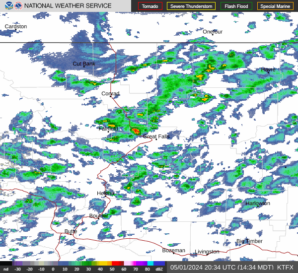
 Great Falls Radar
 Satellite
 Current Observations
 Forecast Discussion
 Montana Weather
 Fire Weather
 Winter Weather Forecasts
 Transportation Forecasts
 Weather Prediction Center
 Storm Prediction Center
 Aviation Weather
 Follow us on YouTube