
Showers and thunderstorms capable of producing widespread heavy rainfall will be possible across much of Puerto Rico today. Heavy rainfall will likely lead to flash, urban and small stream flooding. Some areas may face life-threatening flooding. In the Southeast U.S., strong to marginally severe thunderstorms will be possible this afternoon. Read More >
A major winter storm affected Kansas and surrounding states from Tuesday January 29th through Thursday January 31st.
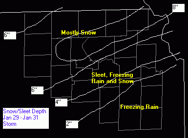
Across east central Kansas, the wintry precipitation took the form of heavy freezing rain. This caused major tree damage, numerous power outages, and horrible travel conditions leading to many accidents. In the NWS Topeka County Warning Area, Anderson, Franklin, Osage, Coffey and Lyon counties received the worst of the icing.
Just to the north, Dickinson, Morris, Wabaunsee, Shawnee and Jefferson counties received a mixture of heavy sleet, and some freezing rain and snow. This also caused numerous travel problems and closed many schools and businesses. Snow, heavy at times, was the main precipitation type across the remainder of northeast and north central Kansas. Across this area, reports of six to ten inches were common.
This storm was unusual not only in the amount of sleet and freezing rain that fell, but also in the duration of the< precipitation. Some areas saw some type of wintry precipitation falling for 48 hours straight. The cold air at the surface was a result of an arctic front that moved through Kansas early in the week. As the front stalled just to the south, warm moist air was lifted up and over the front and resulted in the variety of nasty conditions that Kansans experienced with the storm.
|
|
Map left shows precipitation type and amounts across the Topeka National Weather Service Office County Warning Area. |
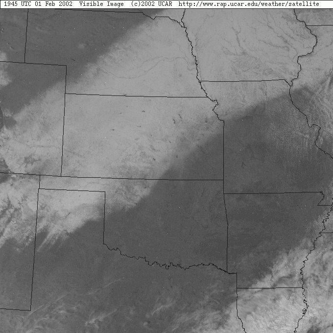 |
Visible satellite image from February 1st showing the swath of snow/sleet left in the storm's wake. |


 Follow us on YouTube