
Showers and thunderstorms capable of producing widespread heavy rainfall will be possible across much of Puerto Rico today. Heavy rainfall will likely lead to flash, urban and small stream flooding. Some areas may face life-threatening flooding. In the Southeast U.S., strong to marginally severe thunderstorms will be possible this afternoon. Read More >
| Manhattan Tornado | Chapman Tornado | Soldier Tornado | June 11th Homepage |
.jpg)
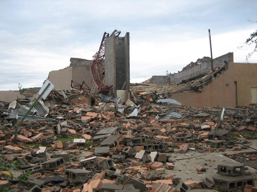
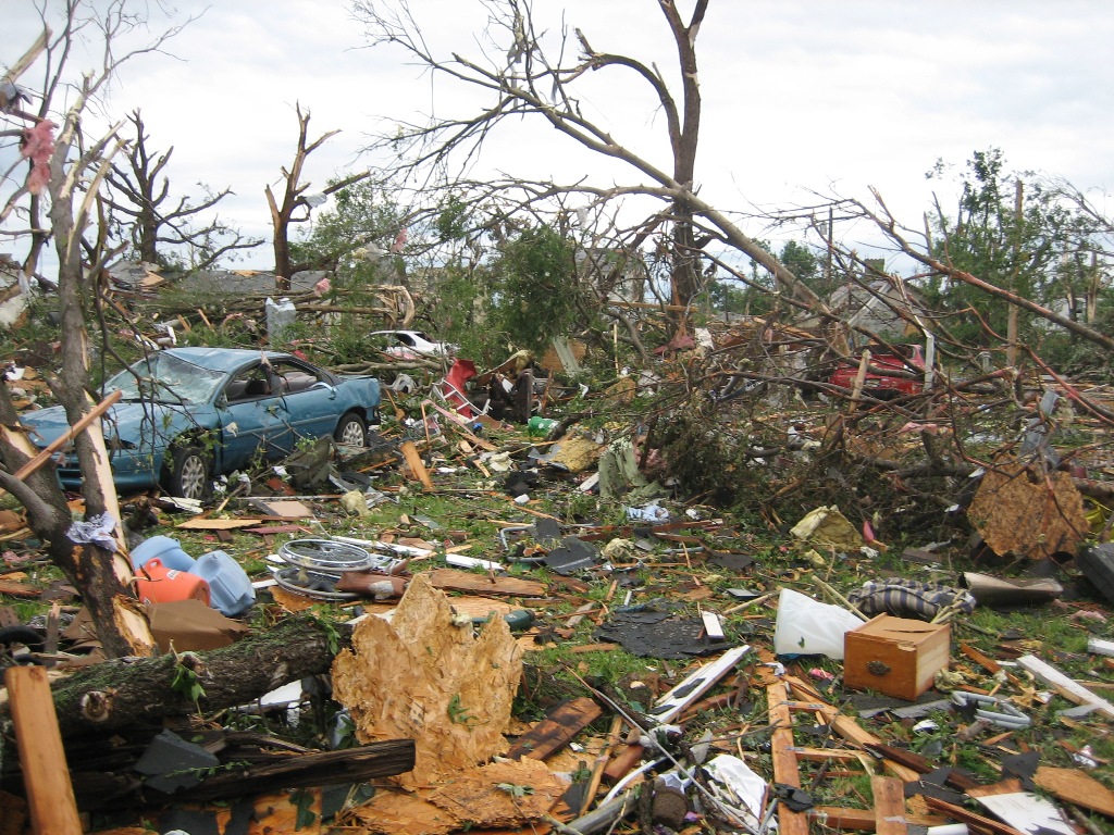
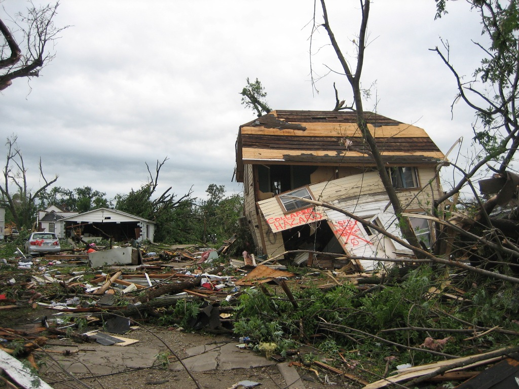
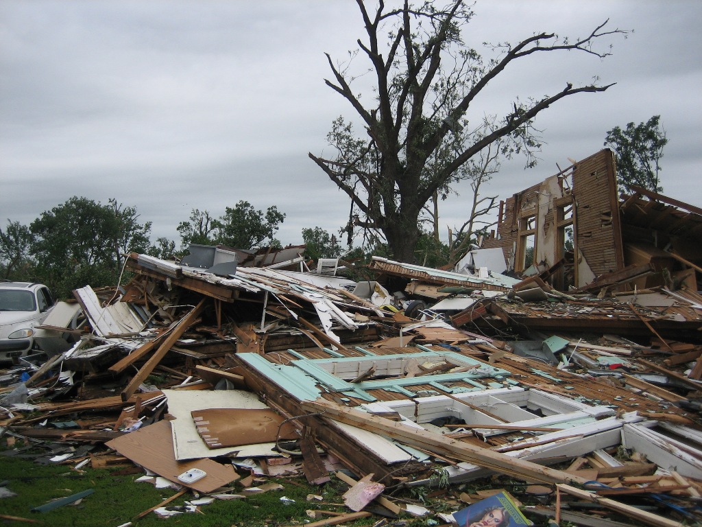
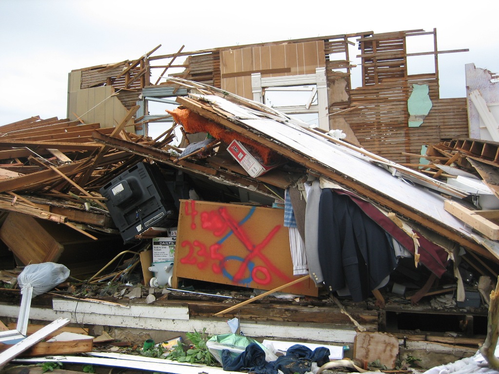
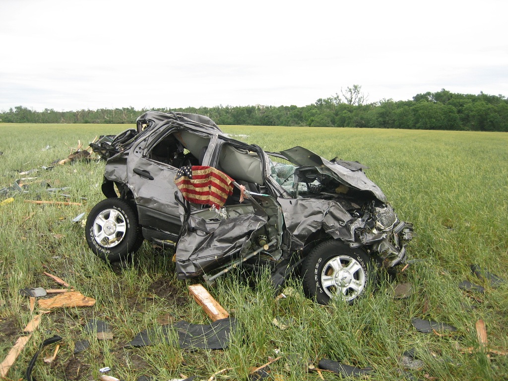
Below are a few damage photos taken by the survey team in Chapman.
(Click images for a larger view)
 |
 |
|
|
|
 |
 |
|
|
|
 |
 |
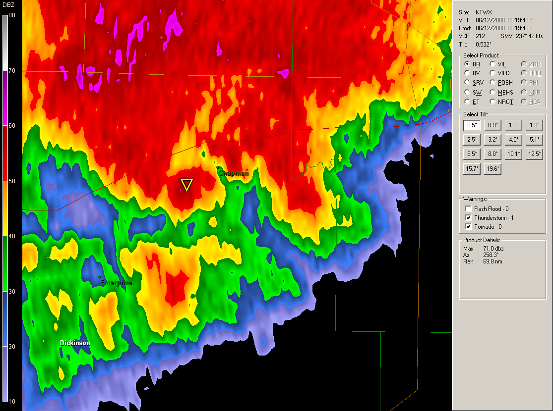
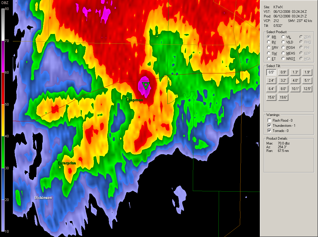
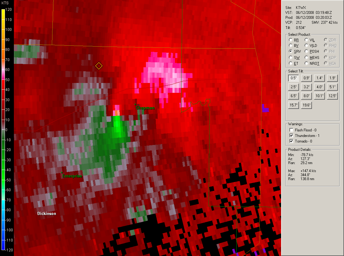
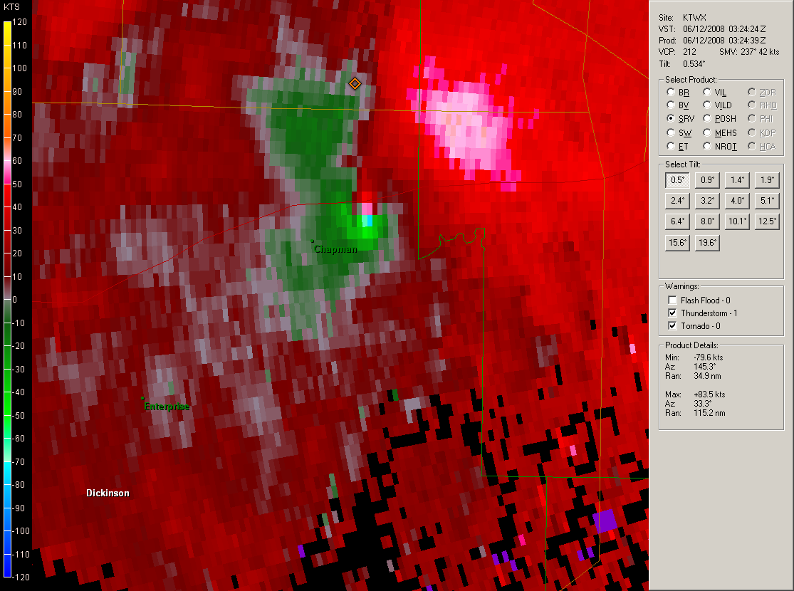
The following is a brief Doppler Radar review from KTWX (the Topeka NWS Radar) of the parent supercell thunderstorm that produced the Chapman tornado. The images on the left show the reflectivity and Storm Relative Motion (SRM) before the tornado moved through Chapman, and the images on the right are the same radar images a couple of minutes after the tornado moved through Chapman. Note the high (purple) reflectivities in the 'hook' after the tornado moved through Chapman. This is debris that the radar was able to detect, a few thousand feet in the air.
 |
 |
 |
 |
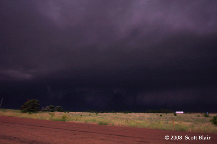
Below is a picture taken by Scott Blair. The photo was taken from near I-70 at mile marker 290. The tornado is seen as a large stovepipe in the center of the image and was roughly 3 miles WSW of his location.


 Follow us on YouTube