
There is an Enhanced Risk (Level 3 of 5) for severe thunderstorms Tuesday with threats for significant severe hail and tornado potential over southern Iowa into northern Missouri and west-central Illinois. Elevated to critical fire weather is possible Tuesday due to gusty winds and dry conditions over parts of the southern High Plains and northeastern Montana. Read More >
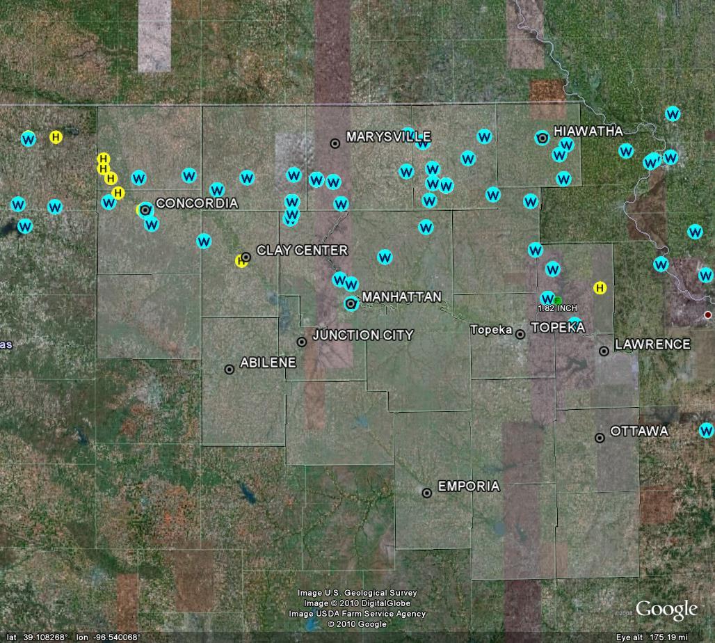
A powerful storm system moved across northern Kansas on Saturday morning, producing winds of 60 to 80 mph or greater from north central Kansas well into Missouri. Some of the strongest winds were experienced along a swath extending from Concordia through Barnes, Blue Rapids and Vermillion along Highway 9, and between highway 16 and 36 over extreme northeast Kansas.
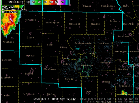 |
| Loop of reflectivity every 15 minutes from 744 AM to 1129 AM CDT June 19 2010. |
Click here for a link to wind speed and damage reports
This page will be updated as more information becomes available this weekend.
A brief overview of storm reports from the morning hours is below...
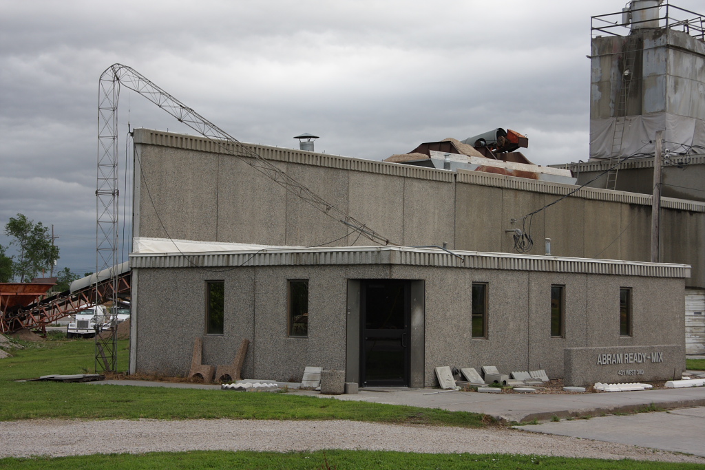
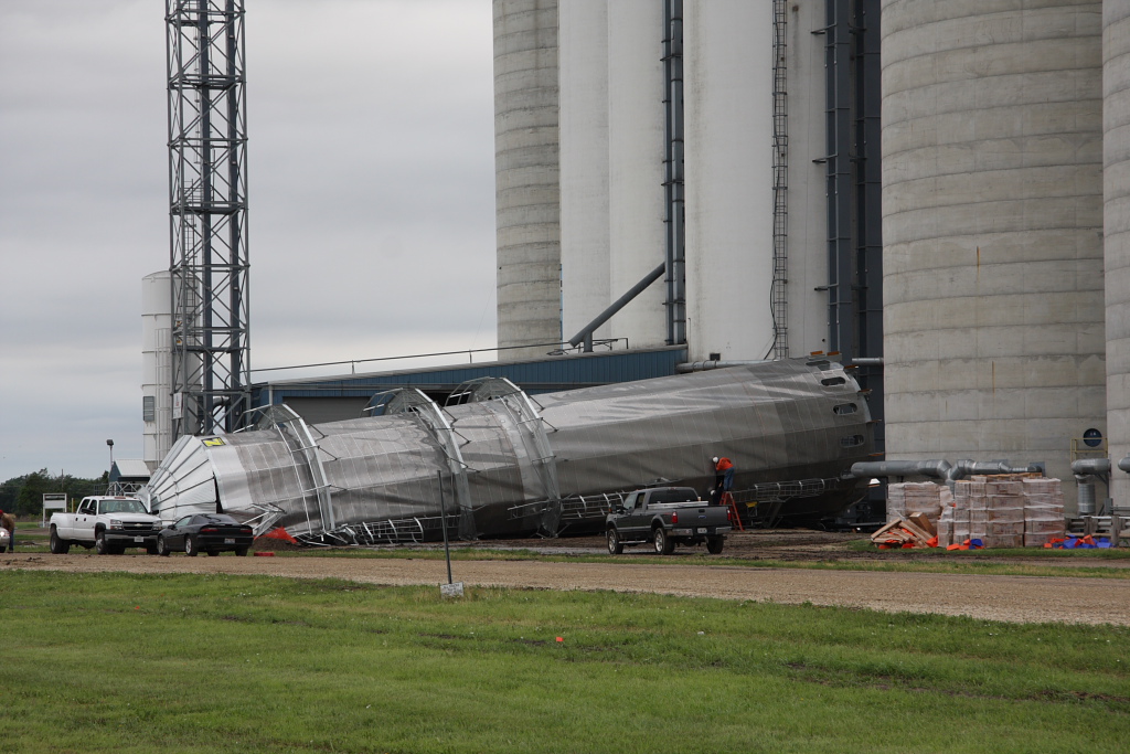
Here are a few images from Cloud County. Pictures courtesy of Tom Roberts.


 Follow us on YouTube