May 18 and 19 Brought Two Days of Severe Weather to the Area

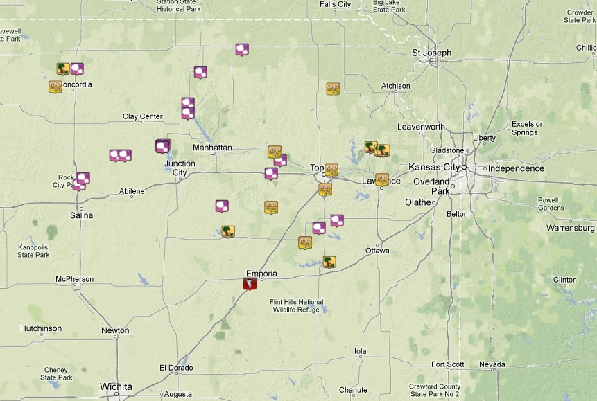
A map of reports from across the area on May 18 (left) and May 19 (right). Not all reports are included as these are preliminary.
Click each map for an interactive display
Saturday, May 18
Strong storms in western Kansas congealed into a squall line that brought heavy rain, strong winds and a couple brief embedded tornadoes. A couple areas with enhanced wind damage, possibly associated with brief tornadic spin-ups were located in Clay and Washington Counties. There were several wind damage reports with structures damaged or destroyed across a large portion of north central and northeast Kansas. Some of the strongest winds not associated with brief tornadoes was near Milford Lake, where a Corp of Engineers wind instrument recorded winds in excess of 100 mph. A camping unit was tipped over by the winds, injuring two people at Milford Lake. Due to the linear nature of the storms not much large hail was produced, however there was an isolated report of golf ball sized hail near Minneapolis.
|
A metal building has its roof removed near Minneapolis, Kansas |
A barn is destroyed near Clifton, Kansas |
A tree is severely mangled near Minneapolis, Kansas |
Click on image for larger version
Sunday, May 19
A very strong supercell formed near Wichita, Kansas and moved northeast along the Kansas turnpike early Sunday afternoon. After producing a couple tornadoes near Wichita it quickly grew into a classic bow-echo storm, racing north along the turnpike through Emporia, Topeka, and Lawrence. There were reports of tornadoes associated with the line of storms near Emporia. Similarly to the previous day's storms the linear nature of the main storms on Sunday did not produce extremely large hail.
|
A detached garage is destroyed near Council Grove, Kansas |
A house is damaged by strong winds near Council Grove, Kansas |
A large tree fell on a house near Barnes, Kansas |


 Follow us on YouTube