
Severe thunderstorms, excessive rainfall, critical fire weather are all in the outlook today and into this last weekend of April. Very large hail, severe wind gusts, and a couple strong tornadoes will all be possible across the central and southern Plains today. Flash flooding also possible for portions of the Plains and Mississippi Valley. Critical fire weather conditions for Southern High Plains Read More >
|
|
Brief Weak Tornado in TopekaClick here to download the KML file
|
|
BRIEF WEAK EF0 TORNADO IN NORTH TOPEKA... RATING: EF-0 ESTIMATED PEAK WIND: 65 MPH PATH LENGTH /STATUTE/: 1.6 MILES PATH WIDTH /MAXIMUM/: 30 YARDS START DATE: 6/29/2014 START TIME: 9:20 PM CDT START LOCATION: LOWER SILVER LAKE ROAD END DATE: 6/29/2014 END TIME: 9:25 PM CDT END LOCATION: NEAR ROCHESTER CEMETARY BRIEF WEAK TORNADO TOUCHED DOWN AROUND 920 PM NEAR LOWER SILVER LAKE ROAD AND SKIPPED ALONG A PATH AROUND 1.6 MILES LONG DAMAGING TREES AND TREE LIMBS ALONG THIS PATH. EF0...WEAK......65 TO 85 MPH EF1...WEAK......86 TO 110 MPH EF2...STRONG....111 TO 135 MPH EF3...STRONG....136 TO 165 MPH EF4...VIOLENT...166 TO 200 MPH EF5...VIOLENT...>200 MPH NOTE: THE INFORMATION IN THIS STATEMENT IS PRELIMINARY AND SUBJECT TO CHANGE PENDING FINAL REVIEW OF THE EVENT AND PUBLICATION IN NWS STORM DATA. 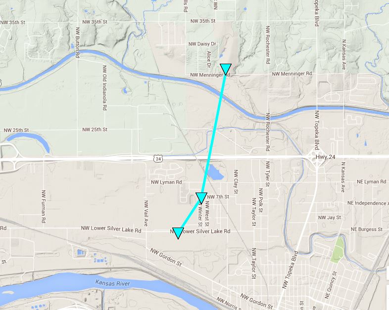
|


 Follow us on YouTube