
A few strong to marginally severe thunderstorms are possible across the Southeast U.S. Friday. A Marginal Risk (Level 1 of 5) outlook has been issued. Strong winds and hail will be the main threats. Elevated to locally critical fire weather conditions will persist across south-central Colorado today due to dry conditions and gusty winds. Read More >
(Last updated 8 am Feb. 3, 2010)
| Event Summary | Snow and Ice Accumulation Map | |
| Radar Images | Satellite Images | |
| Impacts: | Power Outages |
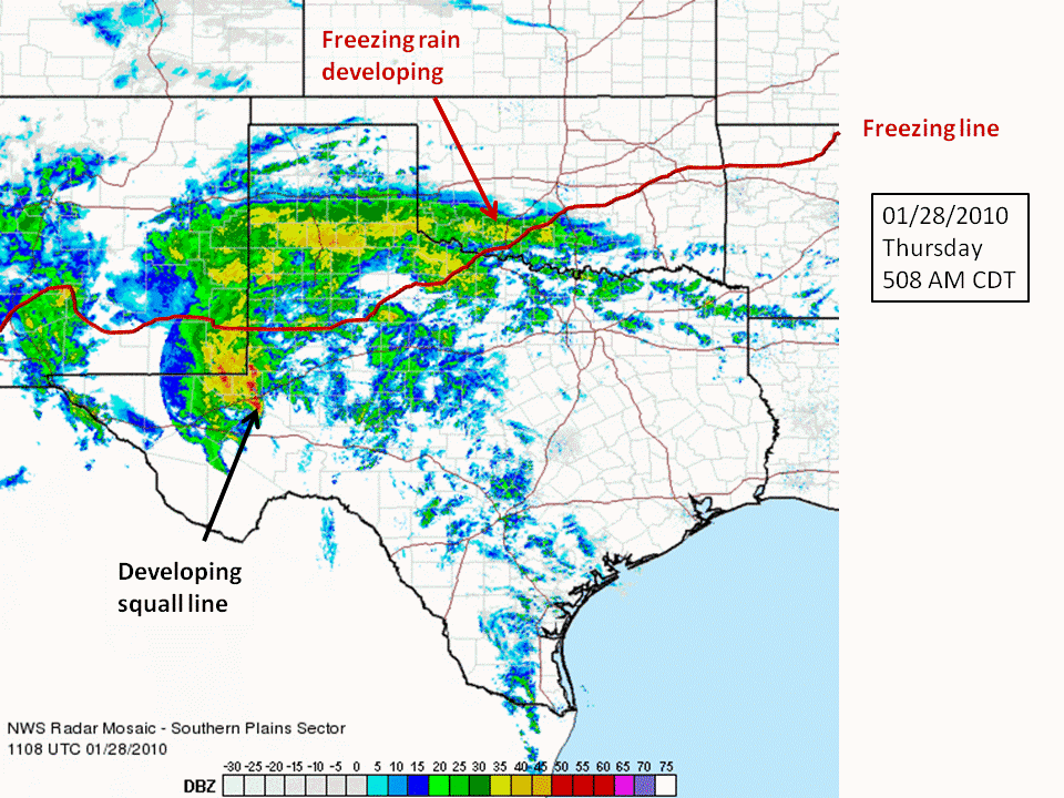
An upper-level low pressure system moved out of the southwest U.S. across Oklahoma and Arkansas resulting in various types of wintry precipitation across eastern Oklahoma and northwest Arkansas January 28-29, 2010. At the surface, a cold front moved south through the area overnight on the 27th, dropping temperatures below freezing across northeast Oklahoma and northwest Arkansas. Weak surface low pressure developed along the front to our south in Texas and moved east into Louisiana on the 29th. The north to northeast surface winds to the north of the low pressure center eventually drew enough cold air into southeast Oklahoma and west central Arkansas to drop temperatures there below freezing.
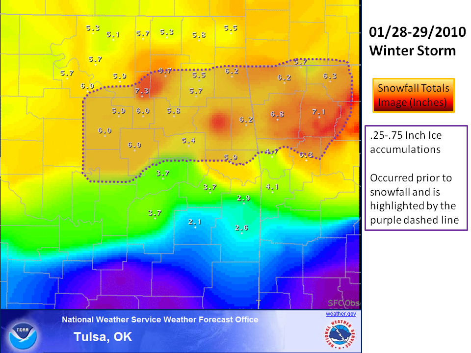
Precipitation ahead of the upper-level low began spreading into eastern Oklahoma on the morning of the 28th and into northwest Arkansas during the afternoon. To the north of Highway 412, the precipitation was mostly a mixture of sleet and snow, with some light freezing rain. To the south of Highway 412, freezing rain was most common, with some sleet mixed in at times. Along and south of a McAlester to Fort Smith line, temperatures were above freezing, so rain was the precipitation type through the day and night on the 28th. Snow and sleet accumulations by the morning of the 29th ranged from 1 to 2 inches north of Highway 412, with ice accumulations of one quarter to one half inch common in the freezing rain area south of Highway 412.
On the 29th, as the upper-level low moved into Oklahoma bringing colder air both at the surface and aloft into the area, the precipitation changed to snow across all of eastern Oklahoma and northwest Arkansas. Moderate to heavy snow fell at times during the afternoon of the 29th across all but far southeast Oklahoma, with the longest duration of snow being in northeast Oklahoma and northwest Arkansas. Snowfall totals of 5 to 8 inches were common across northeast Oklahoma and northwest Arkansas, with 2 to 4 inches across much of southeast Oklahoma and west central Arkansas. In far southeast Oklahoma near the Red River, snow accumulations were under an inch.
|
|
|
|

Satellite Images
 |
|
|
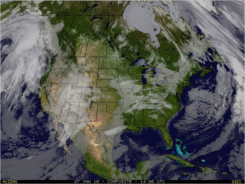
Visible Satellite Image, 8 am CST January 27, 2010 Low pressure system centered over southern Arizona |
Visible Satellite Image, 8 am CST January 28, 2010 Low pressure system centered over west central Texas |
Impacts
Peak Power Outages (this is not a current outage map)
 |
|
(Image Courtesy of OAEC) PEAK OKLAHOMA OUTAGES from the Oklahoma Electric Cooperative system and other power companies that service the state during the January 28-29, 2010 winter storm. The peak in outages occurred around noon on the 29th. The hardest hit areas were in southwest and central Oklahoma where radial ice accumulations were 1-1.5 inches, thousands of power poles were snapped or damaged, and power outages are expected to last for over a week. Note: The Ozarks Electric Cooperative covers portions of Adair, Cherokee, Delaware and Sequoyah counties in OK and parts of Benton, Crawford, Franklin, Madison and Washington counties in AR. In the days after the winter storm, warming temperatures brought melting of the ice on the power lines and tree limbs, leading to 'spiking' of outages. These 'spikes' were a result of the transmission and distribution lines shedding their ice weight and either bouncing together or failing due to tension release. |
|
|||||||


 Follow us on YouTube