Overview
During the afternoon of Monday, August 14th, thunderstorms developed over the northern Black Hills. They gradually merged into a powerful supercell, which moved directly over Rapid City, bringing heavy rain, large hail, and damaging winds. The hail and winds damaged vehicles, gardens, and other property, and runoff from the heavy rain caused flooding. Meanwhile, more storms developed to the southeast of this storm. As the supercell tracked southeastward, a long duration of heavy rain resulted in flash flooding in Oglala Lakota county. Around Sharps Corner, flooding along Porcupine Creek washed out roads and stranded residents and travelers. Additional thunderstorms expanded over the area during the evening. Below are several pictures we received, a radar loop depicting the storms, and a list of significant reports.
Photos:
 |
 |
 |
 |
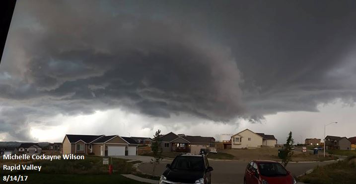
| Storm Clouds (Michelle Cockayne Wilson) |
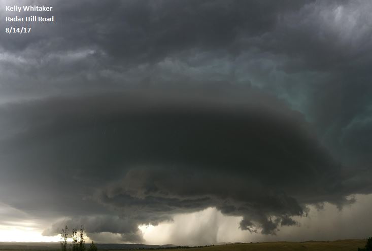
Storm Clouds (Kelly Whitaker) |
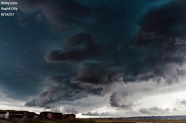
Storm Clouds (Kirby Lirio) |
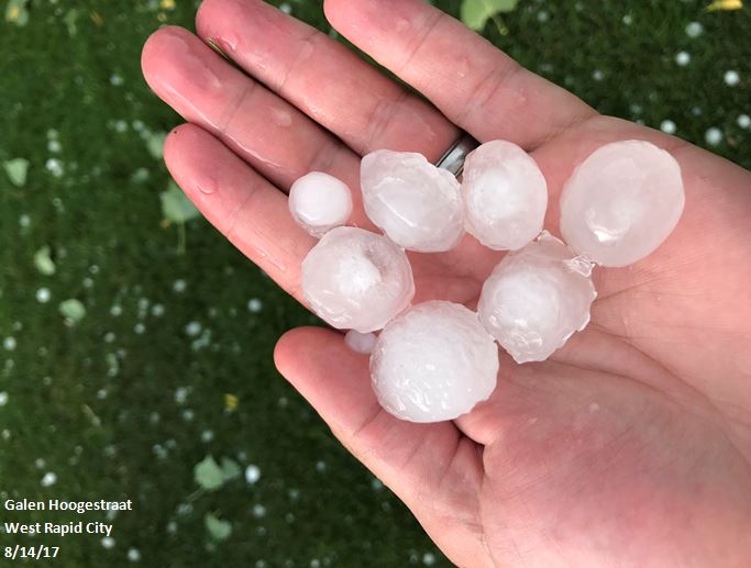
Hail in West Rapid City (Galen Hoogestraat) |
 |
 |
 |
 |
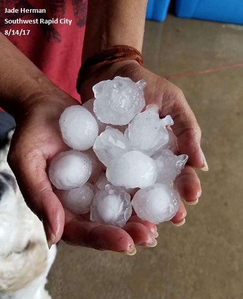
| Hail in Southwest Rapid City (Jade Herman) |
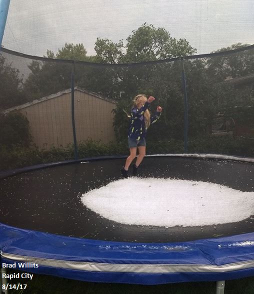
Hail in Rapid City (Brad Willits) |
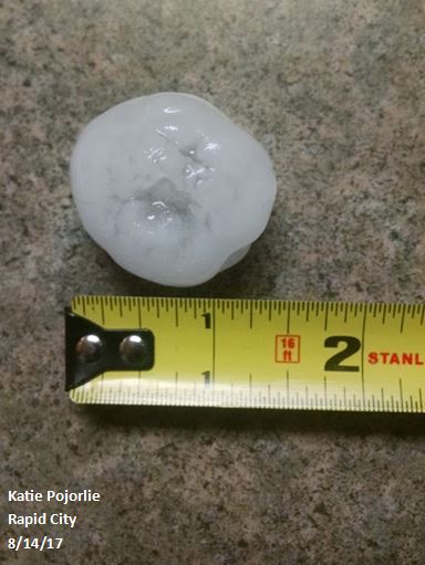
Hail in Rapid City (Katie Pojorlie) |
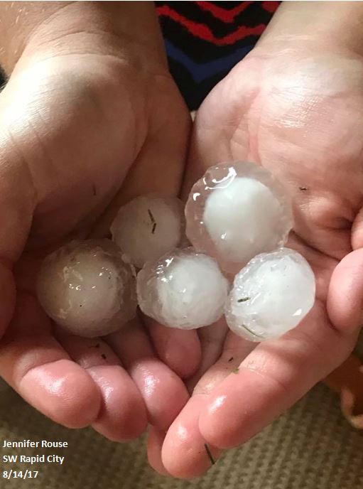
Hail in Southwest Rapid City (Jennifer Rouse) |
 |
 |
 |
 |
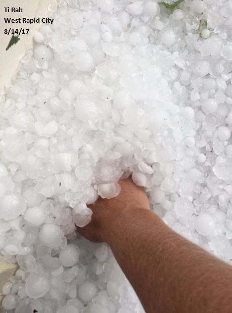
| Hail in West Rapid City (Ti Rah) |
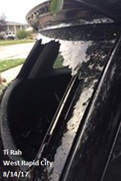
Hail Damage in West Rapid City (Ti Rah) |
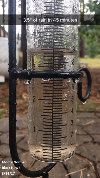
Heavy Rain in Black Hawk (Monte Norman) |
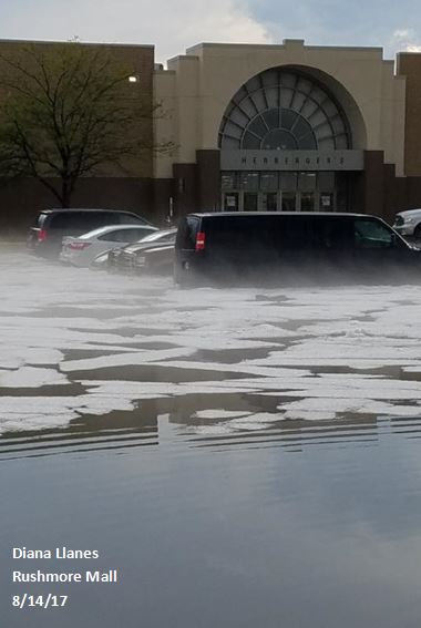
Flooding at the Rushmore Mall (Diana Llanes) |
 |
 |
 |
 |
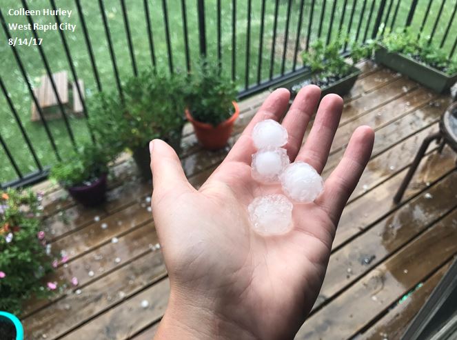
| Hail in West Rapid City (Colleen Hurley) |
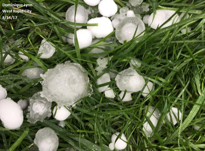
Hail in West Rapid City (Dominique Lynn) |
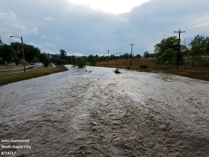
Flooding in South Rapid City (John Hammond) |
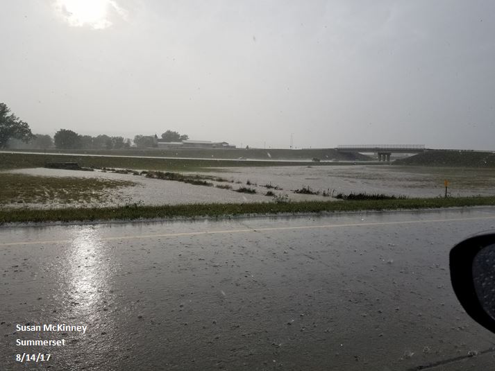
Flooding near Summerset (Susan McKinney) |
Radar Loop
Storm Reports
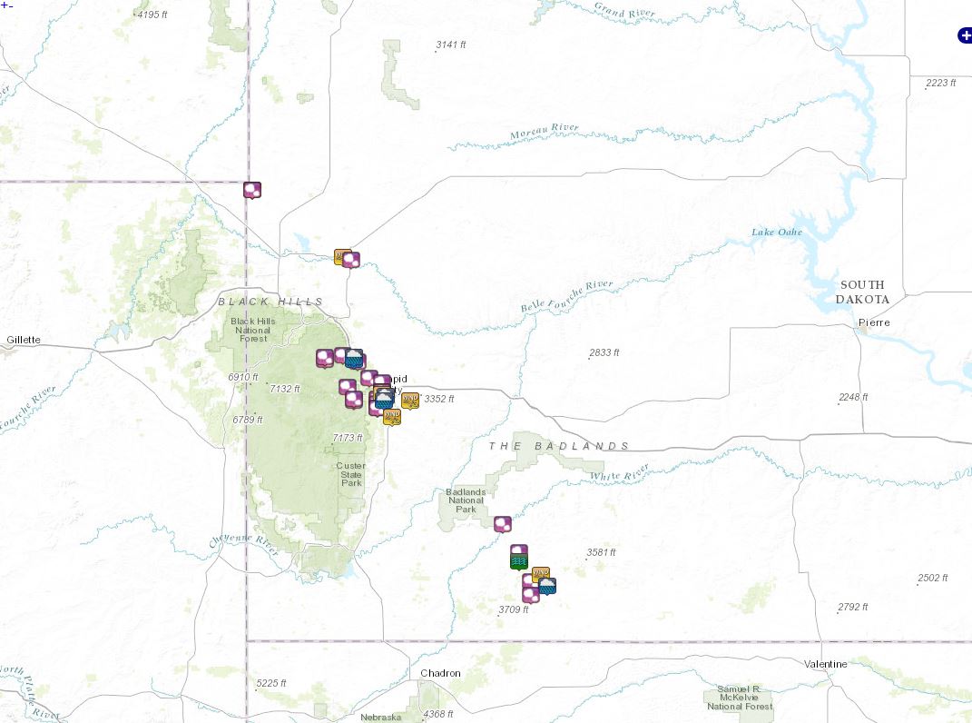
THE STORM REPORTS LISTED BELOW ARE IN DESCENDING ORDER AND MAY NOT NECESSARILY
BE THE FINAL STORM REPORTS.

HAIL REPORTS LISTED BY SIZE (INCHES)

 SIZE    LOCATION                 ST  COUNTY           TIME
 ------  -----------------------  --  --------------   -------
  2.75   SHARPS CORNER            SD  OGLALA LAKOTA    0740 PM
  2.75   1 N ROCKYFORD            SD  OGLALA LAKOTA    0645 PM
                 RELAYED THROUGH LAW ENFORCEMENT FROM BNP
                 RANGER
  2.00   4 WNW NEMO               SD  LAWRENCE         0359 PM
                 LASTED 5 MINUTES
  1.75   5 E PORCUPINE            SD  OGLALA LAKOTA    0845 PM
  1.75   4 SSW RAPID CITY         SD  PENNINGTON       0616 PM
  1.75   3 SSW DOWNTOWN RAPID CI  SD  PENNINGTON       0609 PM
  1.75   1 SW DOWNTOWN RAPID CIT  SD  PENNINGTON       0605 PM
  1.75   BLACKHAWK                SD  MEADE            0545 PM
  1.75   1 SE PIEDMONT            SD  MEADE            0446 PM
  1.75   1 NNW PIEDMONT           SD  MEADE            0442 PM
  1.50   2 N PORCUPINE            SD  OGLALA LAKOTA    0740 PM
  1.50   4 SSW RAPID CITY         SD  PENNINGTON       0615 PM
  1.50   4 N DOWNTOWN RAPID CITY  SD  PENNINGTON       0600 PM
  1.50   HISEGA                   SD  PENNINGTON       0547 PM
  1.25   5 NW NEMO                SD  LAWRENCE         0359 PM
  1.00   2 S PORCUPINE            SD  OGLALA LAKOTA    0855 PM
  1.00   22 NNW BELLE FOURCHE     SD  BUTTE            0701 PM
  1.00   2 SSE DOWNTOWN RAPID CI  SD  PENNINGTON       0613 PM
  1.00   RAPID CITY               SD  PENNINGTON       0609 PM
                 SKYLINE DR
  1.00   1 N RAPID CITY           SD  PENNINGTON       0605 PM
  1.00   HISEGA                   SD  PENNINGTON       0600 PM
  1.00   2 N JOHNSON SIDING       SD  PENNINGTON       0524 PM
  1.00   PIEDMONT                 SD  MEADE            0515 PM
                 RAIN ACCUMULATION IN 1 HOUR
  1.00   4 NNE NEMO               SD  LAWRENCE         0425 PM
  1.00   1 NNW PIEDMONT           SD  MEADE            0415 PM
  0.88   4 S NEWELL               SD  BUTTE            0820 PM


TSTM WIND REPORTS LISTED BY SPEED (MPH)

 SPEED   LOCATION                 ST  COUNTY           TIME
 ------  -----------------------  --  --------------   -------
 66.00   1 E DOWNTOWN RAPID CITY  SD  PENNINGTON       0559 PM
 61.00   5 NE PORCUPINE           SD  OGLALA LAKOTA    0841 PM
 60.00   22 NNW BELLE FOURCHE     SD  BUTTE            0701 PM
 60.00   RAPID CITY               SD  PENNINGTON       0611 PM
 55.00   1 N RAPID CITY           SD  PENNINGTON       0605 PM
 53.00   RAPID CITY AIRPORT       SD  PENNINGTON       0620 PM
 50.00   4 SW NEWELL              SD  BUTTE            0815 PM
 50.00   7 SW RAPID CITY AIRPORT  SD  PENNINGTON       0620 PM


RAIN AMOUNTS (INCHES)

 AMOUNT  LOCATION                 ST  COUNTY           TIME
 ------  -----------------------  --  --------------   -------
  2.65   5 E PORCUPINE            SD  OGLALA LAKOTA    0900 PM
  2.33   1 NNW PIEDMONT           SD  MEADE            0900 PM
  2.02   PIEDMONT                 SD  MEADE            0515 PM
                 RAIN ACCUMULATION IN 1 HOUR
  1.59   2 SSE DOWNTOWN RAPID     SD  PENNINGTON       0730 AM
  1.15   1 E DOWNTOWN RAPID CITY  SD  PENNINGTON       0700 PM

OTHER REPORTS

 REPORT  LOCATION                 ST  COUNTY           TIME
 ------  -----------------------  --  --------------   -------
 FLASH   2 S SHARPS CORNER        SD  OGLALA LAKOTA    1122 PM
 FLOOD            ROAD WASHED OUT, PEOPLE STRANDED
 |
Media use of NWS Web News Stories is encouraged! Please acknowledge the NWS as the source of any news information accessed from this site. |
|


 Follow us on YouTube