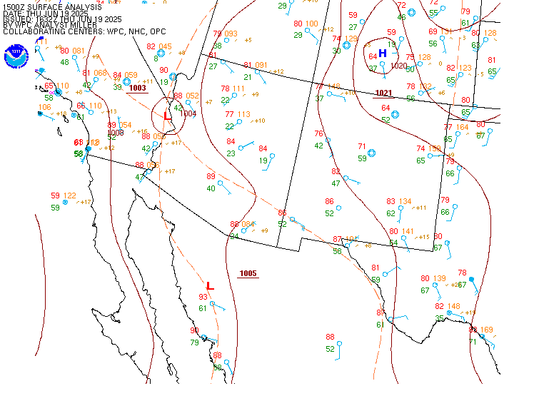
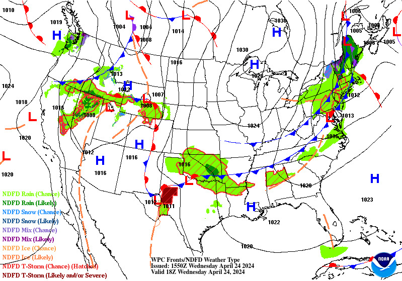
A few strong to marginally severe thunderstorms are possible across the Southeast U.S. Friday. A Marginal Risk (Level 1 of 5) outlook has been issued. Strong winds and hail will be the main threats. Elevated to locally critical fire weather conditions will persist across south-central Colorado today due to dry conditions and gusty winds. Read More >
TAF BoardsView a TAF board showing all TAF sites within BYP or see the TAF board for individual airports. |
METAR Observations |
Forecaster DiscussionsNWS forecaster reasoning behind the TAFs (look for the "AVIATION" section, usually towards the bottom of the product) |
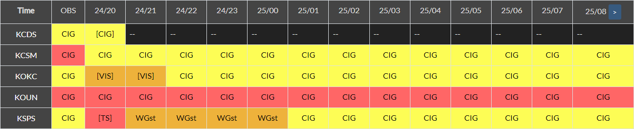
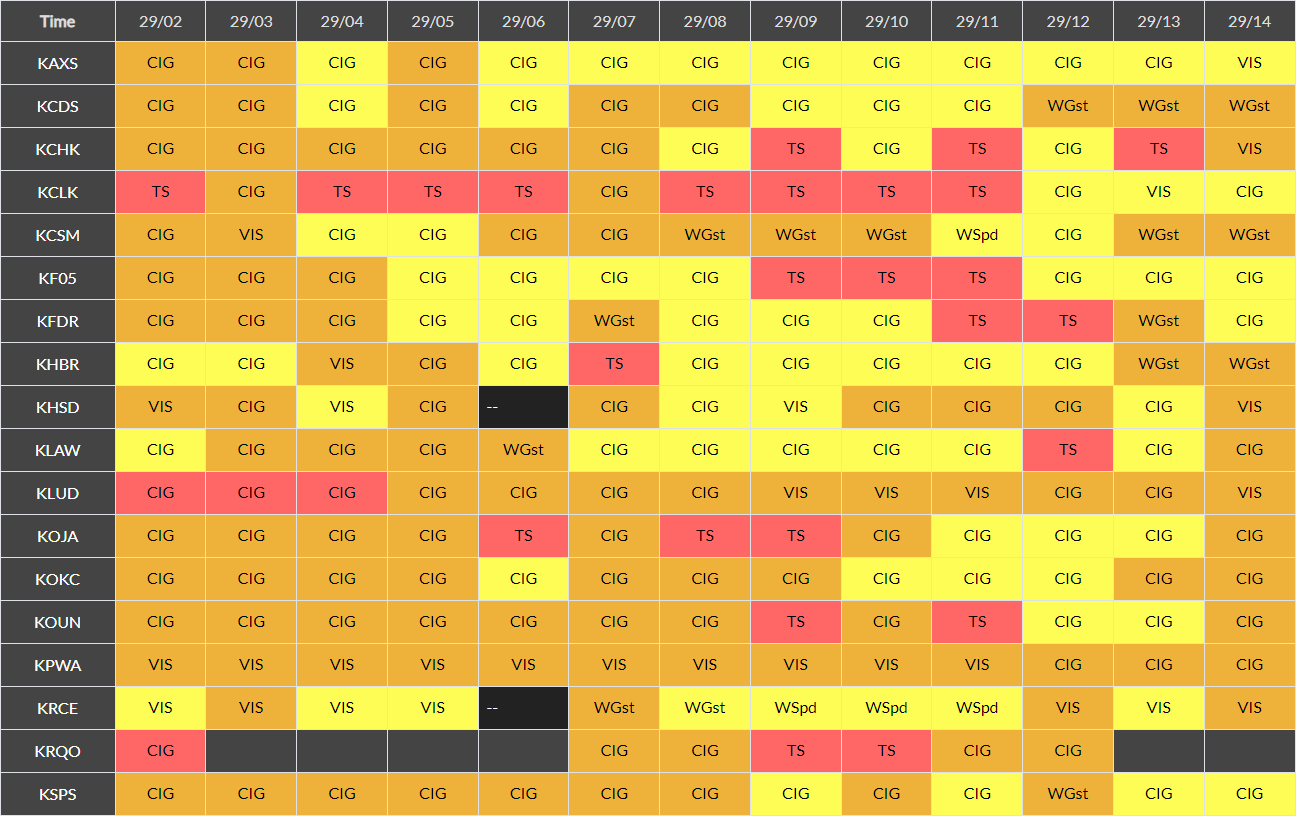
Impact TAF Board for BYP
Individual TAF Boards
|
Impact METAR Board for BYP
Individual METAR BoardsArkansasOklahoma
Texas |
Click on an image to enlarge the hourly weather graphic, or see the 7-day forecast or expanded hourly forecast by visiting the links below the images.
McAlester, OK |
Tulsa, OK |
|
|
|
Click on any image to enlarge it.
CONUS Sector |
Southern Plains Sector |
 |
 |
Fort Smith, AR Radar (KSRX) |
Tulsa, OK Radar (KINX) |
 |
 |
Geocolor Satellite Imagery with Lightning Density |
Infrared Satellite Imagery |
 |
 |
Click an image to enlarge it.
Southwest CONUS |
South-Central CONUS |
 |
 |
Click on an image to enlarge it.
6-Hour Forecast |
12-Hour Forecast |
18-Hour Forecast |
24-Hour Forecast |
 |
 |
 |
 |
Three-Day Loop |
|||
 |
|||
Click an image to enlarge it.
Day 1 |
Day 2 |
Day 3 |
|---|---|---|
 |
 |
 |
Click an image to view the detailed outlook.
Day 1 |
Day 2 |
Day 3 |
|---|---|---|
 |
 |
 |
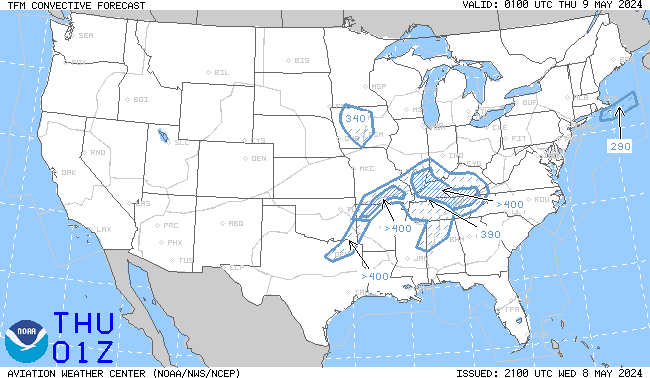
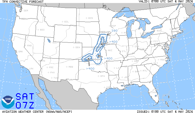
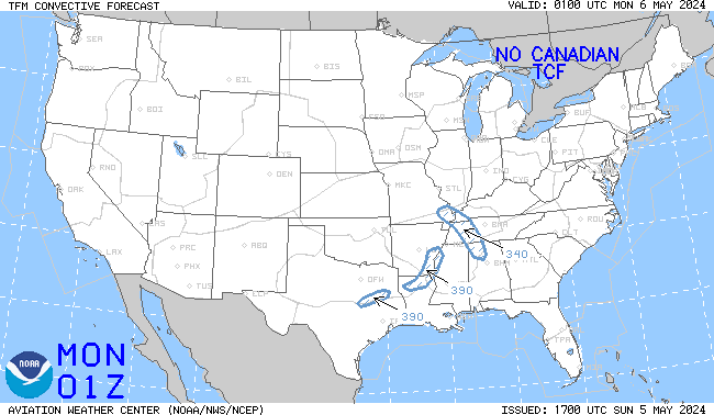
Click an image to enlarge it. Click here to go the AWC TCF website.
4-Hour Forecast |
6-Hour Forecast |
8-Hour Forecast |
|---|---|---|
 |
 |
 |
Click an image to go to the AWC website.
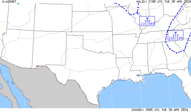
SIGMETs |
||||
|---|---|---|---|---|
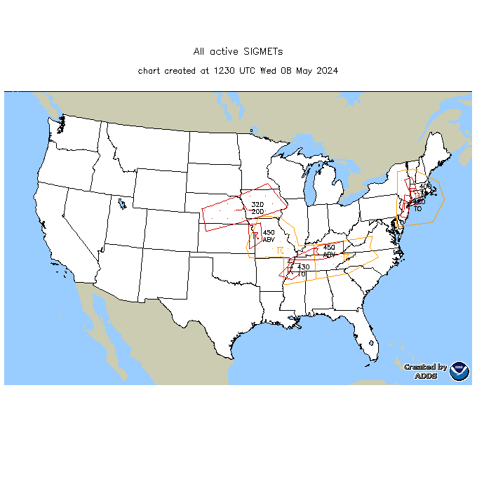 |
||||
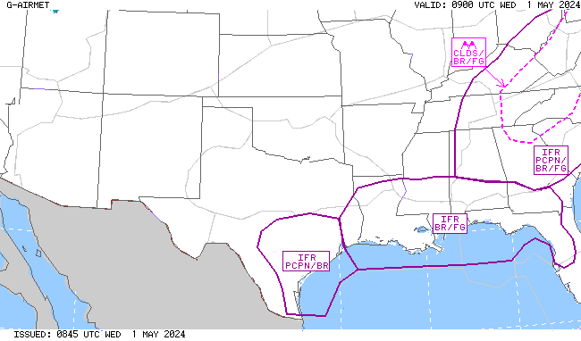
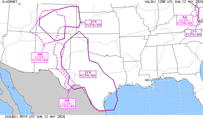
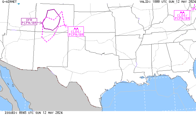
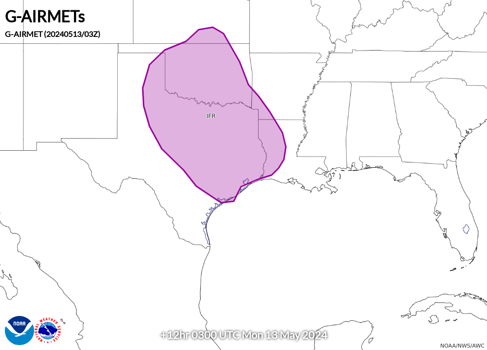
AIRMET Sierra (Ceilings/Visibility/Mountain Obscuration) |
||||
00 Hour |
03 Hour |
06 Hour |
09 Hour |
12 Hour |
 |
 |
 |
 |
 |
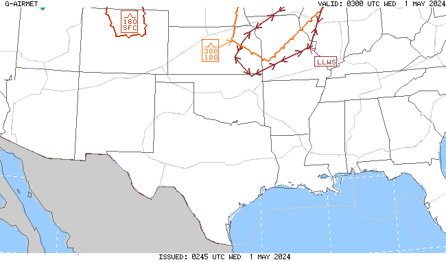
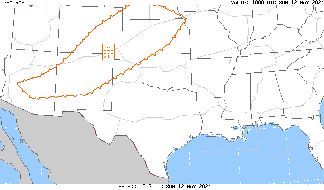
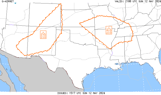
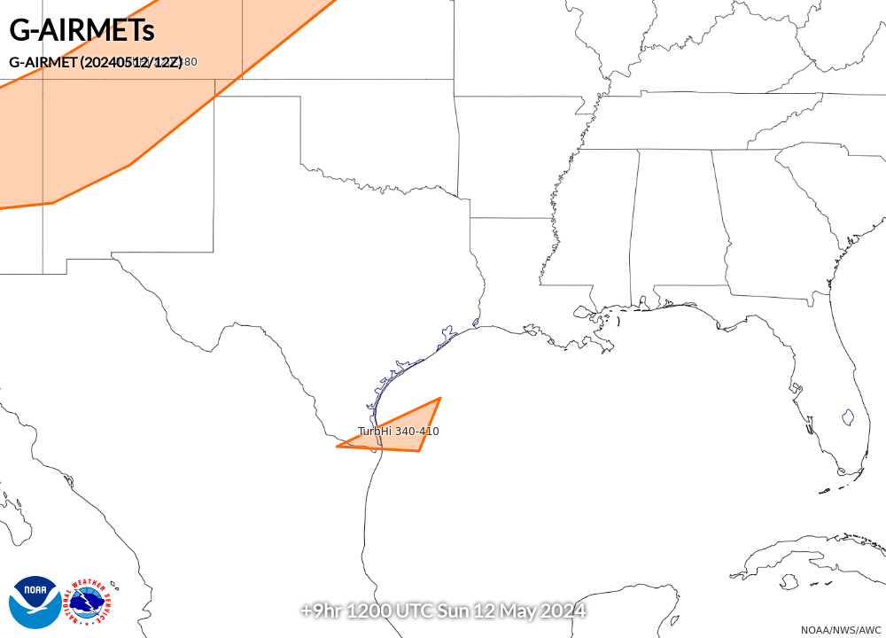
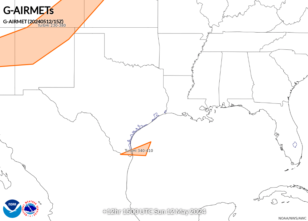
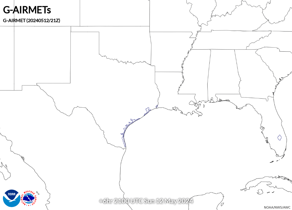
AIRMET Tango (Turbulence/Low-Level Wind Shear/Strong Surface Winds) |
||||
00 Hour |
03 Hour |
06 Hour |
09 Hour |
12 Hour |
 |
 |
 |
 |
 |
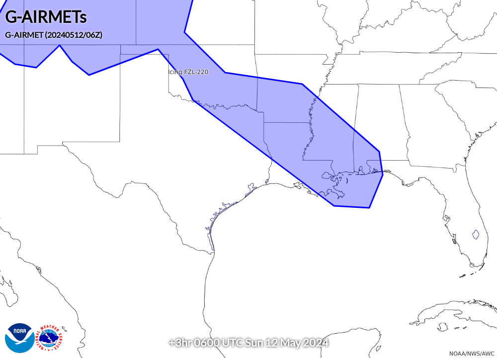
AIRMET Zulu (Icing and Freezing Level) |
||||
00 Hour |
03 Hour |
06 Hour |
09 Hour |
12 Hour |
 |
 |
 |
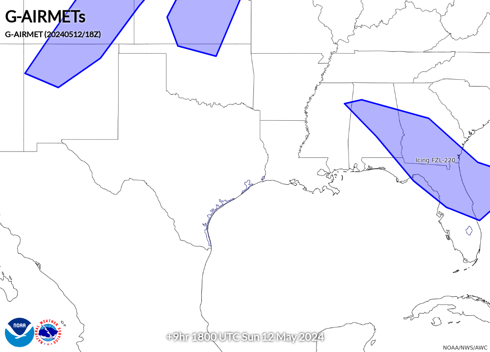 |
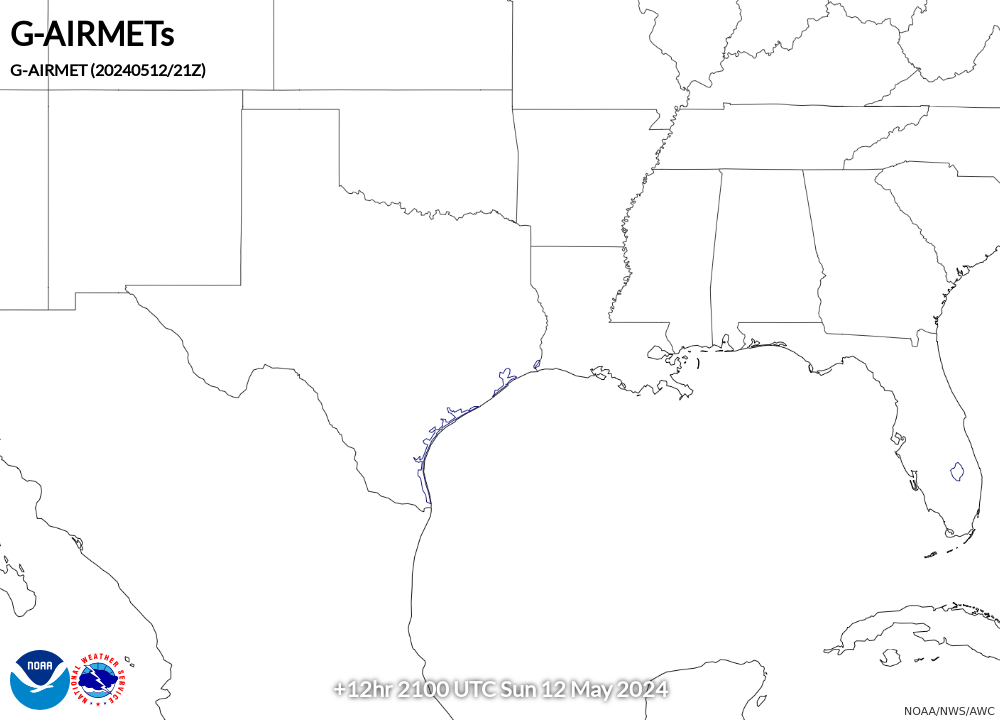 |