
Severe thunderstorms capable of producing damaging wind gusts, large hail, and a few tornadoes, are likely to develop this afternoon from parts of the lower Ohio Valley into the southern Plains. An Enhanced Risk (Level 3 of 5) outlook has been issued. Further north, widespread rain showers are expected across portions of the Great Lakes and Northeast U.S. Read More >
 |
AREA 1 |
AREA 2 |
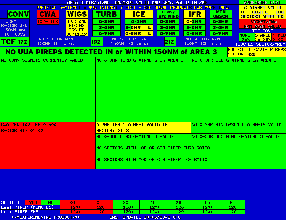
AREA 3 |
AREA 4 |
AREA 5 |
AREA 6 |
|
|
|
|
|
 |
 |
 |

|
|
|
|
|
|
 |
 |
 |

|
|
Lo Sectors Hi Sectors UH Sectors TRACONs Icing: Lo Sectors Hi Sectors UH Sectors TRACONs CIG/VIS: METARs By Sector TRACONs PIREPs: |
|
Plotted Pireps are updated every 5 minutes, for all flight levels and include Pireps from 2 hours previous.
Click on the PIREP icons to get more information.
The map is displaying PIREPs using the following icons:
|
|
|
|
|


