
A few strong to marginally severe thunderstorms are possible across the Southeast U.S. Friday. A Marginal Risk (Level 1 of 5) outlook has been issued. Strong winds and hail will be the main threats. Elevated to locally critical fire weather conditions will persist across south-central Colorado today due to dry conditions and gusty winds. Read More >
| Return to Safety Homepage |
Low Level Wind Shear
Low-level wind shear (LLWS) is defined as “A wind shear of 10 knots or more per 100 feet in a layer more than 200 feet thick which occurs within 2,000 feet of the surface”. So what does this mean? It means that within the lowest 2000ft, the wind speed and/or direction is changing rapidly in a 200ft layer.
Small, general aviation aircraft are much more prone to the effects of low-level wind shear than large commercial aircraft because their approach speeds are much closer to their stall speeds.
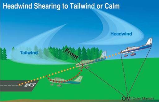 |
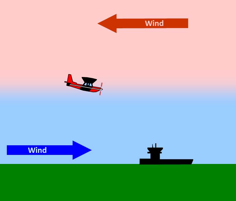
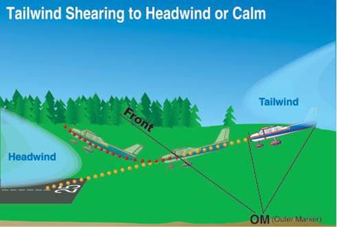
While an aircraft is on approach, a shear from a headwind to a tailwind (or calm) causes: - The airspeed to decrease; If the pilot pulls the nose up to compensate, airspeed will be reduced even further. |
|
|
If the wind is calm, or there is a slight tailwind, and the flow shears into a headwind, this causes:
|
Here are a couple of examples of how aircraft can be affected by windshear:
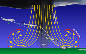
LLWS can also be generated by a downburst from a thunderstorm or heavy rain shower. See the thunderstorm section for more specific information on downbursts. Notice in the video animation, an outflow boundary develops and radiates outward from where the downburst takes place. This is typically where wind shear can occur.
To avoid landing in LLWS, look at the forecast for the destination. If there is a TAF for your arrival airport, they'll show a wind shear group if the hazard is expected. Here's an example of a TAF with wind shear expected:
KMEM 081503Z 0815/0912 20006KT P6SM SCT100 BKN250
FM082100 21006KT P6SM VCSH SCT050 BKN200
FM090000 18005KT P6SM -RA OVC015
FM090200 18010KT 2SM -RA BR BKN008 OVC015 WS020/20045KT=
AIRMETs are issued for large areas of LLWS. While in flight, listen for hazardous weather messages and other pilot reports of wind shear near your landing site. If you hear any, consider an alternate landing site.
For a current display of PIREPs, click here.
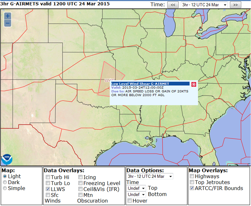
For a current display of AIRMETs in effect, click here. To view only the LLWS products, check only the LLWS box.
Turbulence |
Thunderstorms |
Icing |
Ceiling and Visibility |
LLWS |
Density Altitude |

