National Weather Service United States Department of Commerce
Click a location below for detailed forecast.

Last Map Update: Wed, Apr. 24, 2024 at 5:41:18 pm CDT

National Weather Service Pueblo, CONational Weather Service Dodge City, KSNational Weather Service Wichita, Kansas
National Weather Service Albuquerque, NMZoom
Out

National Weather Service Norman, OK
National Weather Service Albuquerque, NMNational Weather Service Lubbock, TXNational Weather Service Fort Worth/Dallas, TX

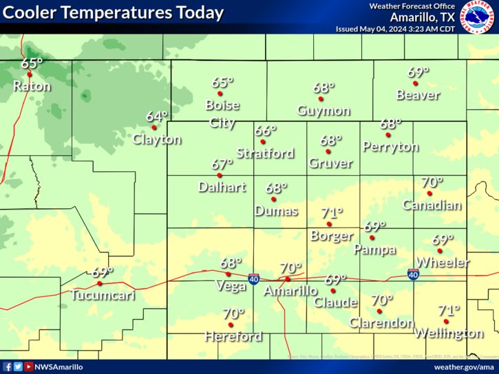
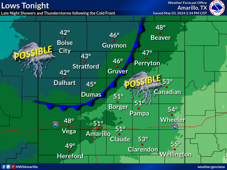
Moisture is expected to keep funneling into the lower-level for today thanks to good easterly flow present for the day. This moisture is mostly expected to bring cloud cover and cooler conditions with the occasional showers in the east. However, as we head to the overnight potential is present for instability to move in ahead the next system and create chances of thunderstorms. While chances are low, the ingredients are present for a severe thunderstorm to occur, so make sure to have a wary to keep posted for any watches and warning for tonight!
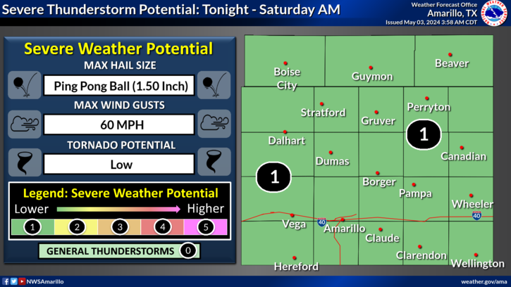
Thursday continues to present a conditional chance for severe storms in the eastern Panhandles. While we are not confident storms will develop, if they do they'll likely be severe, bringing a risk for very large hail, damaging winds, and tornadoes.
The actual chance for storms developing in the eastern Panhandles Thursday afternoon and evening is 20 to 40 percent. If storms develop, they'll likely be severe.
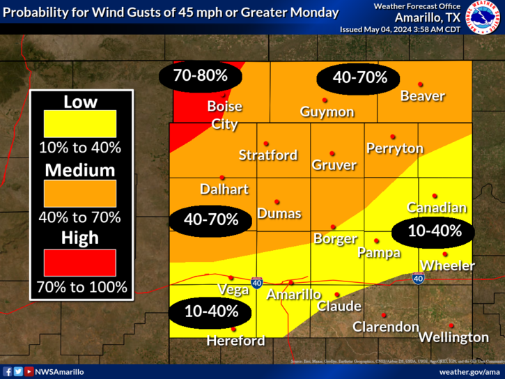
Critical fire weather conditions are possible west of the dryline on Thursday due to windy and dry conditions.
The automated weather observing system at the Perryton airport continues to report highly erroneous temperatures and dewpoints. This equipment is not owned or maintained, either directly or indirectly, by the National Weather Service. Thus, we have no estimated time to repair.

Text Product Selector (Selected product opens in current window)


Current Observations ( )
Location Sky/Weather Temp (°F) Dewpt (°F) RH (%) Wind (mph) Pressure (inHg) Remarks
 Amarillo
N/A
N/A
N/A
N/A
N/A
N/A
N/A
 Borger
N/A
N/A
N/A
N/A
N/A
N/A
N/A
 Canadian
N/A
N/A
N/A
N/A
N/A
N/A
N/A
 Dalhart
N/A
N/A
N/A
N/A
N/A
N/A
N/A
 Dumas
N/A
N/A
N/A
N/A
N/A
N/A
N/A
 Guymon
N/A
N/A
N/A
N/A
N/A
N/A
N/A
 Hereford
N/A
N/A
N/A
N/A
N/A
N/A
N/A
 Pampa
N/A
N/A
N/A
N/A
N/A
N/A
N/A
 Perryton
N/A
N/A
N/A
N/A
N/A
N/A
N/A
 Amarillo 9NNE
N/A
N/A
N/A
N/A
N/A
N/A
N/A
 Amarillo 7SSE
N/A
N/A
N/A
N/A
N/A
N/A
N/A
 Bootleg 11WNW
N/A
N/A
N/A
N/A
N/A
N/A
N/A
 Canadian 6E
N/A
N/A
N/A
N/A
N/A
N/A
N/A
 Clarendon 2WSW
N/A
N/A
N/A
N/A
N/A
N/A
N/A
 Claude 12SW
N/A
N/A
N/A
N/A
N/A
N/A
N/A
 Hereford 2NW
N/A
N/A
N/A
N/A
N/A
N/A
N/A
 McLean 1E
N/A
N/A
N/A
N/A
N/A
N/A
N/A
 Palo Duro SP
N/A
N/A
N/A
N/A
N/A
N/A
N/A
 Pampa 2E
N/A
N/A
N/A
N/A
N/A
N/A
N/A
 Umbarger 3NNE
N/A
N/A
N/A
N/A
N/A
N/A
N/A
Note: "N/A" or "MISG" will be displayed if values are not available. In the LOCATION column, click on links for a list of recent observations at sites of interest. In the WIND column, VRB is "variable" and G is "gust". In the REMARKS column, HX is "heat index", WCI is "wind chill index", and VSB is "visibility" (if shown).


Aviation Drought Fire Weather Hydrology Severe Weather Winter Weather
 
Climate Graphs Hourly Forecast Long Range Local Model Data Precip Maps Office Webcam
 
Education Local Research News Skywarn Weather Calculator Weather Radio