Summary
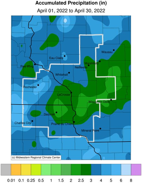
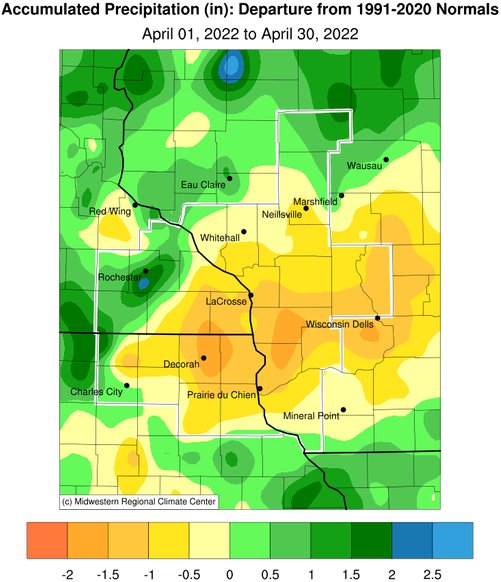
Precipitation ranged from 1.85" at Gays Mills, WI (COOP) to 7.24" at St. Ansgar, IA (COOP). This precipitation ranged from 2" below normal to 3" wetter than normal. Rochester International Airport (6.83") had its second wettest April. Only 2001 (7.30") was wetter. Records date back to 1886. St. Ansgar, IA (7.24") had their 3rd wettest April. Their wettest April occurred in 2013 (8.39"). Records date back to 1950. Elgin, MN (5.47") had their 9th wettest April. Their wettest April occurred in 1999 (8.19"). Records date back to 1939. The highest one-day precipitation was 4.50" at St. Ansgar, MN (COOP) from April 12-13.
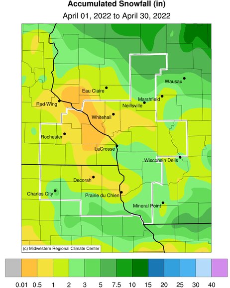
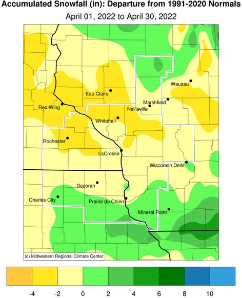
April snowfall ranged from no snow to 7.2" near Medford, WI (CoCoRaHS observer). This snowfall ranged from 2.5" below normal to 2.5" above normal. The highest one-day snowfall was 3.6" in Charles City, IA (COOP) from April 1-2.
Flood Conditions
From the evening of April 12 into the early morning hours of April 13, a 2 to 4.5” rain band fell from western and northern Mitchell County in northeast Iowa northeast across eastern Mower, western Fillmore, southern and eastern Olmsted, and western Winona counties in southeast Minnesota. The highest reported rainfall was 4.5” in St. Ansgar (Mitchell County). This prompted a Flash Flood Warning for Mitchell County in northeast Iowa.
This band of heavy rain caused minor river flooding along the Middle Fork of the Whitewater River near Whitewater State Park (WSPM5) in eastern Olmsted County in southeast Minnesota. It crested at 14.3 feet at 2:30 AM on April 13 (flood stage is 13.5 feet), and along Deer Creek (a Cedar River tributary) at Carpenter (CTRI4) in northeast Iowa (Mitchell County). It crested at 83.74 feet at 7:30 AM on April 13 (flood stage is 83 feet).
River Conditions
USGS average monthly streamflow for April 2022 was below normal along the Lemonweir River at New Lisbon, WI. Elsewhere, the monthly streamflows were near normal in the NWS La Crosse Hydrologic Service Area (HSA).
During April, the Mississippi River at La Crosse, WI had an average 7 AM stage of 8.42 feet. This was 0.1 feet above the 1937-2022 long-term average of 8.32 feet. The highest stage was 9.82 feet on April 19. This was the first time that it was this high since April 22, 2020 (9.66 feet). That April was also the last time that minor flooding (April 3-13) occurred there. This site has not been at or above flood stage (12 feet) since April 13, 2020. This ongoing stretch of 748 days is the 13 longest without reaching the flood stage. It is the longest since an 811-day stretch from July 8, 2014, to September 25, 2016 (11th longest stretch). The longest stretch was a 3,986-day stretch from May 12, 1954, to April 9, 1965.
Drought
In April 2022, the above-normal precipitation in the areas which had been dry resulted in more improvement in the abnormally dry (D0) and moderate (D1) drought in the La Crosse Hydrologic Service Area (HSA). At the beginning of the month, about 33% of the area was either abnormally dry (25.5%) or in moderate drought (7.5%). By the end of the month, the drought had ended and less than 7% of the area was still abnormally dry.
| Precipitation | ||
 |
 |
|
| Snowfall | ||
 |
 |


 Follow us on YouTube