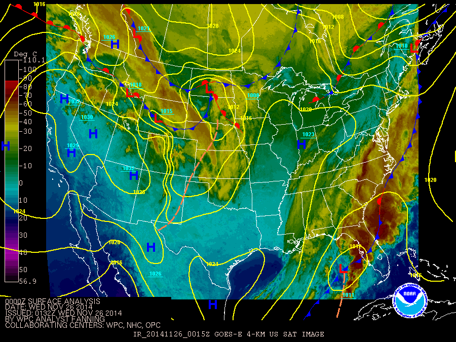
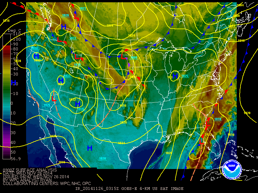
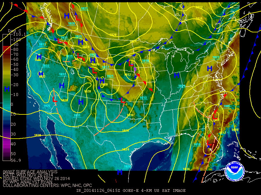
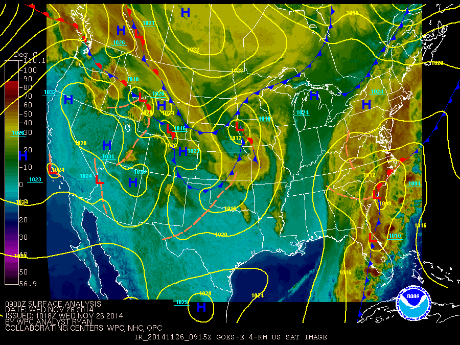
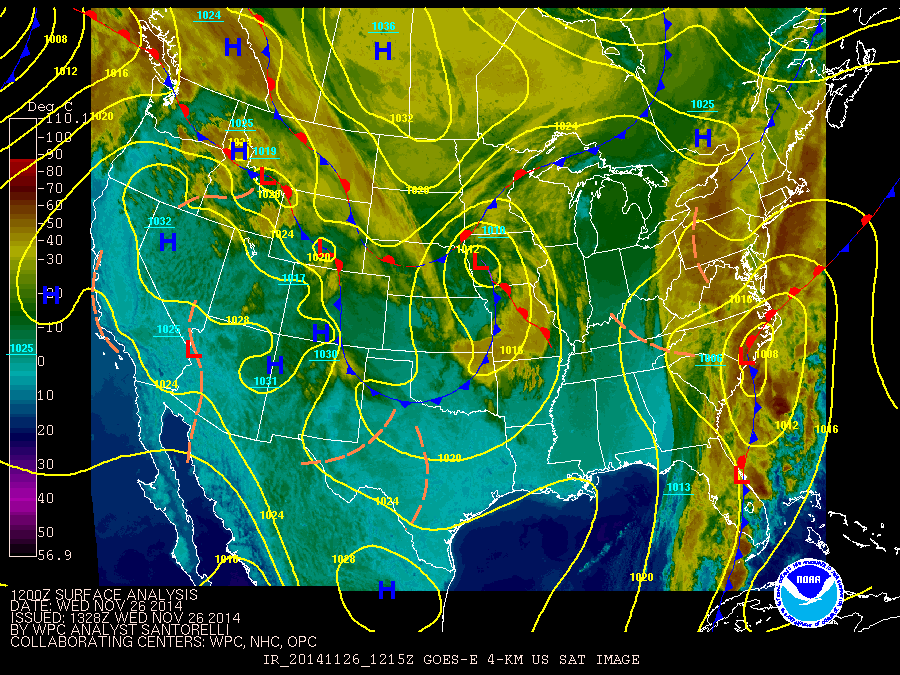
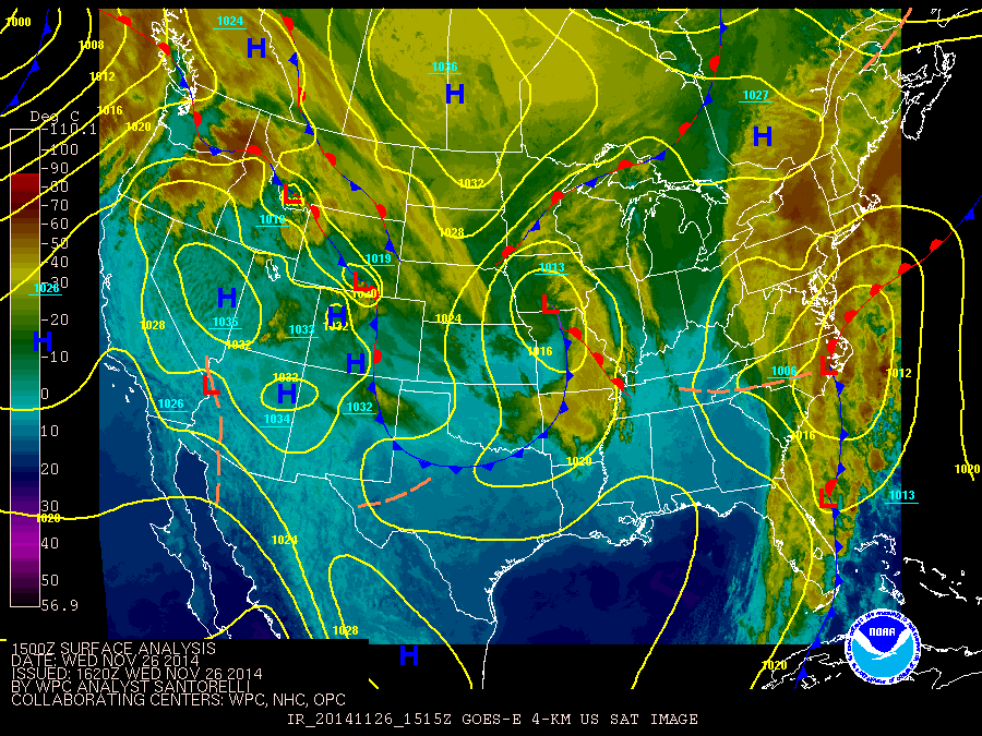
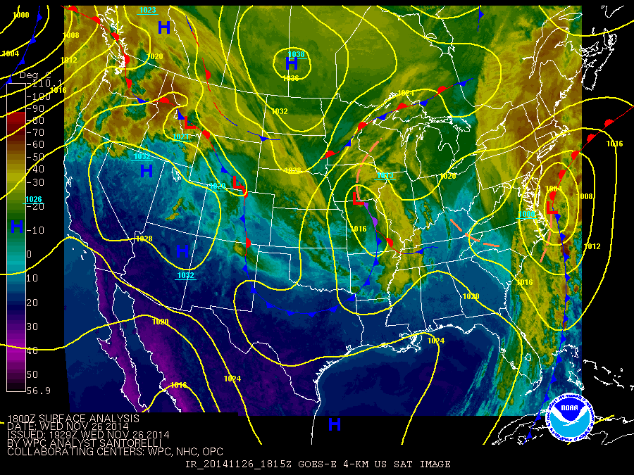
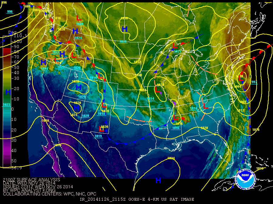
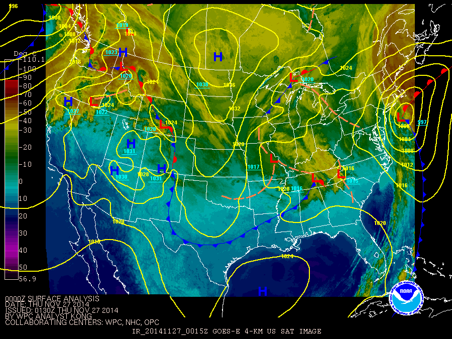
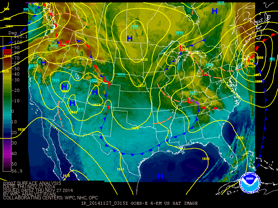
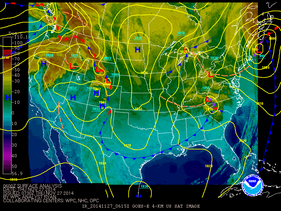
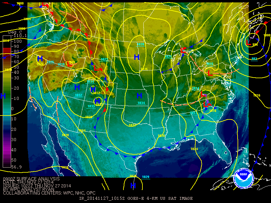
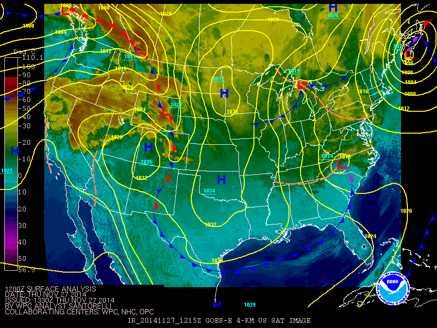
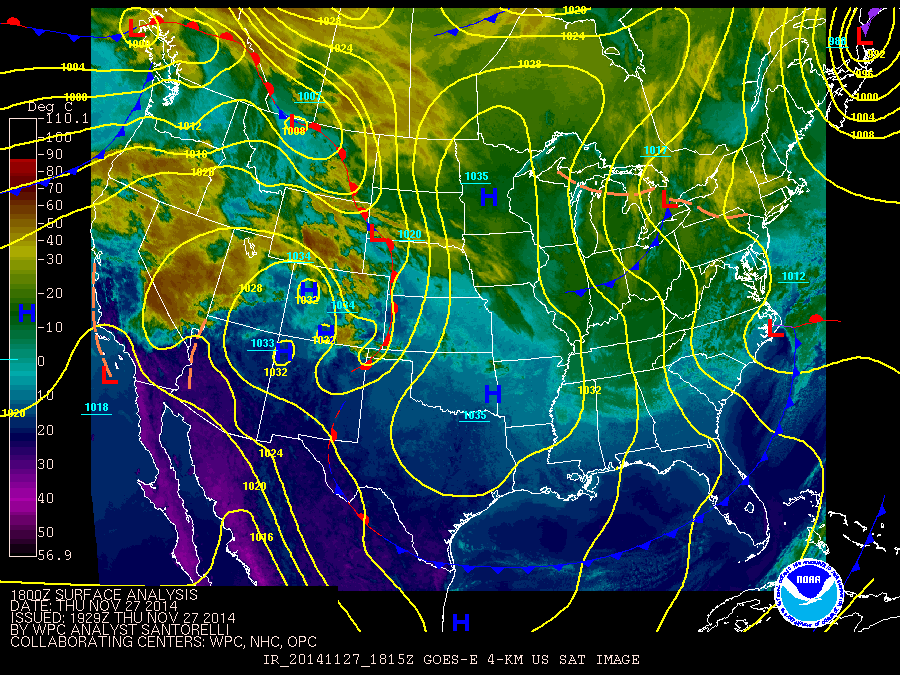
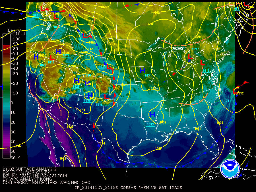
The loop below is map combination of satellite images and surface analysis. The storm system or Nor'easter that produced the snow across the area moves from the west coast of Florida in the Gulf of Mexico northward along the east coast of the Unitied States.
Times on the images are in Zulu or UTC times. The loop starts at 0132 Z November 26 or 08:32 PM EST November 25, to 2237 Z November 27 or 05:37 PM EST November 27, 2014.
These images are from Weather Prediction Center's (https://www.hpc.ncep.noaa.gov/) archive web site.
Use the slider bar to control the speed of the loop.


 Follow us on YouTube